
 The Flood of '97
doesn't that just sound like an old-timer thing to say?
Like many Manitobans, I was affected by the flood of 1997, and it's something I'll always remember. Strangely though, even though I say that, it's already (six months later at the time of this writing) difficult to precisely picture how things were, and hard to imagine that that volume of water was really there. So I keep this up, it reminds me about it now that the water marks on the telephone poles aren't there any more.
I live in Southern Manitoba, and my whole area was behind a dike, though thankfully we didn't have to evacuate. That left me in kind of a limbo most days as far as getting back and forth goes, trying to both put in time at work while attempting to move possessions to higher ground and help out others. I think the most fun out of the whole episode was moving a friend's landlady's freezer up three flights of stairs.
The following are a selection of pictures that summarize a few of my adventures. Most of them aren't action shots as (unlike Jean Cretien and numerous others) I didn't think cameras were an appropriate tool to be bringing along sandbagging.
| April 26th, my last trip down highway 59 through Grande Pointe. I was on my way to the 74.102 final, and was running late. I thought I'd take a gamble that the quickest direct road to the U of M open to that point in time would still be open. I won, barely, and they closed the road about 20 minutes after I got through. I got stuck behind a truck without quite knowing how much water there'd be. Later on, this road was covered by around four feet of water and left me with about an hour and a half drive to work rather than the usual 25 minutes. Thankfully, I could still drive to work. | 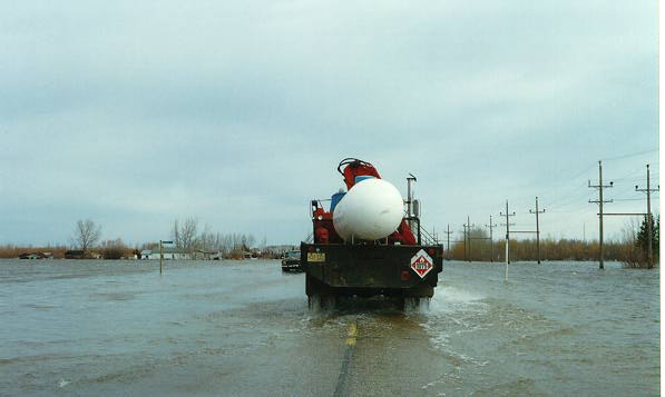 |
| April 30, a close view of the water around the ring dike near home. You can see military vehicles making their way through the flooded waters to nearby farms. The major base used for Eastern Manitoba was close to my house, and I was getting woken up by helicopters more often than the average character in a L.A. gang movie. | 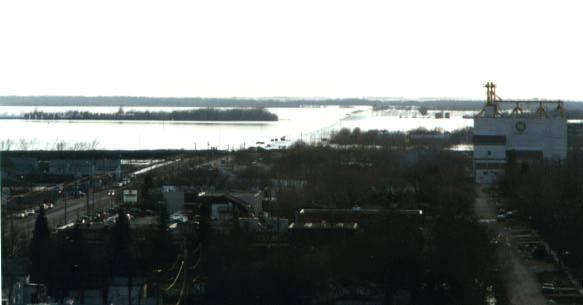 |
| Facing North, you can follow the shoreline as far as the eye can see. Looking closely above the farm, the skyline of Winnipeg, largely protected by its floodway system, can be seen. | 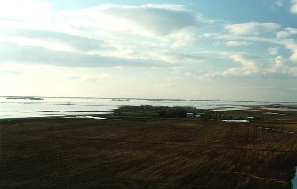 |
| April 29, closing the ring dike around St. Adolphe. Two military helicopters can be seen overhead. They're a common occurrence these days. | 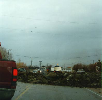 |
| A signpost marks a non-existent road south of St. Adolphe. This photograph was taken on April 29, and the final crest was at least three feet higher than the level shown in this photograph. | 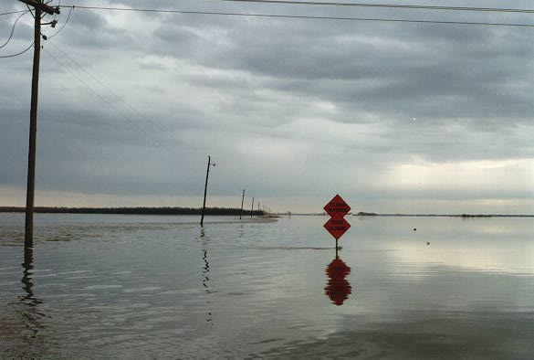 |
| The same day, looking east. The barn on the right was washed away at the crest. | 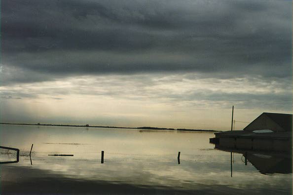 |
| Horrific and damaging though it can be, the floodwaters can also be strangely beautiful. | 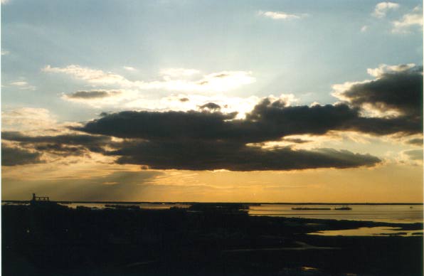 |