
Mayan Ruins in the Yucatan
A Semi-Guided Tour
I've always been fond of Mexico, particularly the Yucatan peninsula. I have been taking my vacations there, and I'd highly recommend it (though inside, I really want to say "there are too many tourists here, stay home and take someone back with you!").
Over the years I've been to most of the major Mayan ruin sites easily accessible from the east side of the peninsula (Quintana Roo, which is the side that's convenient for booking cheap airline charters to from this part of the world, and a darned cool name to boot). It's about time I started working on the west side, or south into Honduras, but that hasn't happened yet.
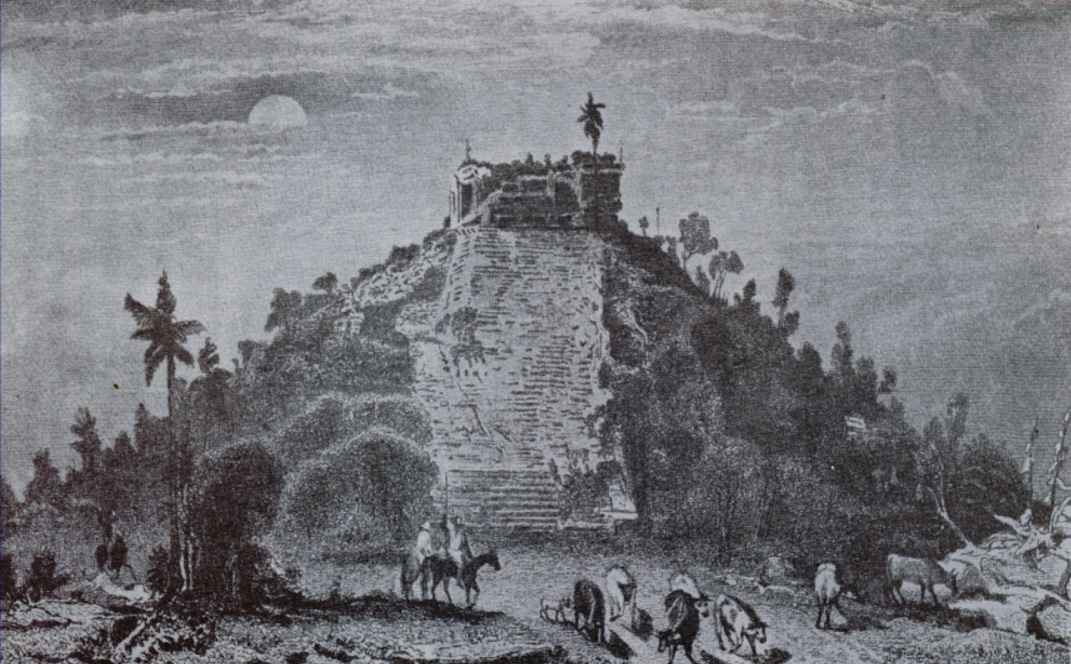
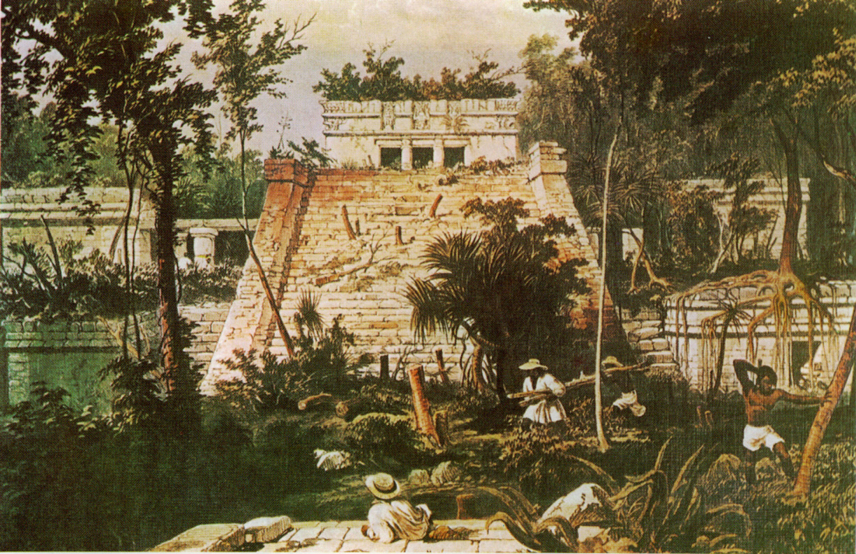
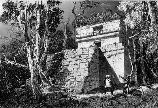
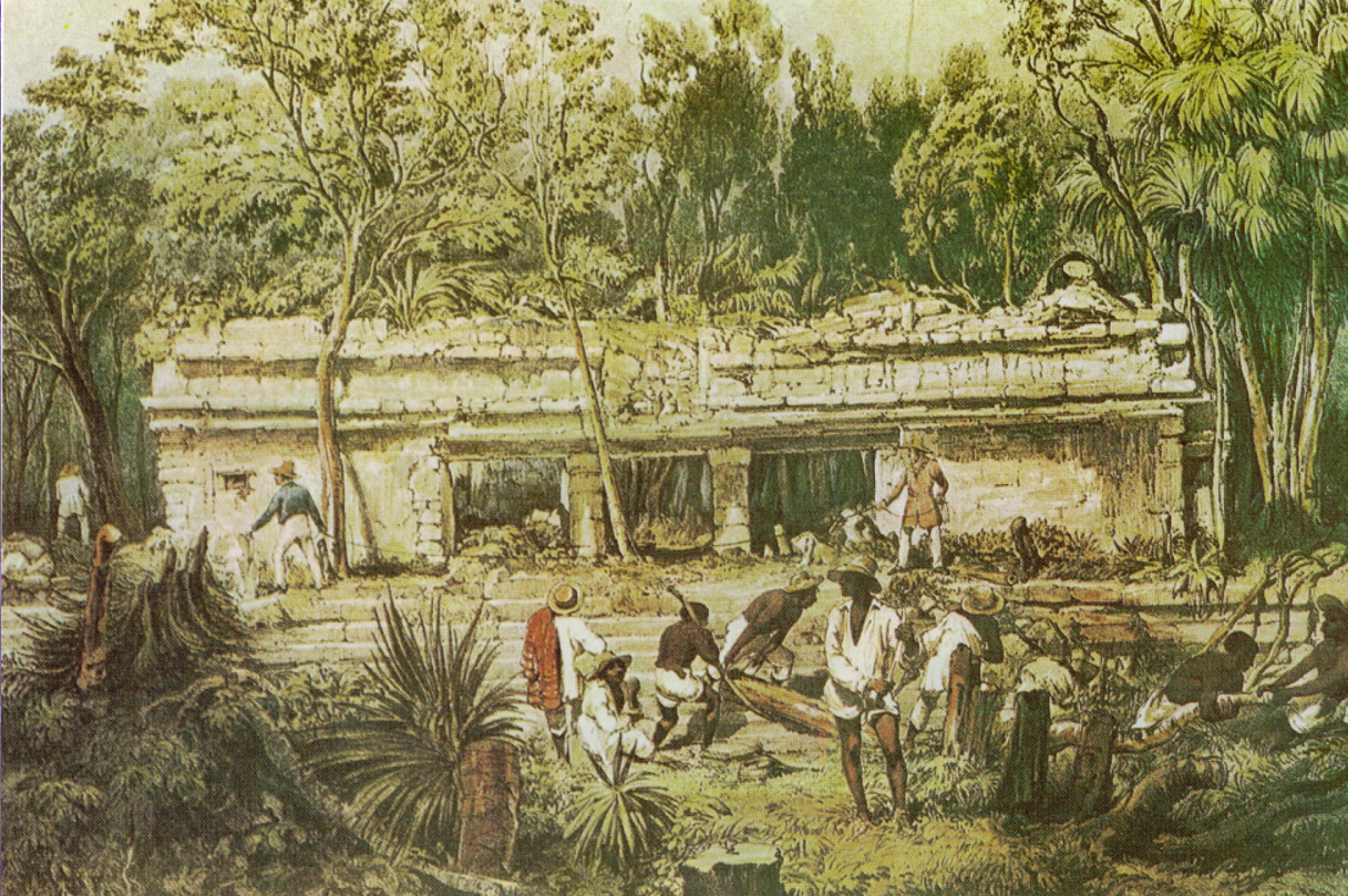
If you don't know much about the Maya, they were and are a fascinating people inhabiting southern Mexico and northern Central America. Though their classic civilization had largely waned long before the arrival of the Spanish, they left behind an incredible legacy of art, science, and architecture, much of which is understood only minimally even today. If what you see here interests you more in their history and culture, there are loads of books available. From the perspective of the ruins that remain, one of the best books is still the classic Incidents of Travel in the Yucatan, by John L. Stephens. Stephens was one of the first Europeans to do major archaeological studies of the cities of the Maya, and while he pillaged a lot of places as well, the book does a wonderful job of describing the cultural remnants that Stephens' found in the 1830's. The accompanying Catherwood illustrations, some of which are shown below, do a nice job of allowing you to contrast the unrestored structures to the modern restoration work. If you're more interested in history, you can't go wrong with the original Yucatan Before and After the Conquest, by Diego de Landa, one of the men largely responsible for the destruction of Maya cultural remnants and ironically, also one of the main sources for modern knowledge of Maya Culture.
I've divided the images by site, and in some cases within building groups within the site. Some of the older images are poorer quality, but I've still kept them around.
Chichen Itza
Chichen Itza is likely the best-known Mayan site, and is certainly one of the most interesting to explore, because of its size, its state of preservation, and the huge variety of its architecture due to the length of time the site was inhabited. The site's somewhat remote location as far as access from the coastal resorts makes it more of an effort to get to, but that unfortunately does not stop the ever-increasing influx of tourists. When I was last there in 2005, it was sadly overcrowded compared to previous years, and the Government's decision to allow roving bands of cheap souvenir vendours definitely lowers the atmosphere of the place (if the throngs of tourists treating the place like Disneyland don't already to that enough for you). If you have the option of getting there early, or late enough that most of the throngs have gone, I'd urge you to do so. Even if you can't, chances are you can find a few moments away from the groups to really appreciate this location.
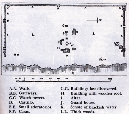
Chichen itza is a very large area, and it may help when reading these descriptions to refer to the modern map, below. Stephens' 1840 map of Chichen Itza is also included for purposes of comparison - you can see how many structures do not appear on it, or were unidentified.

Modern map of Chichen Itza |
Stephens/Catherwood map of Chichen Itza, 1840-1 |

Chichen Itza can be divided into two cities, one that has most of the really large and spectacular temples and public buildings, and the other a much older city with a completely different (and to me much more beautiful) style of architecture. In some cases old-city buildings were added to in later periods, resulting in an interesting conglomeration of architectural styles. In both cases, the work is stunning, and the size of most of the buildings is astounding, given the comparatively primitive technology of the time (No, I don't believe aliens helped them build these structures, though there are of course those in the tinfoil-hat brigade that do). If you're considering visiting Chichen Itza, be aware that the quality of the guides available varies enormously. The first time I went there I was happy to have a guide that knew more than I did, despite my having spent a couple of months of gathering background material on the place. It's certainly what you should expect. I've known many people (and had firsthand experience myself) with guides that were absolutely terrible, to the point where they basically spent an hour or so with gory tellings of human sacrifice and literally nothing about the rest of Mayan culture, let alone anything of significance of the various architectural styles that one was witnessing. In some cases I've even heard of people basically being dumped off at the great pyramid of Kukulkan and not even told that there was a large outlying area beyond it. Part of this can be blamed on the general ignorance of most of one's fellow tourists: there are far too many people who want to visit only to hear gory stories and photograph themselves in stupid poses at the top of the pyramid. However, for the few that are willing to look beyond this, there is much to be seen here.
I'm starting off with the old-city buildings (likely away from where you'll start if you go on an organized tour of the place) and moving to the later ones as we go along. In time I may add some scans from Stephens' book to illustrate how extensively the buildings have been restored. Really, looking at that is part of the adventure too, since it becomes so much easier to imagine what it must have been like to have been at the place when it was in a more natural state.
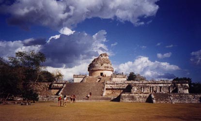
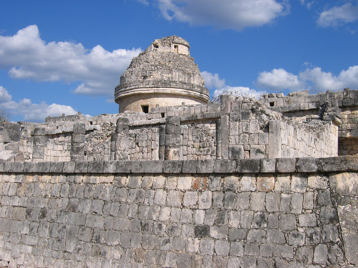
The Observatory
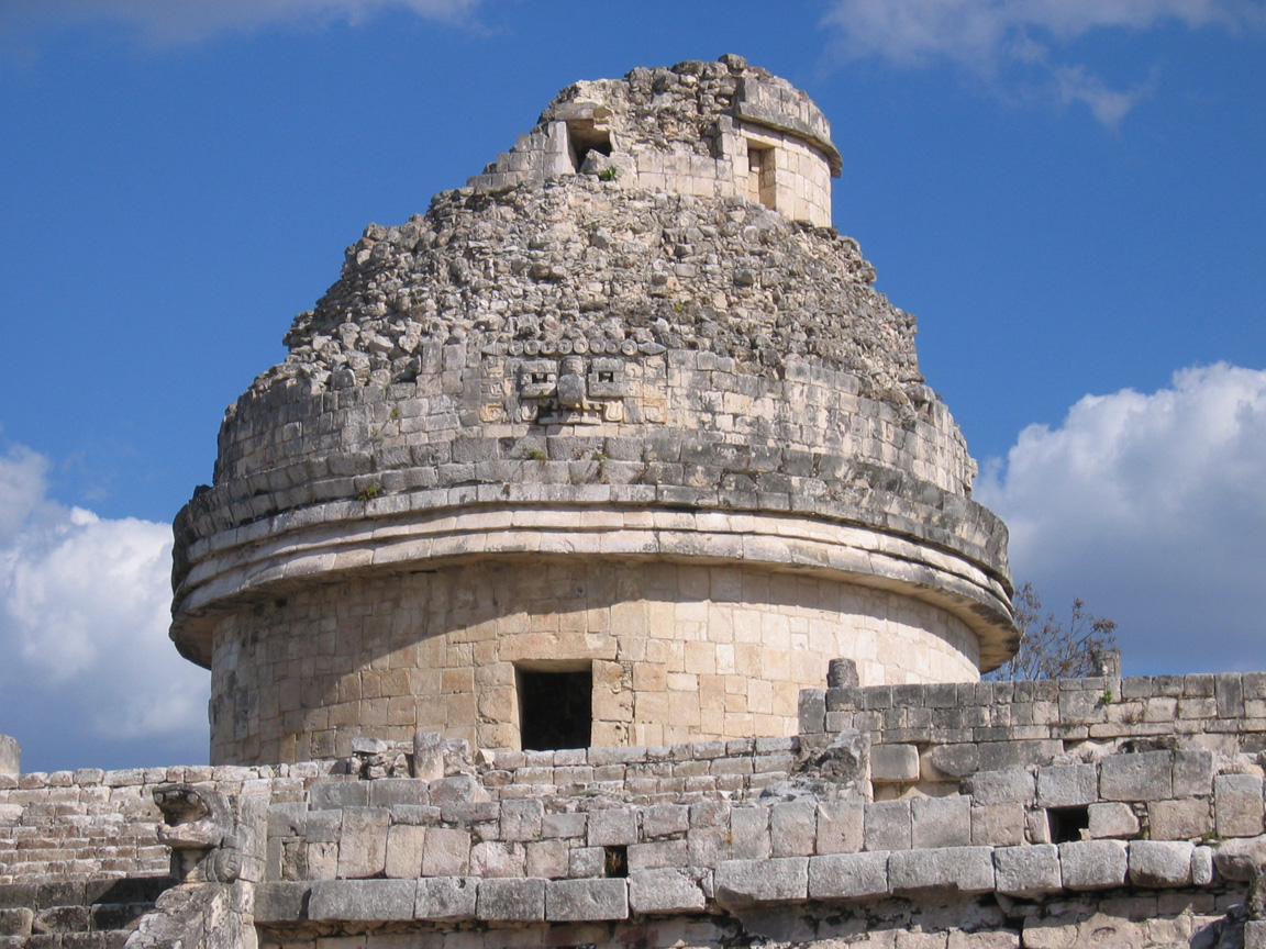
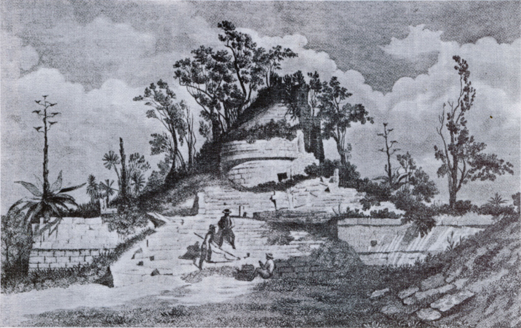
The observatory is probably the most well-known building in the older part of the city. It really is an observatory, and has holes in the upper structure that align with the points of the compass. It's also an example of the Mayan tradition of imposing structure upon structure, so it doesn't have one real age. Parts of it date to the 7th century AD, other parts are several hundred years more recent in construction. The accompanying Catherwood painting shows the degree to which the structure was buried before restoration.
|
The Observatory, or el Caracol, from the front |
Most of the platform extending along the sides was added long after the original structure was built |
|
Detail of the dome, with mask of Chac in centre |
Catherwood painting of the Observatory, 1840-1 |

The Nunnery and Church Complex
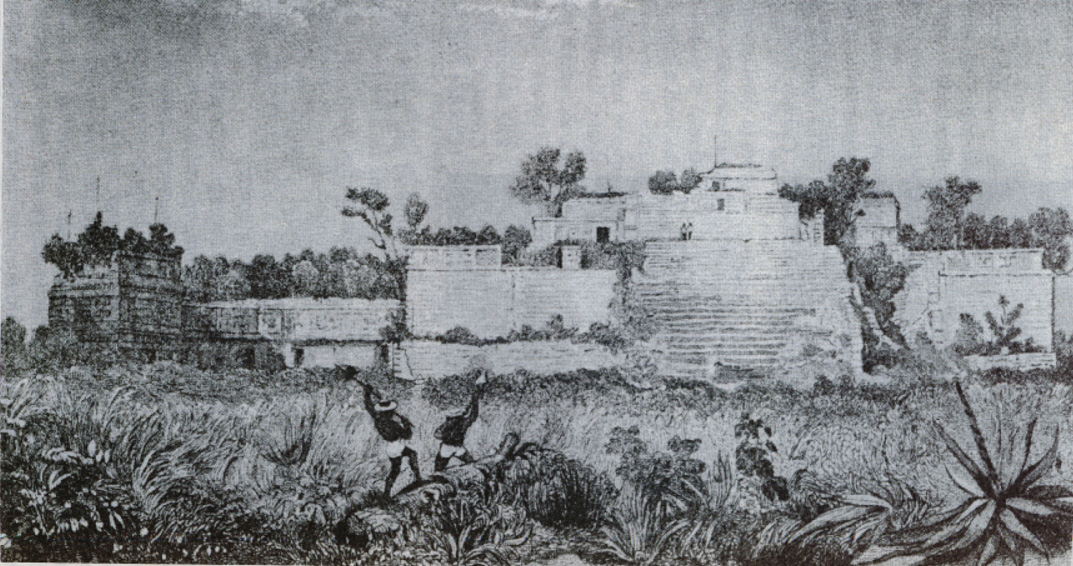
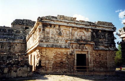
The Church and the Nunnery are shown in the pictures below. The Church is easily my favourite of all the structures I've seen, and is really the jewel of Chichen Itza, despite the fact that everyone goes there for the larger pyramids. It's one of the most elaborately decorated puuc structures from ancient mesoamerica, and has numerous faces of Chac as well other carvings of religious significance.
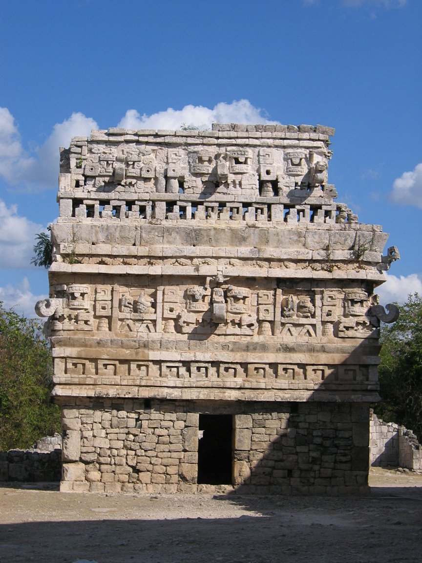
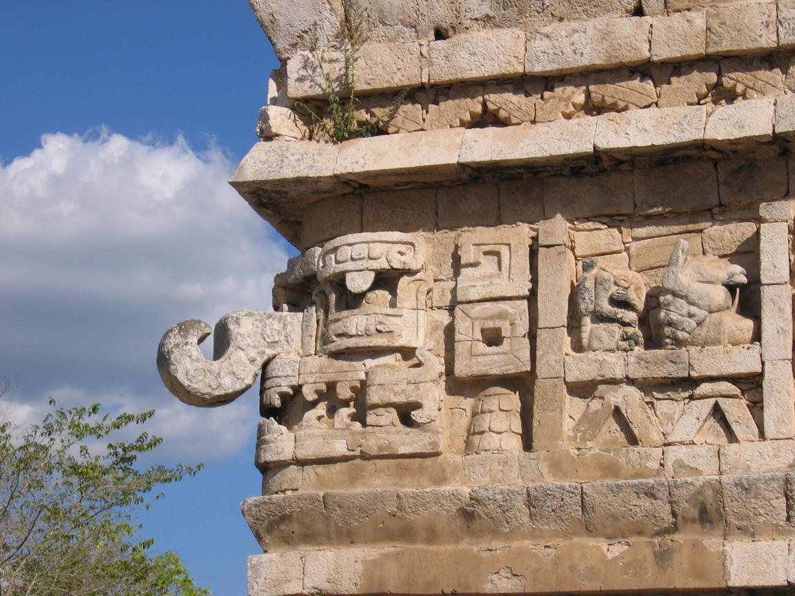
The Church. The hooks parts are noses of the god Chac, prominent in much puuc architecture. |
Details of the carvings on the Church. |

Catherwood painting of the Church, 1840-1 |
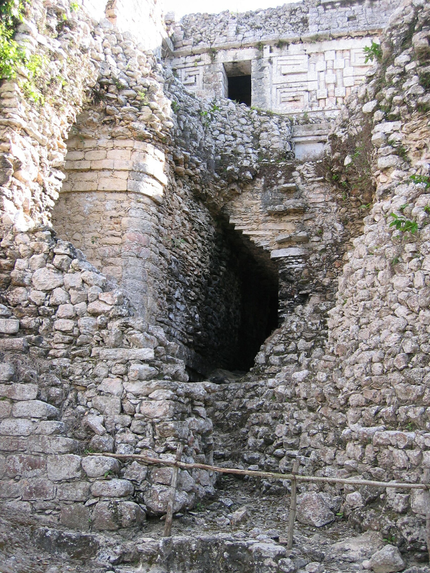
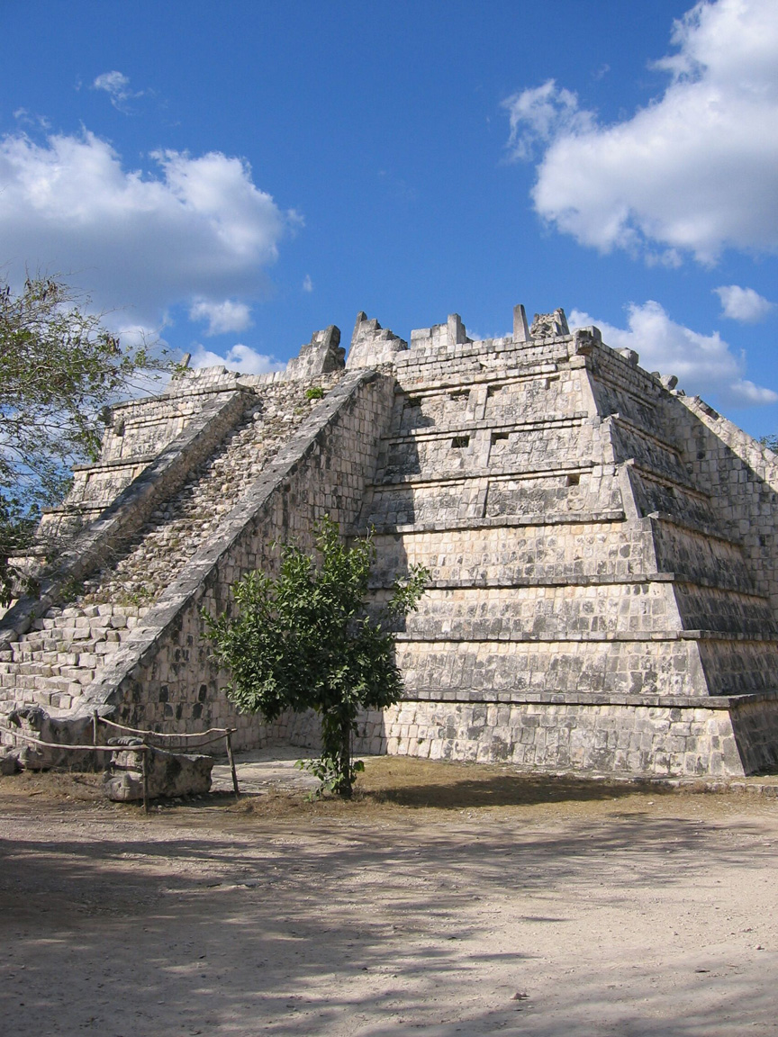
The nunnery is a large building with a huge set of steps running along most of the front, and puuc temples at the top. It has nothing whatsoever to do with Nuns, and gets its name because its many internal chambers apparently reminded the Spaniards of a convent (lots of other Mayan cities have "nunneries" as well, though none of them ever functioned as what we'd think a nunnery was). The Nunnery faces the right side of the Observatory. On the right side of the Nunnery is a large hole where Augustus le Plongeon, a french archeologist from a less enlightened age, used dynamite as part of his archeological efforts. Sadly, this was not the only place this occurred. The hole in the Nunnery, however does allow the visitor to see something that is not visible in many mayan structures: the fact that newer structures are built overlaying old ones. The inner, older layer of the Nunnery is very clearly visible (the recursive nature of this should also be cool to any computer scientist!)
|
The Nunnery |
Dynamite hole on the right side of the Nunnery, showing a corner of the inner (previous) nunnery |
|
Catherwood painting of the Nunnery (and annex), 1840-1 |

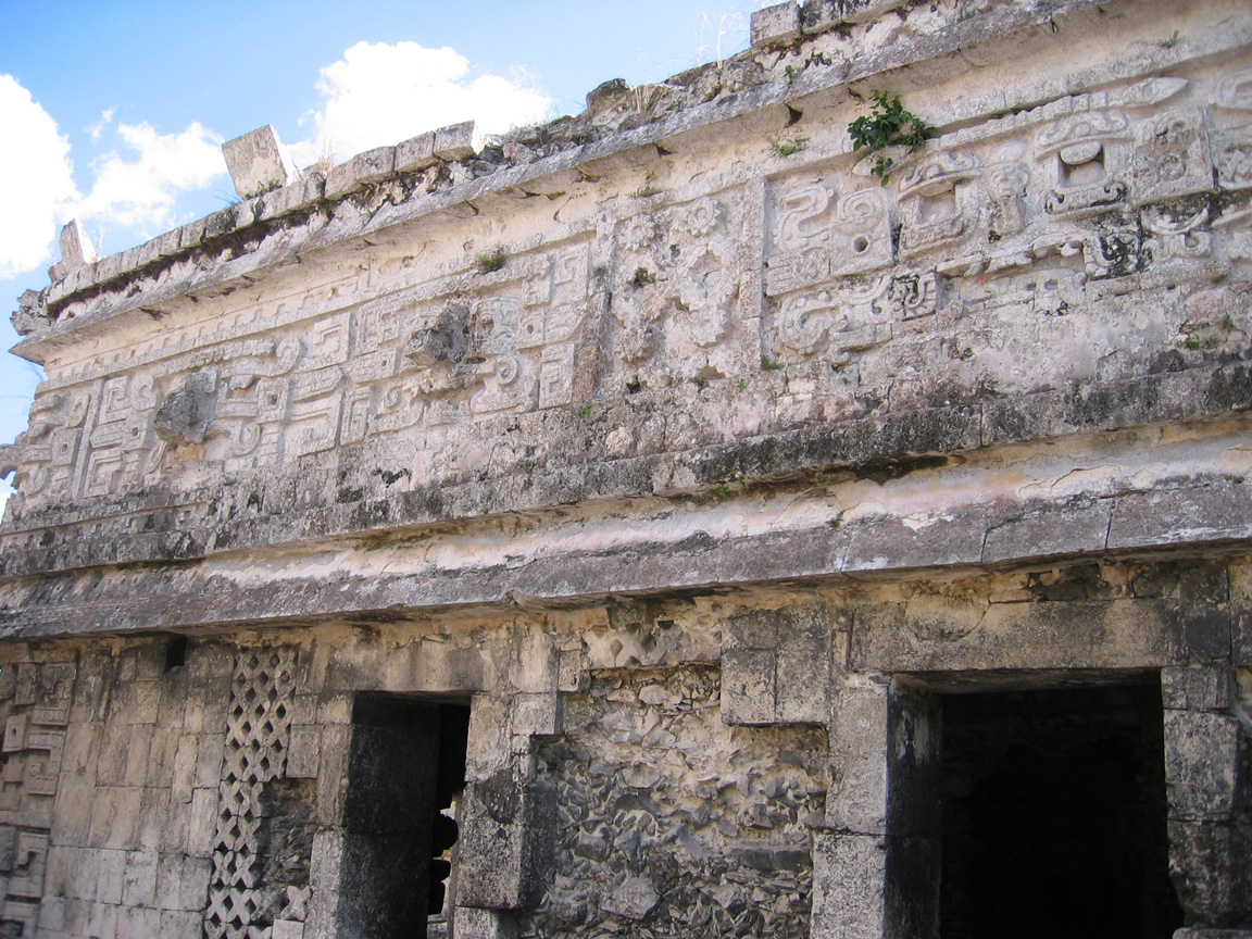
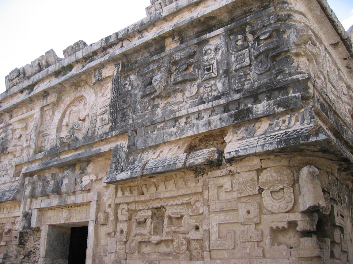
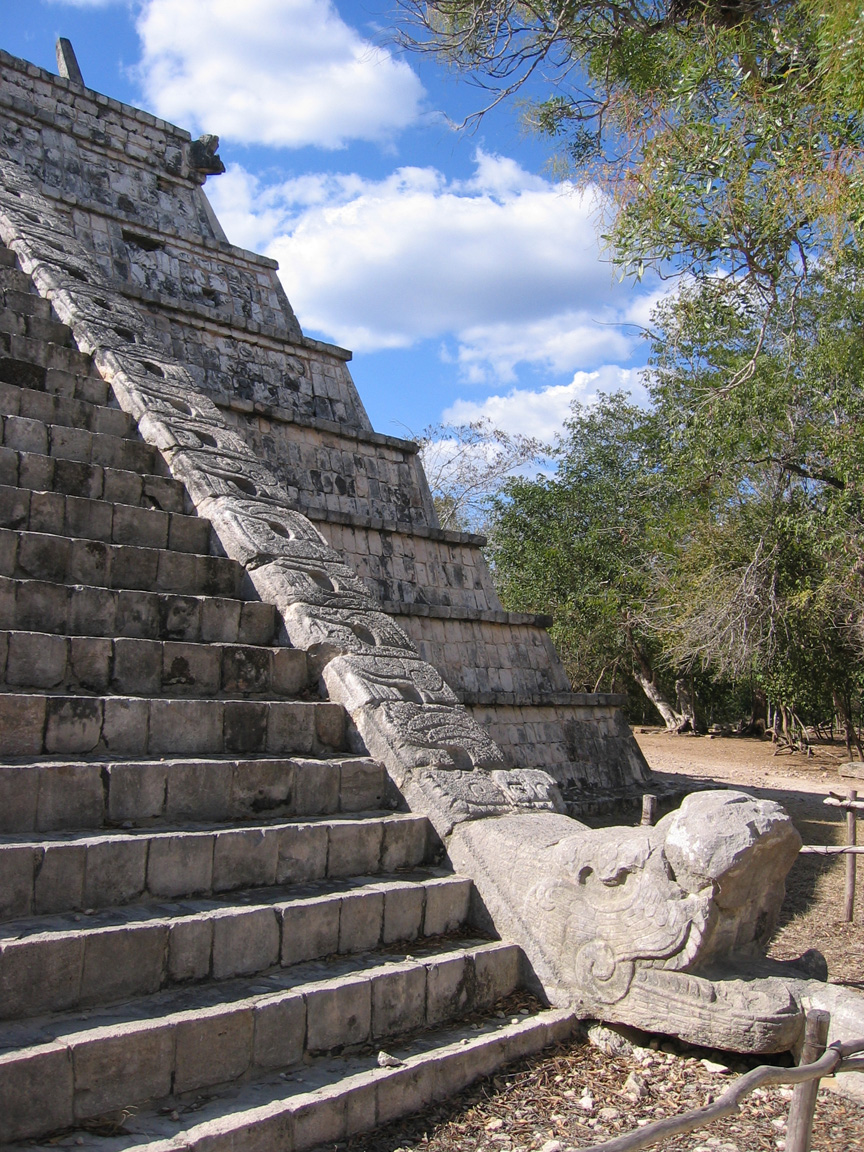
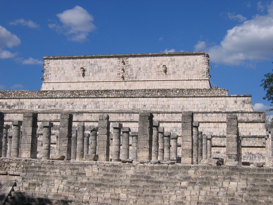
On the left side of the nunnery, a large annex was built - that is, a building of a slightly later time period and different architectural style, resulting in a very different appearance from that side. The front (south side, above) is classic puuc style where only the top part of the building (it's frieze) is decorated, and the east side of the building (detail below, matching the Church) is elaborately carved, and forms a courtyard with the Church. It really is absolutely the most beautiful area of Chichen Itza in my opinion, and is often less crowded as well.
|
|
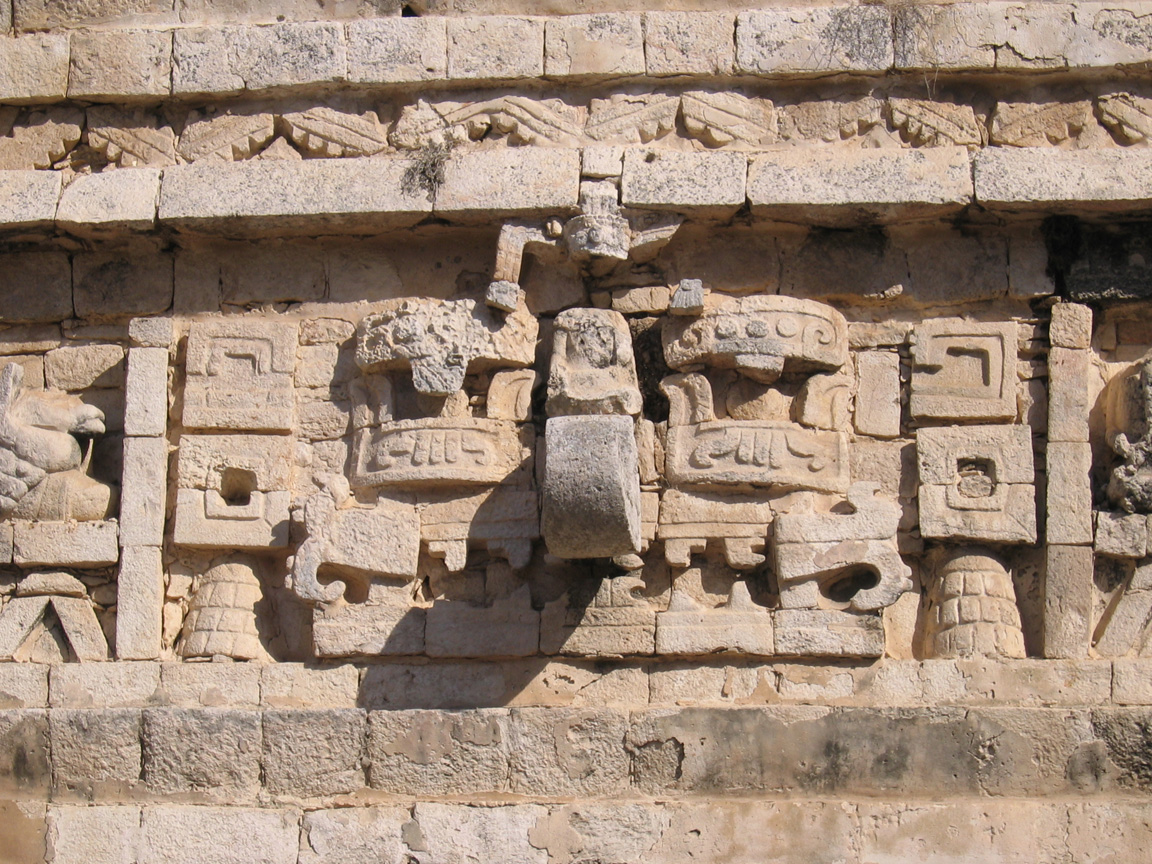
closer view of the carving on the Nunnery Annex |
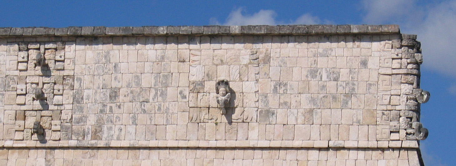
 Detail of the frieze on the Nunnery Annex. You can see the image of the God Kukulkan in the centre - a man's face emerging from a winged snake's mouth. You can also see many faces of the god Chac. |
Other Buildings In/Near Old Chichen
There are a number of other buildings in the area that do not stand out as particularly impressive amid the more grand structures in Chichen Itza, but would be more noticable at other sites. These include the Red House (Chichanchoob), pictured below, and the House of the Deer nearby.
|
The Red House, in a classic puuc style with a decorated frieze and simpler bottom portions |

Bounding Old and New Chichen: the Ossuary and the Temple of Venus
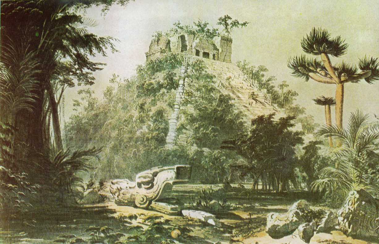
As one walks between Old and New Chichen, a group of boundary structures is encountered. These make a transition between the two complexes. The Ossuary (also called the Temple of the Sorcerer) is similar in style to the Great Pyramid, but has more elaborate staircases. In Stephens' time it was basically a big mud pile, but is partially restored now by fitting original block to original block like a big jigsaw puzzle. Its name is derived from the fact that it contains tombs. Across from the Ossuary is the Platform of Venus, a squat low structure with four small staircases. It is the smaller of two platforms of Venus at Chichen Itza, the other being closer to the Temple of Kukulkan. It is similar to the other platforms described below, but contains different decoration.
|
The Ossuary |
Detail of the snake motif on the staircases - the carved body is more elaborate than that of the Great Pyramid. |
|
The Platform of Venus. |

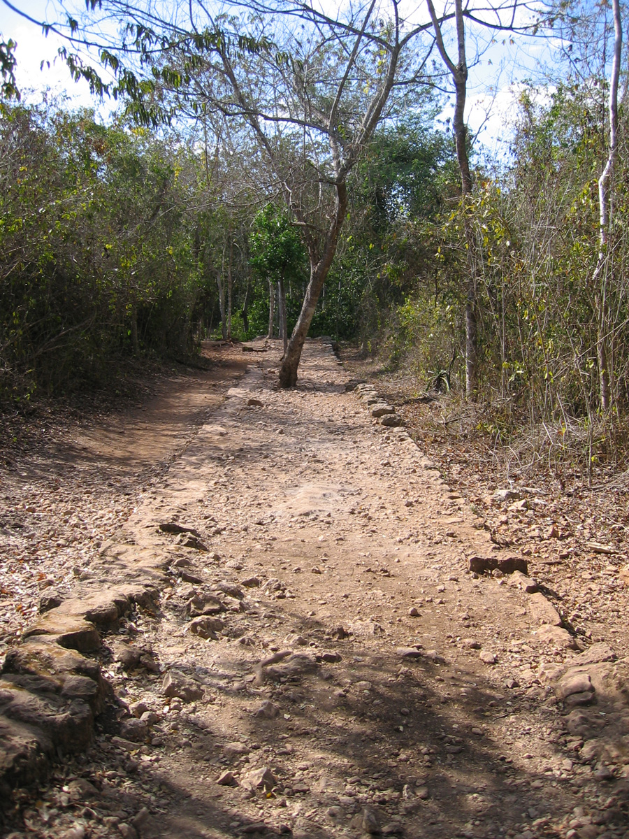
Sacbo'eb
Also visible at Chichen are some remnants of the Sacbe system connecting the ancient mayan cities. These were raised sacred roads, sometimes more than a hundred kilometers llong, complete with ramped intersections (which is unusual because the Mayans did not use wheeled transport or beasts of burden). For example, Chichen Itza was connected to Coba (below) via sacbe. You can see some of the remaining pieces of these in Chichen Itza as well as the other sites.
|
Remnant of one of the sacred roads |
New Chichen
As mentioned above, the newer parts of Chichen Itza are very different from the old - the boundary structures above already illustrate this, and the toltec influences are apparent in all the newer structures.
The Temple of Kukulkan
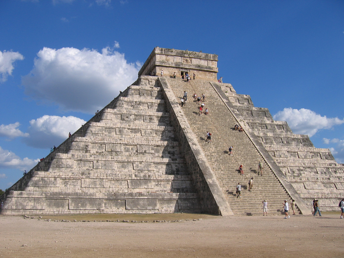
We may as well begin by getting the Pyramid (or El Castillo)out of the way - you've probably seen it, it's one of the most common images of Mayan architecture, and also one of the first buildings you see when you move from the old city to the new. It's also the tallest thing around, so it's visible from a long way away. The first thing to say is that it's not a pyramid - the Mayans didn't build them - it's a set of tapering terraces- and is actually a large temple, the Temple of Kukulkan (the snake-man-bird god shown on one of the Nunnery Annex pictures).
There are stairways on all four sides, with 91 steps on each (which, including the temple floor at the top, gives a total of 365 steps). Each one of the staircase edges begins with a serpent's head at the bottom and ends with a serpent's tail at the top. Many columns in this later (Toltec) period are also similarly organized (including those at the top of the Temple of Kukulkan, the Temple of the Warriors, and the Temple of the Jaguar). The Temple of Kukulkan is angled precisely such that on the equinoxes, the shadow of the terraces fall on the sides of the main stairway, giving the illusion of a writhing snake.
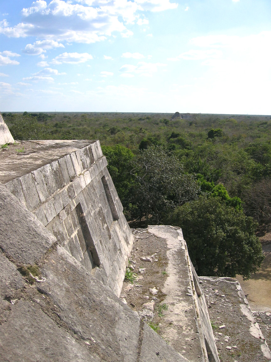
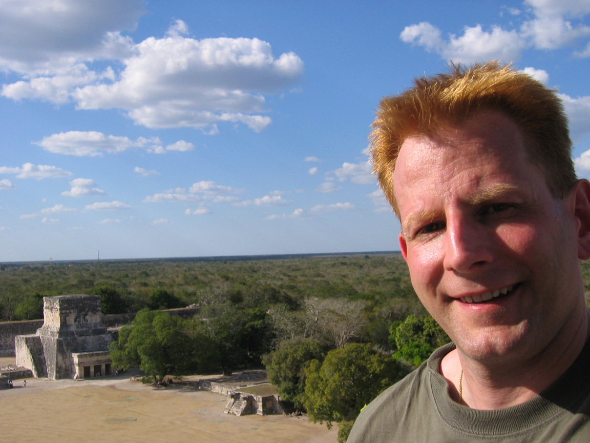
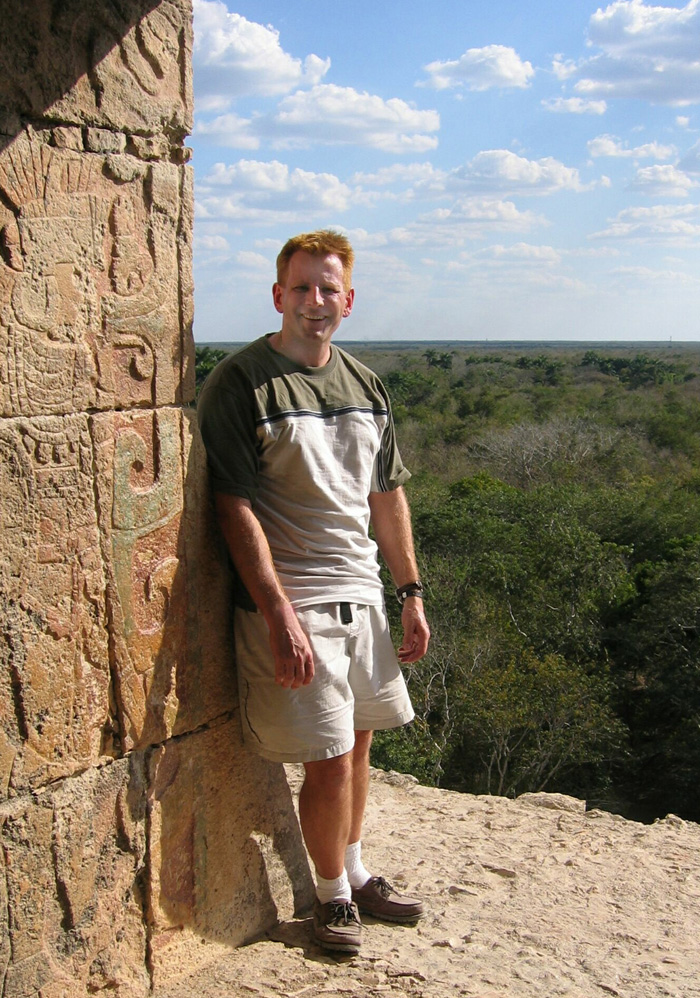
Once at the top, you really get a feel for the grandeur of the place. You can see most of the major temples and miles of empty jungle. It's really easy to imagine what this place must have been like during the centuries it was deserted and untouched (When the Spanish arrived, it had already been largely deserted for almost 200 years).
The accompanying Catherwood paintings show what a striking building this was even before any restoration or clearing was performed.
|
Climbers on the face of El Castillo |
Detail of the terraces. the right shows the flat staircase edge, and off in the jungle, the Nunnery and Observatory can be seen. This gives you some idea of the distance between the old and new parts of the city. |
|
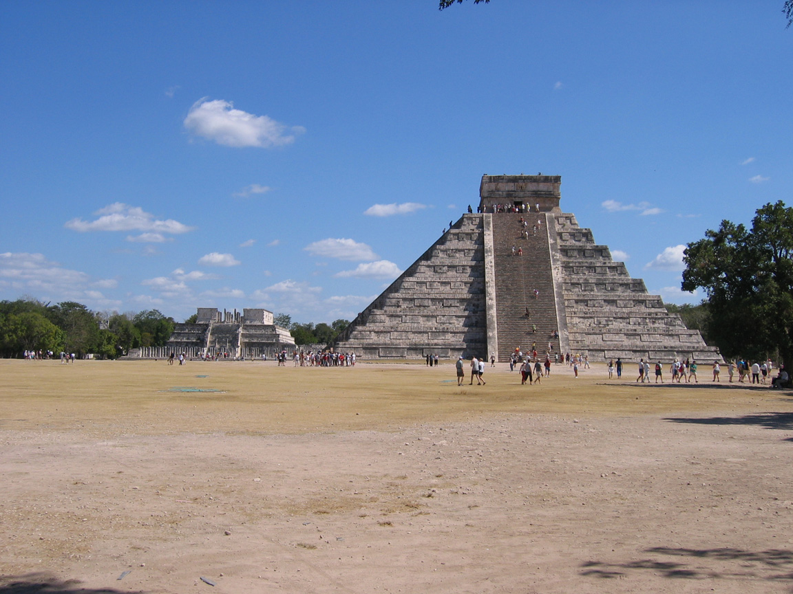
Other Perpsectives of the Temple of Kukulkan: from the front of the Temple of the Warriors (Left) from the path leading to the older part of the city (right) |
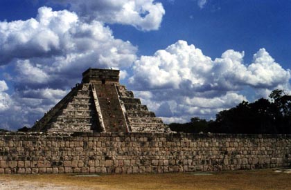
Views of the Temple of Kukulkan from the Ball Court. The left includes the wall bounding that side of the ball court, while the right shows the Temple of the Warriors in the background. |
Catherwood painting of the Temple of Kukulcan, 1840-1 |
Catherwood painting of the Temple of Kukulcan, farther view, 1840-1 |


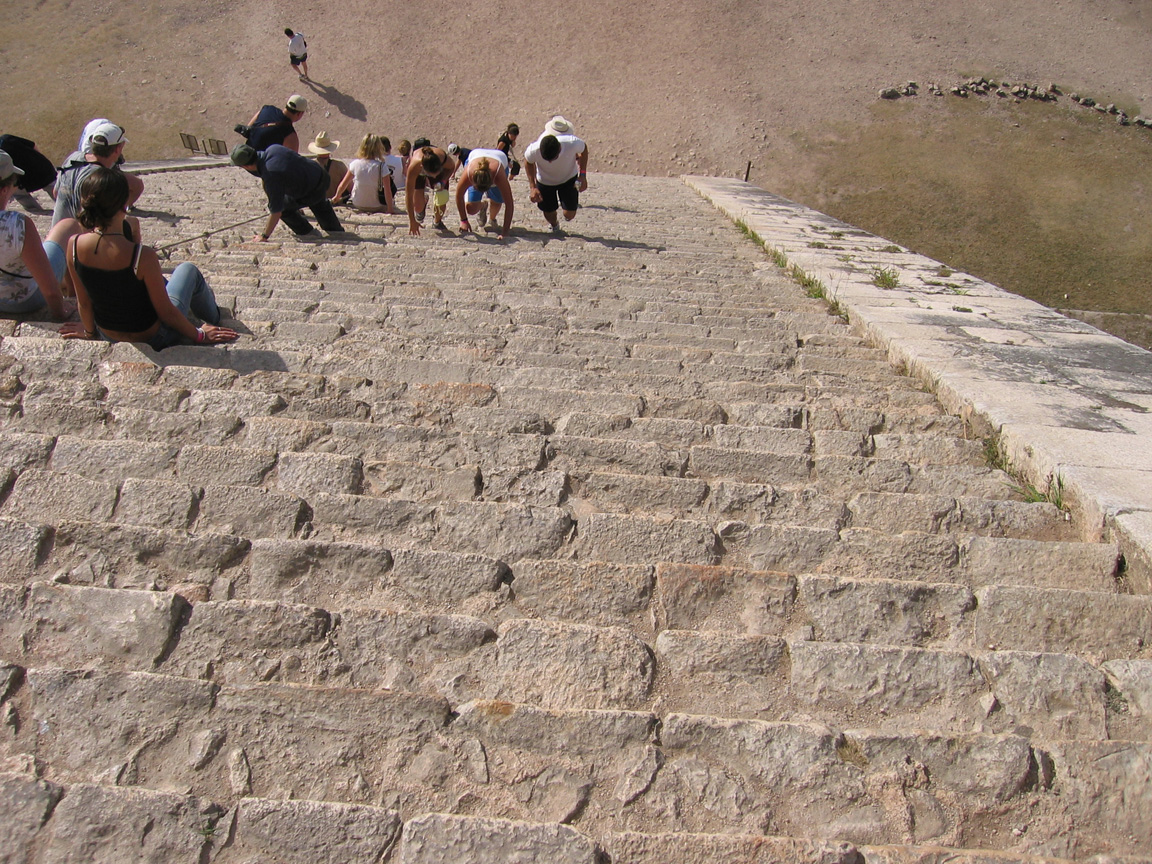
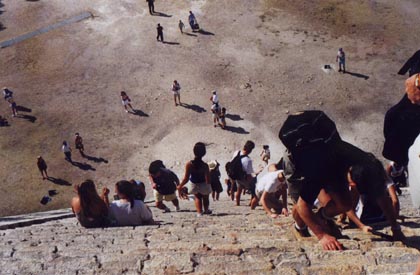
Climbing The Temple of Kukulkan
This is the cheesy thing that most of the tourists used to be here for (since climbing has been prohibited since 2006, not long after some of these pictures were taken - showing pictures of what you can no longer do gave me the idea of putting up information on climbing other world icons, so watch for that in a nearby page in future). While understandable from the standpoint of preserving an archaeological treasure, climbing the monument was still a breathtaking experience, asssuming you could ignore the other tourists. The view at the top and on the way up really gave you a good picture what it must have been like when this was a living city. Going down was a great deal harder than going up.
|
View from the bottom going up |
View midway up looking down |
From inside the Temple at the top - details of carvings and Yours Truly |
 At
the top, with the Temple of the Jaguars and the Ball Court in
the
background At
the top, with the Temple of the Jaguars and the Ball Court in
the
background |
Badly backlit shot of Yours Truly with the Temple of the Warriors behind me |
Your Host on the other side of the temple. My feet are standing where a missing serpent head should be. |


Inside the Temple of Kukulkan
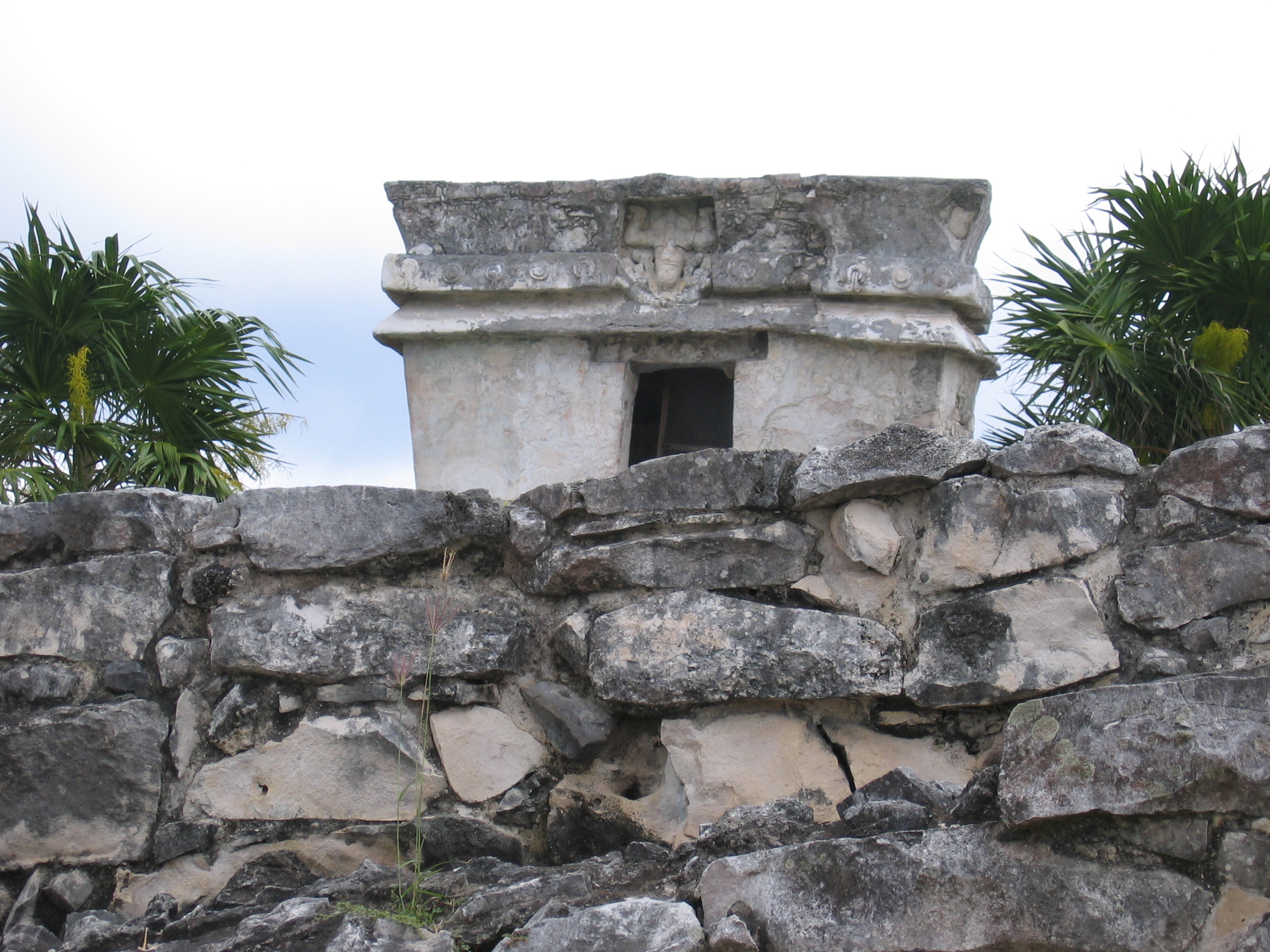
As I mentioned in the section on the Nunnery, there are not many places where it is obvious that Mayan structures are built atop previous structures like a nested set of dolls (although in some places, such as Tulum, diagrams are provided on the signage that show that the inner structures look like). The Temple of Kukulkan, however, shows this spectacularly. A tunnel accessible beside one of the staircases allows one to enter the pyramid itself, and climb up what would have been one of the outer staircases of the prior temple. It's an interesting experience because not only are you climbing up a narrow passage inside tons of stone, you're also climbing up what was once an outdoor temple just as the external pyramid is today. It is also a seriously claustrophobic experience: it is narrow enough that you get very, very friendly with anybody who is attempting to go the opposite direction past you, and you can easily touch your hands (and possibly your head) on the side and top of the passage. It is definitely not for those who have problems with enclosed spaces. It is also very humid, to the point where water is dripping down the stone walls, which makes it very easy to slip. The only thing that got to me during the experience was the idea that somebody would fall ahead of me while going up, and take me down with them.
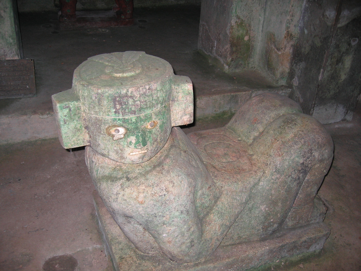
Upon getting to the top inside, there are some beautiful objects in the inner temple: a Chac Mool in far better shape than the one on top of the Temple of the Warriors, and a red jaguar throne. These are behind a large gate, but you can still get a good view. One thing I couldn't properly capture with my camera was that if you look up as you go into the inner temple at the top, you can see the edges of decoration that used to be outdoors and is now partly covered with the new outer stonework.
|
The passageway up to the inner temple |
The Chac Mool (sacrificial platform to Chac) inside the inner temple |
|
Behind the Chac Mool is a chamber with a red jaguar throne |


It is fairly obvious where the entrance to the inner temple is, as there are usually long lineups to get in, but I've been there when there were plenty of tourists and no lineups at all, and I'm putting that down to more tourists not knowing it's there.
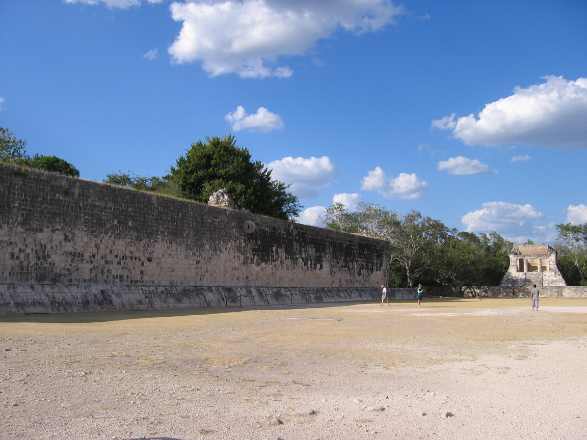
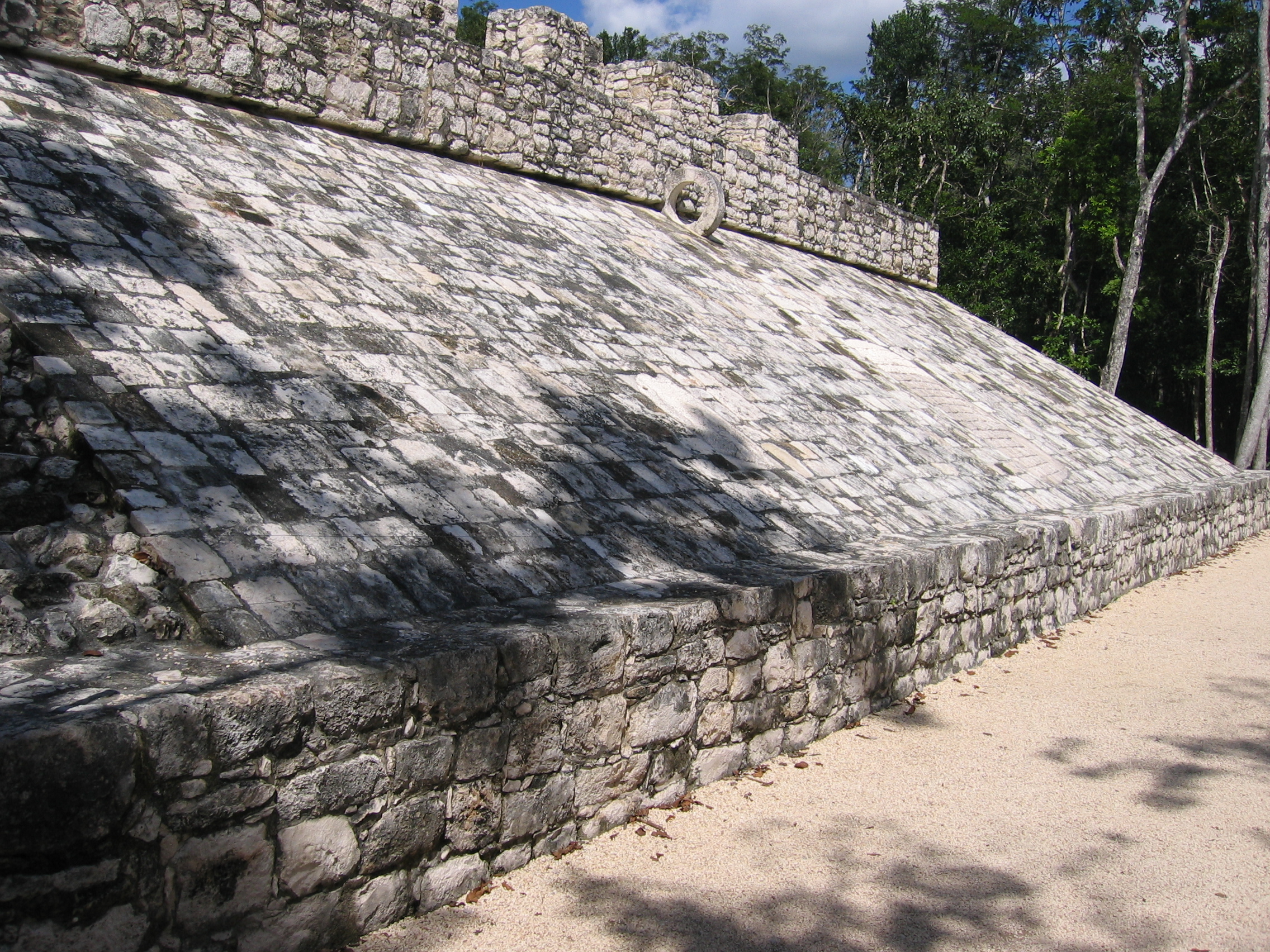
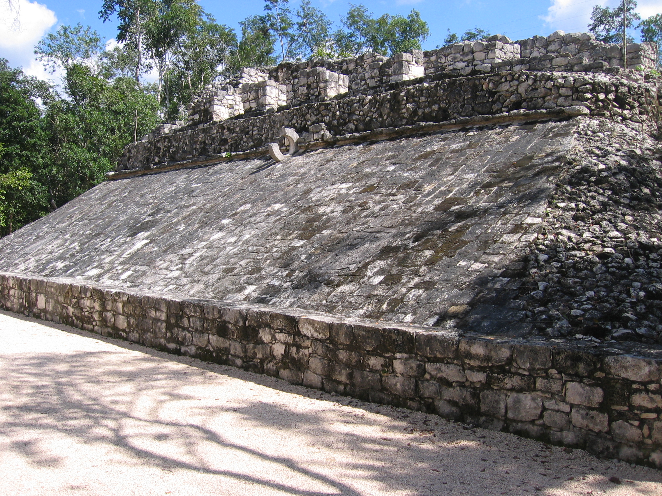
The Ball Court
The Mayans, like most Mesoamerican peoples, played a form of ceremonial ball game that formed both a sport and a facet of religion. Sacrifice played a part in this as it did in many aspects of Toltec religion that had influenced the Maya by this time.
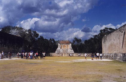
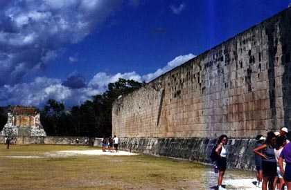
The ball game itself is poorly understood, though images along the sides of the court illustrate what the players looked like. The ball court at Chichen Itza is the largest in Mesoamerica, and really is a sight to see. As the pictures below illustrate, it's enormous, and even given its size (189 yards x 76 yards), its acoustics are such that you can hear someone talking at one end from the other (provided the place isn't too crowded). The court itself is at one end of a very large compound that the Temple of Kukulkan forms roughly the centre of. The ball court itself has very high walls, and Pictures 12 and 13 are taken from the same end (roughly from the far left of the court as you saw it in the background of Picture 8. In both pictures 12 and 13, you can see one of the two rings through which the ball was thrown, high on the court wall. You can also see a temple at the far end (the Temple of the Bearded Man).
|
|
Closer view of one of the walls |
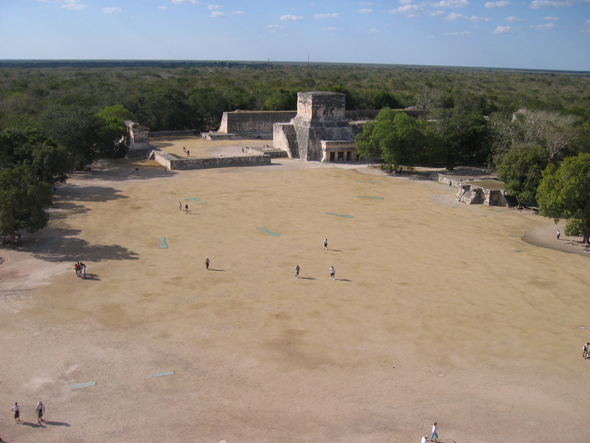
View of the ball court from the top of the Temple of Kukulkan (the large green pads are steel covers for lights for a night show, and are painfully obvious during dry times when the colour doesn't match the surrounding turf) |
|
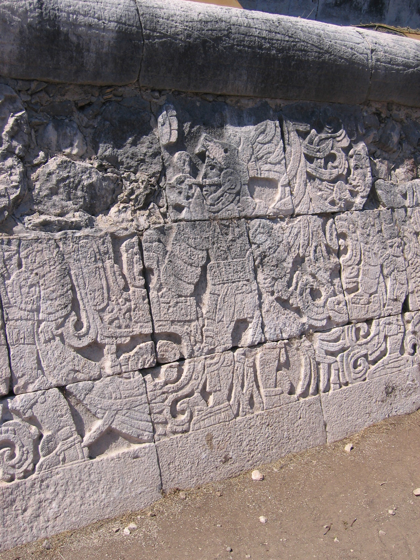
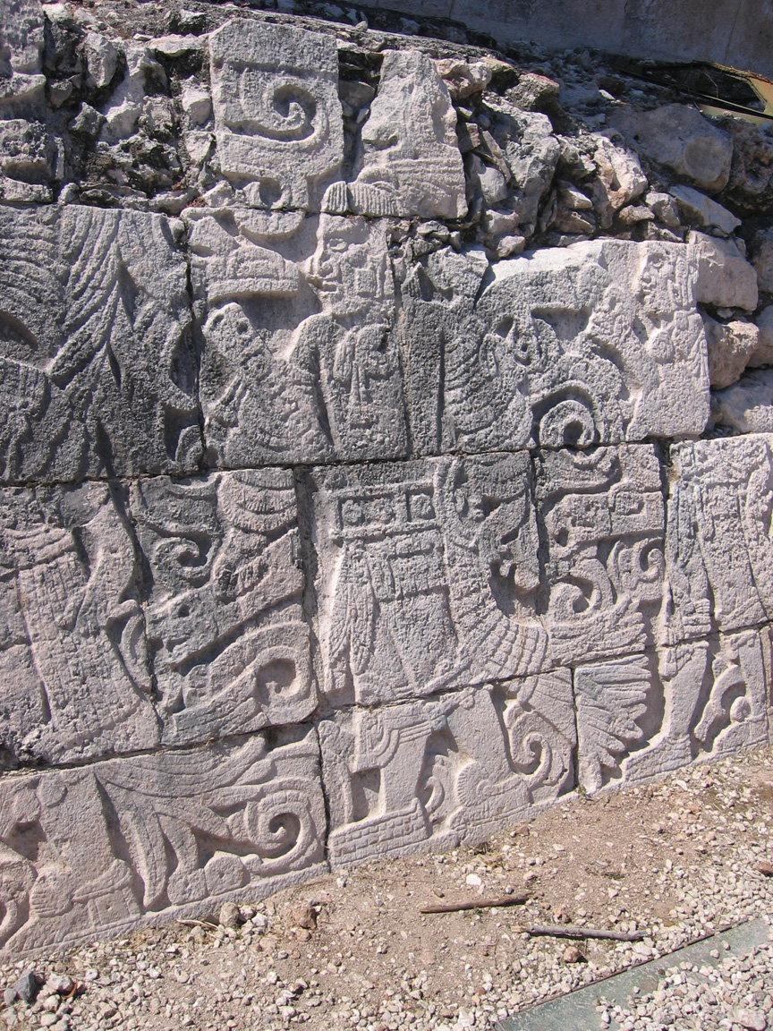
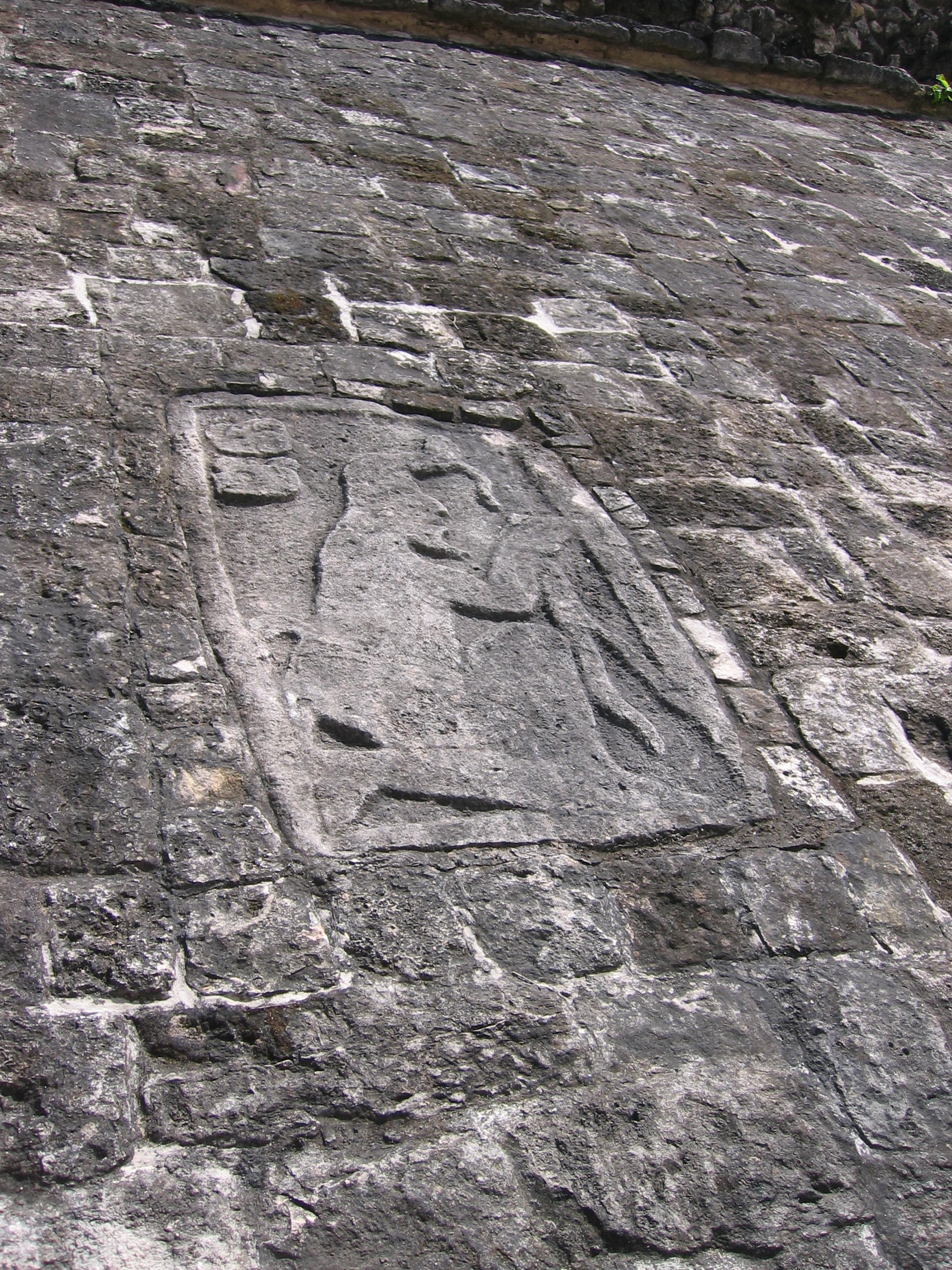
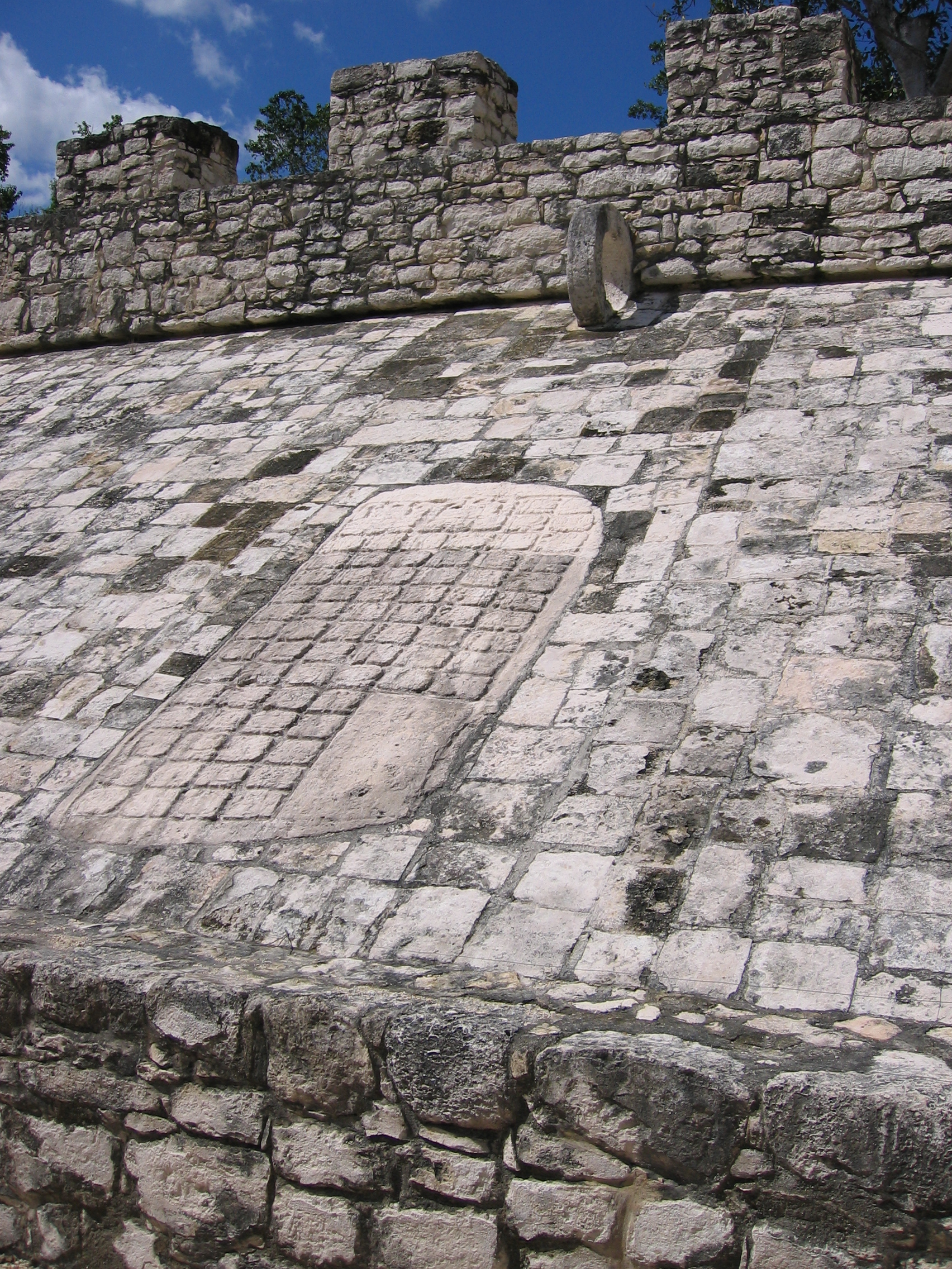
Carved panels along the bottom of the walls provide some details of the game |
|
|
|
Catherwood painting of the ball court, 1840-1 |


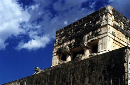
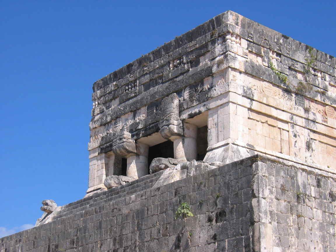
The Temple of the Jaguars and the Tzompantli
As can be seen from the Temple of Kukulkan, the ball court also has a much larger temple attached to it on one side, called the Temple of the Jaguars. It can be seen outside the ball court in the background of Picture 8, and actually overshadows one side - that is, the right wall in the pictures of the ball court is not thin, but is actually the width of the temple. As can be seen in the pictures below, the front of the temple overlooks the proceedings in the ball court, and has the same serpent pillars noted elsewhere. On the rear of the temple outside the court, there is an annex of the temple at ground level with a stone Jaguar throne in the centre. This is similar to the jaguar throne at the top of the interior of the Temple of Kukulkan, but less richly decorated.
Outside the ball court is the Tzompantli, or platform of the skulls. This is similar in structure to the platform of Venus noted earlier, but larger and with an elongated wall on one side. the decoration consists entirely of carved skulls. This was a sacrificial platform. In addition to this platform, there is another to Venus nearby, and a third platform to the Eagles and the Jaguars, two cults thought to be associated with the teams on the ball court.
Stephens' Incidents of Travel notes the collapse of the lower part of the Temple of the Jaguars, and its poor condition can also be seen in the Catherwood painting of the Ball Court above.
|
The temple of the Jaguars overlooking the ball court |
The Jaguar throne on the opposite side of the Temple of the Jaguars |
|
Decoration on the Tzompantli |

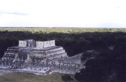
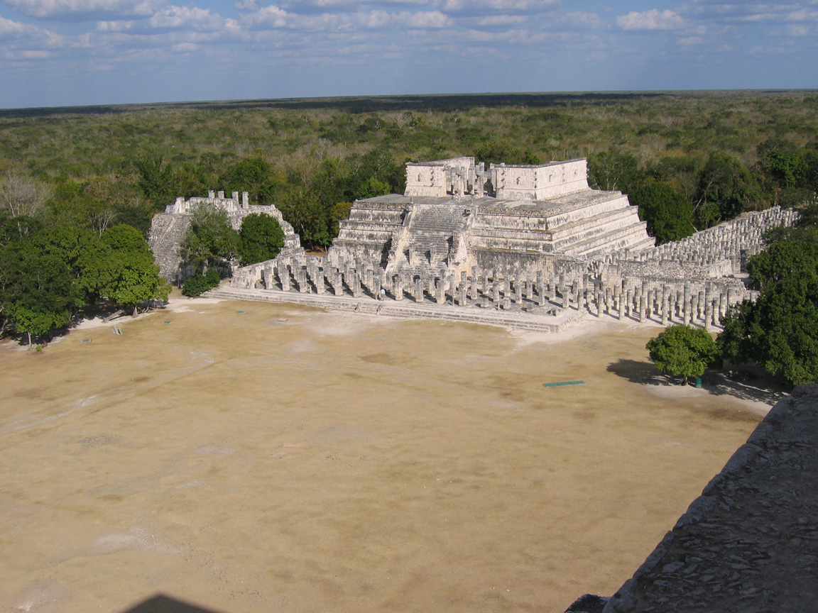
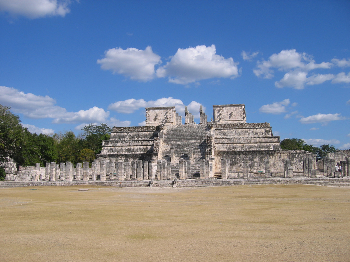
The Temple of the Warriors and the Group of the Thousand Columns
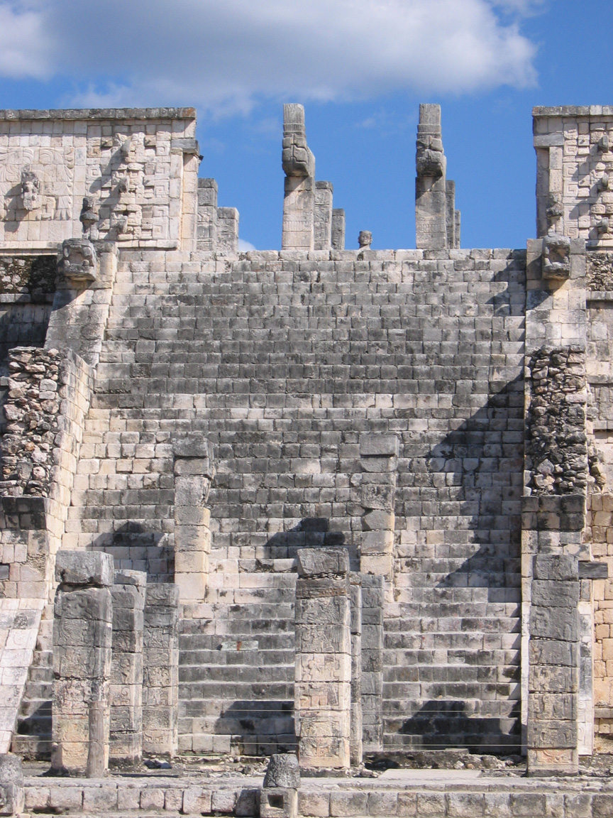
This structure is at the opposite end of the same compound as the ball court - there are several platforms (the Temple of Venus, and several sacrificial platforms) between these, all running along one side of the Temple of Kukulkan. The Temple of the Warriors is actually two abutting structures - the temple itself, and the Group of the Thousand Columns (no there aren't a thousand of them, but there are lots), which was a much larger structure that was roofed in wood and thatch. Pictures 17 and 18 show where the Temple of the Warriors from ground level. The temple, like most Mayan temples, is built on earlier incarnations and used to be the Temple of the Chac Mool. The Chac Mool (a reclining statue of the god) can barely be seen at the front of the top of the temple in Picture 16, and would be slightly to the left on Picture 18. It is between the columns at the top of the stairs in Picture 19.
|
The Temple of the Warriors from the Temple of Kukulkan. A Chac Mool can be just barely be made out in the front of the top of the temple. To the left of the Temple of the Warriors is the smaller Temple of the Big Tables |
The Temple of the Warriors from Ground Level |
A closer view of the staircase shows the serpent columns on the top, along with faces of Chac and Kukulkan |
|
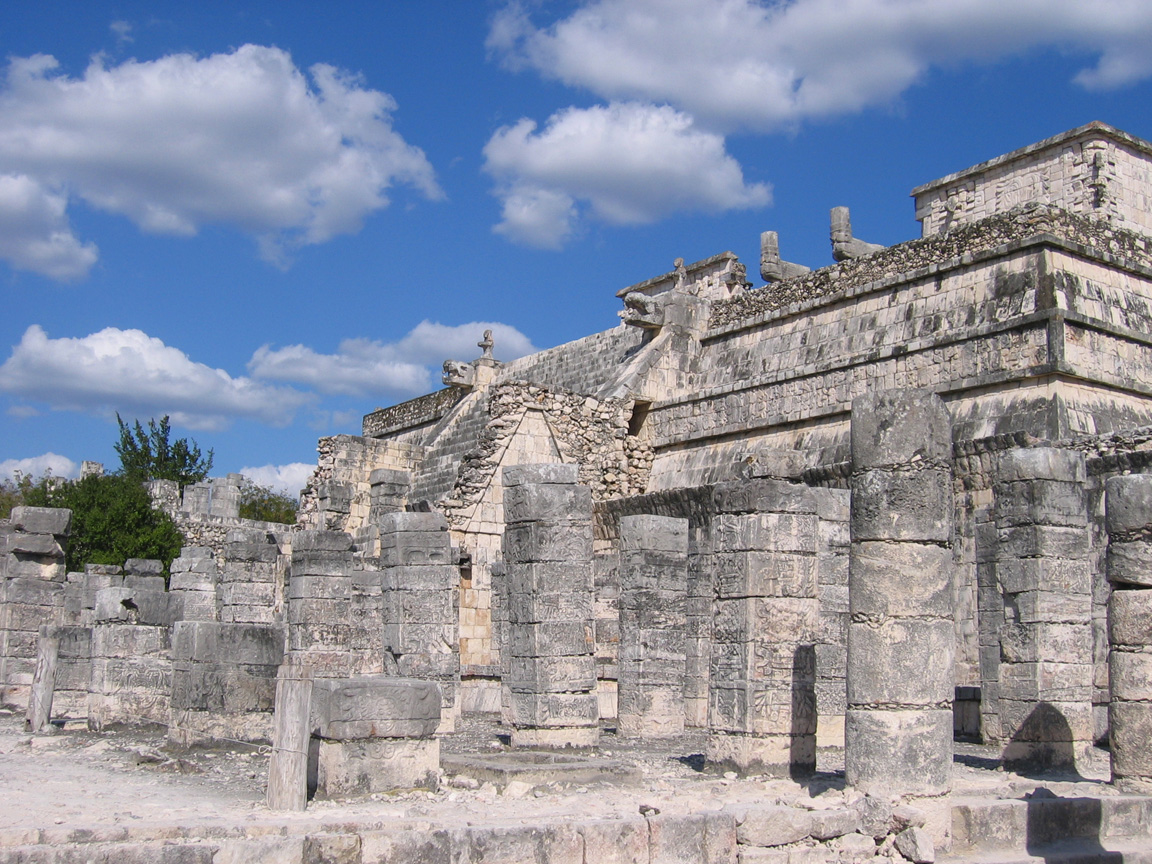
Carved columns in the front of the temple once held an overhead roof |
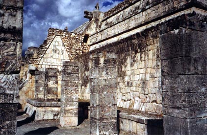
Columns are beautifully carved, but become less decorated around the back of the complex |
|
|
A view from the side shows less decoration but this side is extremely well restored. |
Detail of the faces of Kukulkan and Chac. The human face emerging from the snake's head in the face of Kukulkan can be seen. |
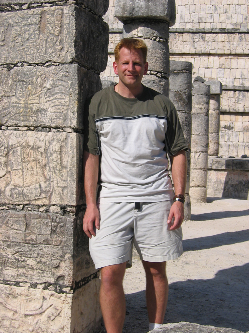
Your Host with a random column |
As can be seen on the map, there are many other groups of buildings that are not described here, and are not even seen by the average visitor. Indeed, as one traverses the sacbes between buildings, there are numerous untouched mounds, and that is just what the jungle hasn't covered. It really was a huge city.
Coba
Coba is a very interesting contrast to Chichen Itza, and if you were choosing only two places to visit, these are the two I'd suggest. Coba is also a very large city - at one time it had 50,000 inhabitants and covered 80 square km - and is further interesting in that excavation and restoration work has barely begun there. This is evident both in the nature of the structures and in the number of unexcavated mounds (I have seen an estimate of 6500) that one sees in relation to the number of uncovered structures. Unlike the other sites described here, there are no early drawings of the unrestored buildings. The reason for this is that it was not visited by Stephens and Catherwood, and indeed was not re-discovered until the 1890's.
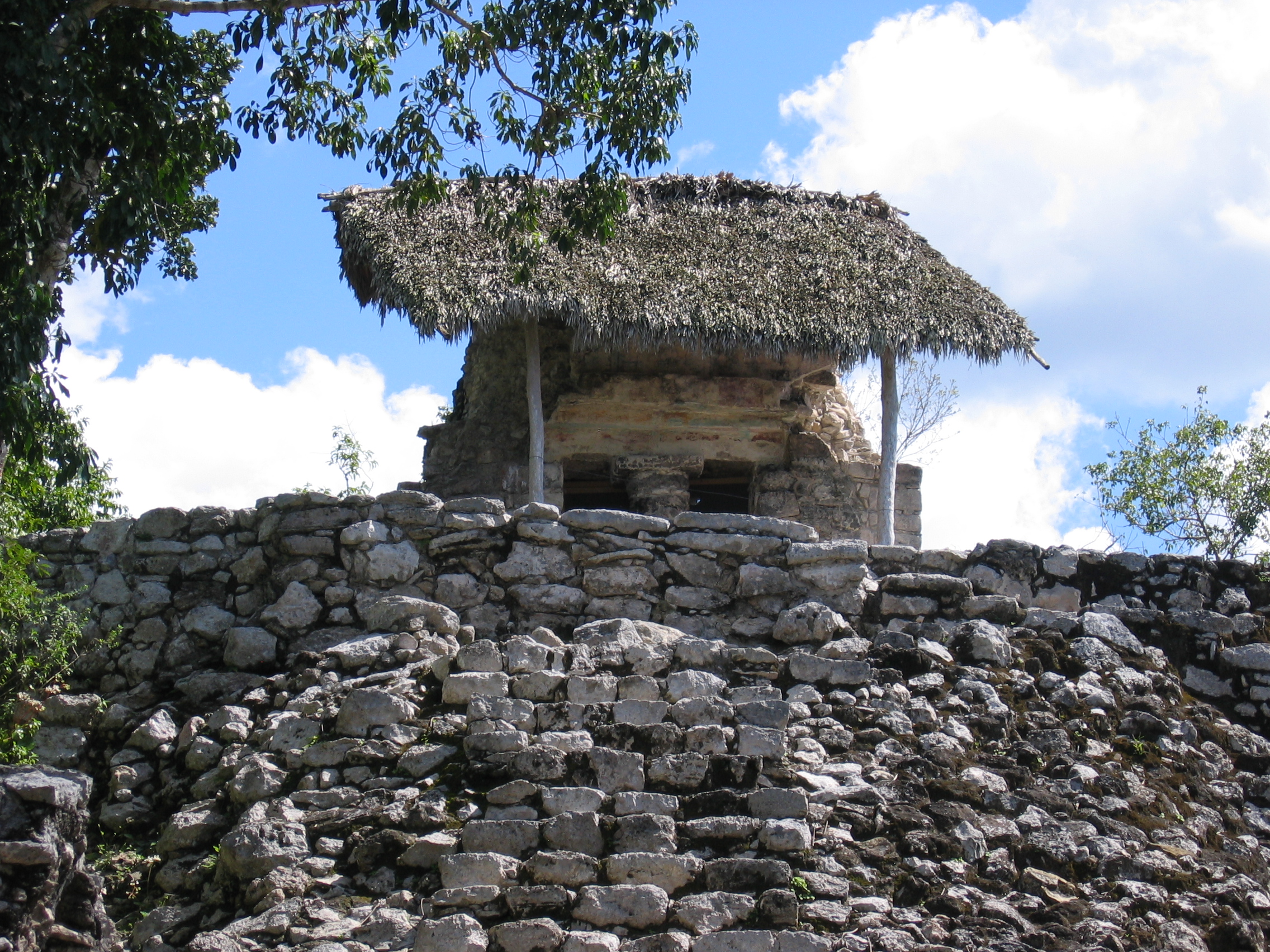
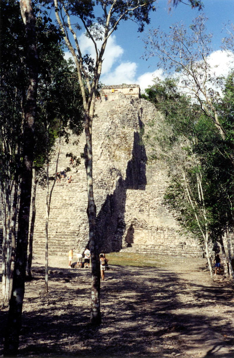
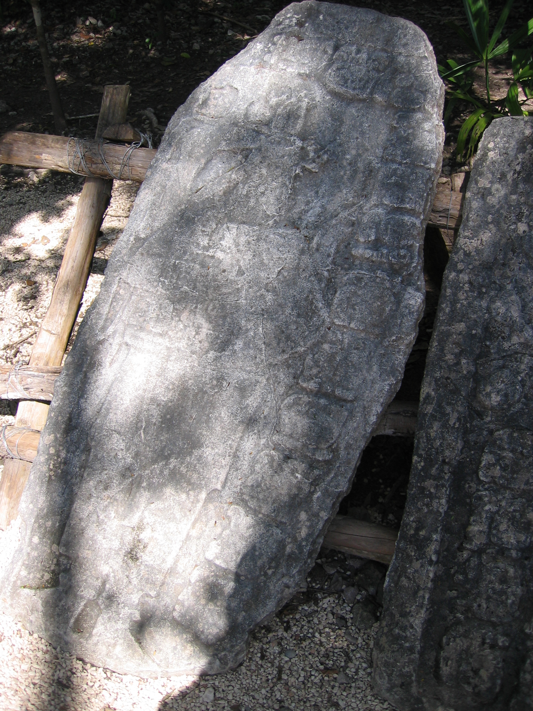
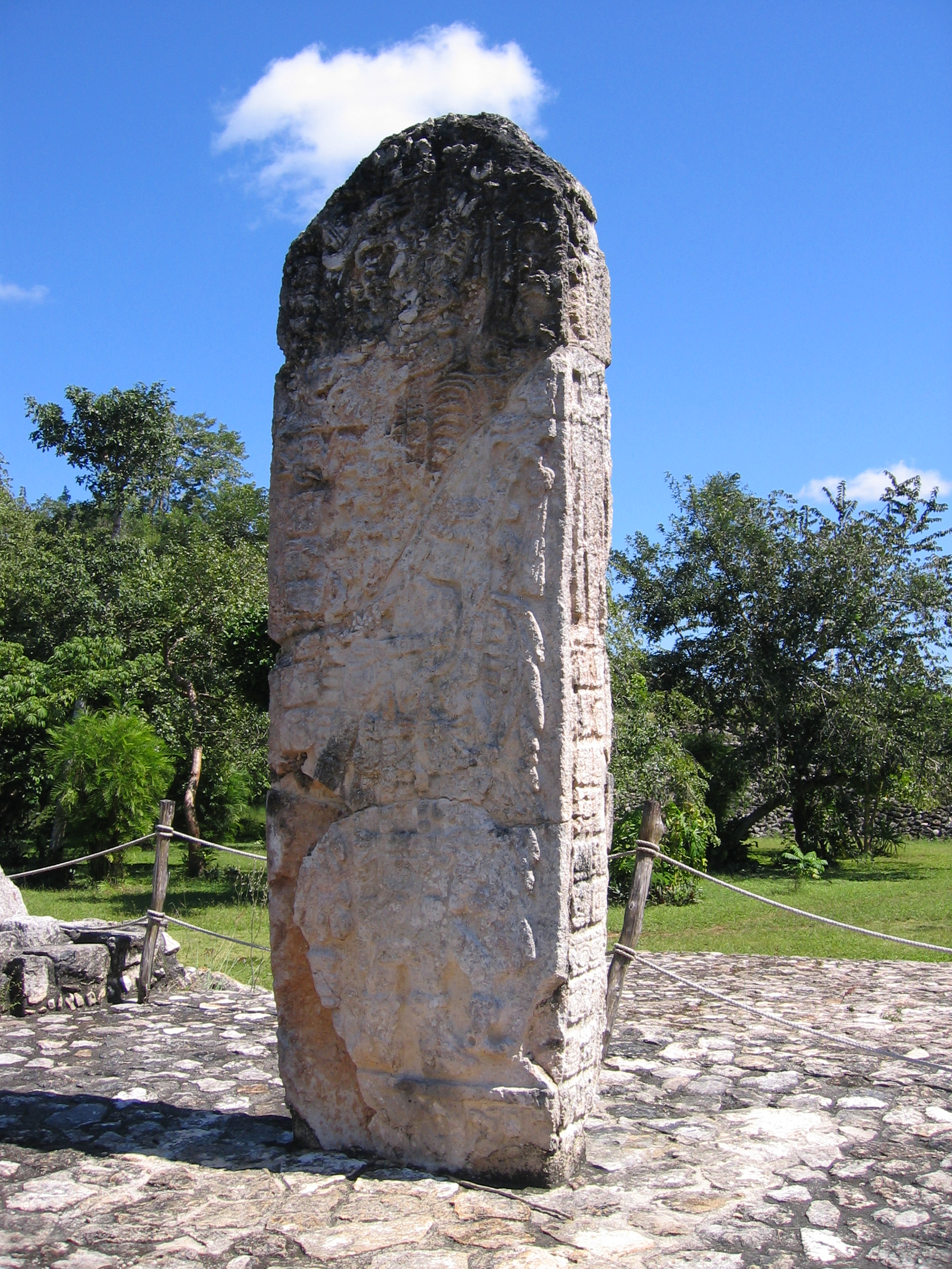
Coba must have been a very beautiful city when it was inhabited - it is situated on one of the few lakes in the Yucatan peninsula. It also has much larger, albeit unrestored, structures than Chichen Itza, including the largest mayan pyramid in the yucatan. This gives one a sense of grandeur and also seems in some ways more realistic - you are seeing a much more unenhanced view of an ancient culture, as opposed to something with significant reconstruction and restoration. Coba is also very different than Chichen Itza in that there are many stelae - standing relief panels noting dates of religious and political significance - which would have also existed at Chichen Itza as well. Many of these are sheltered by thatch structures to preserve the remaining relief from the elements.
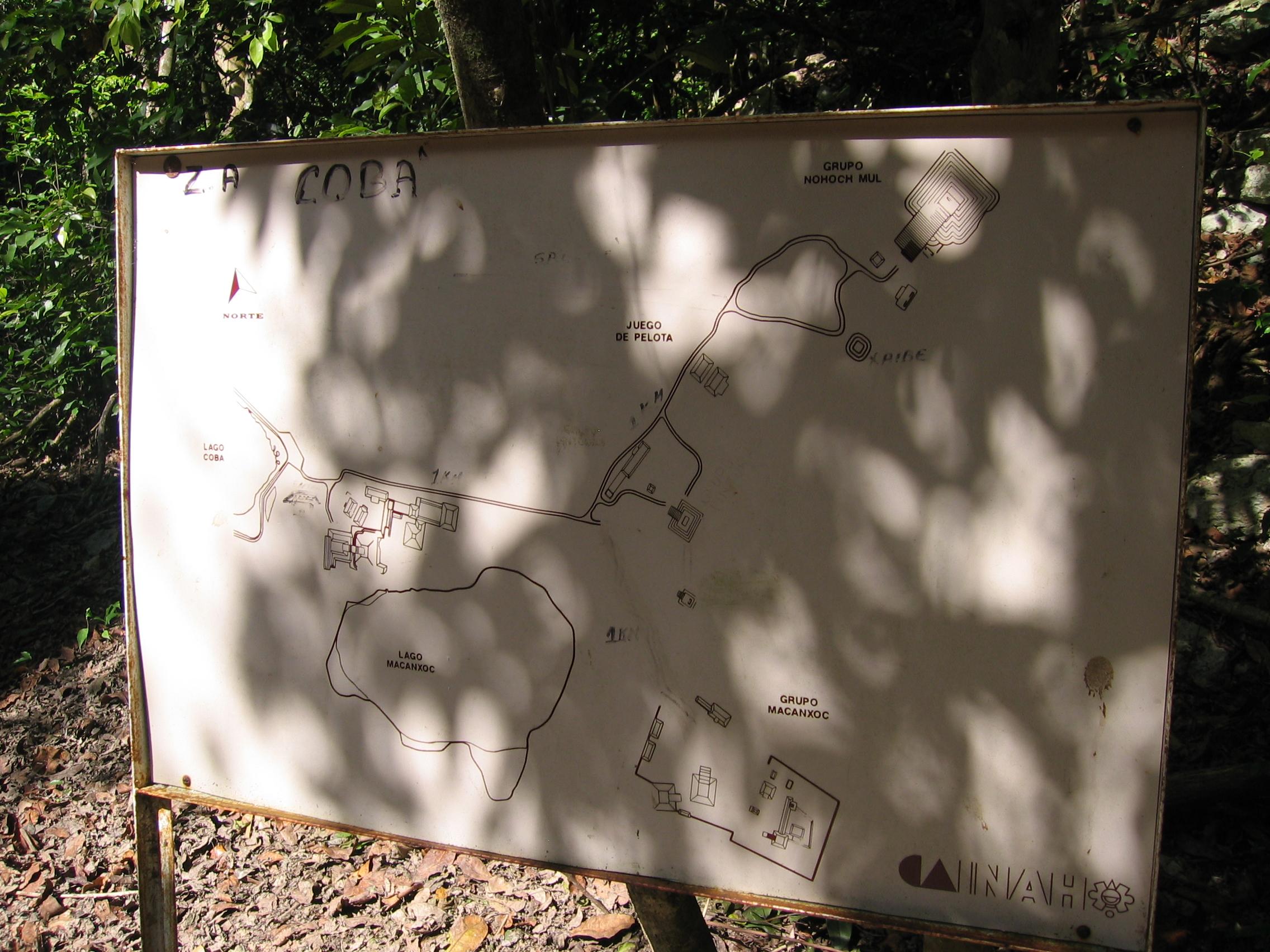
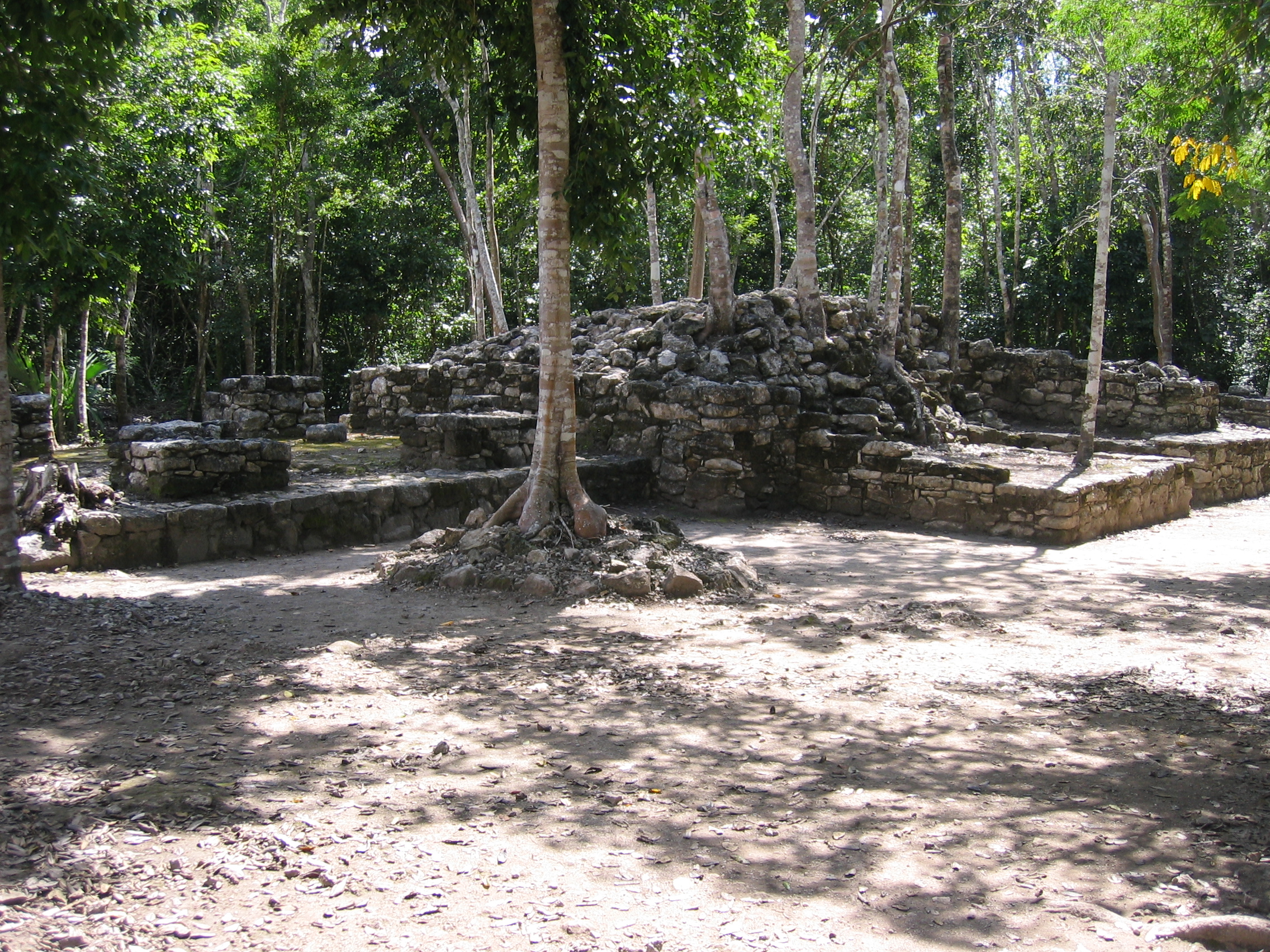
The uncovered structures at Coba are much more spread apart than those in Chichen Itza, and form several groups with long trails between them. The easist way to get between them, especially if you are operating on limited time, is by bicycle (which are available for rent from many independent entrepreneurs in the compound). The trails are certainly walkable though, and the jungle with its unexcavated mounds is beautiful to walk through as well - just be aware that it will be a fair distance between the really interesting buildings, and it's easy to lose your bearings (I wouldn't say "become lost", since the trails are well-signed).. As a basis for comparison, the largest pyramid, Nohoc Mul, is over a mile away from the next largest pyramid, the Church.
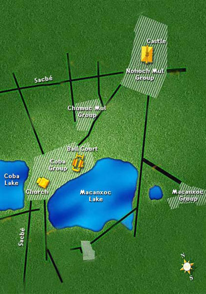
Consider the maps below. Each of the major building groups contains several structures, with long areas between groups through which you'll see many unexplored mounds in the jungle. The left image shows in yellow the major areas that tours tend to hit before leaving you to explore on your own. The right is one of the many map boards you will see when you are at the site (note additions in marker - there are excavations underway and some elements are not even on some of the older map boards on the site). I have divided discussion of Coba by the major building groups labelled on these maps.
|
Graphic map of the main areas (yellow) you're likely to see on a tour |
One of the many map boards in the Coba archaeological zone. |
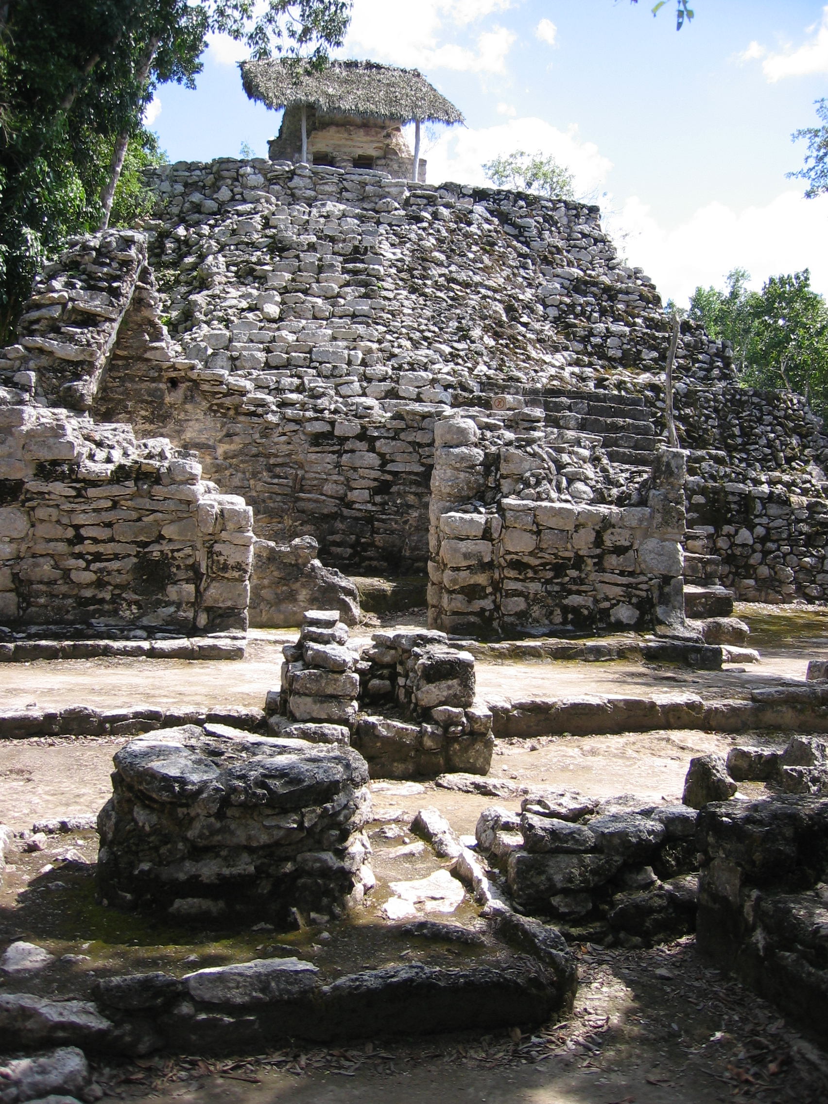
Coba Group
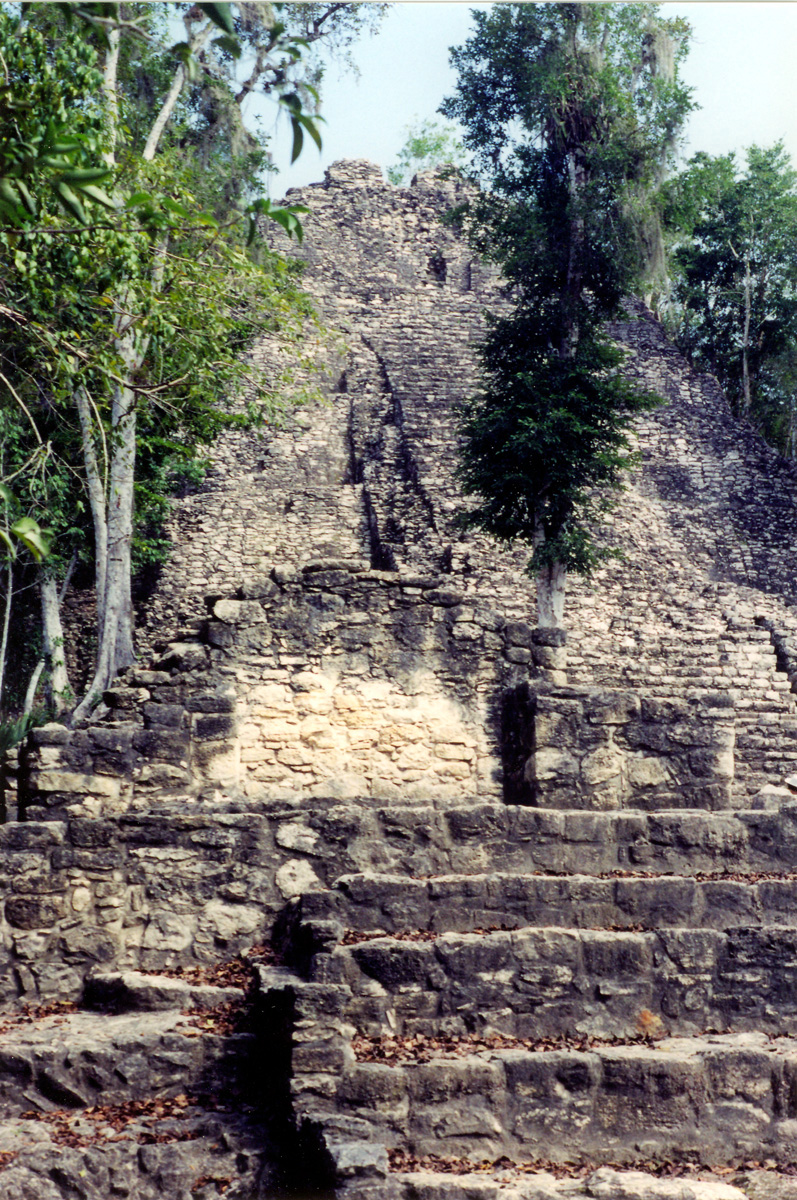
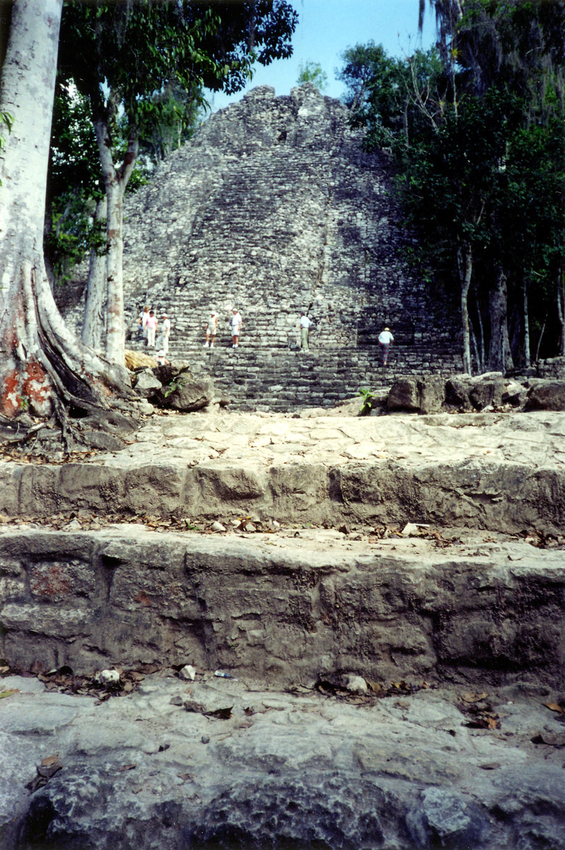
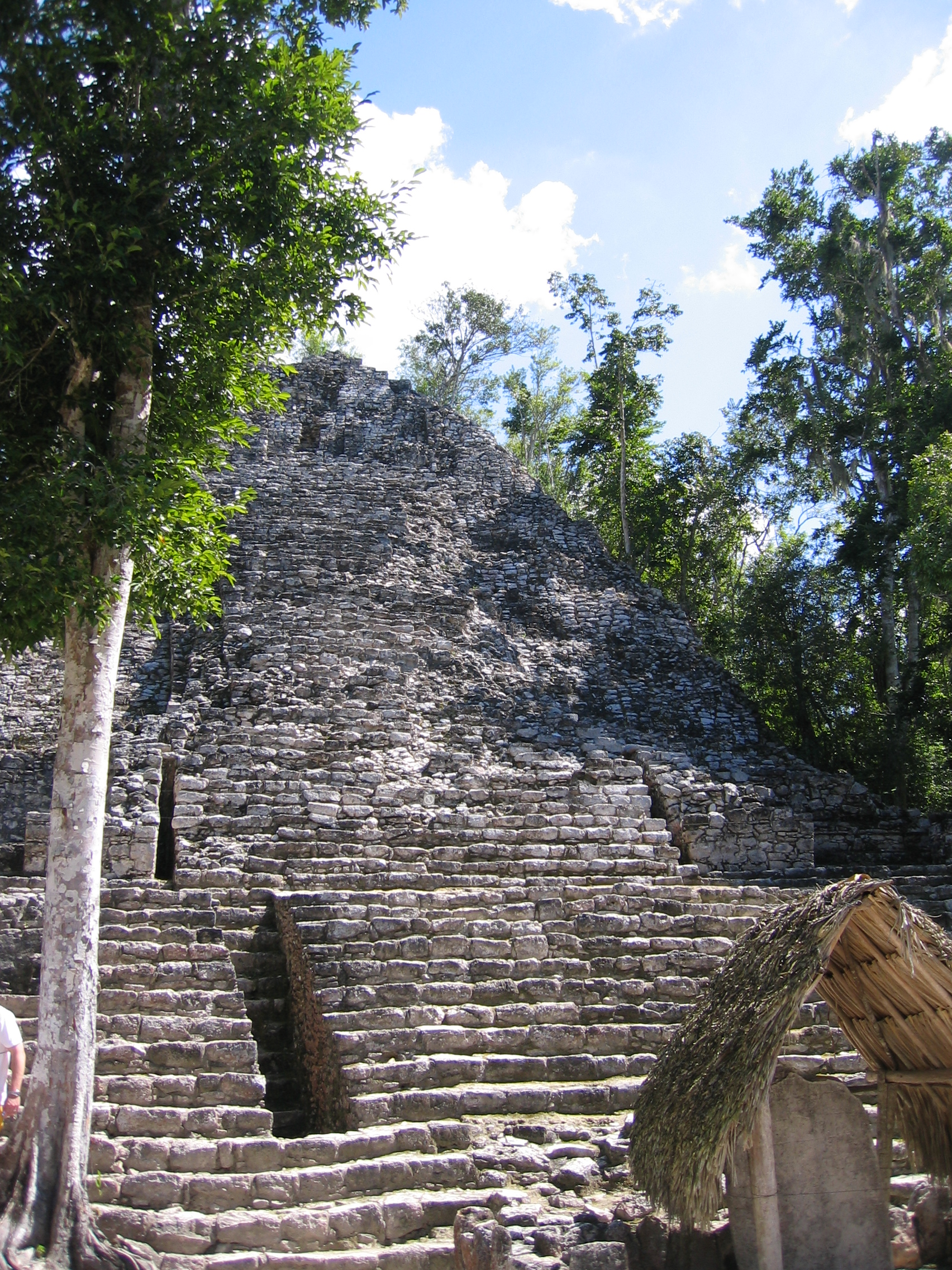
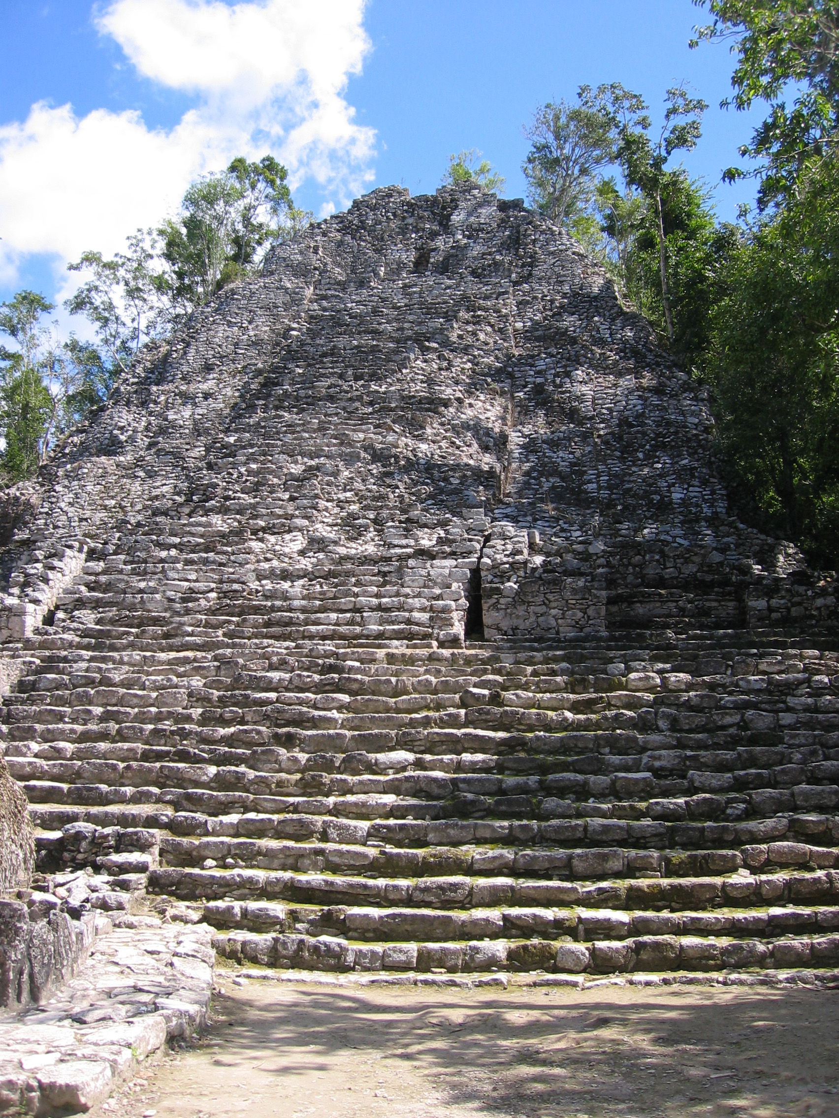
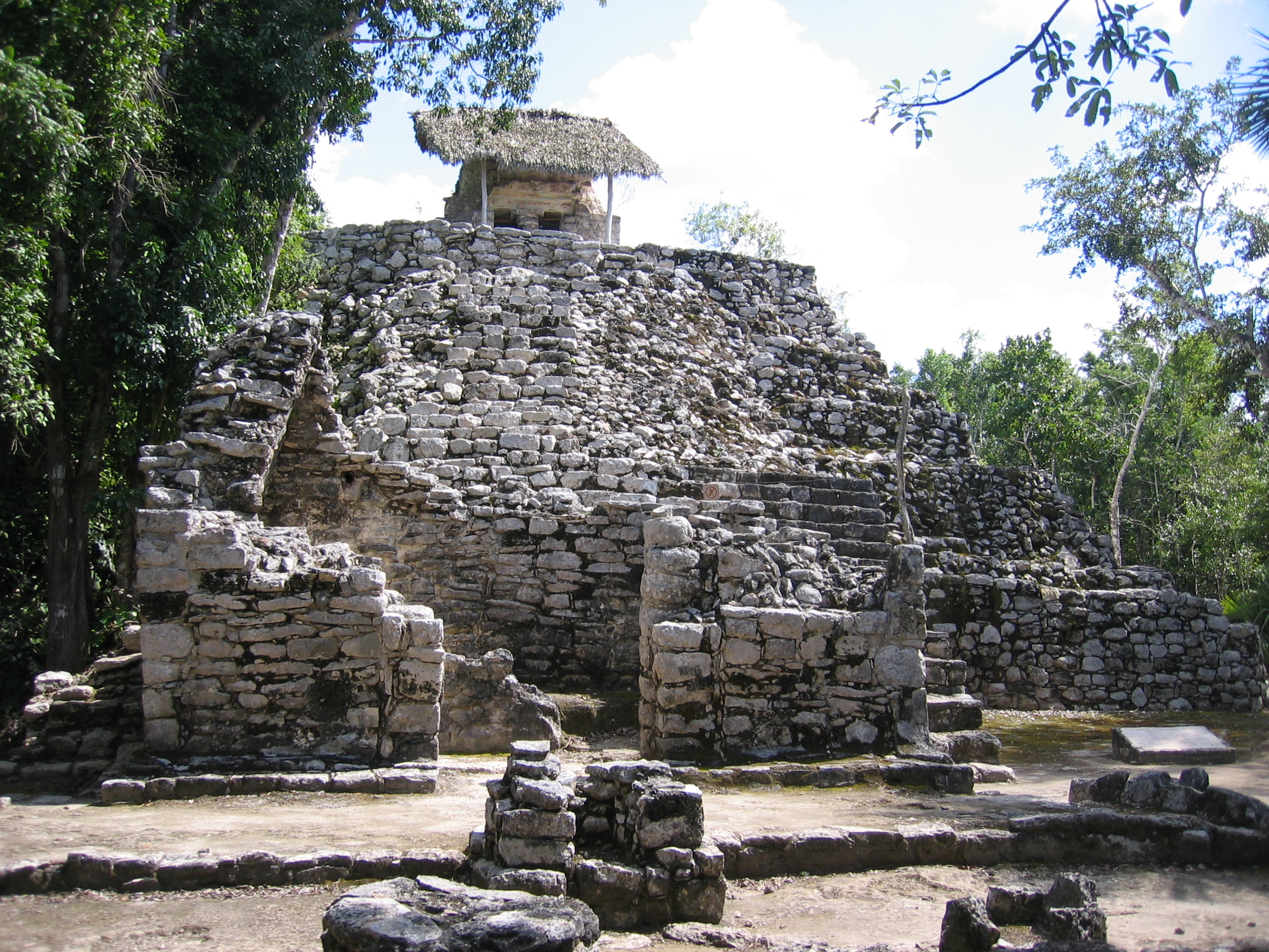
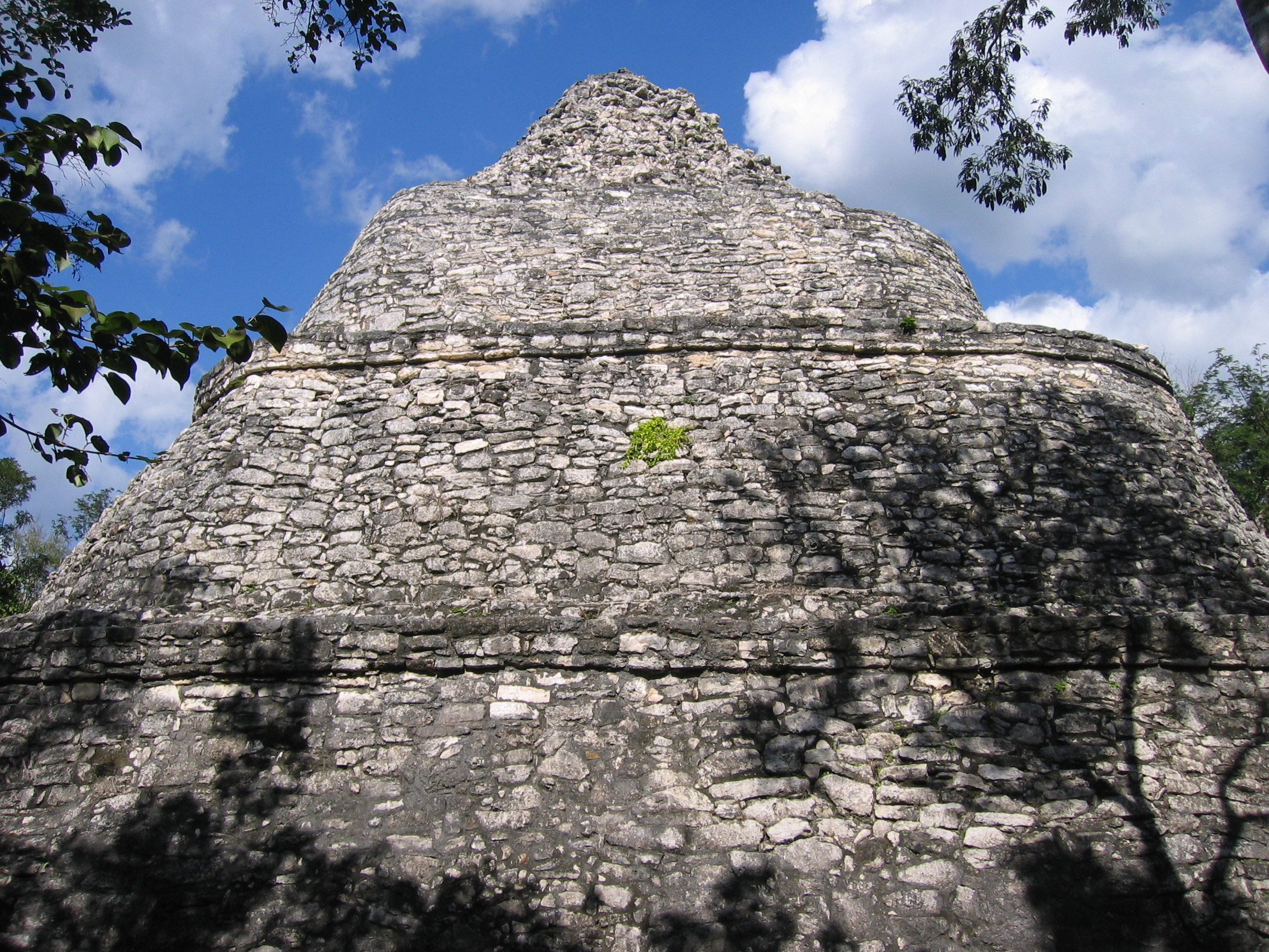
The Church (La Eglise)The Coba group is the area at which you enter the archaeological zone. There are 43 structures in the group, but only a few opened and visible. The structure known as the Church is the first major structure one sees. It is 20 m (65 ft) high. To put this in perspective, this is almost as high as the Temple of Kukulcan at Chichen Itza. The Church looks taller and steeper, mainly because depth is hard to perceive in the plain white stones, and because the surrounding jungle forces you to see it reasonably close, as opposed to the distant open views that are available in the cleared-out Chichen Itza. As can be seen in the images below, the steps are very uneven and it is not the stablest looking structure I've seen. You can go a short way up and are barred from going further once the steps get very uneven. Only the very front of the structure is open/uncovered.
|
The Church from the bottom of the complex - later pictures are from the first platform shown partway up from here |
Another view of the Church from the jungle floor. |
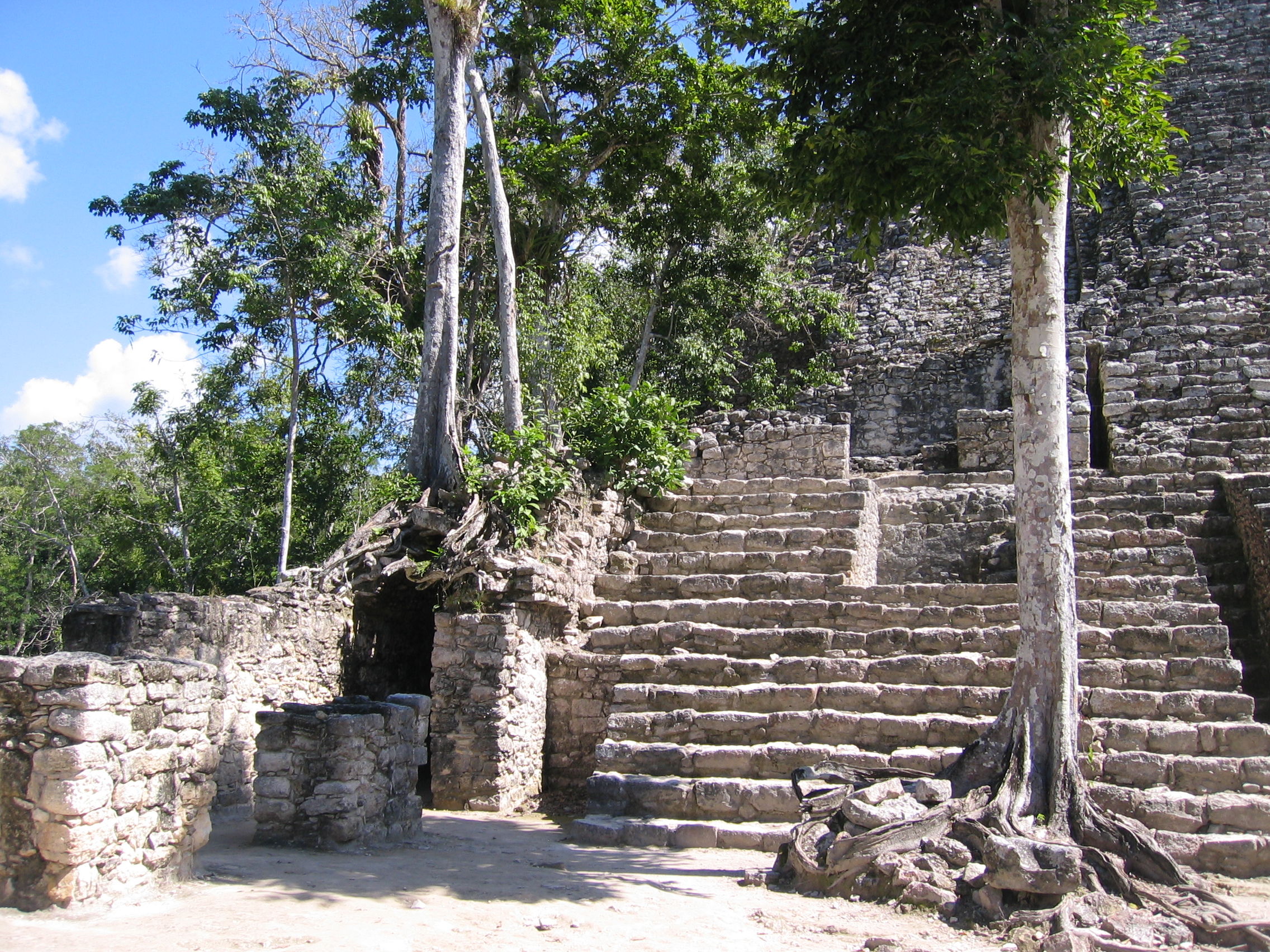
the main lower-level platform from which most of the church rises has an arch/passageway down the left side. |
|
View up the left side of the front of the Church. Note the covered stele in the foreground. |
View up the right side from the same level (note the edge of the same stele in the left foreground). |
The side of the church. |
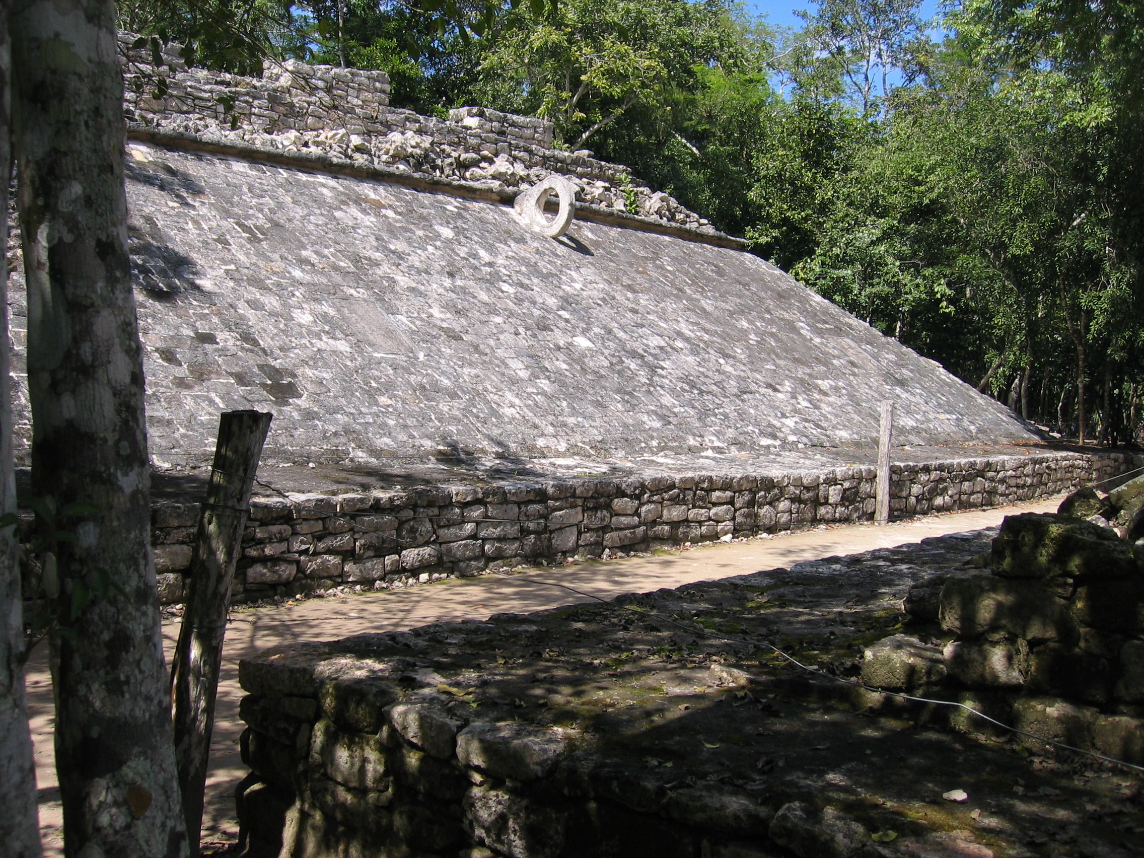
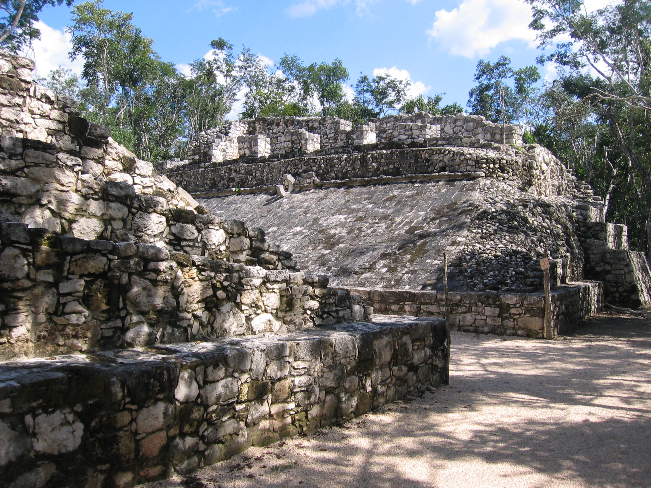
The Coba Group Ball Court
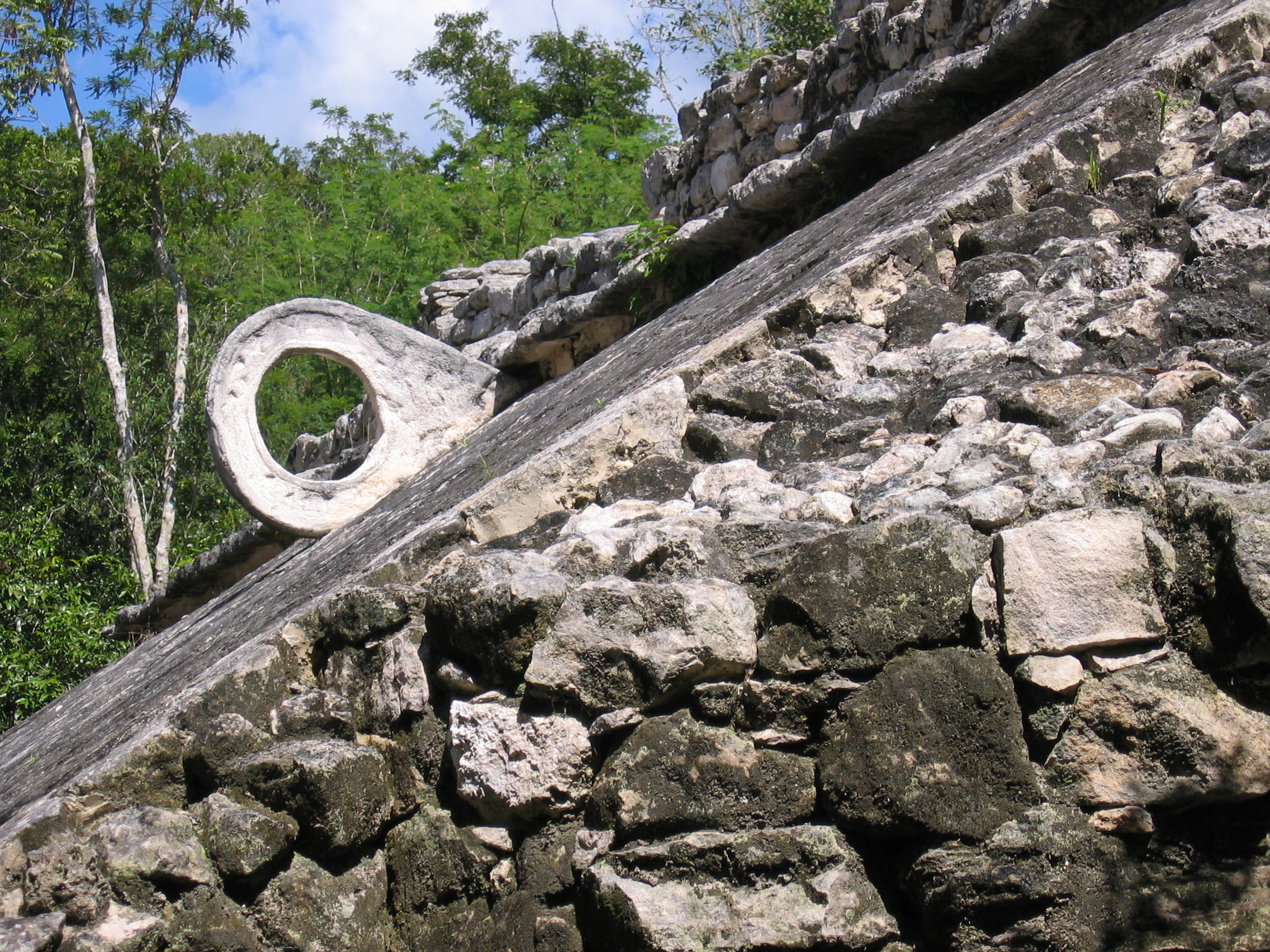
The Ball Court here is part of the same group as the Church, and is slightly south of it. This Ball Court is another interesting contrast to that of Chichen Itza: having seen the largest ballcourt in mesoamerica, you can now see one of the smallest. It is hard to imagine anything like the same game being played here, as the width of the court is only a few yards, and the hoops are much larger and mounted on low, very sloping walls.
|
The left bank of the ball court - note the significant slope. |
The corresponding right bank. |
The very very narrow space between the two |
|
In 2004, a stray tree remained |
Close up of the ring. |
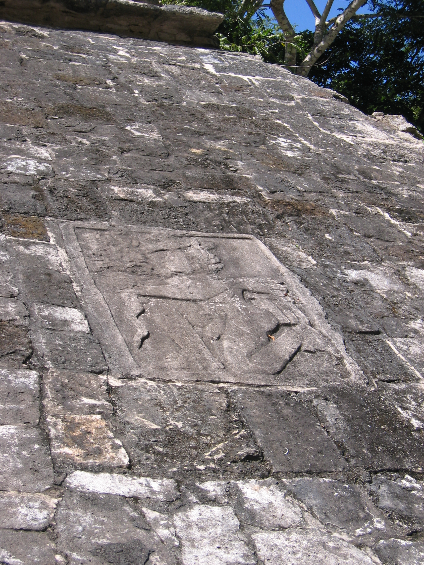
A carved panel forms part of the angled surface in this ball court. |


There are also some smaller structures here, but not much more has been excavated in this group. From here you travel down the remnants of a sacbe to the other groups. Coba can also be judged as an important and long-inhabited city by the fact that 40-50 of these roads exist, connecting the city to other places. As you pass along these, you'll see many mounds going off into the jungle.
Chumuc Mul Group: Ball Court
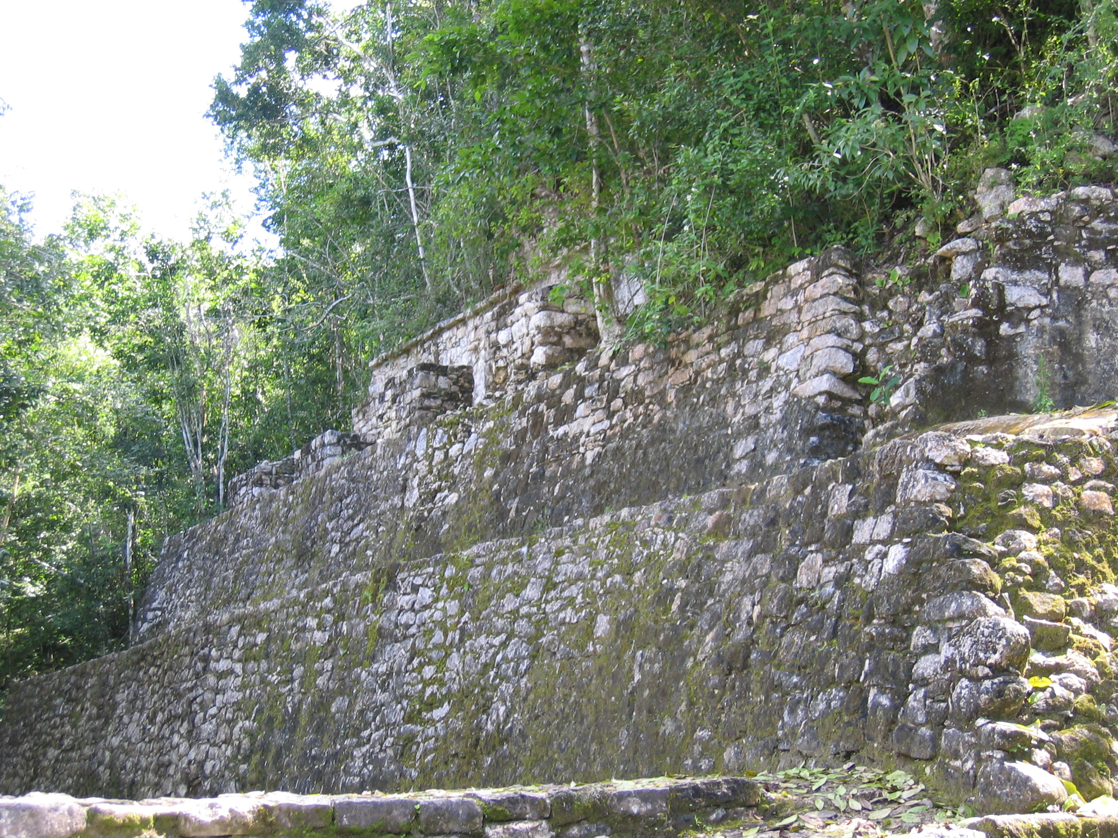
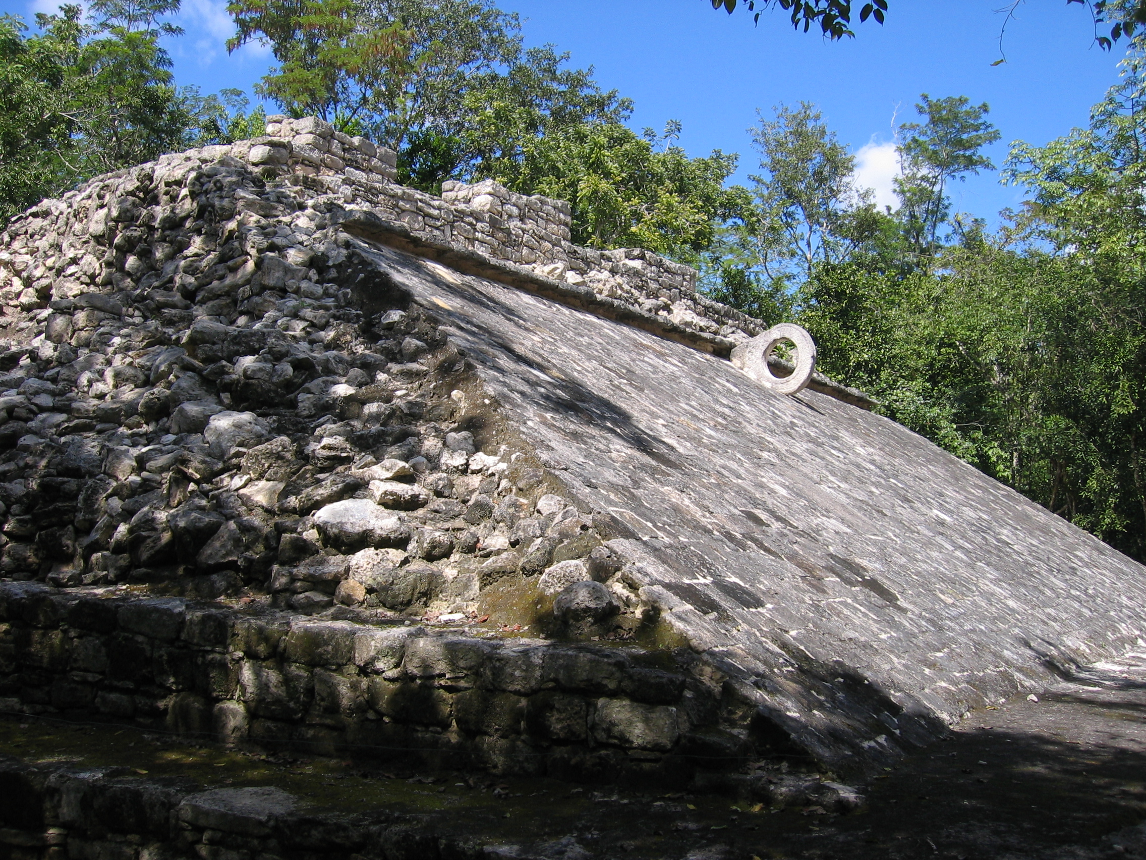
The Chumuc Mul group is mainly unrestored, but contains a remarkable second ball court that is significantly larger than that shown above.
|
Entering into this ball court, you can see it takes the same angular form that the smaller court did. |
The left bank. |
The corresponding right bank. |
|
The surface of the angled section, head on. |
Close up of the ring - note the ring itself is embedded into this court, rather than being mounted outside of it as in the smaller court shown previously. |
Like the court shown previously, there is also a carved panel on one of the sloped sides. |
|
The center of the court also has a mosaic of smaller panels. |
A carving of a human skull marks the center of the playing surface - the shadows are the bars that surround it. |
|
|
A composite panorama of this ball court shows the positioning of the skull in the center. |
A panorama of the rear of the court - note the layered structuring typical of Mayan temples. |
|


Las Pinturas Group
The Group of the Paintings consists of the Temple of the Paintings and surrounding structures. It is not labelled as a group on either of the maps shown above, but appears as the group of buildings on the main sacbe above those marked Groupo Macanxoc. There are also other structures here, but not many that have been excavated. Though you can't ascend this temple, the name is taken from remnants of murals that exist at the top (which is sheltered by a thatched structure). Its ceremonial importance is also indicated by the numerous stelae that exist in front of the temple, and the columns in the area.
|
The temple of the paintings - note the structures in front of the temple, and the partial layer at the bottom.. |
Temple of the Paintings. |
The levels can be seen from the side as well. |
|
Top of the temple showing remnants of colored stuccowork. |
Separate structure beside the temple. |
Separate pillared structure in front of the temple. |

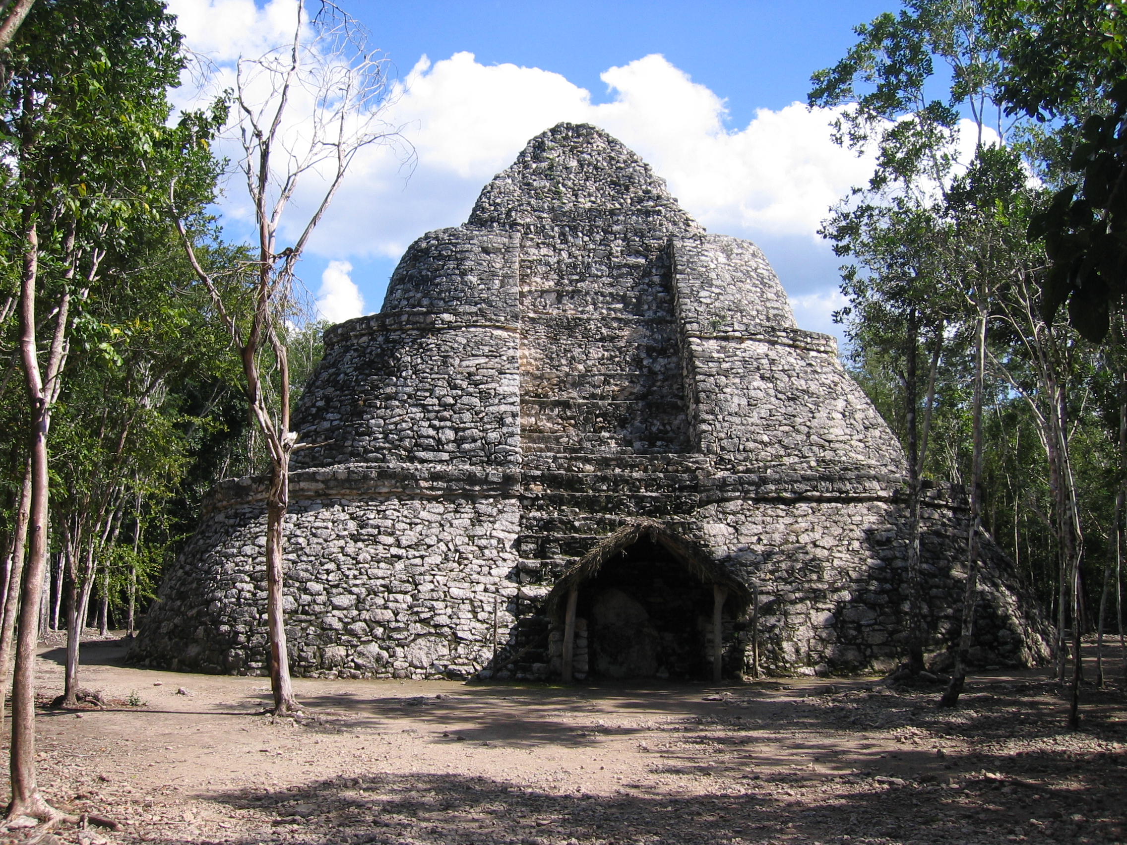
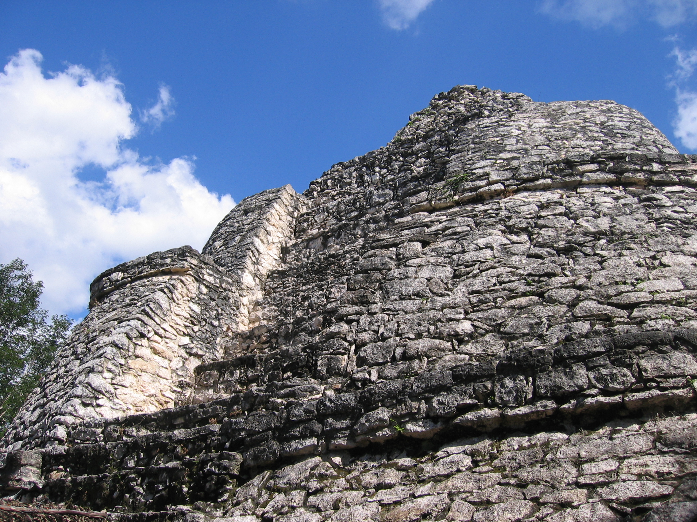
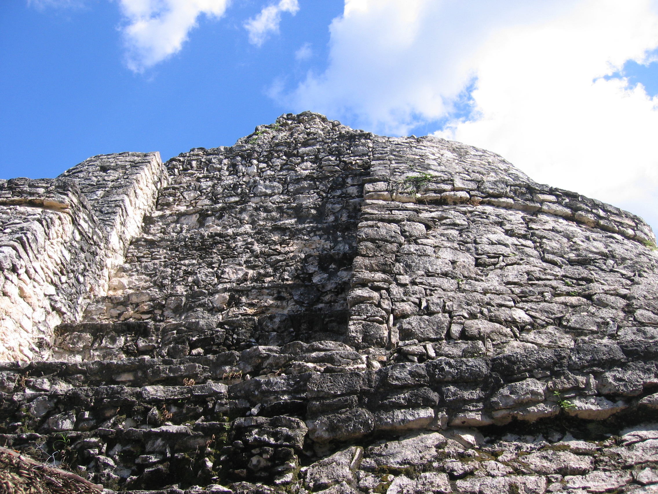
Nohoc Mul Group
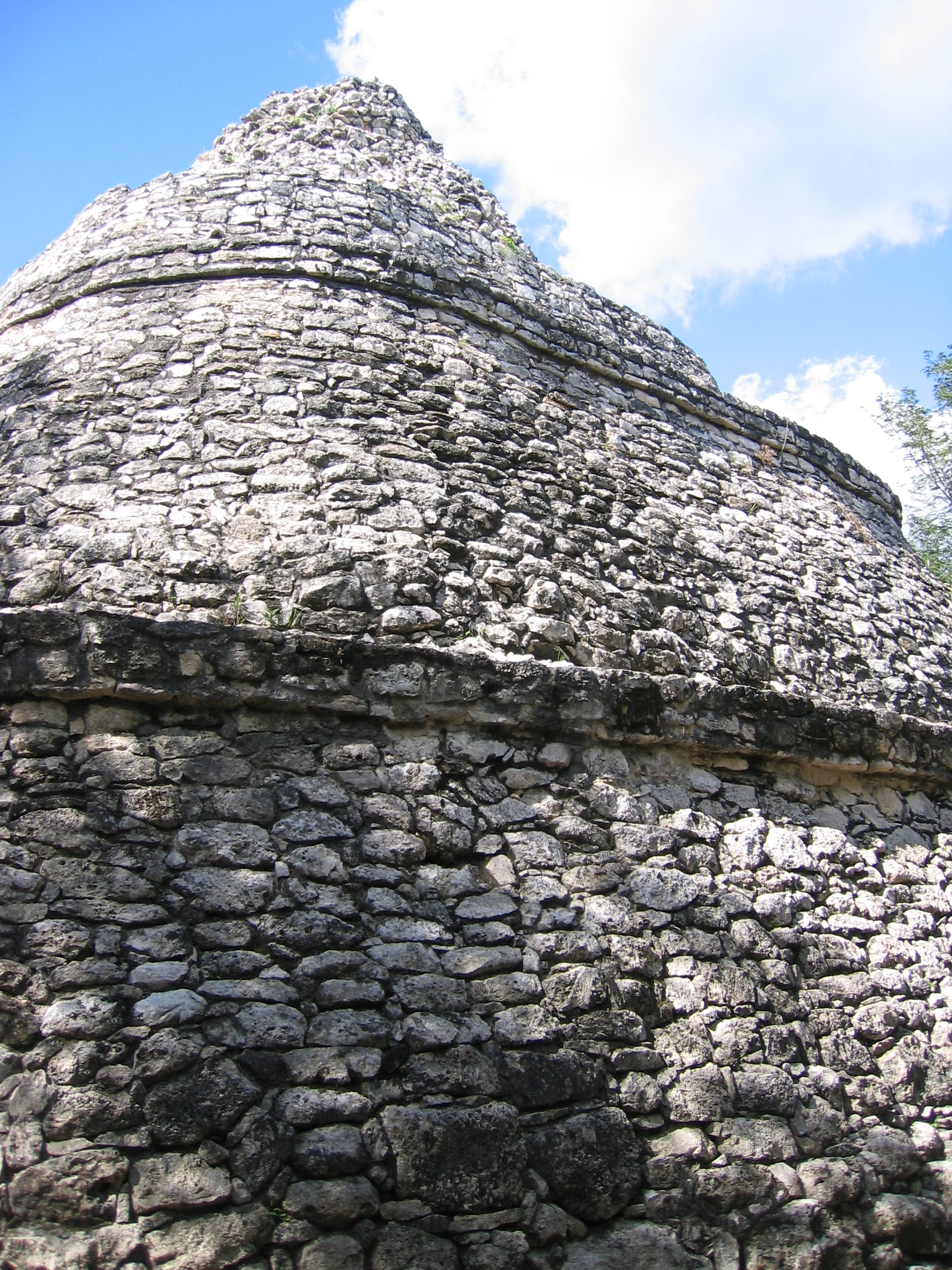
Xaibe - The Crossroads PyramidThis rounded structure is separated away from other structures in the Nocuc Mul group, and is the major structure you will see on your way to the Nohoc Mul pyramid. It is called the crossroads pyramid because it exists at the intersection of three different sacboeb. It's easily my favourite here, despite the fact that it isn't particularly large. The architecture is graceful, and the round shape brings a lightness to the terraces that is very different from the other terraced structures such as the Temple of Kukulcan at Chichen Itza. There's really nothing like it anywhere else I've been, but its basic shape is reminiscent of pictures of the pyramid at Uxmal.
|
Xaibe, front view. Covered stele at the bottom. |
Another view of Xaibe. |
Front of Xaibe from an angle, showing the cut in portion. |
|
Another angled view of the front of the temple. |
The curve of the side. |
The curve of the rear. |

Nohoc Mul
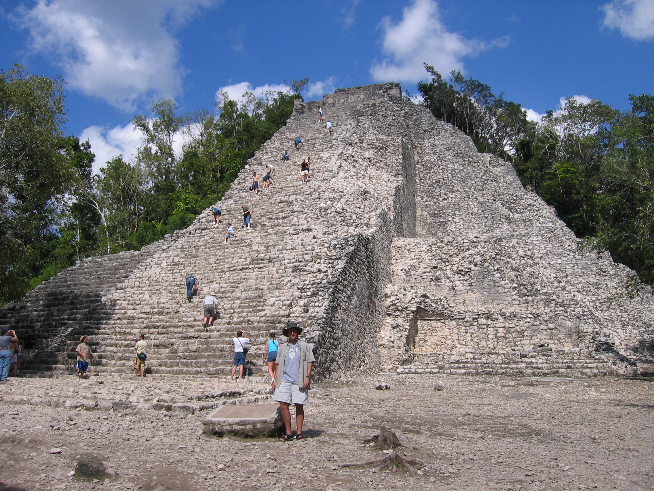
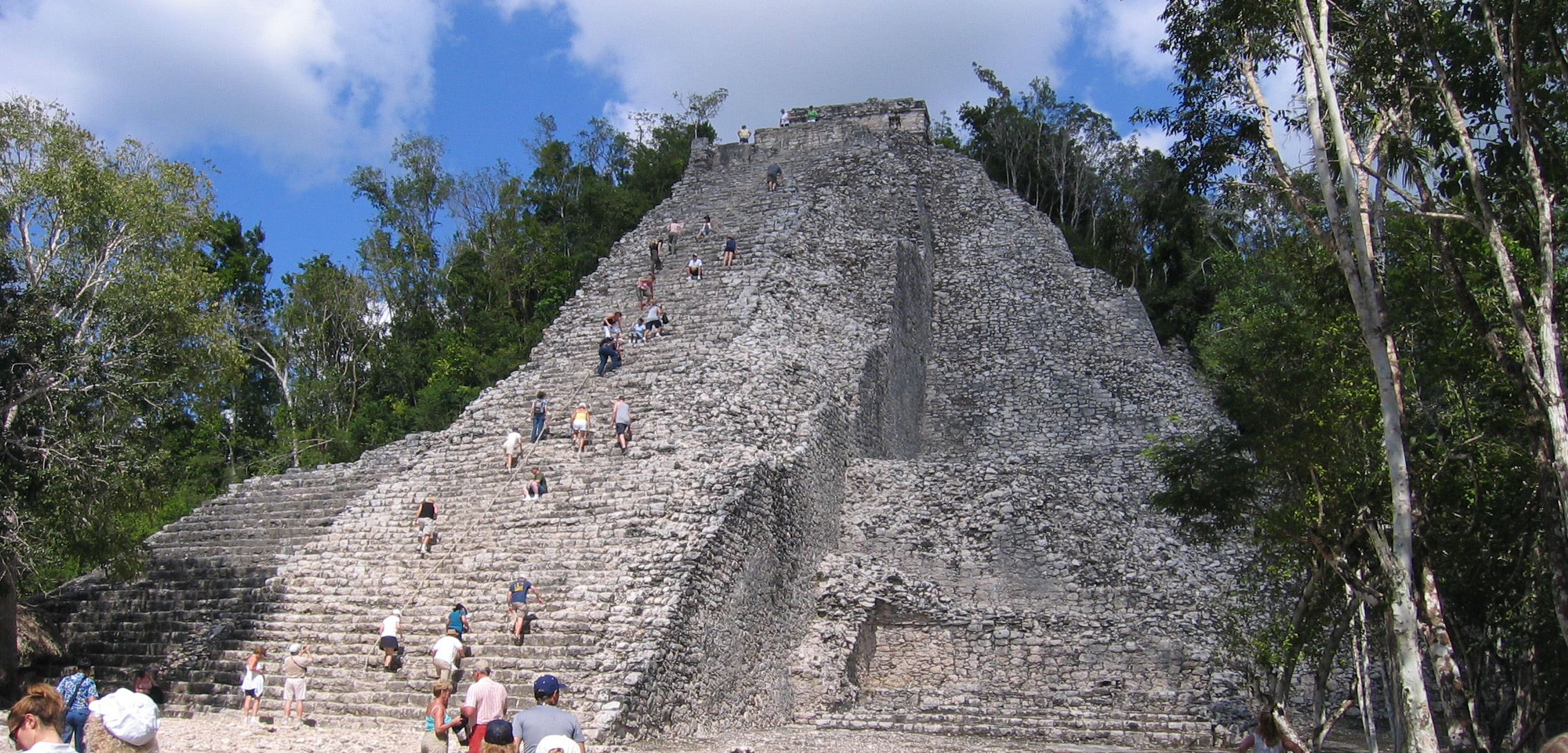
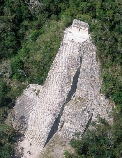
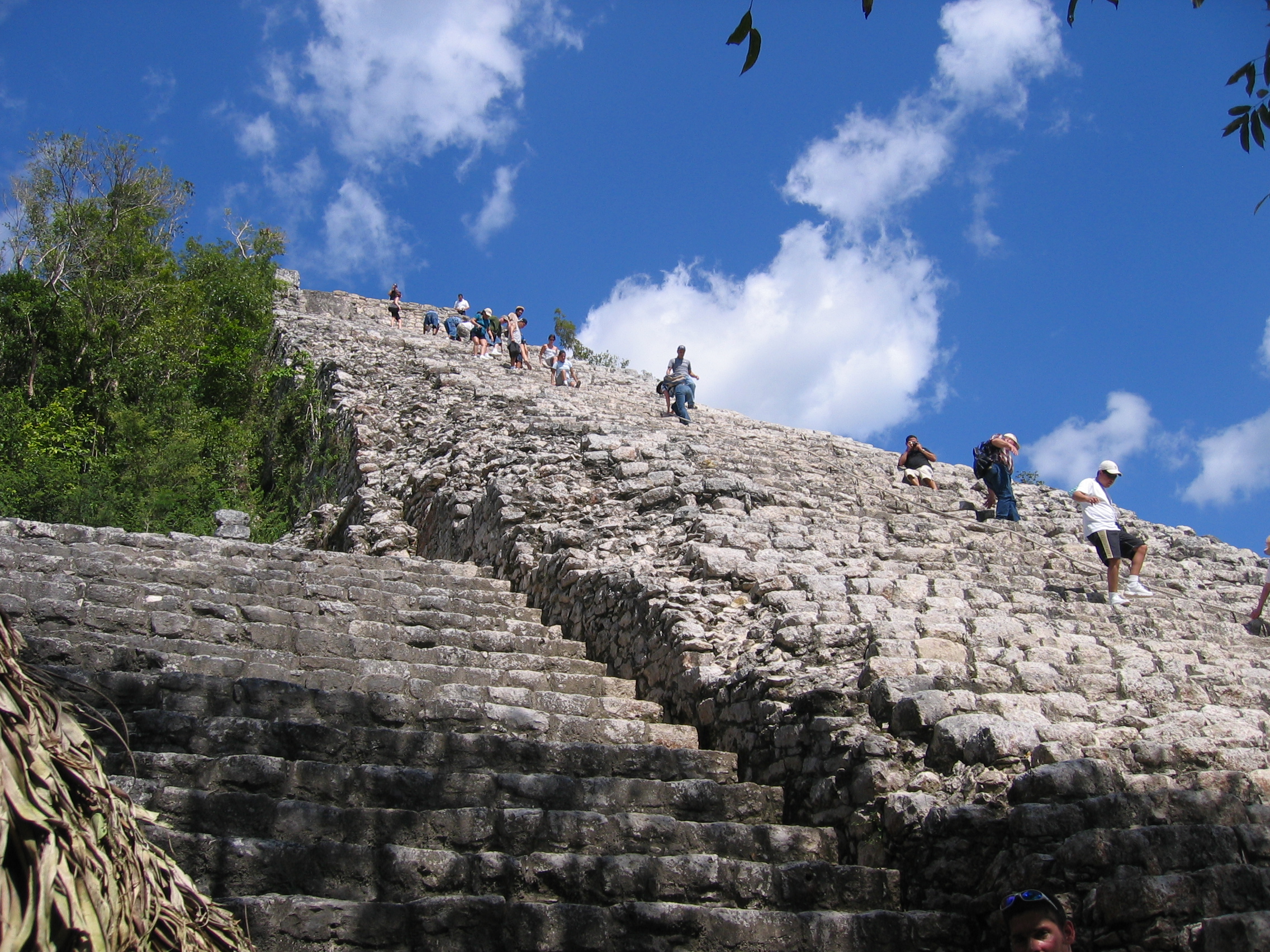
Nohoc Mul is the largest pyramid in the Yucatan, at 42m (136 ft) high - considerably larger than the Temple of Kukulkan at Chichen Itza. There are 120 steps to the top, and as can be seen even in the far view, the steps are very uneven and only partly restored. This is where you will find most of the people who come to this site, since many people only come here to climb this temple, and pretty much ignore everything else. Be very careful if you're climbing, and as usual, it's a lot harder going down than up. The temple at the top was added later, and bears the image of the descending god.
|
Your host at the bottom of Nohoc Mul. |
Note that the temple looks much steeper if viewed from slightly to the right - the white steps and bright light give the illusion of less depth, and because you can't properly perceive the depth at the top, it looks shorter. |
A photograph of mine from several years earlier, at a later time of day. The greater shadow starts to show you how high this really is. |
|
This is the only photograph on this website that is not mine, and I include this popular postcard just for perspective. It's only when viewed from above that you truly get an idea of how high this is. |
Almost at the mid-level platforms up the side of the pyramid.. |
The stairs looking off to the side. |
|
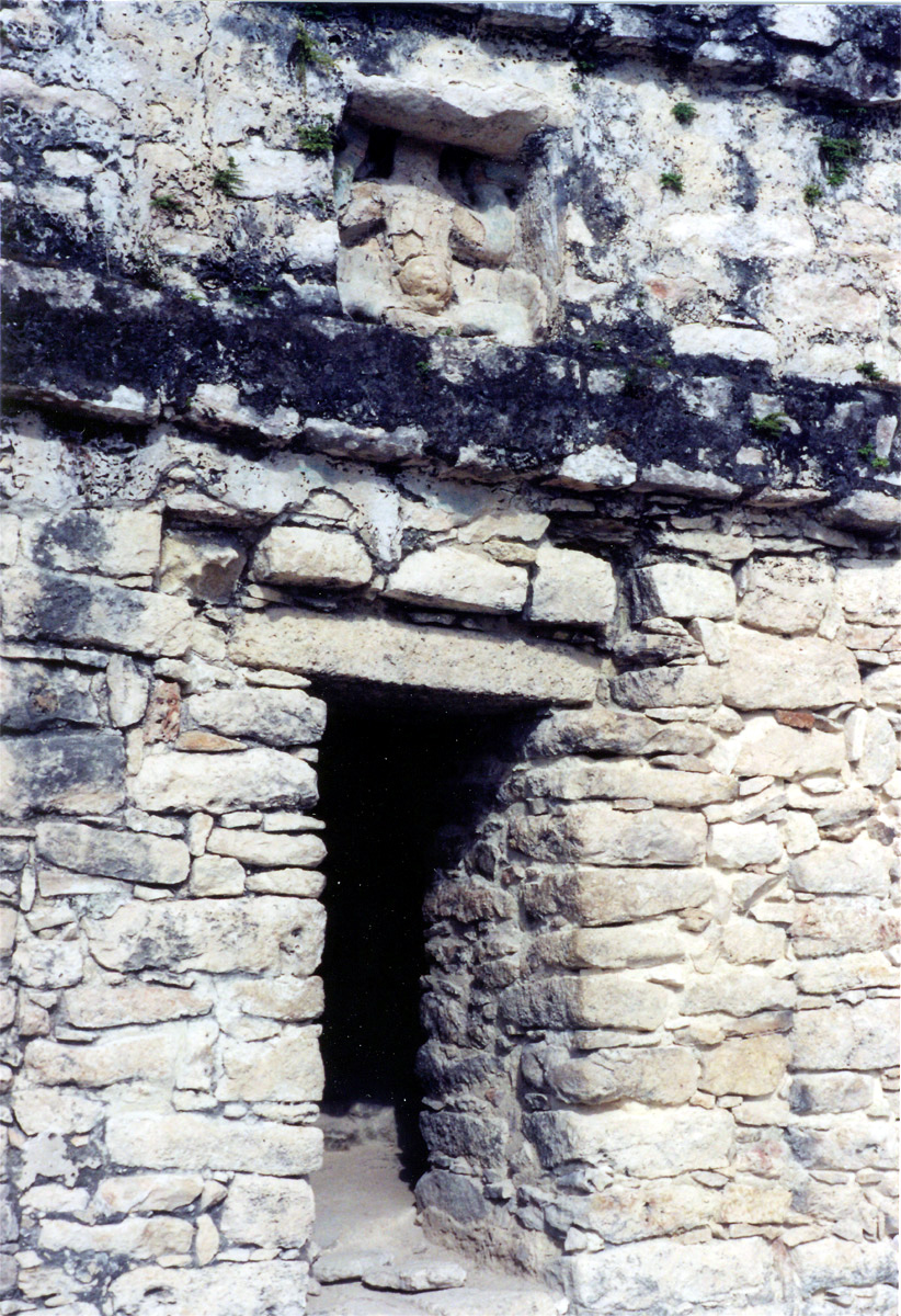
The temple at the top of the pyramid. |
Close-up of the descending god on the temple.. |
Xiabe behind yours truly, from the top of Nohoc Mul (side note: don't forget your hat on any ruins adventure! The sun is extremely strong). |
|
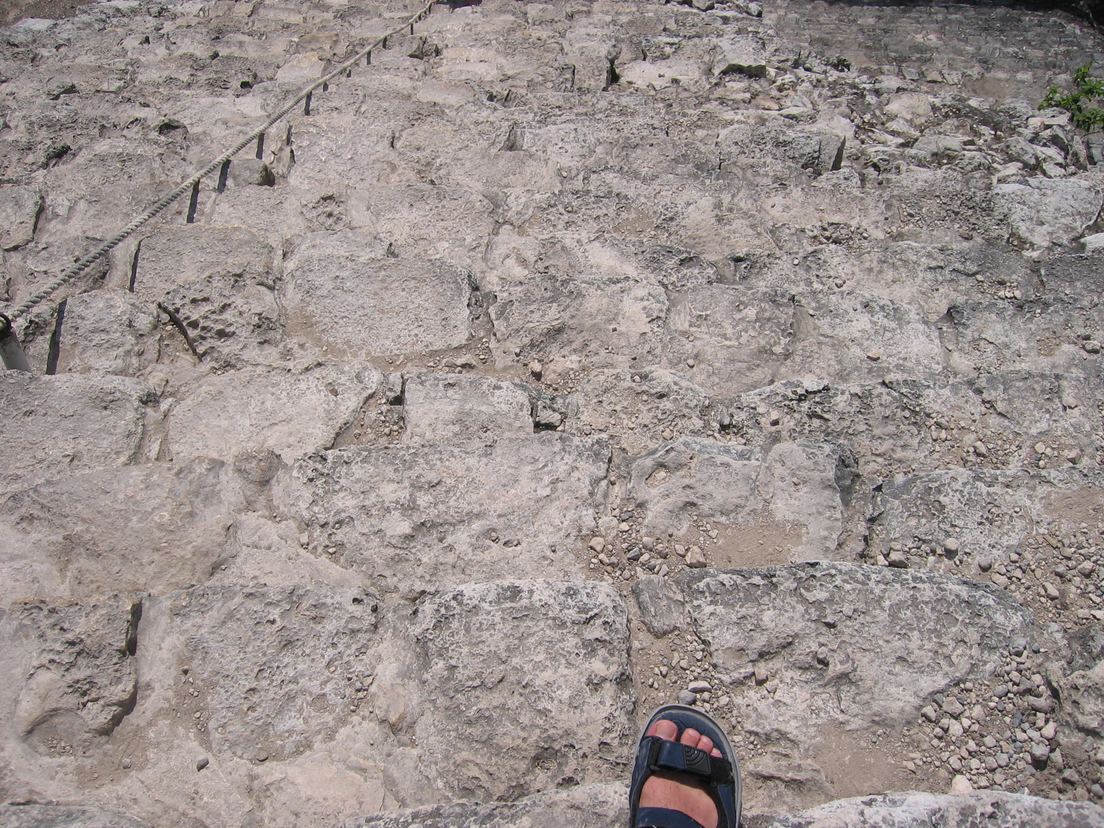
Illustrating why going down is difficult: even perceiving the edge of the steps is not easy. |
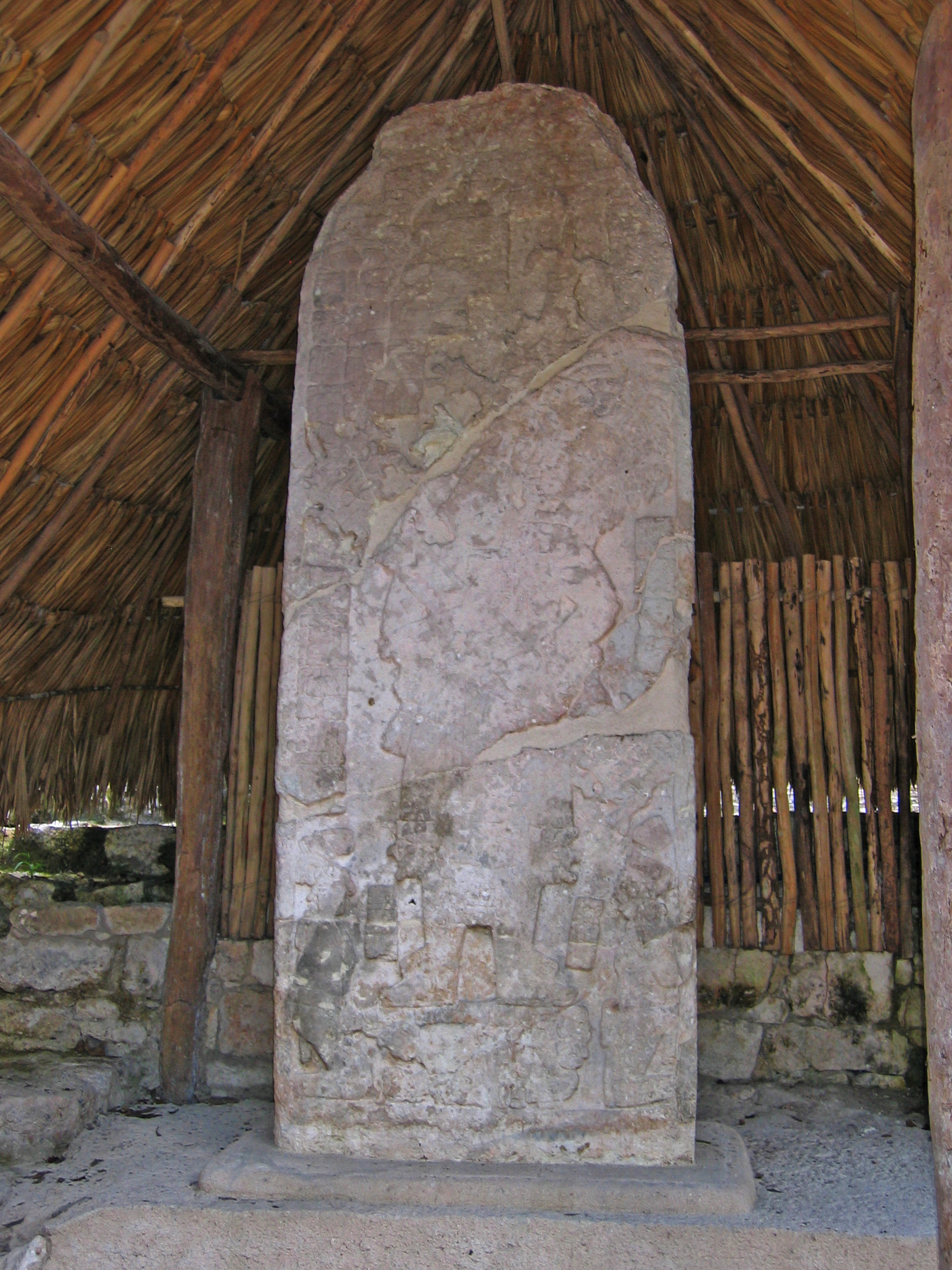
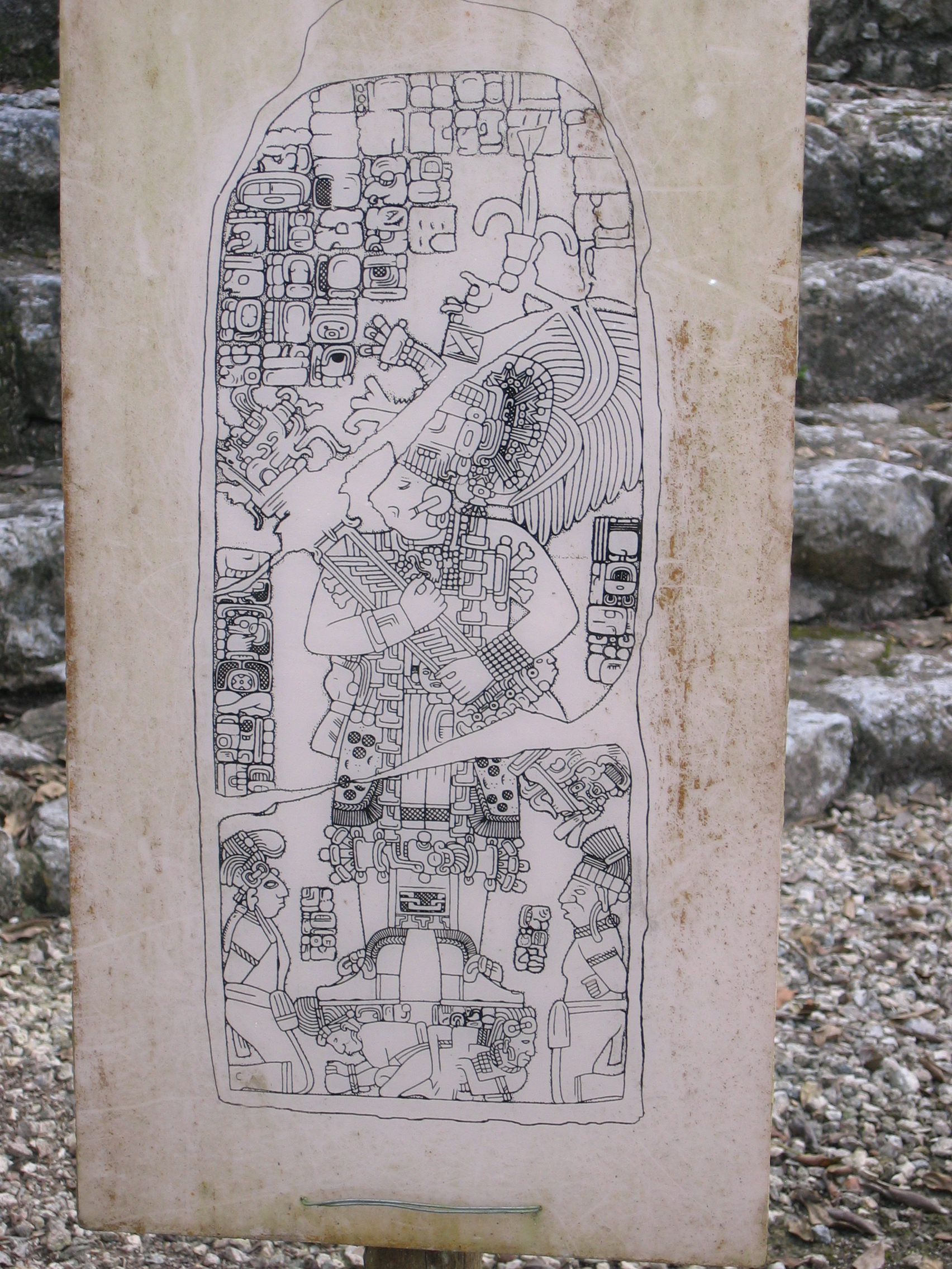
A very large stele beside Nohoc Mul - the light was not good enough to truly capture the relief left in it |
An accompanying drawing showing the relief outlines on the stele more clearly. |


Macanxoc Group
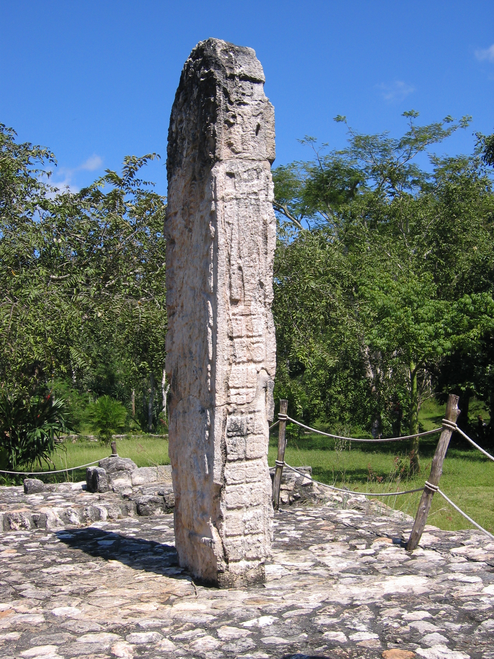
Finally, there is the Macanxoc group, which exists fairly far away from all the others. The site maps illustrate many buildings here, but at the time of this writing no work has yet been done to uncover them. The only obvious things to see here other than the same mounds that dot the rest of the jungle are a collection of Stele - leave this area for last, since the other areas have far more to see.
|
One of the Stelae in this area. |
Another stele. |

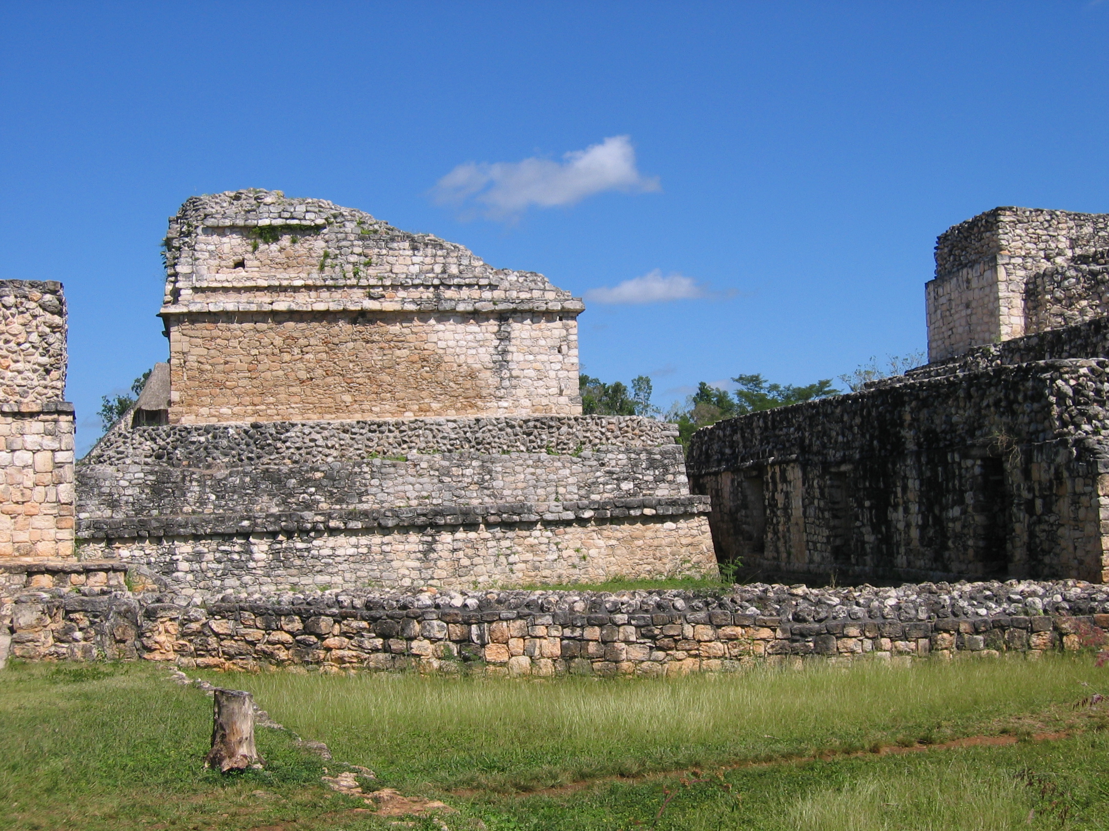
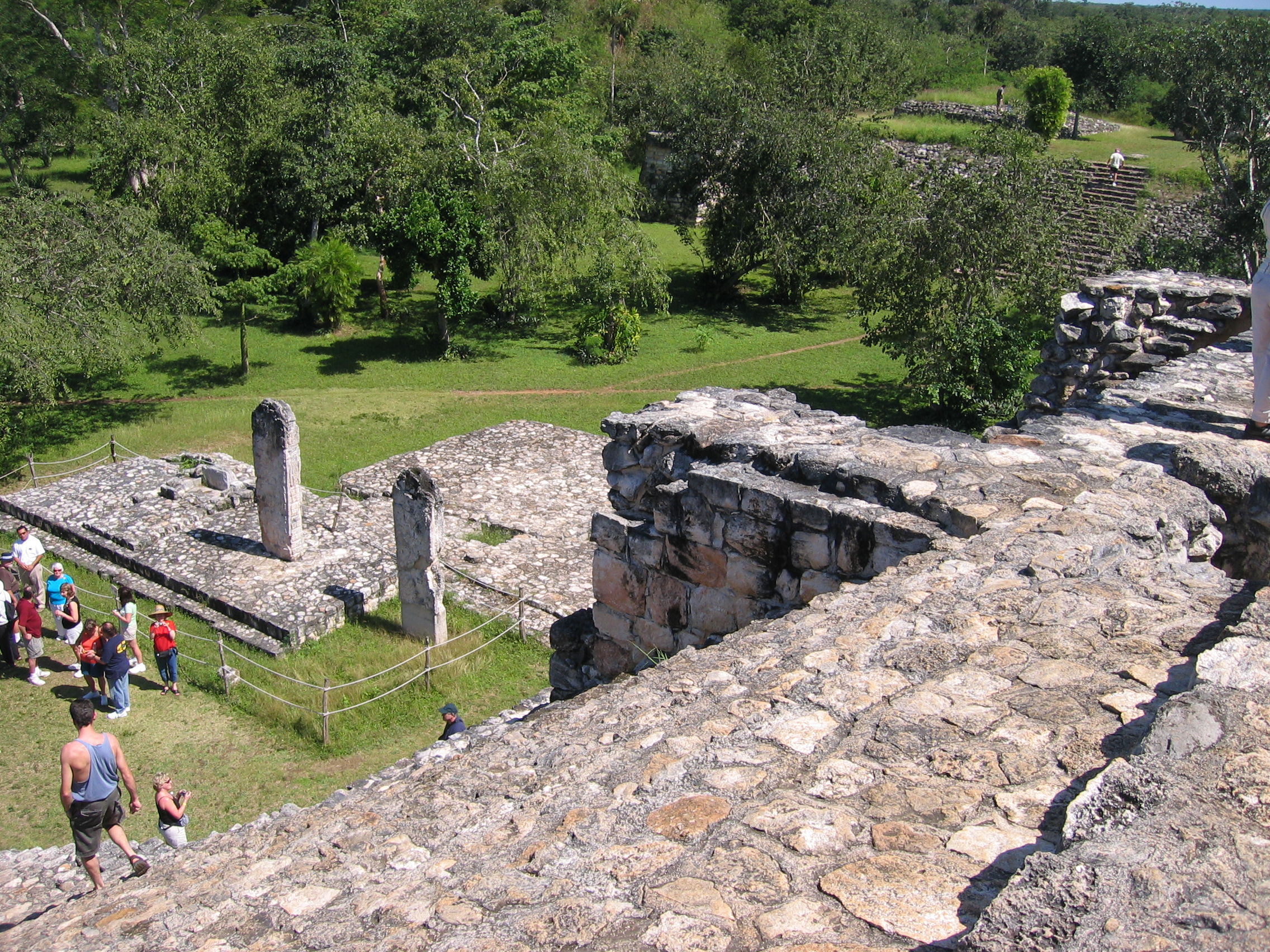
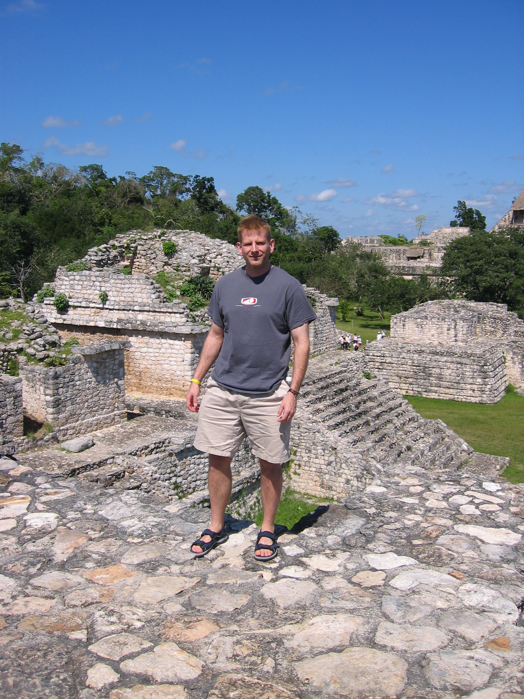
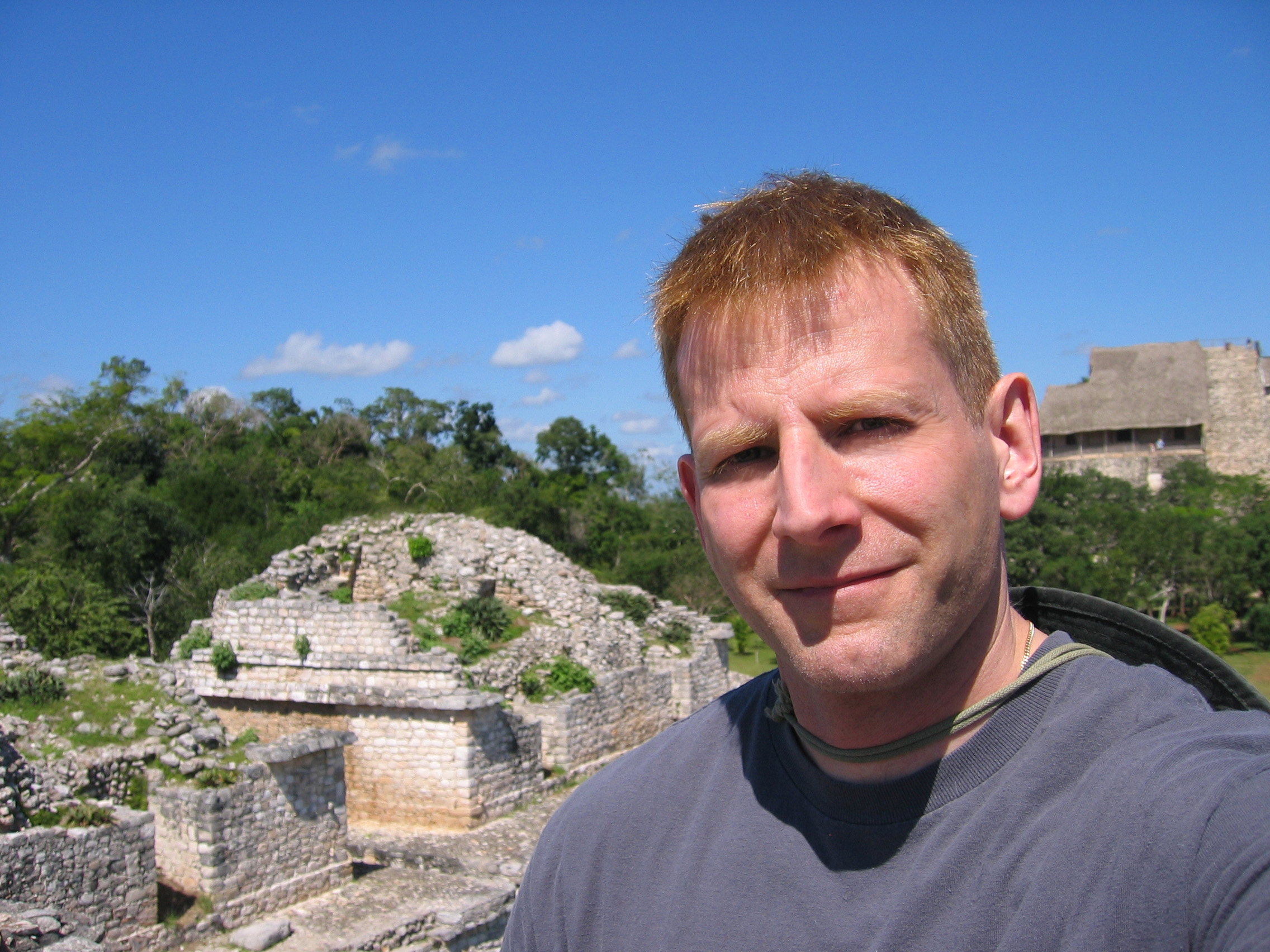
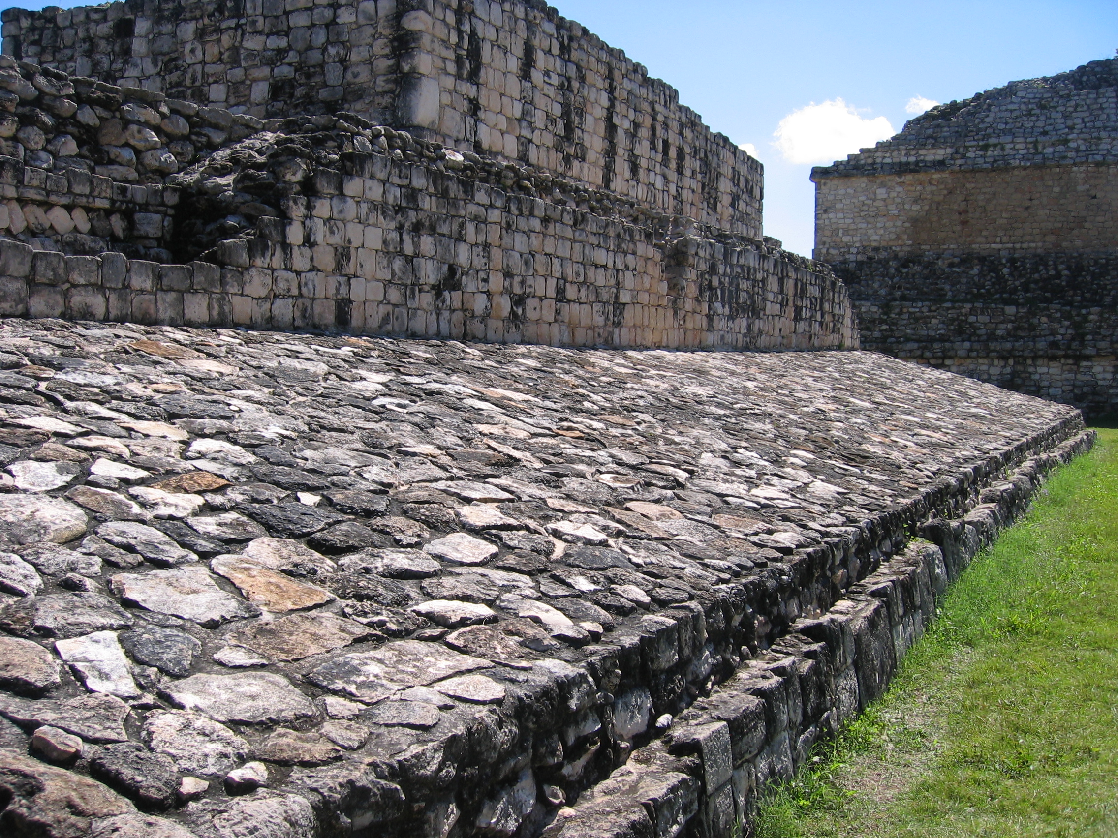
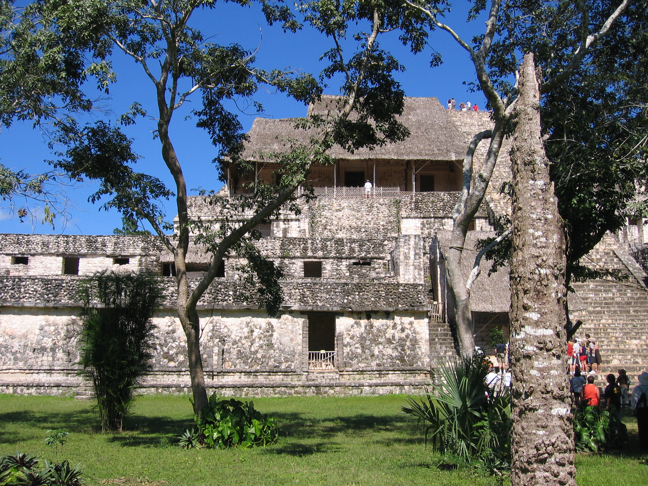
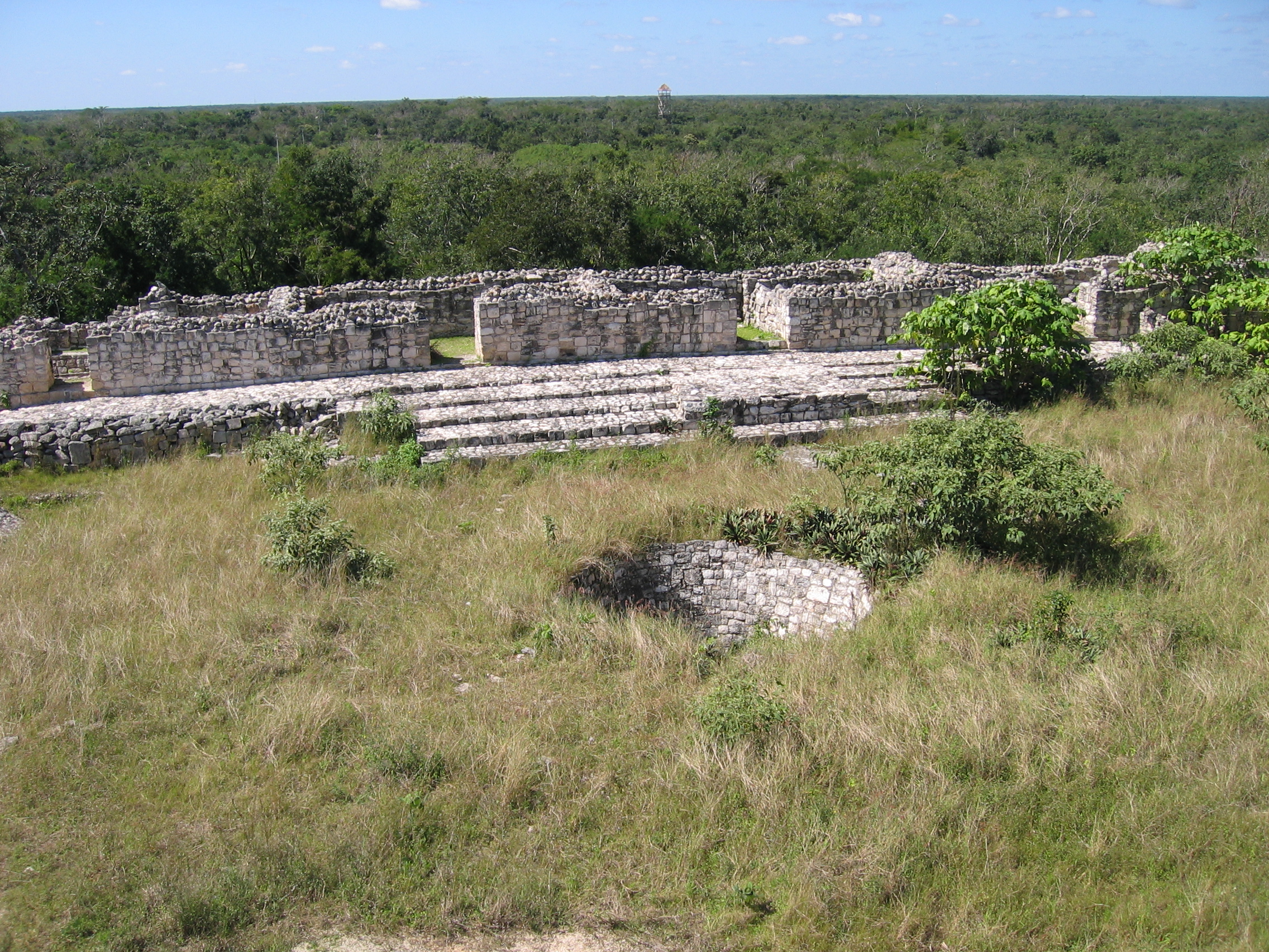
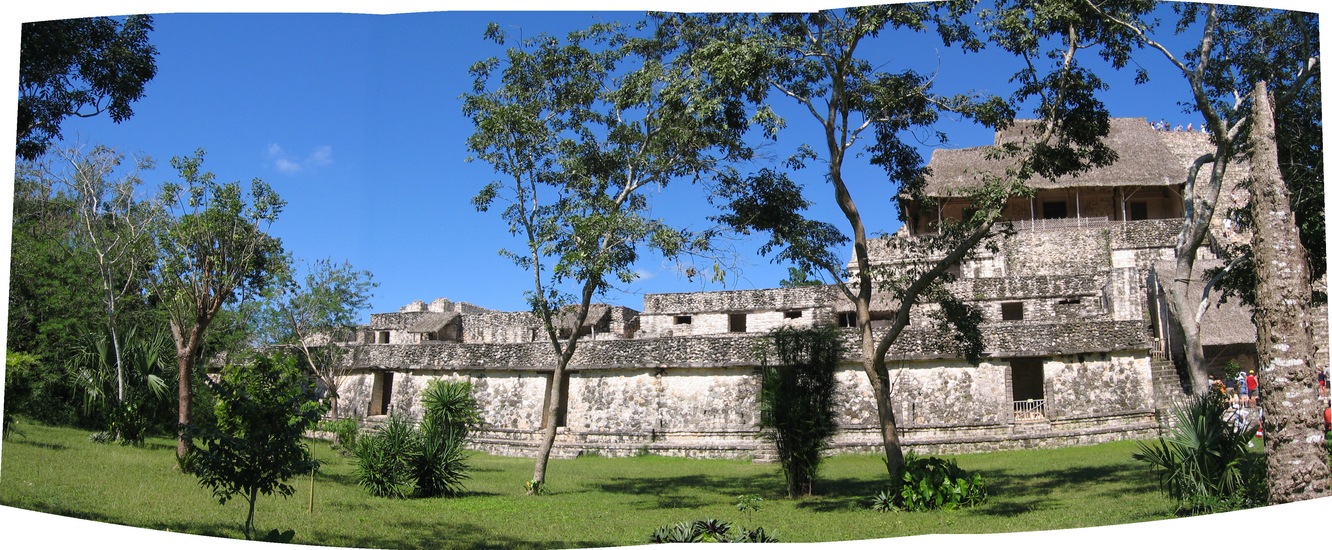
Ek'Balam
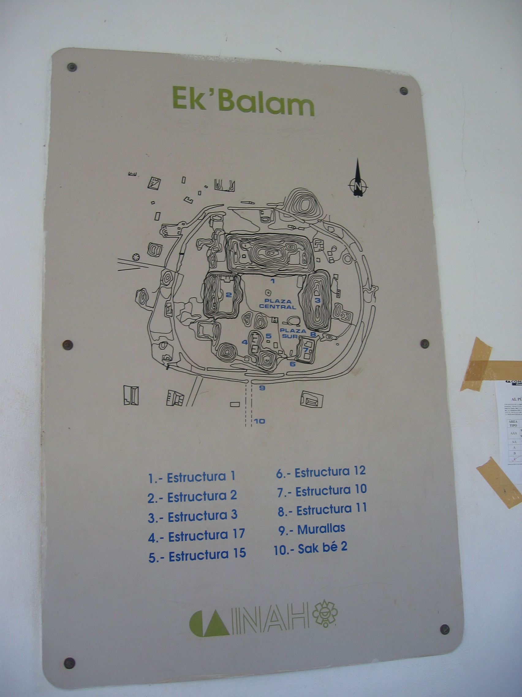
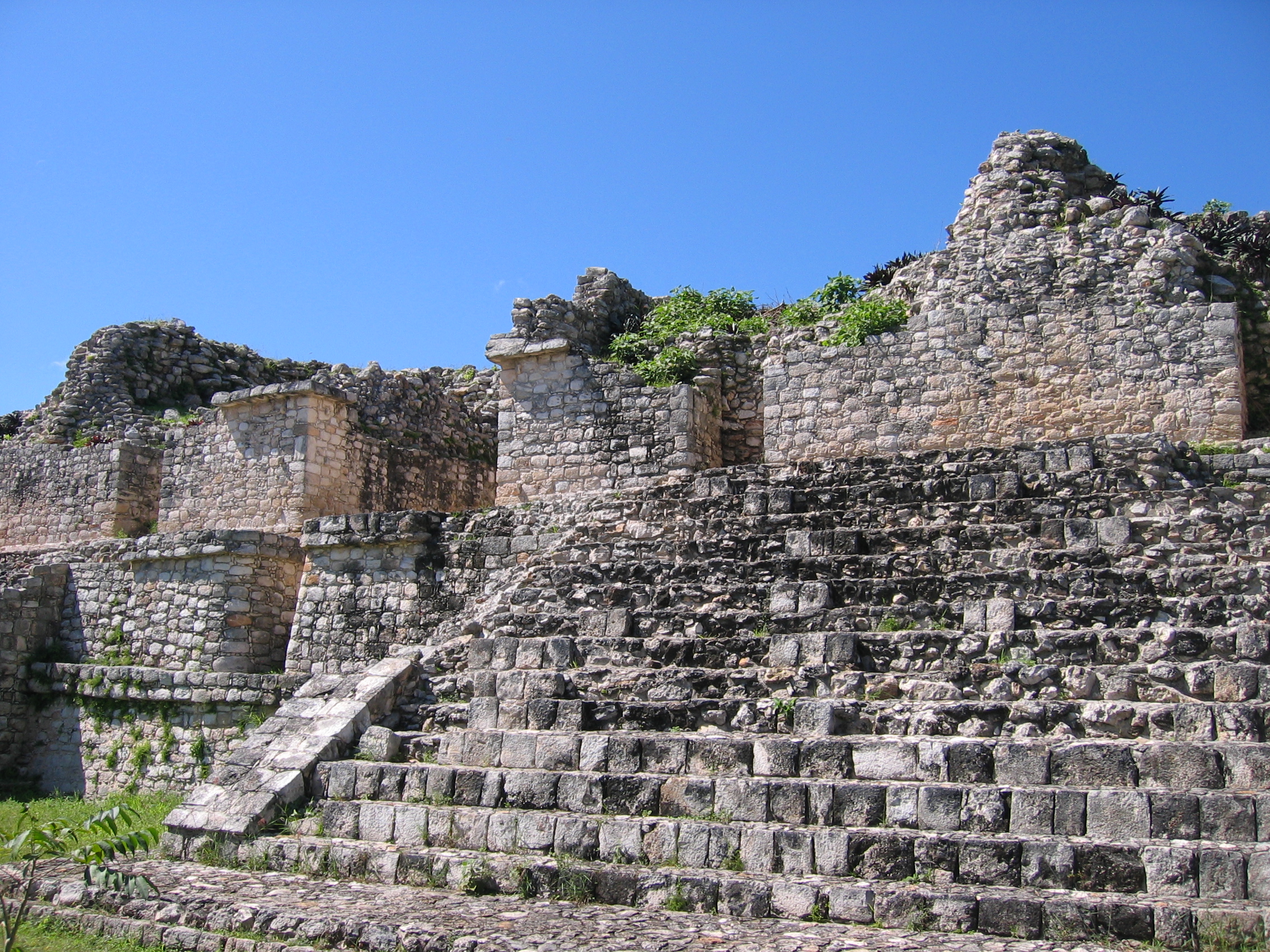
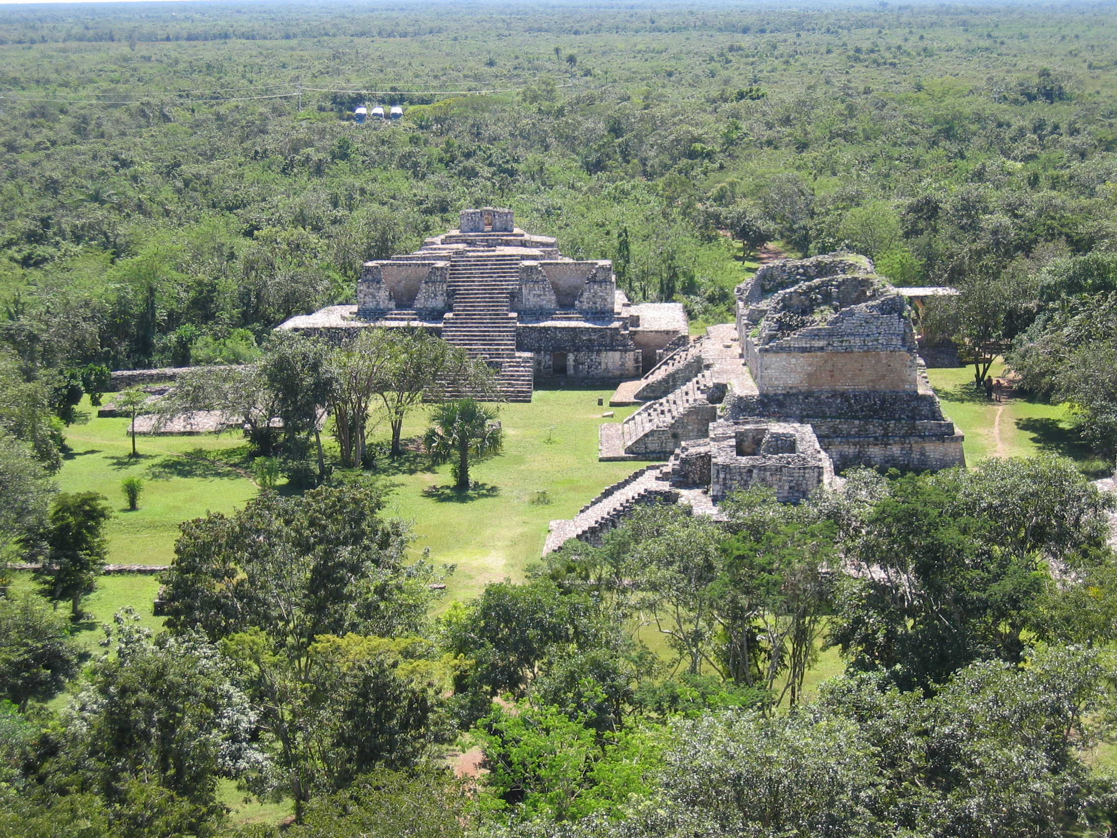
Ek'Balam is one of the most interesting ancient Mayan cities to visit, partly because it's largely unknown to most tourists, and at least at the time these pictures were taken (2007) there were few tourists there. This is a mystery to me, in that it isn't very far from Chichen Itza given the distance one goes from the Cancun resort areas to get to this area, and could easily be piggybacked onto an escorted tour there. My only explanation is an assumption on the part of tour operators that people don't really want to spend that much time at the ruins, and seeing two cities at once would be too much for many tourists. This may be true, but Ek Balam is amazing enough to be worth a trip on its own on a separate day from Chichen Itza, even given the amount of travel necessary. It may be difficult to even find an organized tour here, but it is well worth the trouble, because there's something to see here that you'll find nowhere else: it has the finest stucco work in the Yucatan (unlike Chichen Itza, these buildings were decorated in sculpted stucco rather than stone carvings), and is pretty much the only place you can get an idea of just how elaborate the Mayan ruins you see today used to be. Although the city was known in the 1800s, serious excavations only began here in 1987, and much remains to be uncovered.Ek Balam is a compact city compared to any of the others discussed here, and you will not be spending a great deal of time covering distance on foot between structures: in fact, the fifteen or so excavated structures are all visible from most any point in the area, as you can see on a map of the city. Most of the structures were built between AD 700-1000, but the city remained inhabited after this time.
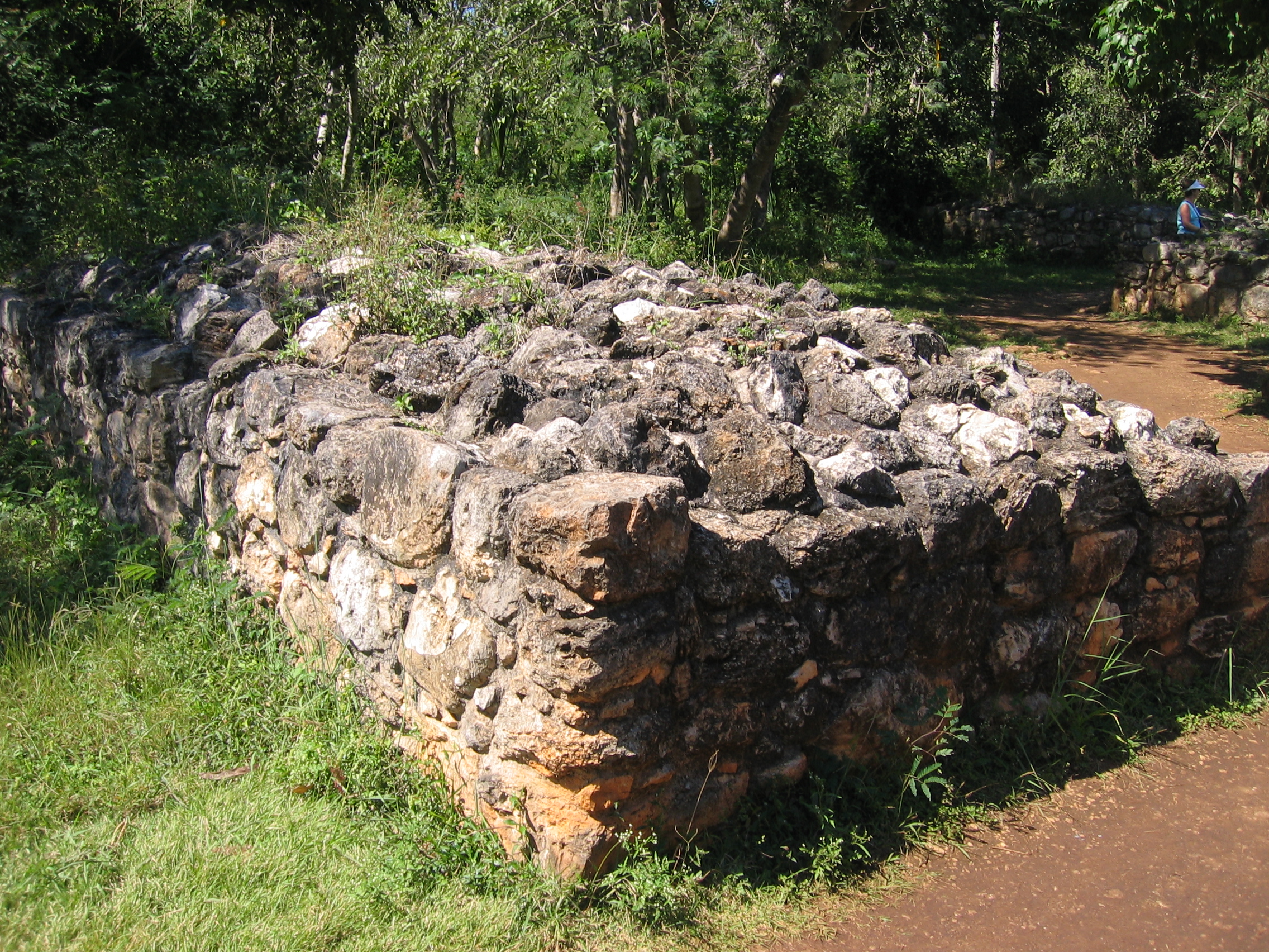
Ek Balam was a walled city, and the defensive walls are visible as one
enters.
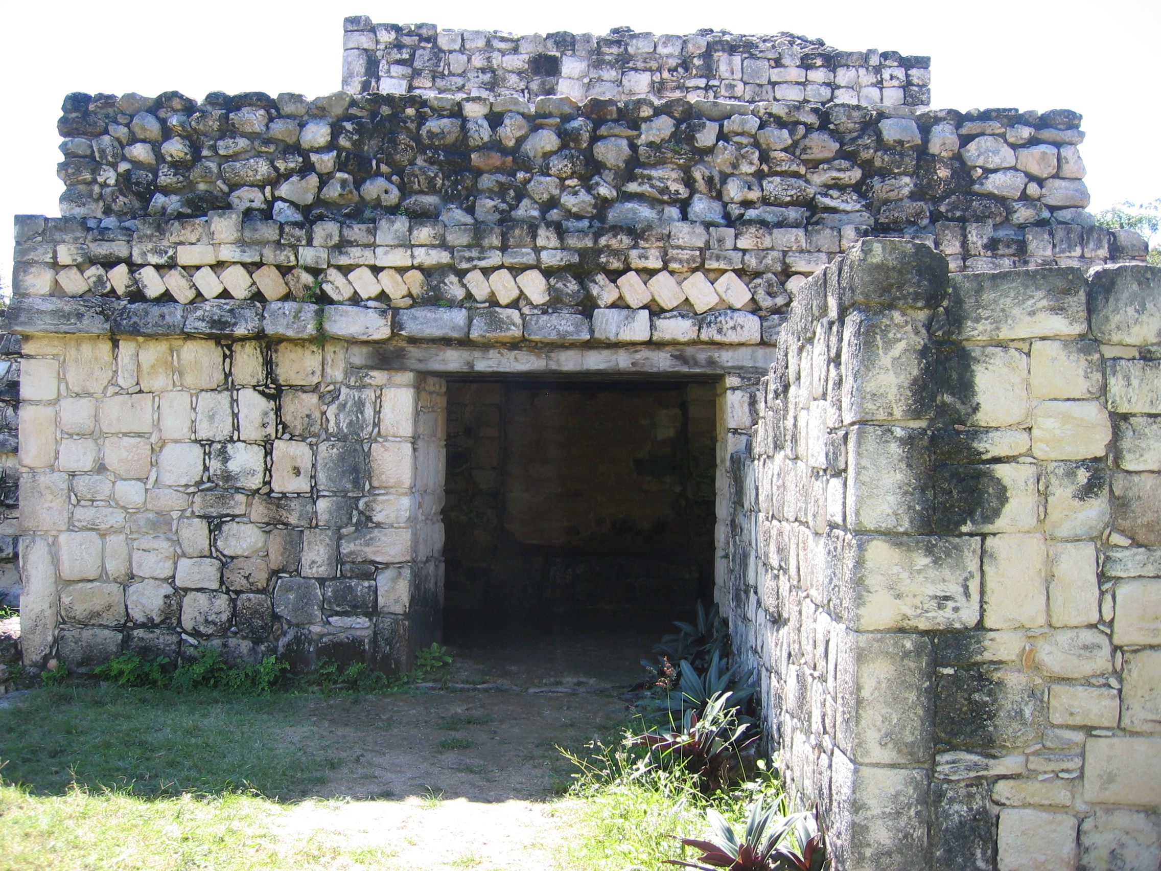
The first structure encountered is the Entrance Arch, a typical Mayan
arch built
upon a raised platform. Skirting the side of this, one enters the main
site,
passing by the rear of what is known as the Oval Palace, the major
southernmost
structure in the compound.
|
Map of the central Ek'Balam compound. |
Remnants of the city walls. |
Upper portion of the entry arch, just inside the city's walls in the south. The structure actually has arches on all four sides, and provides a ceremonial entry through which the sacbe passes. |
|
East of the entry arch, the side of the multi-layered Oval Palace. |
The edge of the Oval Palace almost abuts the Twin Pyramids, identical buildings in front of the palace - this path, just east of the entry arch, shows the rear of these. |
Rear of the Twin Pyramids. |

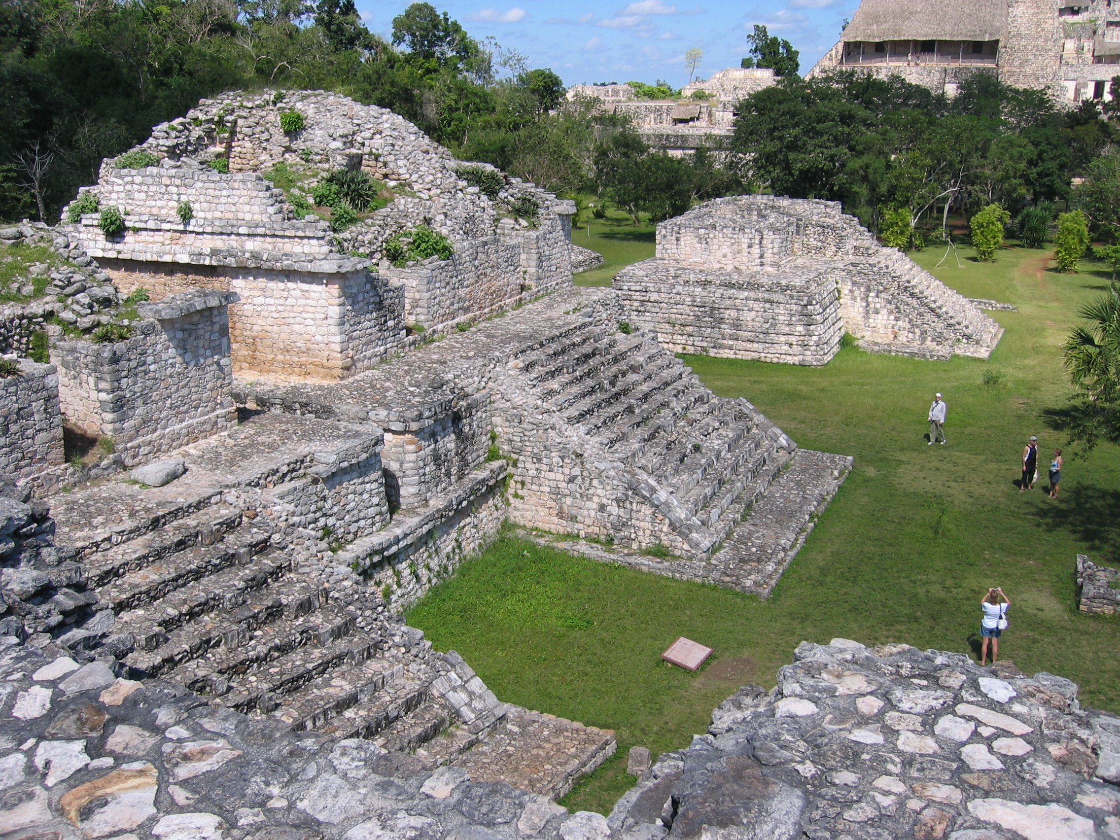
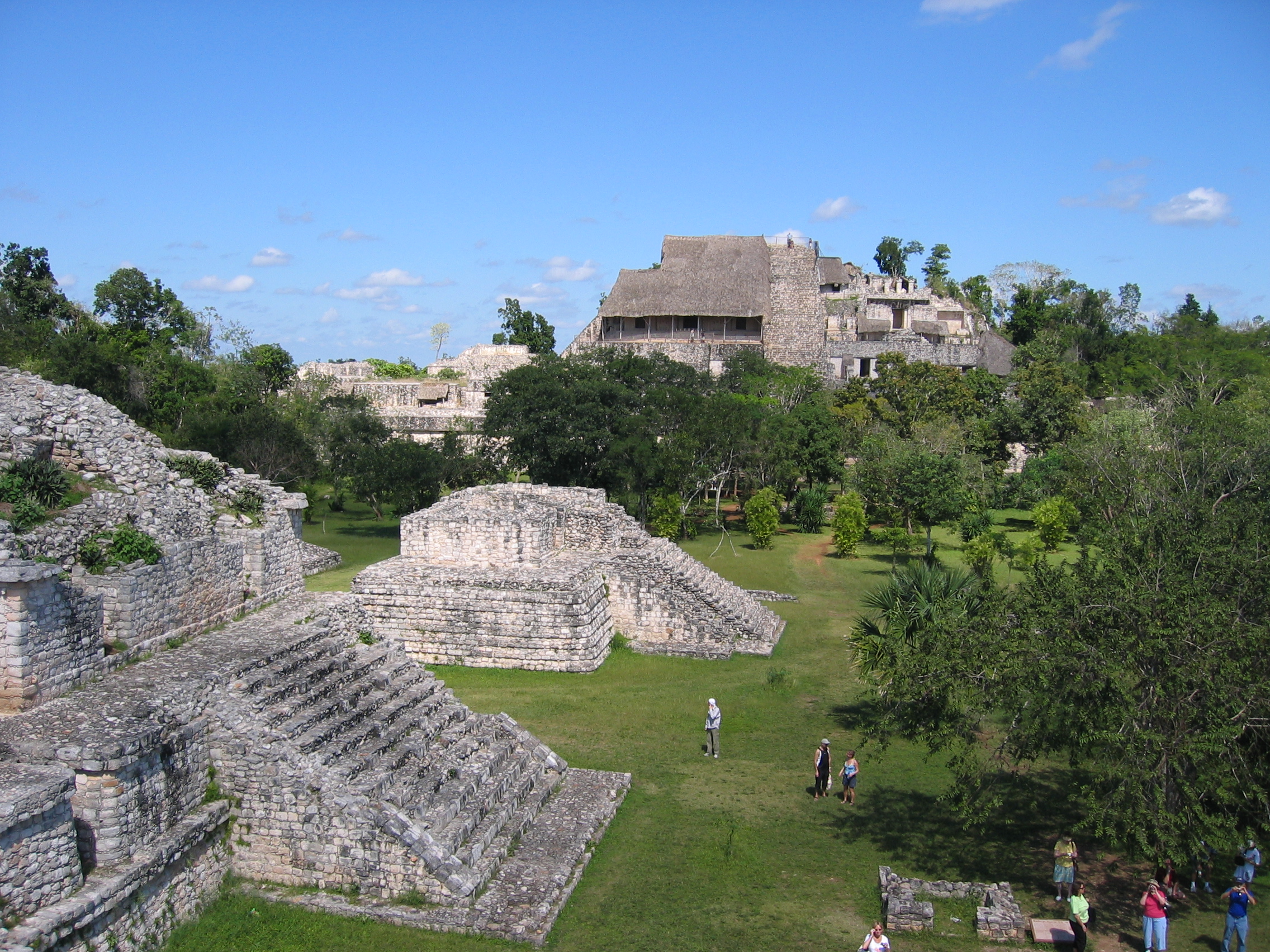
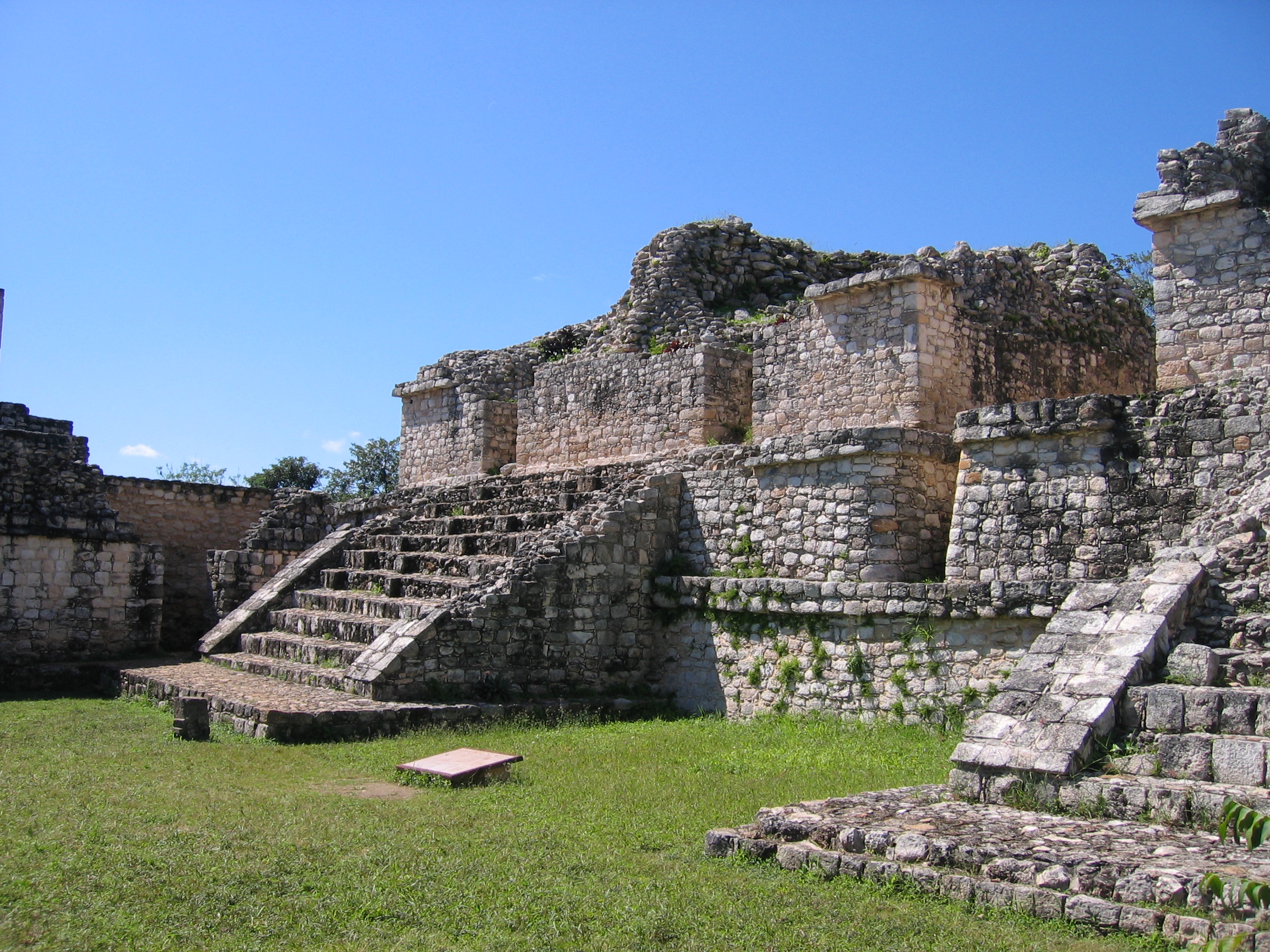
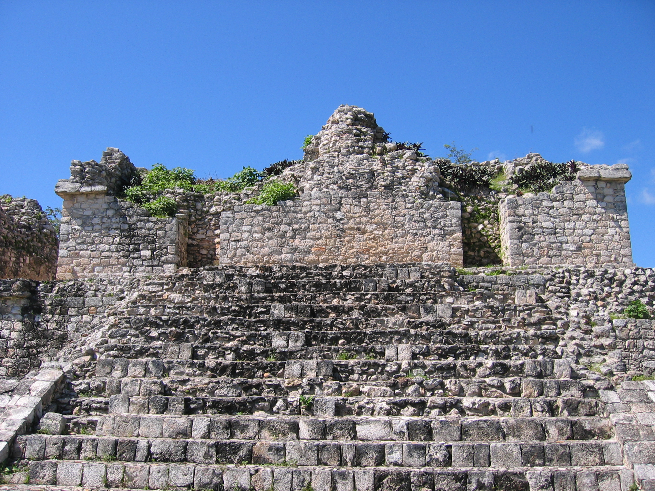
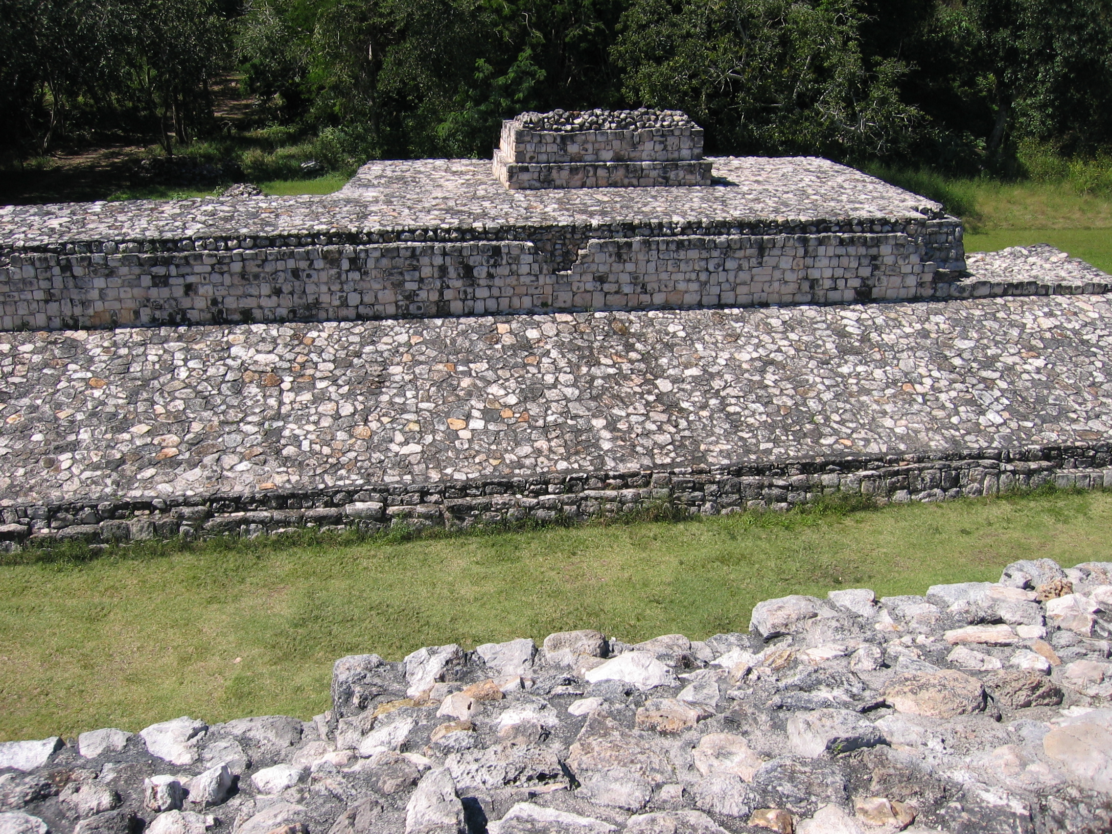
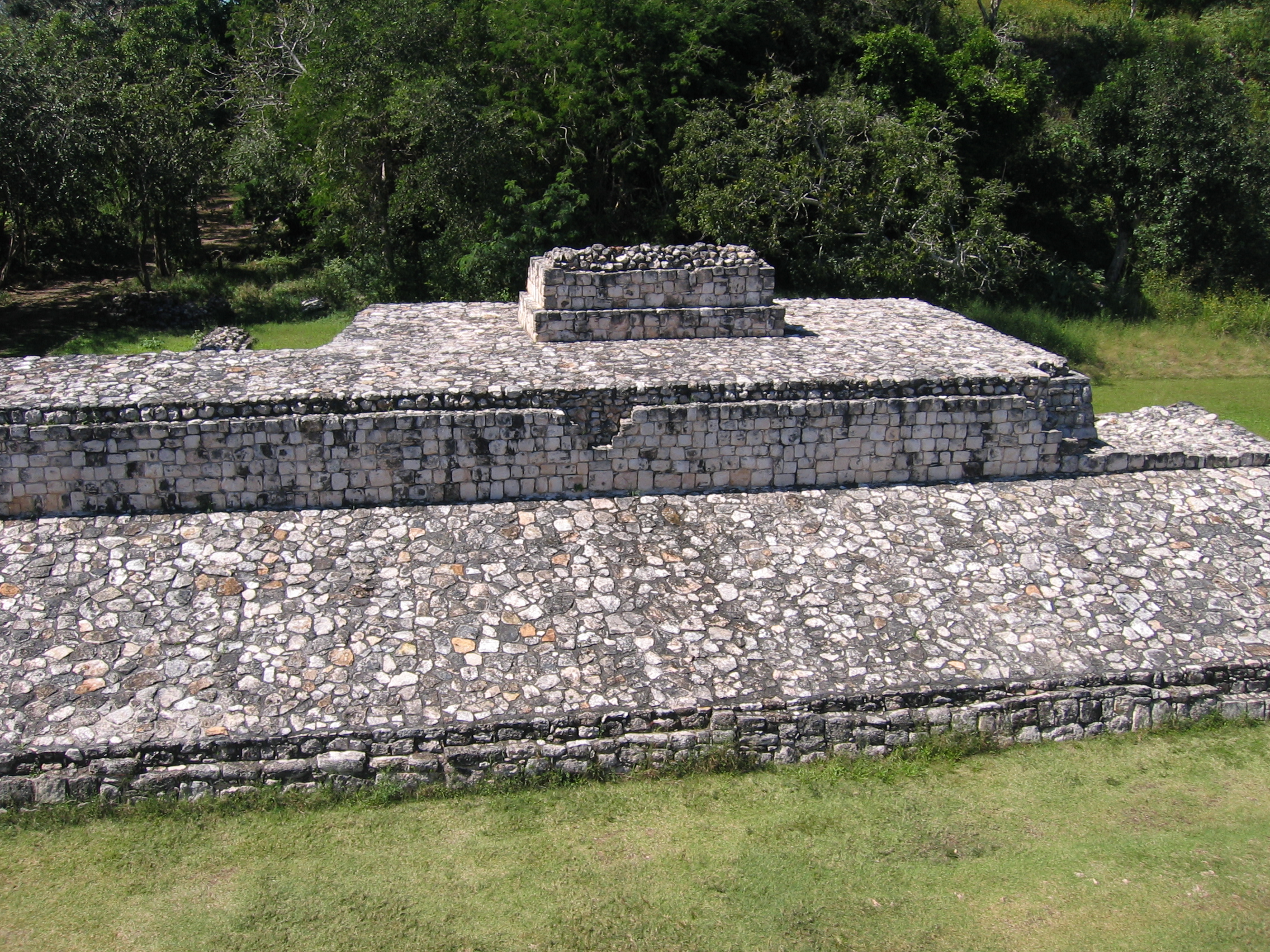
The Oval Palace and The Twins
From the front, the Oval Palace forms the anchor for a courtyard (from which it no longer looks oval - the oval appearance is really only obvious from the rear and sides). It is the major structure in the south of the city. It is also known as La Redonda, and seems comparable in height but smaller in length than the main pyramid at Tulum. It can be climbed (as of 2007 at least), and from here one gets the general layout of the rest of the structures. There are a number of important Stelae which are still reasonably well-preserved around this area. Video of this is also available.
|
View from the top of the Oval palace, looking toward the twins. The twins are actually two identical temples on one single foundation platform. |
To the far north (forming the northern boundary of the city) lies the Acropolis, the largest structure in the city. Between the twins and this structure is a temple that fronts the ball court. |
To the east side of the Oval palace like two tall Stelae. Further east can be seen the remnants of another structure. |
|
To the east of the Oval palace lies another, lower structure, which is not as well preserved and bears only the name Structure 10. |
Stelae, depicting a ruler of Ek'Balam. |
Stelae, Side. |
|
Two views of yours truly on top of the Oval Palace. |
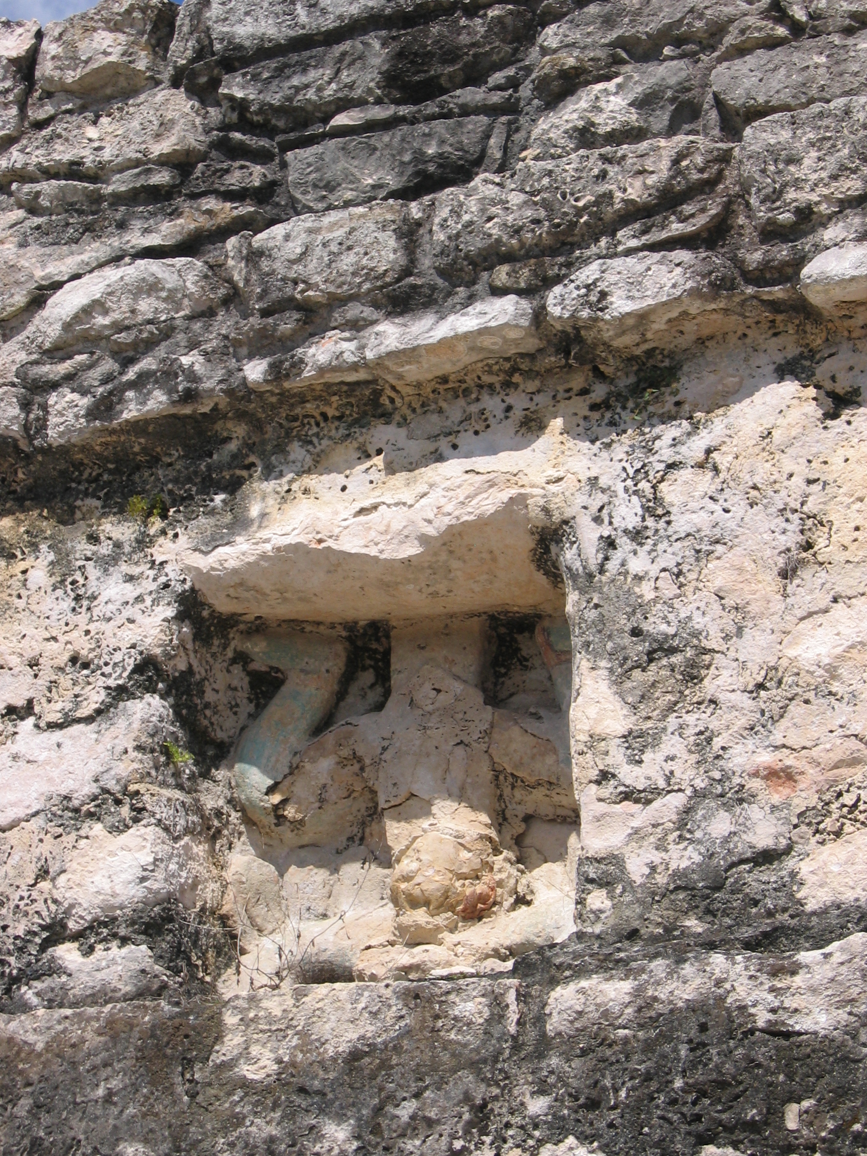
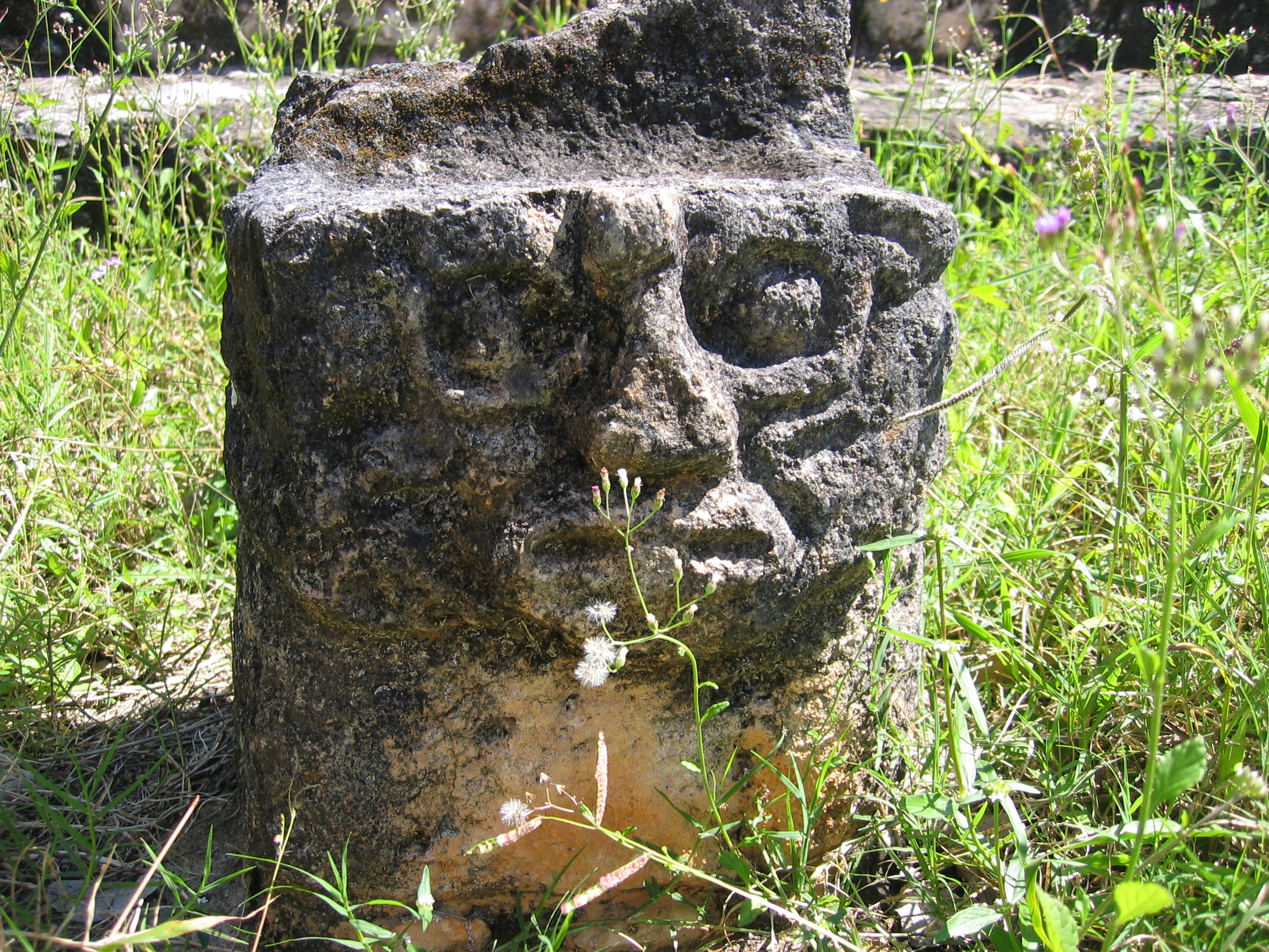
South platform of the Twin Pyramids.Unlike Chichen Itza, the building decoration here was entirely done with stucco rather than stonecarving. Several masks were found here which once decorated the facades of this building. |
North platform of the Twin Pyramids. |
|
The Twin Pyaramids. |
To the north of the twins, and slightly to the west, lies the ball court and an attached temple. |
Alter in the shape of a human figure, in the Oval Palace courtyard. |
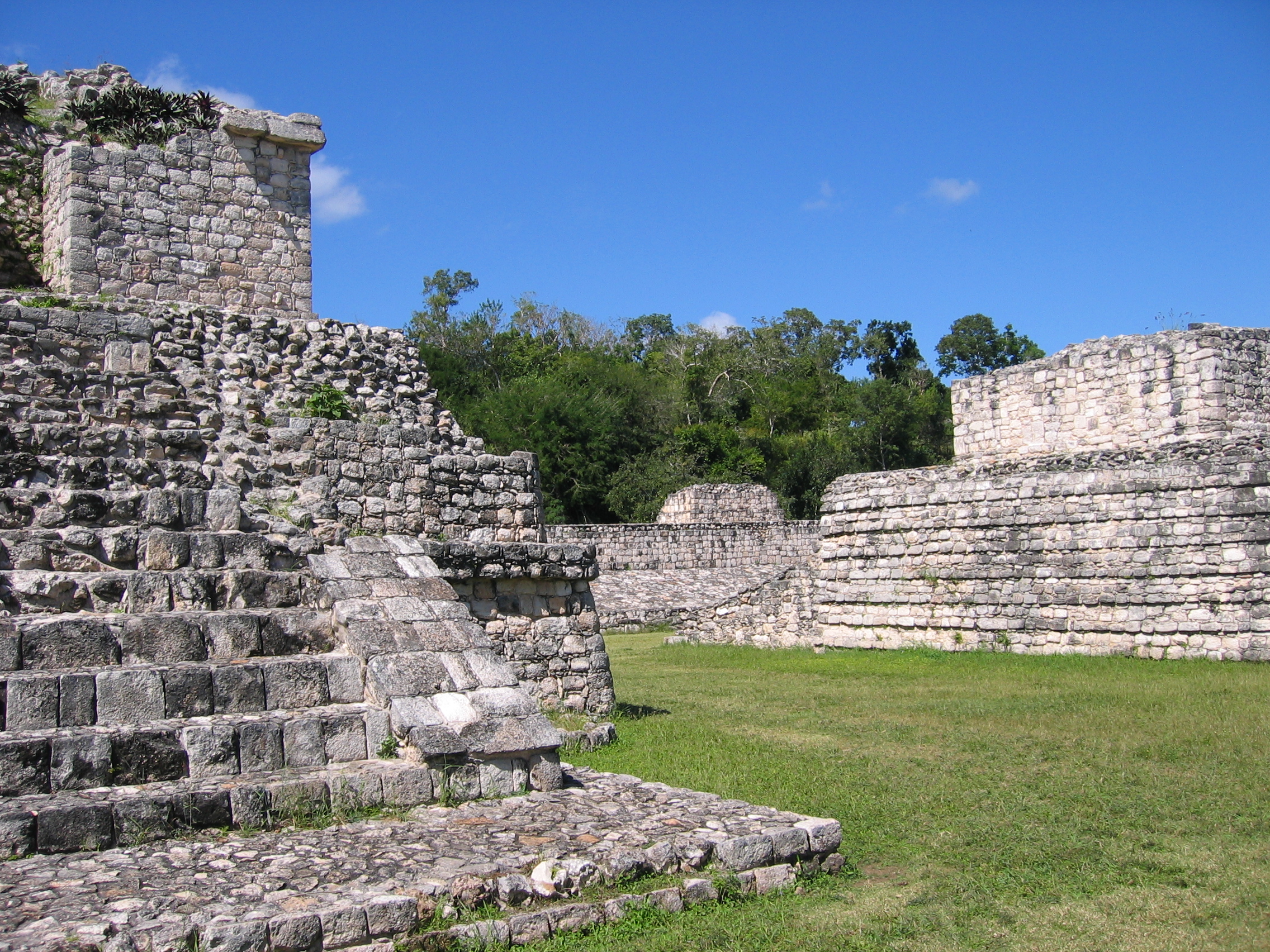
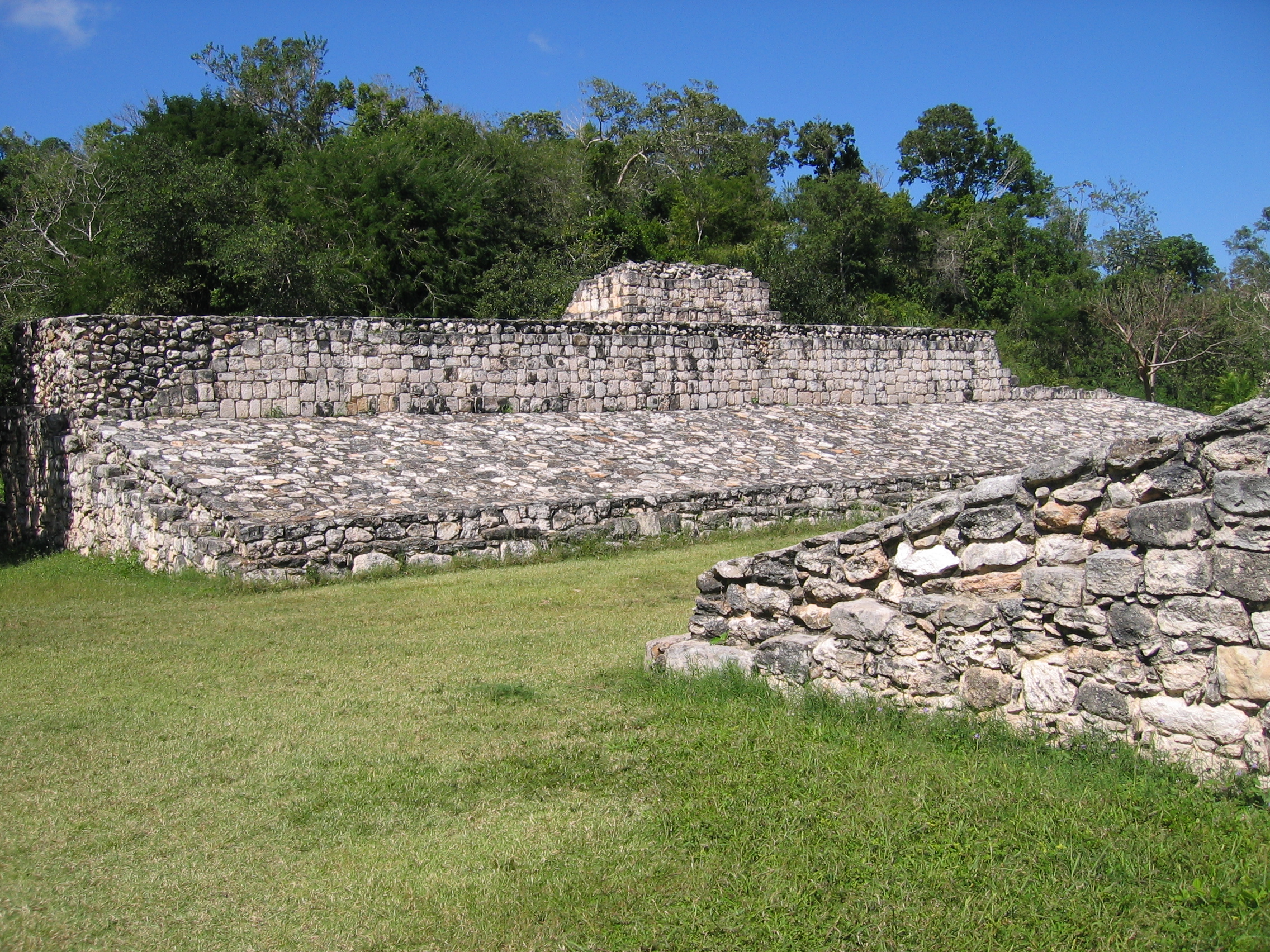
The Ball Court
Ek'Balam has a well-restored ball court. Like that of Chichen Itza, it has a temple attached to it - but the ball court itself is much smaller, and the temple physically runs the entire length of one side. The sides of the ball court are also set at much less of an angle than the other ball courts of other sites depicted here.
|
The west side of the ball court and the playing area, viewed from the south (just North of the Entry Arch) |
The east side of the ball court. The ball court wall forms the rear wall of an attached temple. |
From the north looking back, one can see how close the court is to the Twin Pyramids.. |
|
Viewed from the north, the east side of the ball court has an enterable chamber, into the base of the attached temple. |
Close up of the chamber itself. |
The front side of the ball court, showing the attached temple, with the Acropolis in the background. |
|
Climbing the ballcourt temple provides a view down into the playing field. |
Another view from the top of the ballcourt temple. |
Panoramic montage of the ballcourt. |


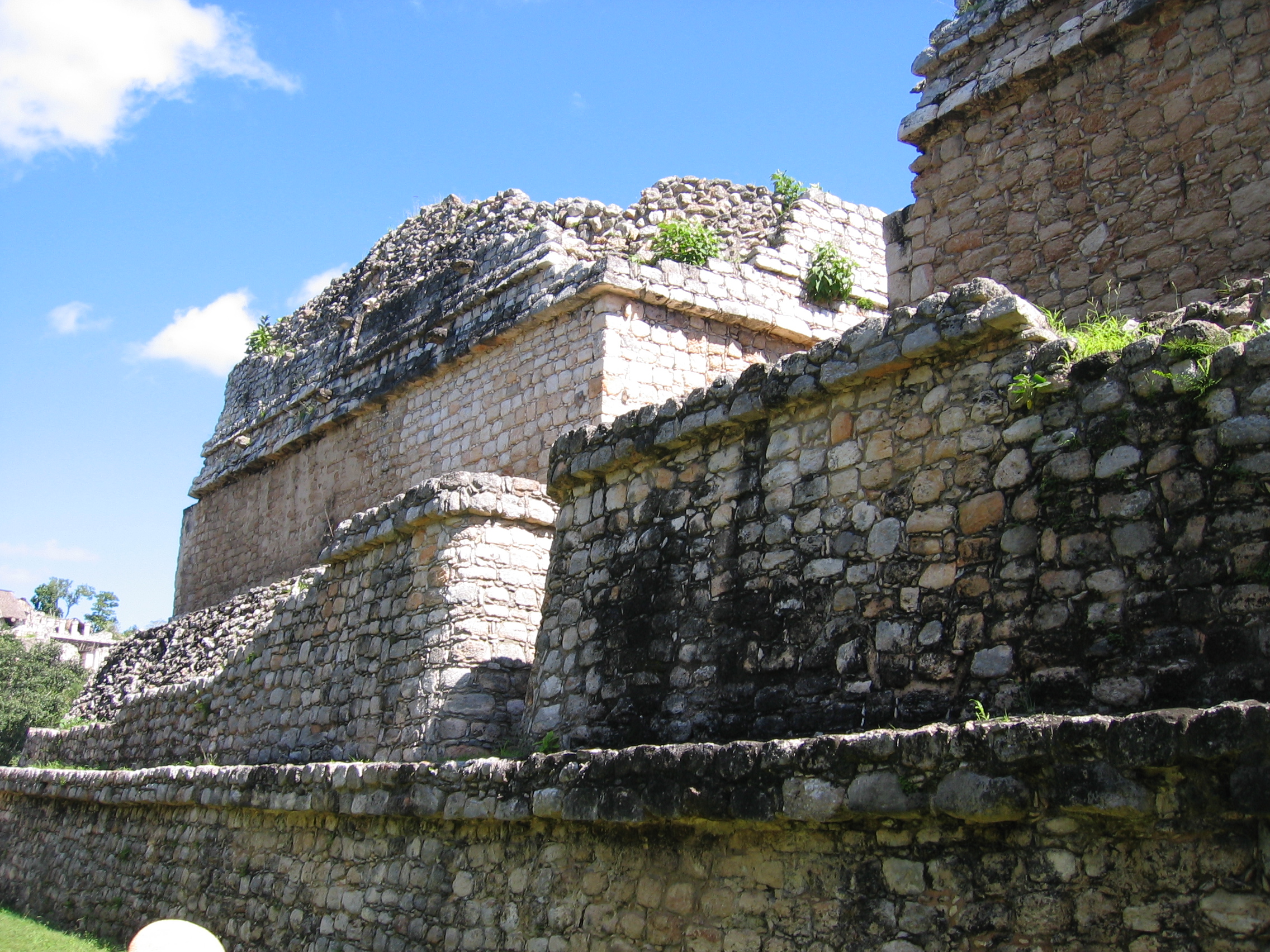
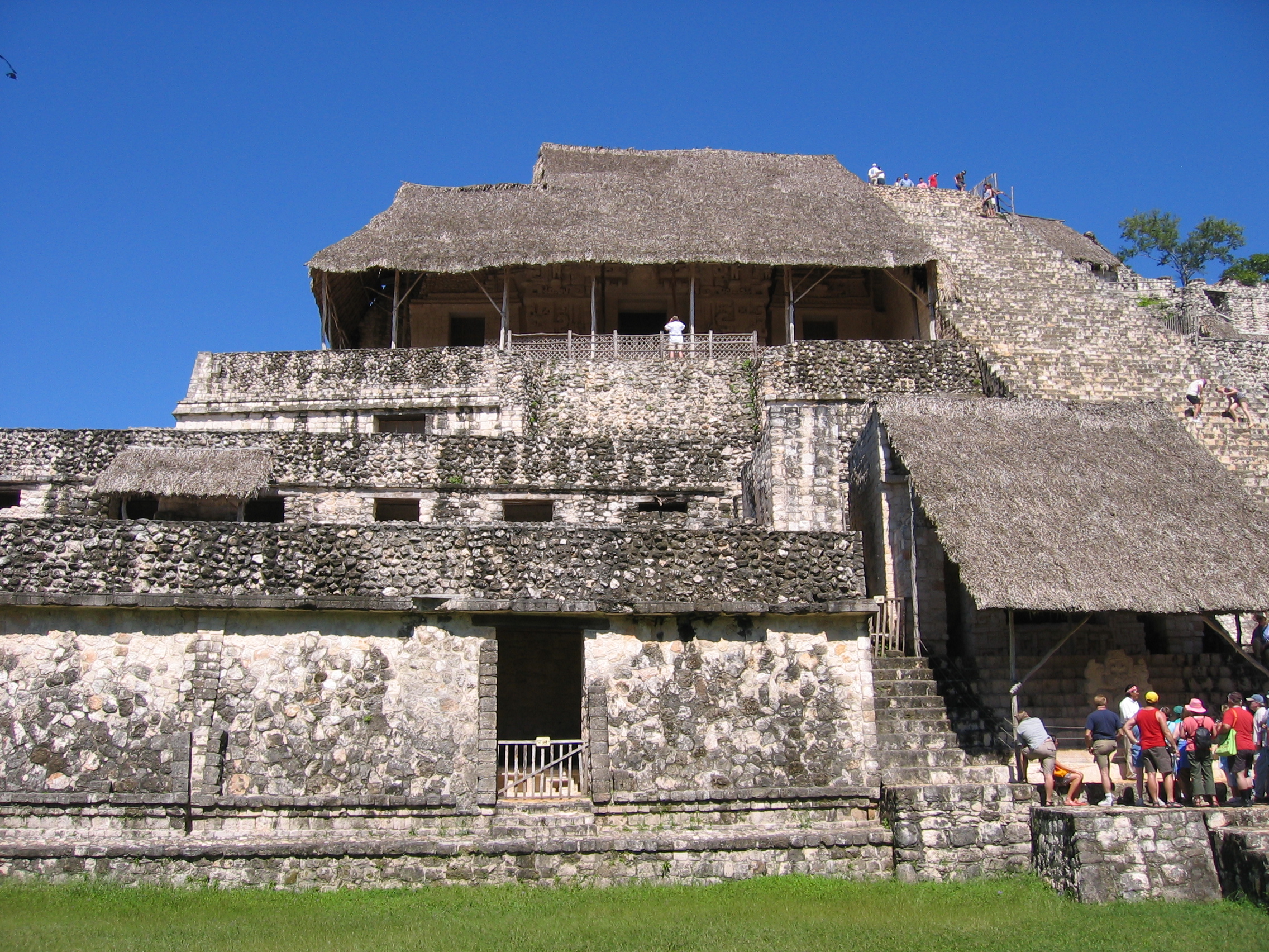
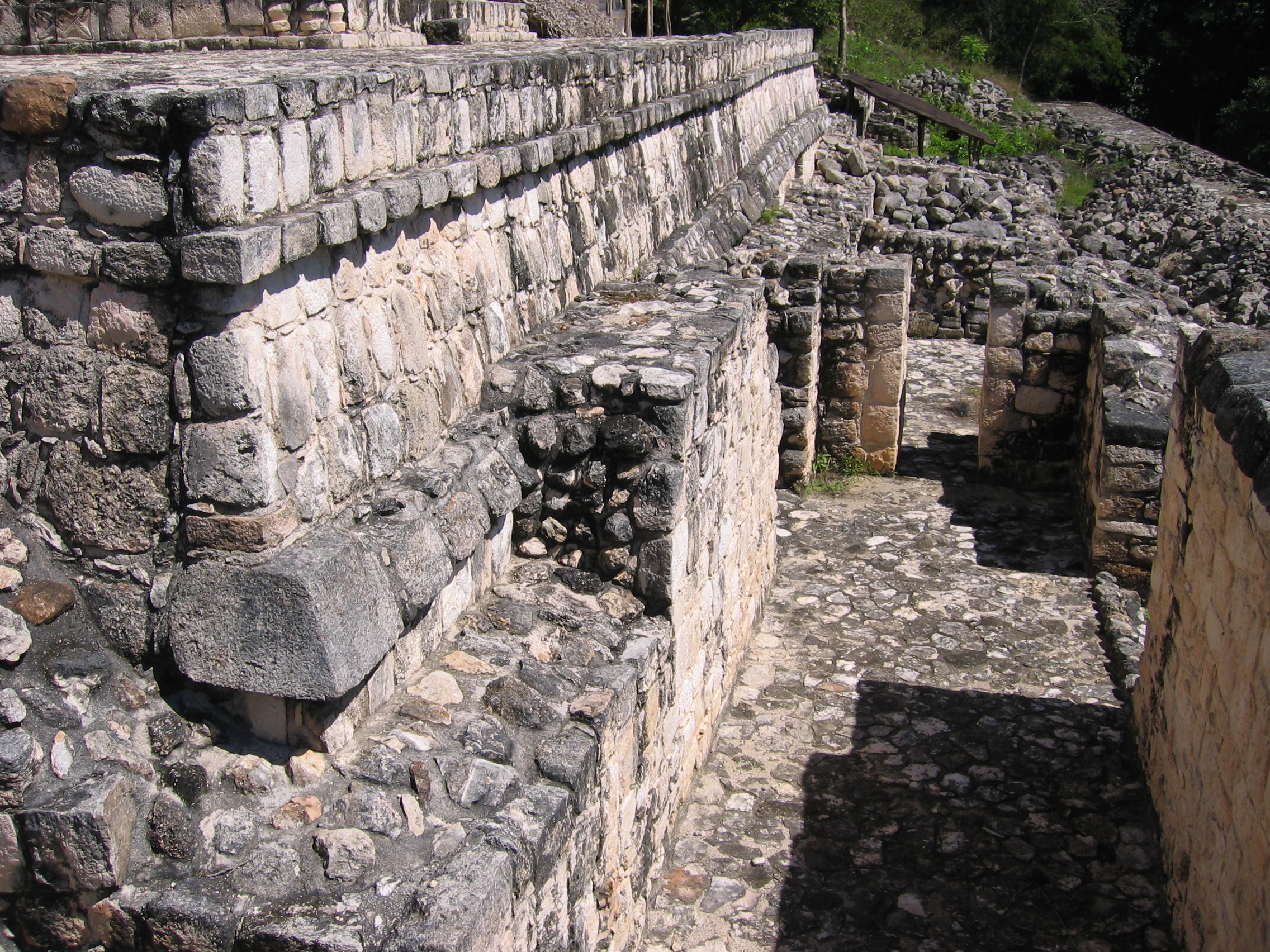
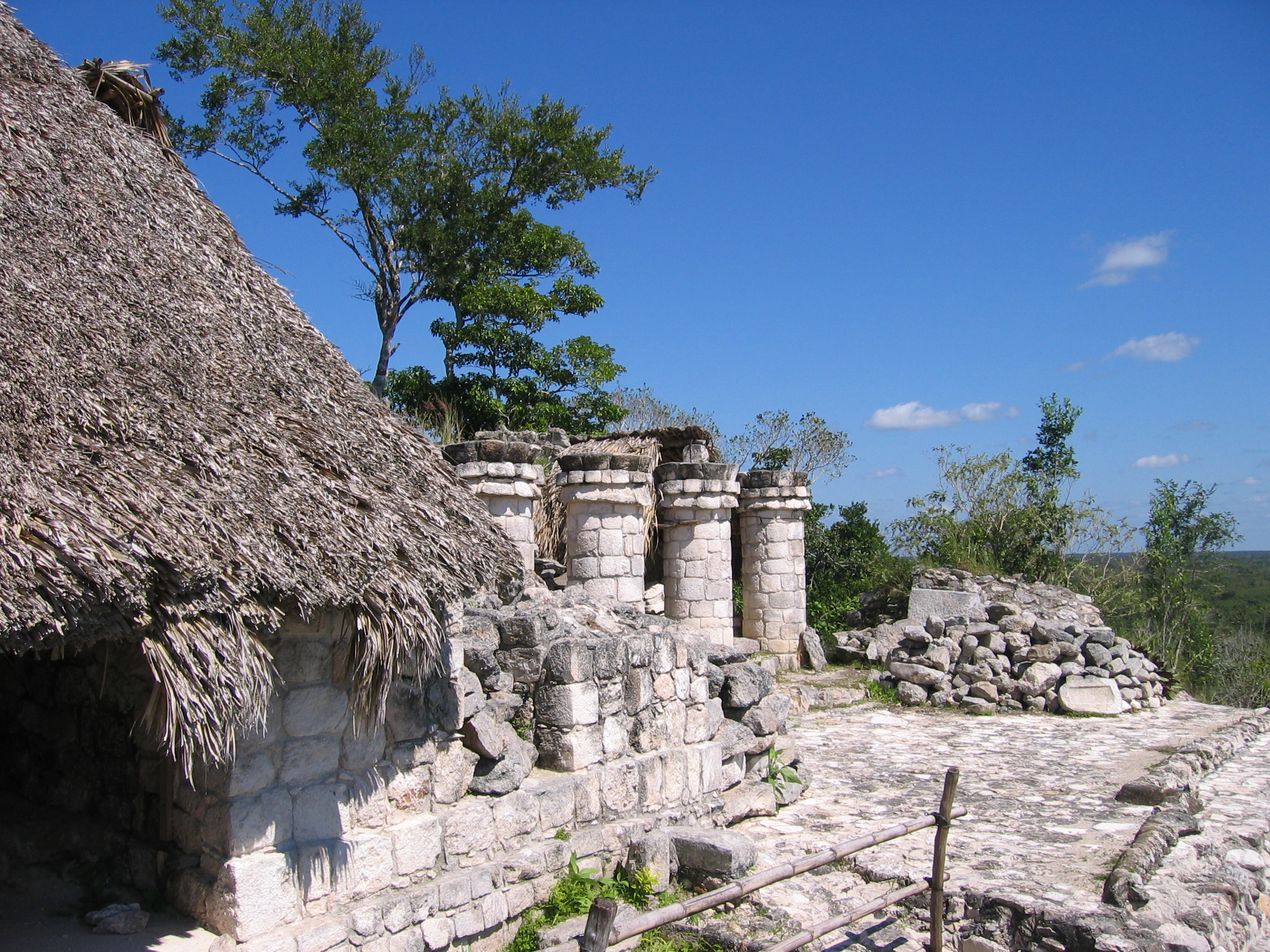
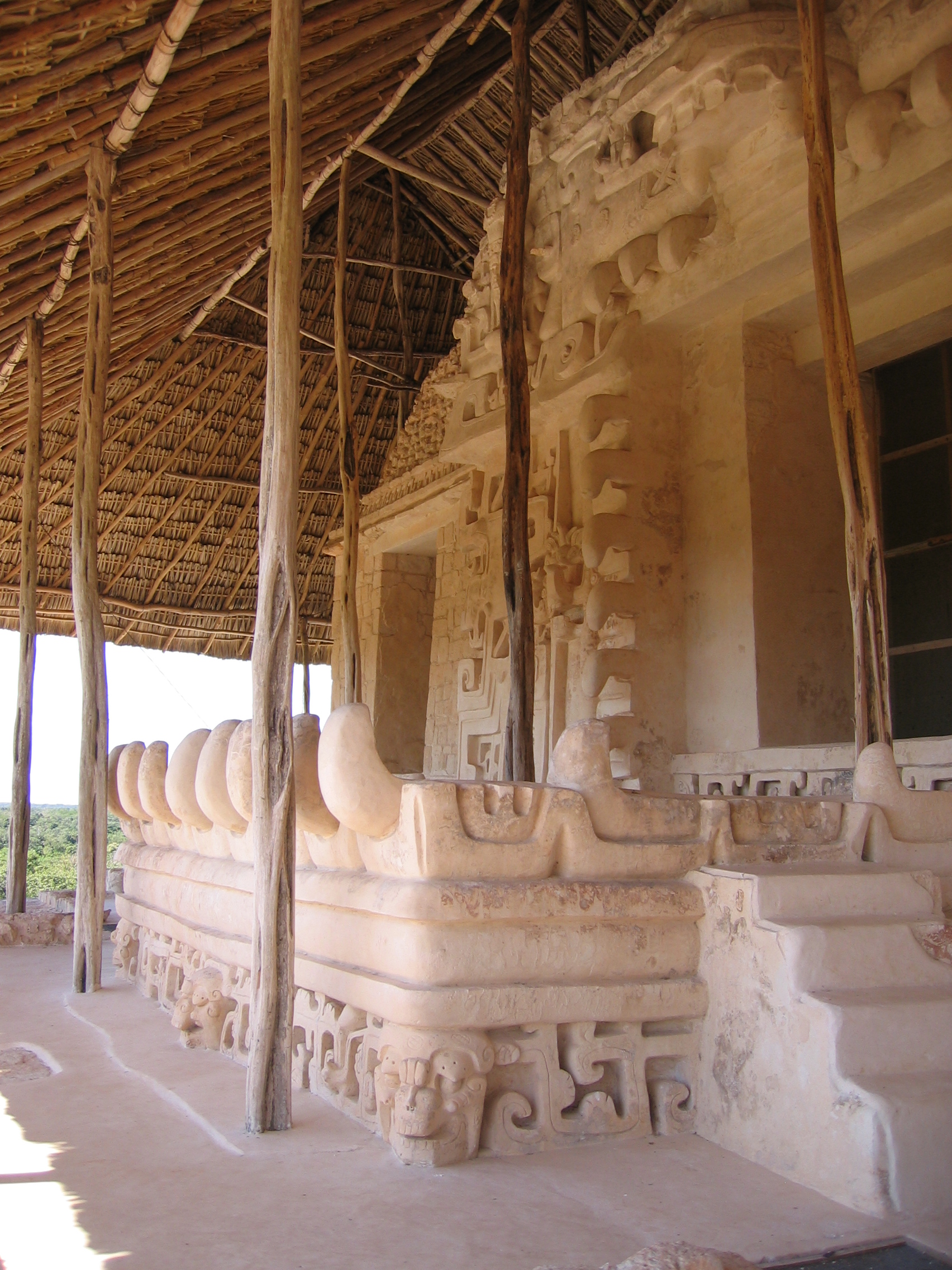
The Acropolis
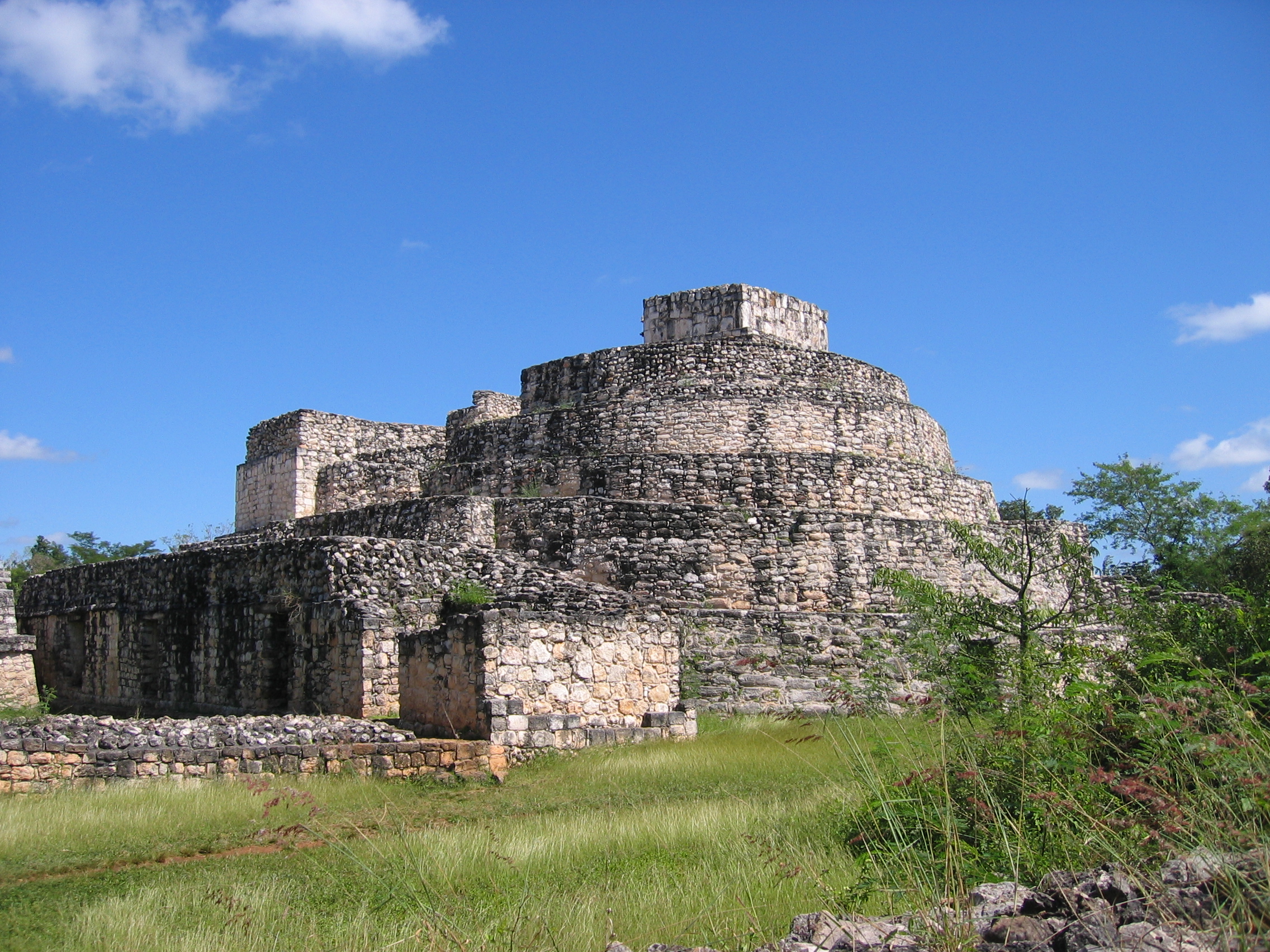
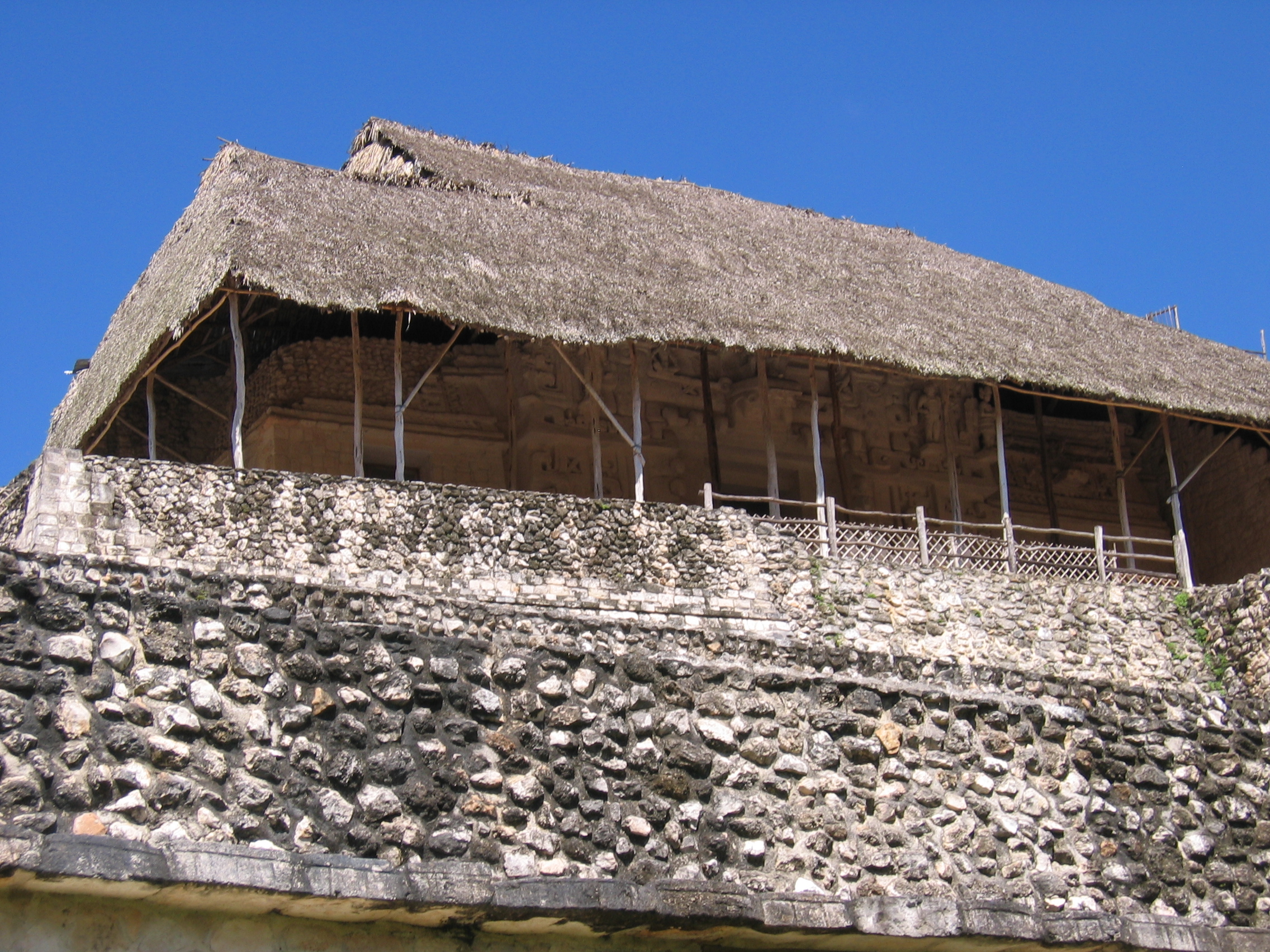
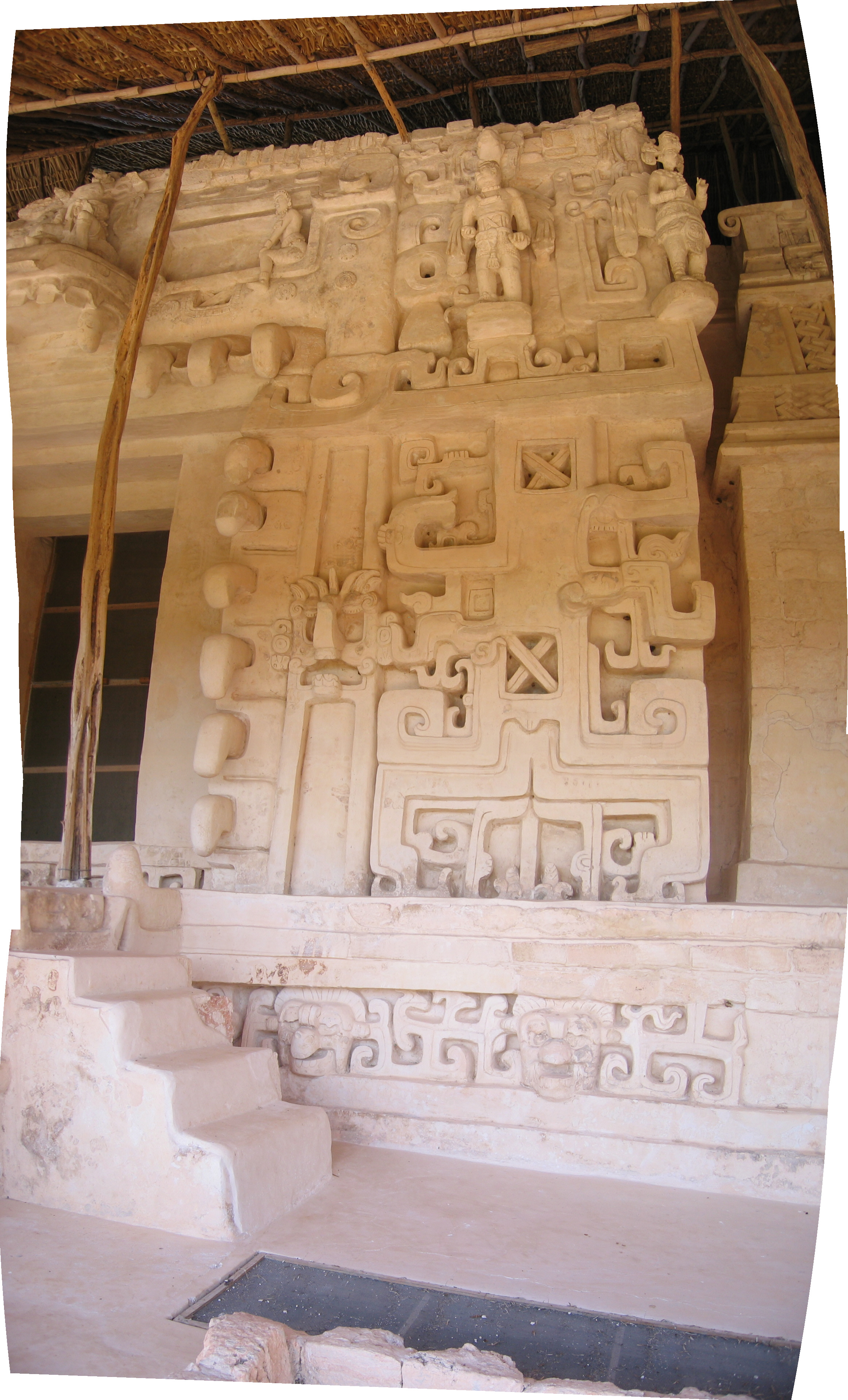
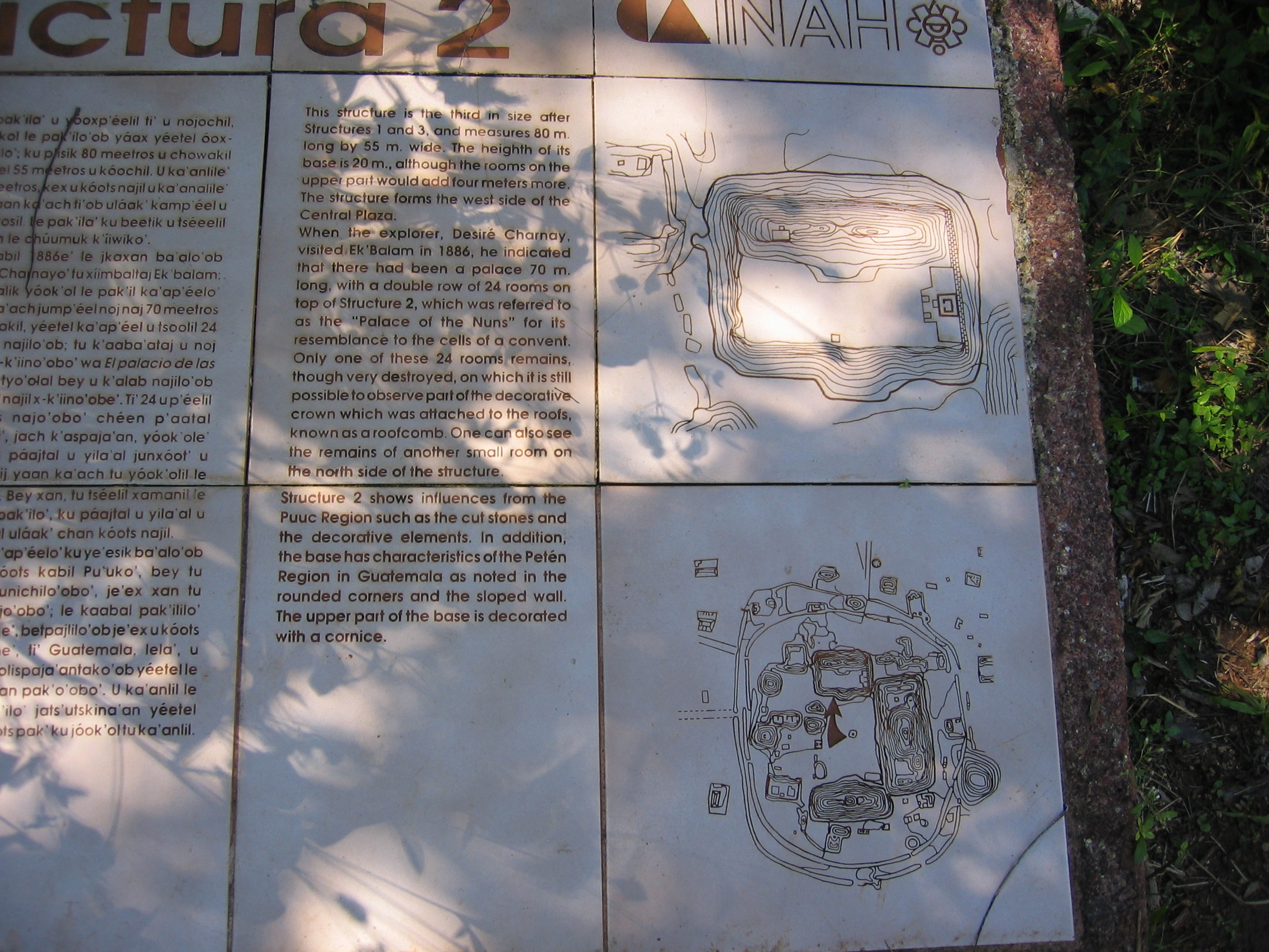
The acropolis is the main attraction at Ek'Balam - not only is it enormous (29 meters tall, 146 meters across, 55 meters deep), but it contains the best-preserved carving and stuccowork in the Yucatan. To maintain this preservation, much of the structure is covered in thatch to keep out sun and rain, and so the detail is only visible once one has climbed the structure. It contains the tomb of a powerful ruler named Ukit Kan Le'k Tok', who ruled the city at the height of its power, and whose glyphs label some of the structures and stelae here.
Between the ball court and the southern courtyard and the acropolis, there remain two very large structures forming the east and west boundaries of the walled city. These are simply labelled Structure 2 and Structure 13 - they are enormous (the second and third largest buildings here), but only give a vague hint of the shape they will have once they are excavated.
|
The acropolis looks unusual compared to most large structures, mainly because of the extensive thatchwork protection |
A more tree-free view of the acropolis. |
The west side of the structure extends outward in a single level |
|
View of the single level west end from the ground |
The westernmost side above this first level has some separate built-up structures |
...including a small opening leading down further into the interior |
|
Climbing the structure shows how steep it is (though the restored stairs are more even than most large restorations). |
Partway up the structure, excavations show prior layers inside, typical of Mayan architecture. |
A temple a third of the way up the structure shows the first example of the equisite preserved stuccowork, and the reason for the extensive thatch coverings. |
|
Pillars on the eastern edge of the structure. |
2/3 of the way up the structure, we see the amazing stuccowork of the tomb of Ukit Kan Le'k Tok' |
Panoramic montage of the acropolis complex |


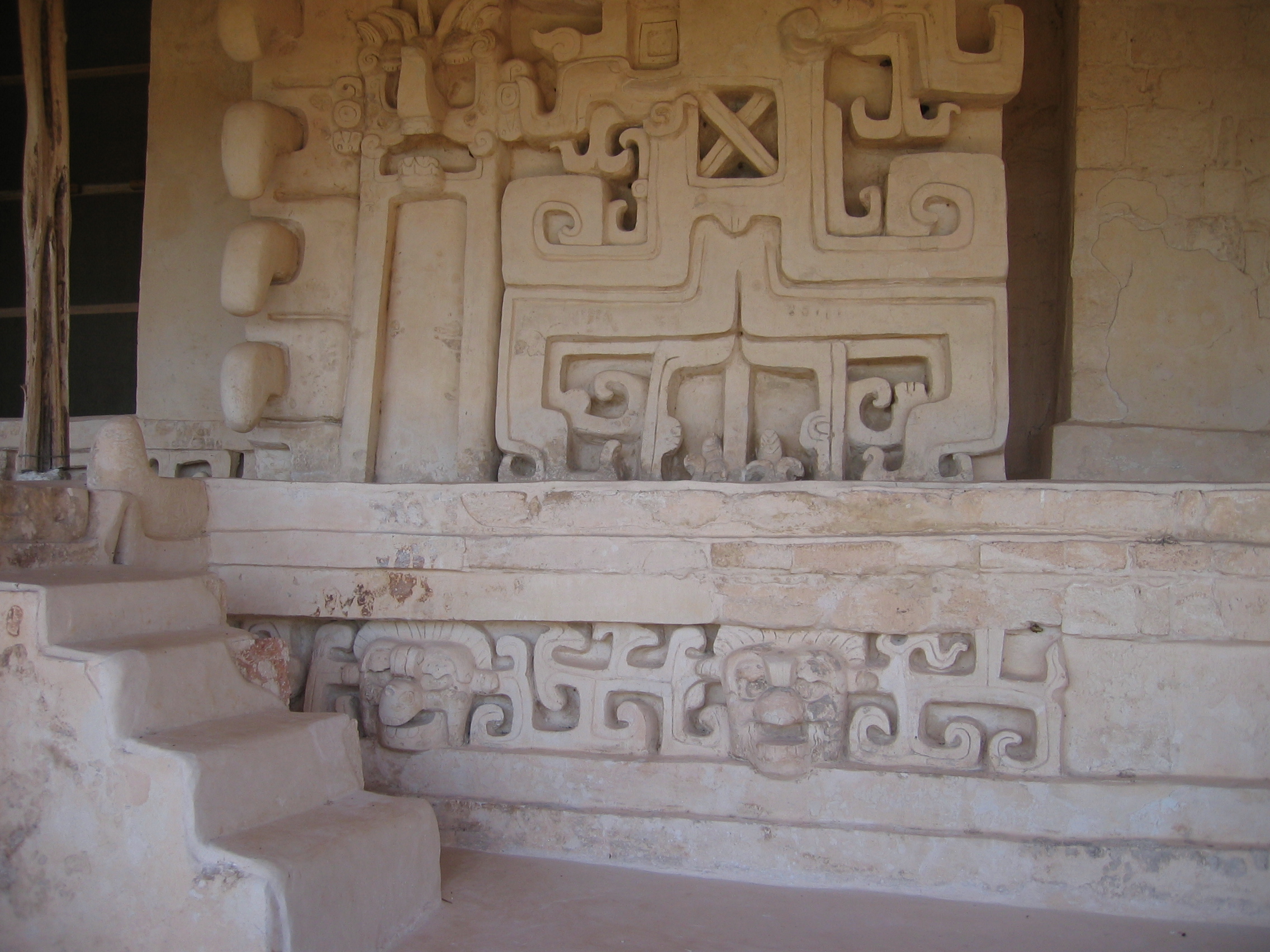
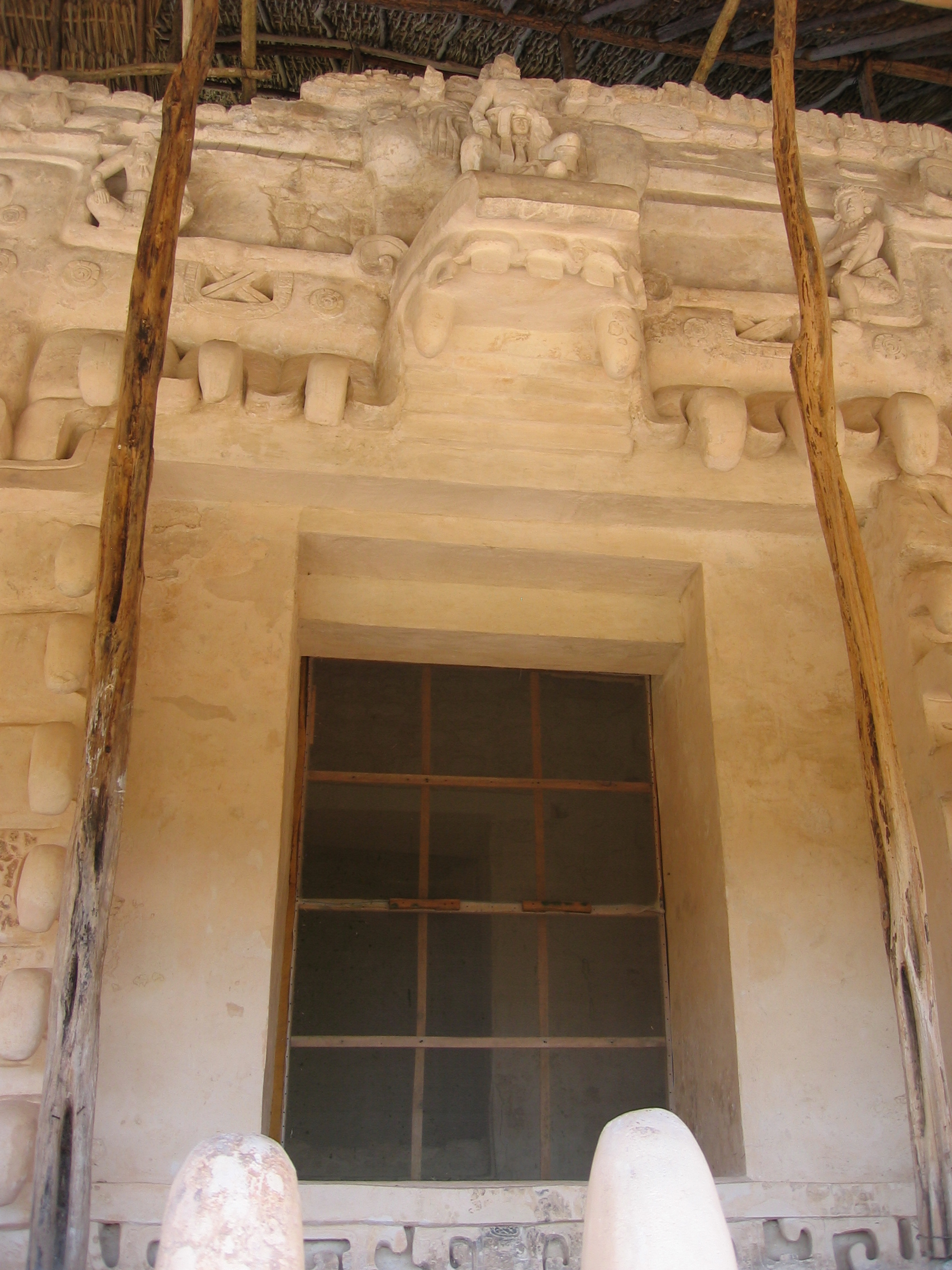
Tomb of Ukit Kan Le'k Tok'
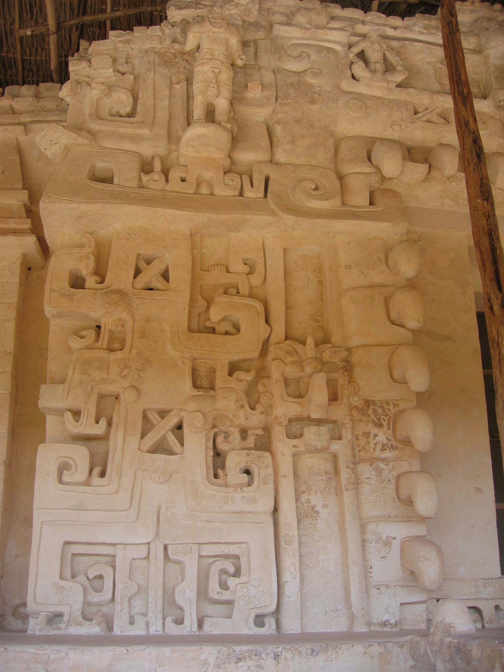
Approximately 2/3 of the way up the Acropolis lies the tomb of Ukit Kan Le'k Tok', the best preserved stuccowork in the Yucatan. It is an absolute miracle that this remains so well preserved - it looks like it could have been completed yesterday. This is because the temple area was completely covered over with rubble shortly after its completion. After seeing this, you have a hint of how beautiful and elaborate the structures you see in places like Ek'Balam and Tulum once were when all their stuccowork was intact. A panorama of the plasterwork is included below, but to really see the effect of something this large, two videos do a better job. There is also a level above this tomb, showing a tapered capstone with masks of Chac (similar to those of Chichen Itza, but again in stuccowork), which is not open to the public.
|
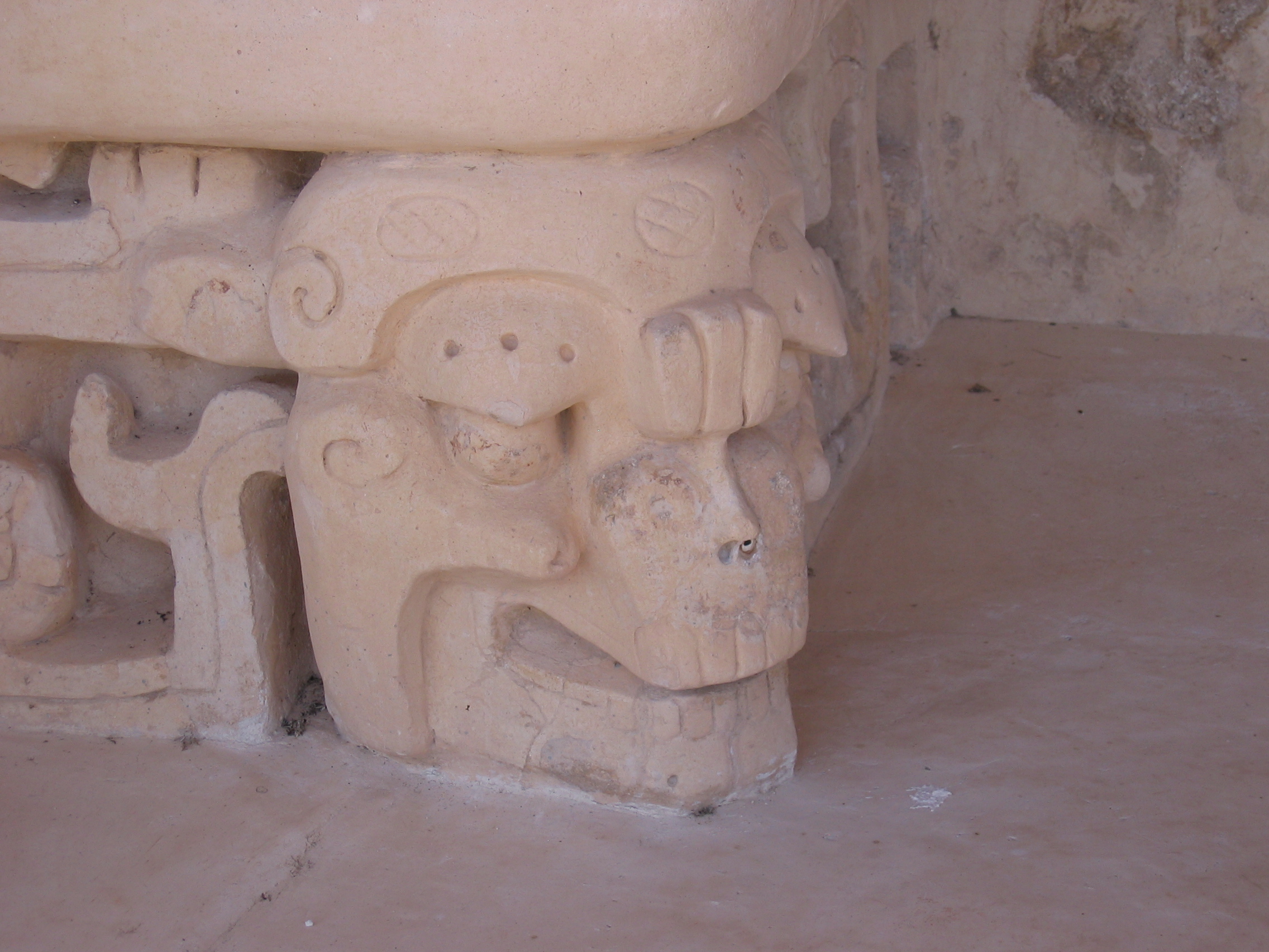
The tomb itself takes the form of a monster, some say a jaguar - the jaw of teeth is fairly obvious, and the upper mandible (though a lot smaller!) is equally obvious. Less obvious to me are the downward facing teeth surrounding the door |
Detail of the stuccowork around the steps |
The entry into the tomb shows the upper jaw above it. |
|
To the east side, a second entry/window shows elaborate stuccowork above. |
In the entryway, heiroglyphs that are bright enough they could have been painted yesterday |
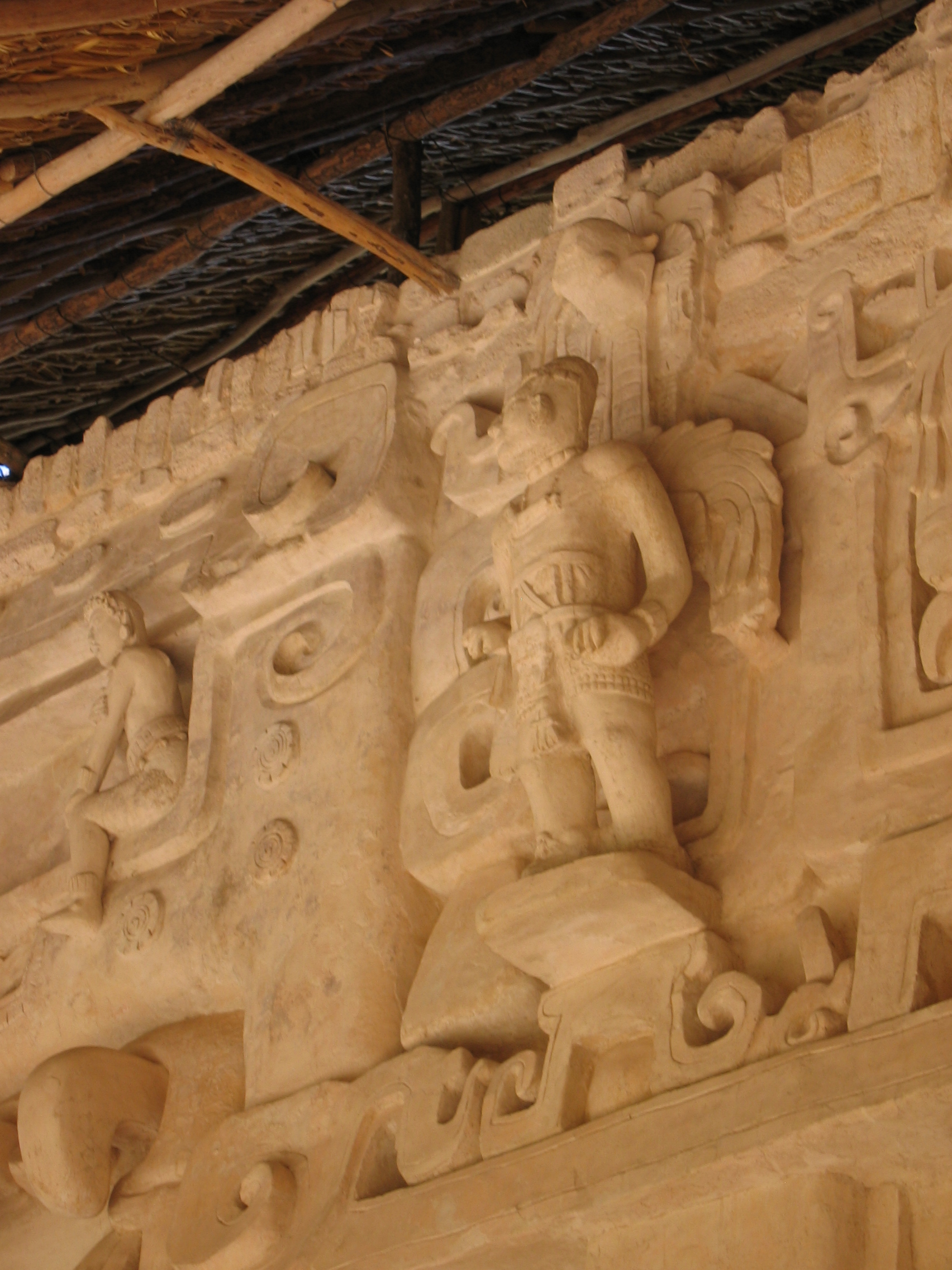
The incredibly elaborate stuccowork to the east side of the tomb entrance. |
|
Detail of the figures in the frieze. |
One of the pediments of the tomb. |
Panoramic Montage of the plasterwork. |

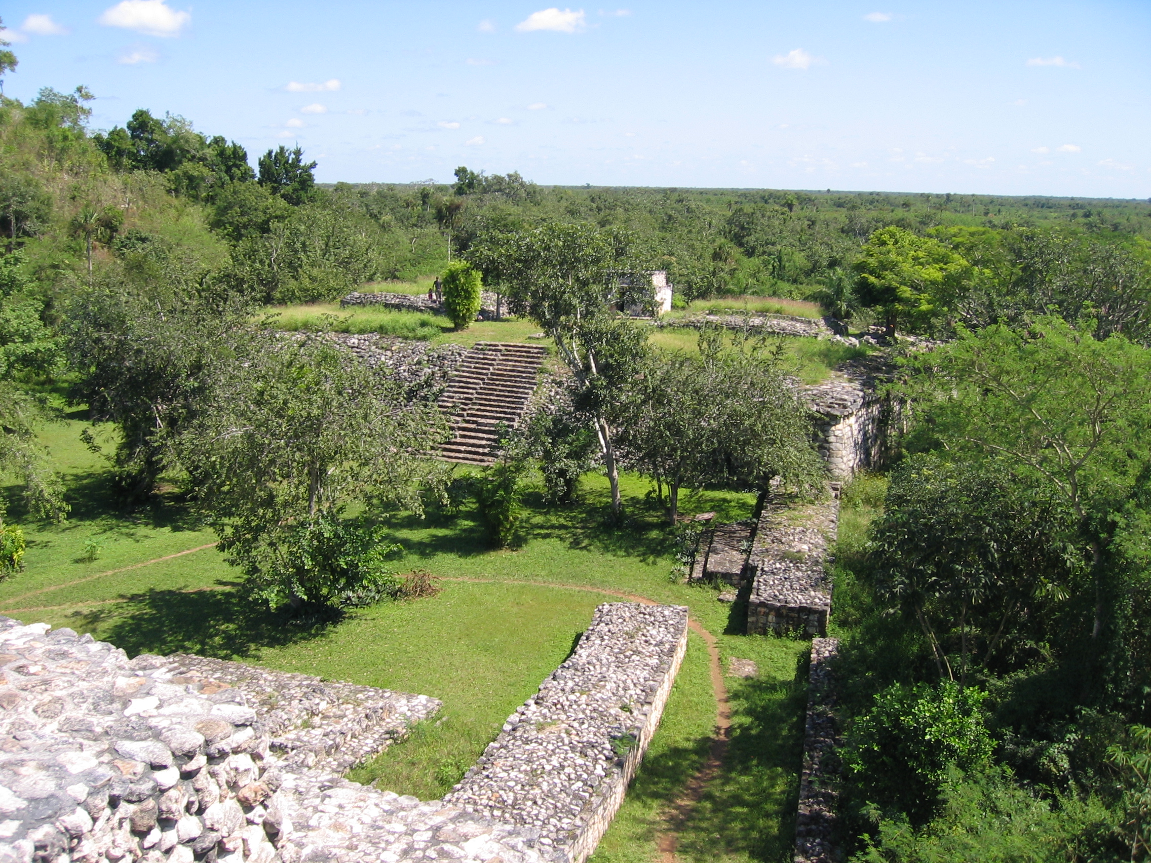
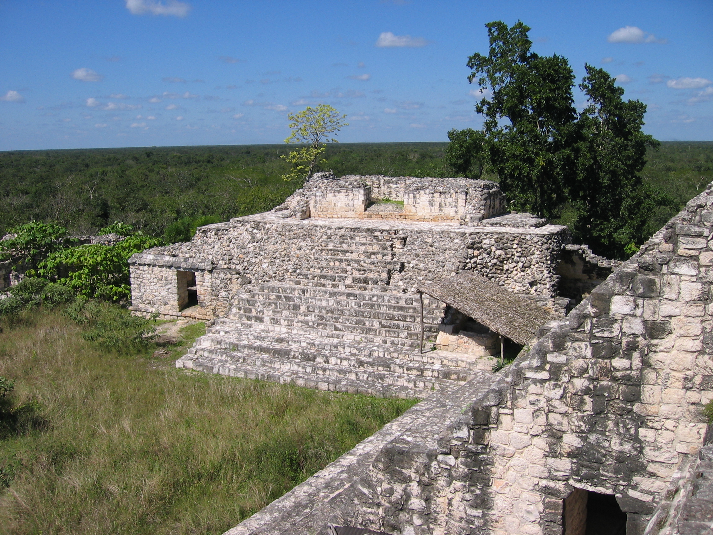
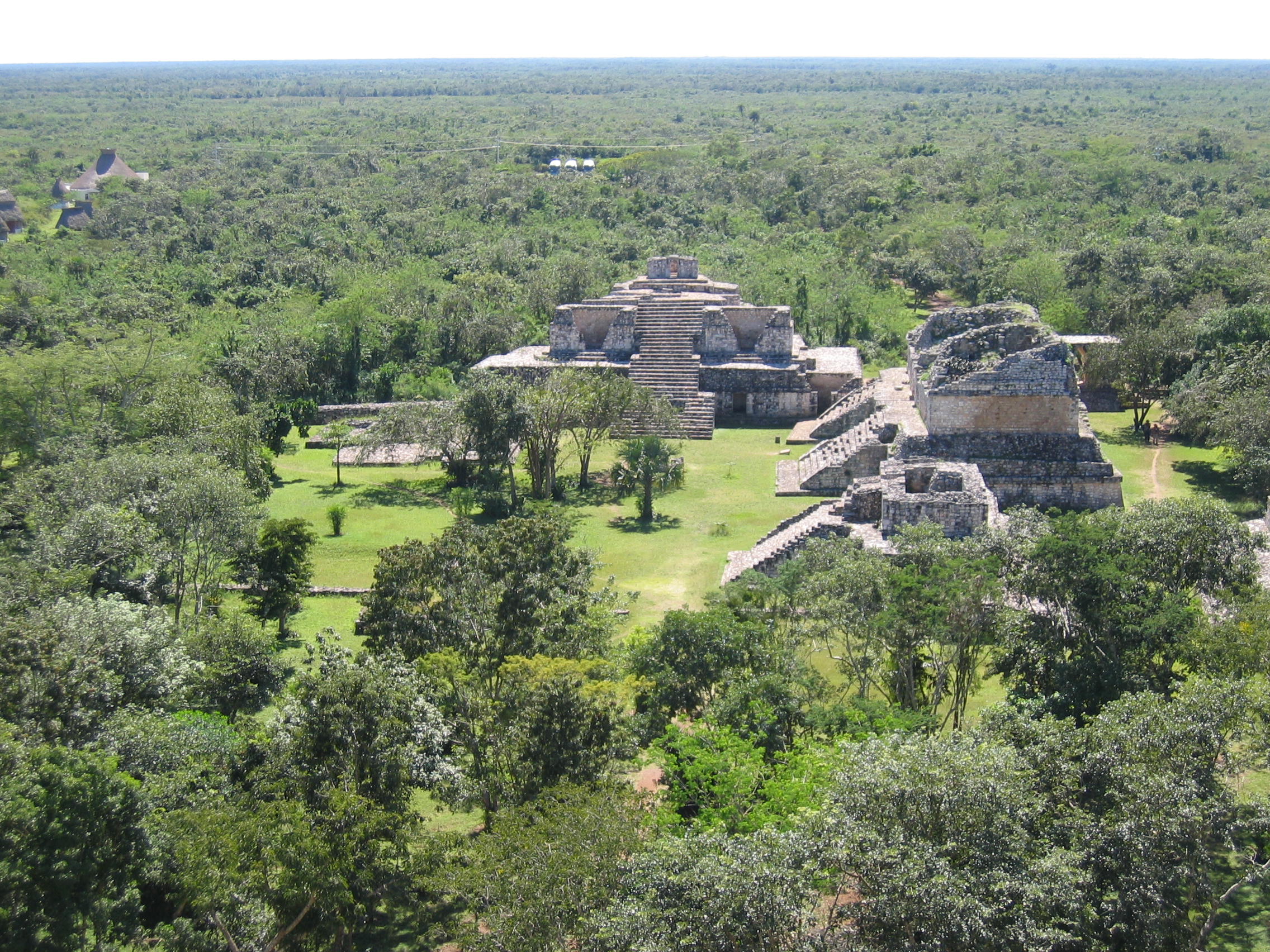
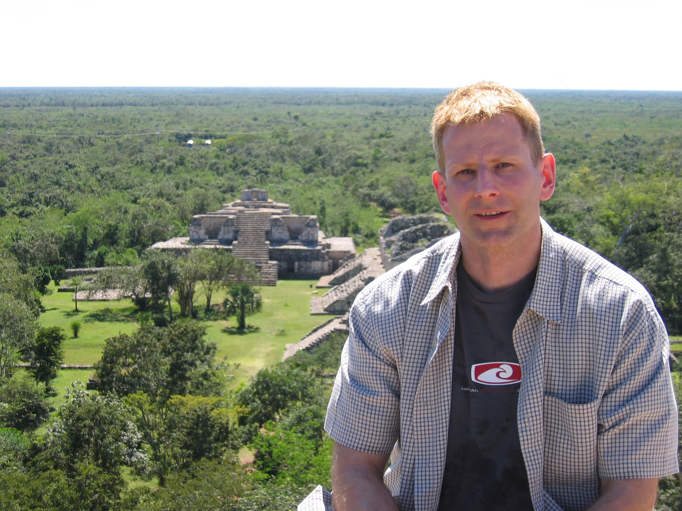
Top of the Acropolis
The view from the top of the Acropolis, like all high structures in the Yucatan, is amazing! Video of this is also available.
|
From the top, one can see the rooms in the upper parts of the Twin Pyramids (right) clearly, as well as detail in the Oval Palace |
Another view from the top. |
Yours truly at the top. |
Other Structures
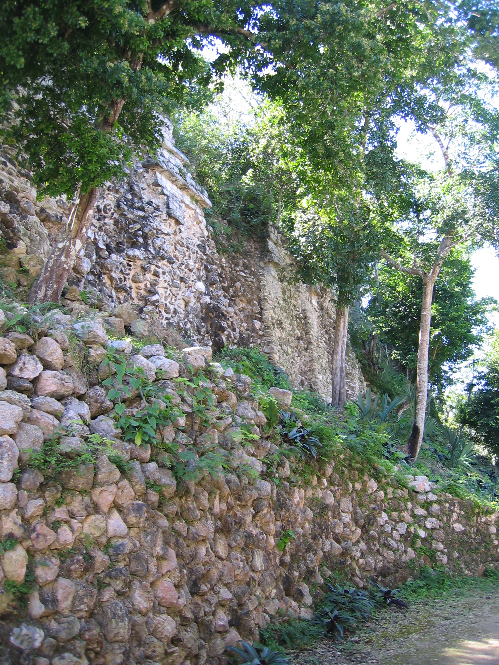
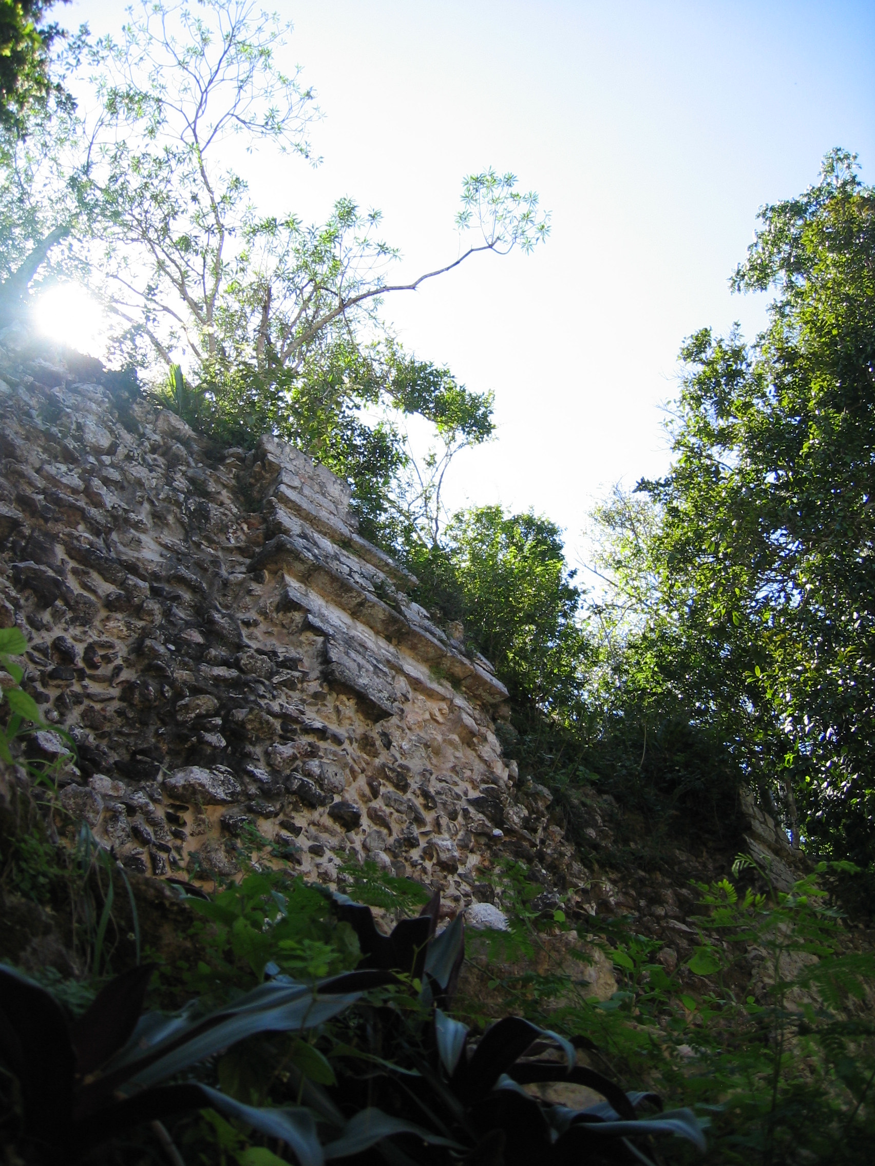
As mentioned above, to the east and west of the Acropolis are the two next largest structures in the city, which remain unexcavated at this time. Walking around them, however, gives one an indication of what these restored structures looked like before excavation began, and how much work is involved in these explorations.
|
The explanation of Structure 2 contains a topographical map that gives some indication of what the other structures looked like pre-restoration |
Walking around structure 2. |
View of the upper parts of structure 2. |
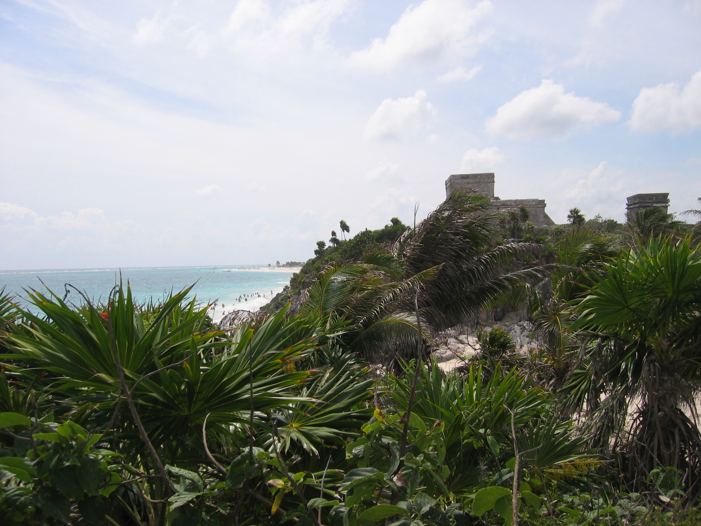
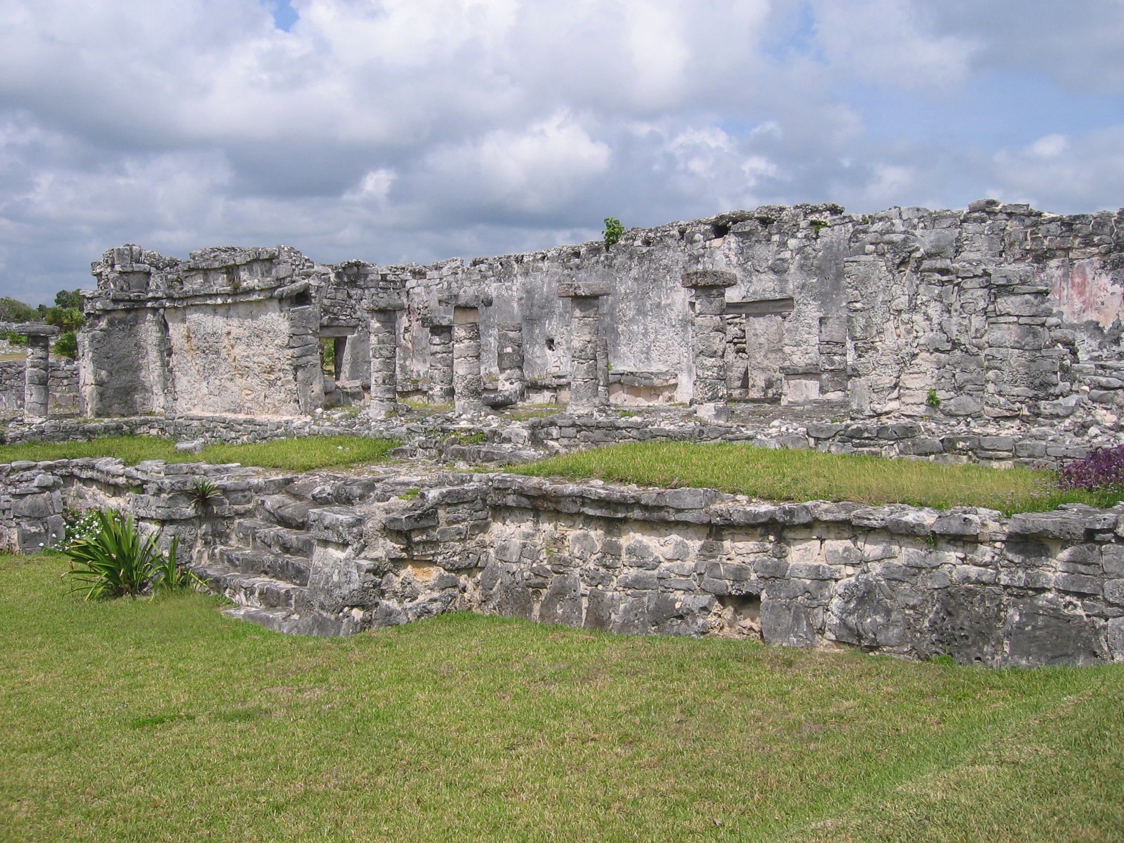
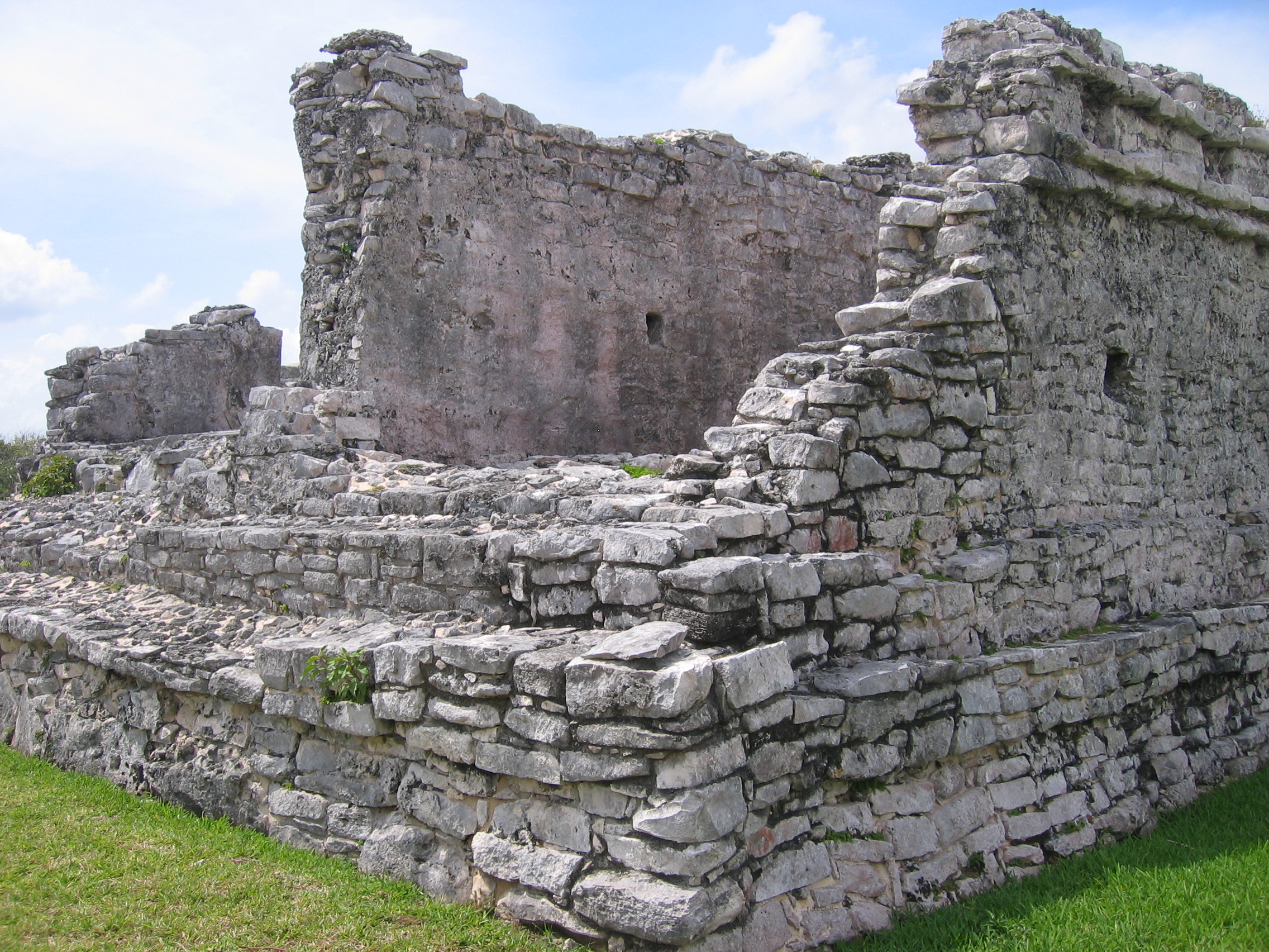
Tulum
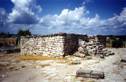
Tulum is a very different city from from those mentioned so far. For one thing, it is the only Mayan city built directly on the coast (though there are certainly other coastal ruins); it's also one of only a very few walled Mayan cities fortified with watchtowers, and the only city that was still inhabited at the time of the Spanish conquest of Mexico. It's also very different in that it's much, much more accessible than the others - it is not a long trip from Cancun or Playa del Carmen, and the resorts along the Mayan Riviera now reach all the way to, and past, Tulum. This means that there tends to be far more tourists and they tend to be far less appreciative of local culture than those who would be willing to drive three hours through the jungle to see the same things. If you go here, be prepared for many people and lots of idiots. There's something about a drunken fool stabbing his cigarette out on a sacrificial platform while his wife yells that she wants to take his picture and his kids run around screaming that they'd rather swim with dolphins that makes me much more appreciative of the cultures that created these structures.
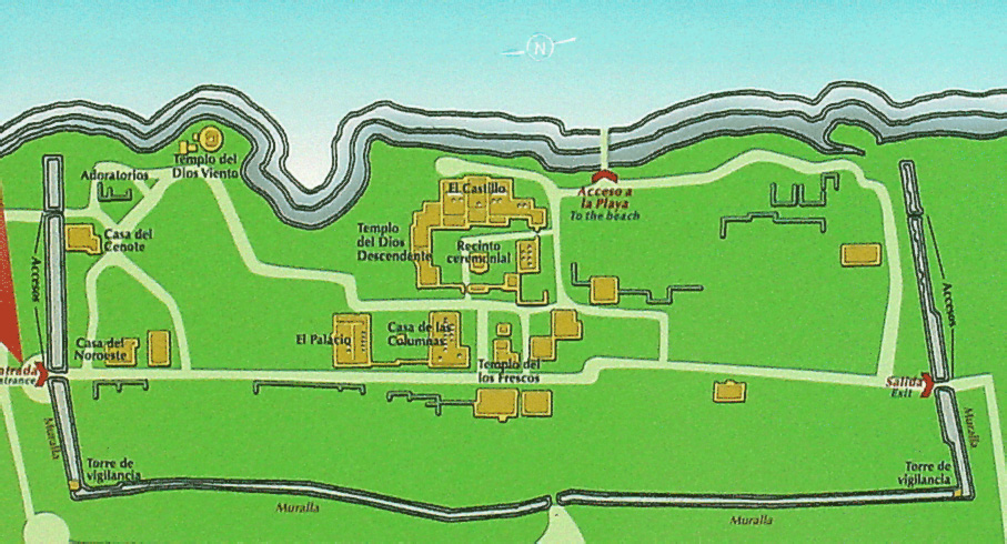
Now that I've moaned about that, be aware that Tulum is still well worth seeing and easy to get to - it just tries my patience with people. Get there early, and you can always move away from the main structures to get a little space to yourself and pictures without other people in them, because it is also a large very open area. The two maps below (the left is from Incidents of Travel; the right is a modern map with a more accurate scale) show the spread out area and the obvious feature of its walls and watchtowers.
|
Stevens/Catherwood map of Tulum. |
Modern map of Tulum. |
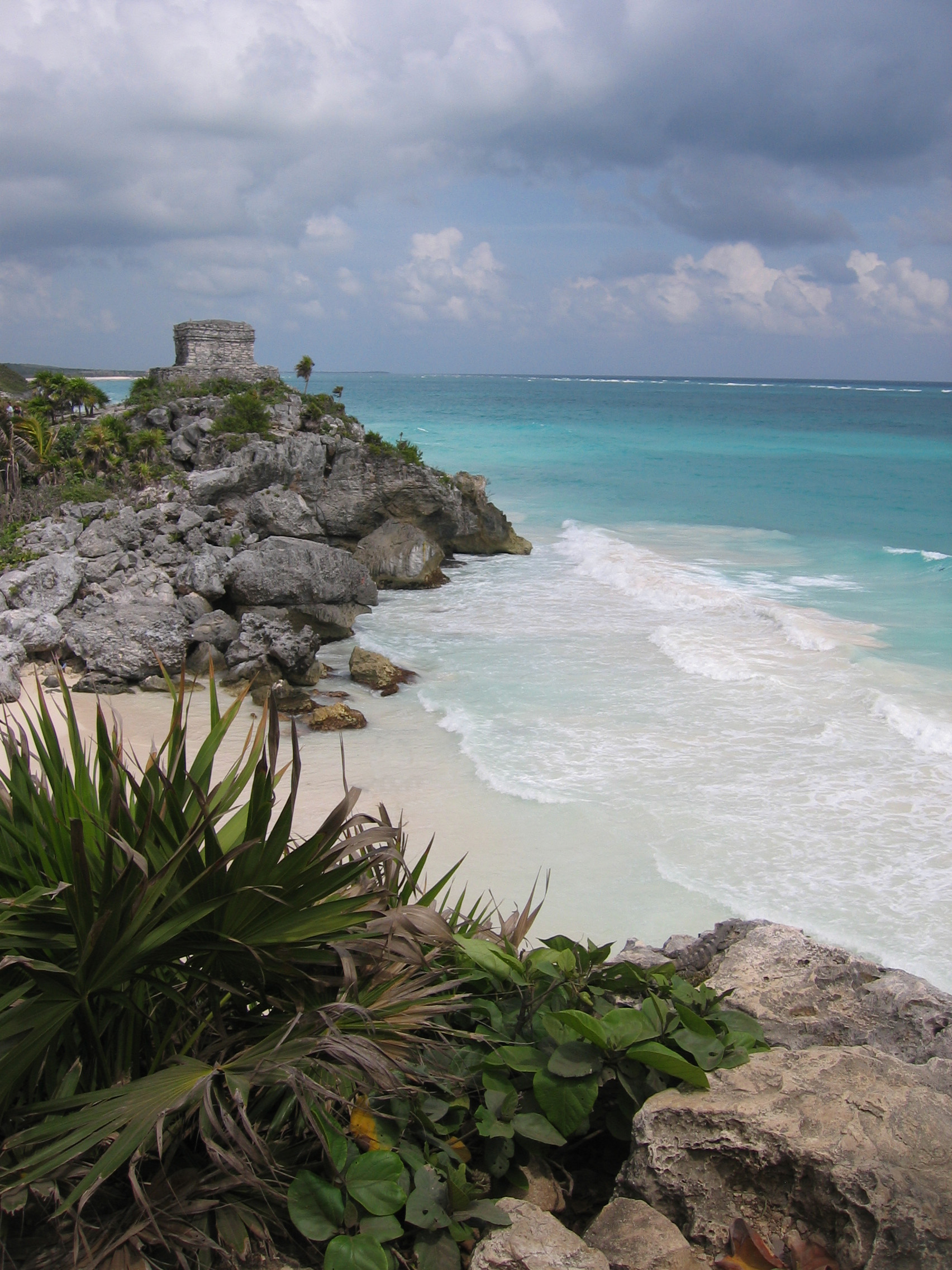
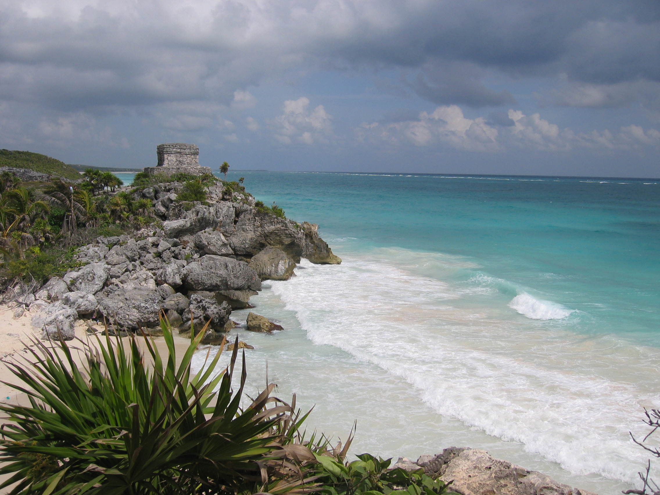
The seaside makes Tulum very striking, but its proximity to the ocean is also very apparent in its condition - you can imagine the number of hurricanes that have hit this place, and it shows. The buildings are for the most part in very poor shape, and unlike Coba, because they have been battered over the years, in addition to being buried in the jungle. Comparing the modern structures with Catherwood's paintings shows that in general the structures were much better preserved 150 years ago, and a few have collapsed since Catherwood's time. Despite this, there are still a lot of interesting things to see here. Like Ek'Balam, the main form of decoration on the structures in Tulum was stucco plasterwork, and while most of this is gone, what remains is quite beautiful, especially after having seen Ek'Balam and gotten an indication of what it would have looked like when it was fresh. There are also some relief sculptures and stonework still visible as well.
Here we begin with the main structures in the centre of the compound. A video lets you see the relative positioning of these to one another, once you can recognize them from the pictures below.
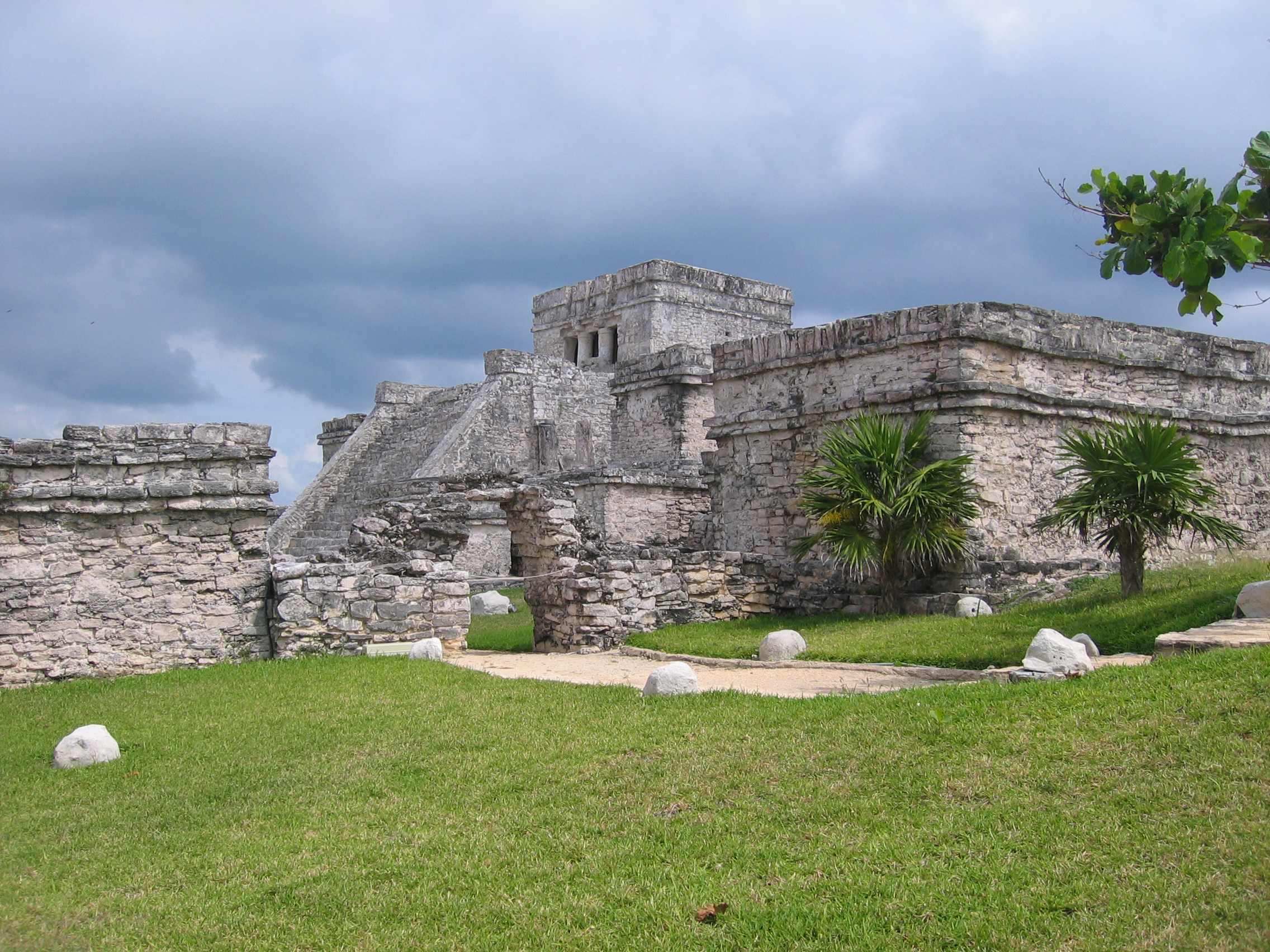
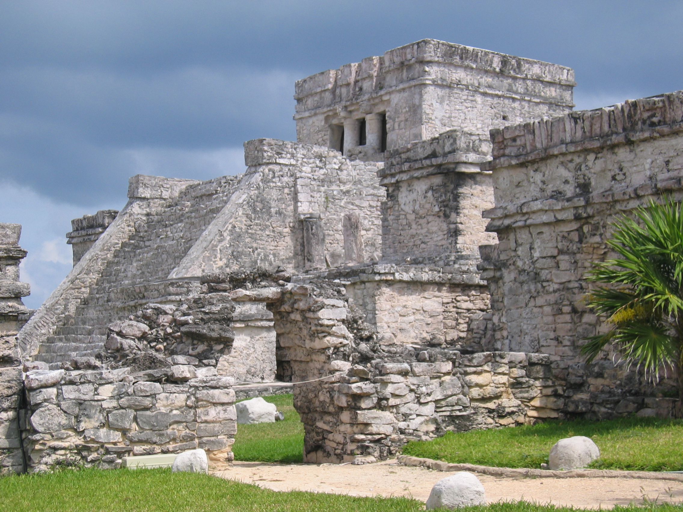
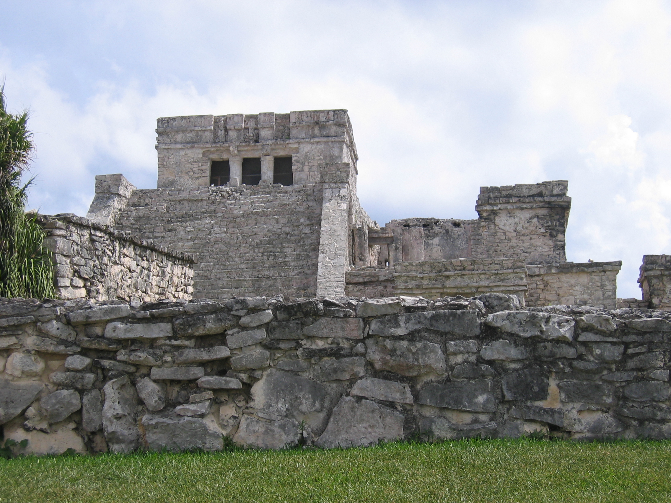
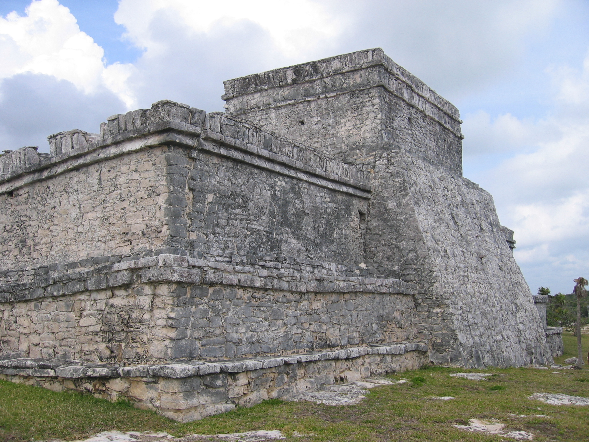
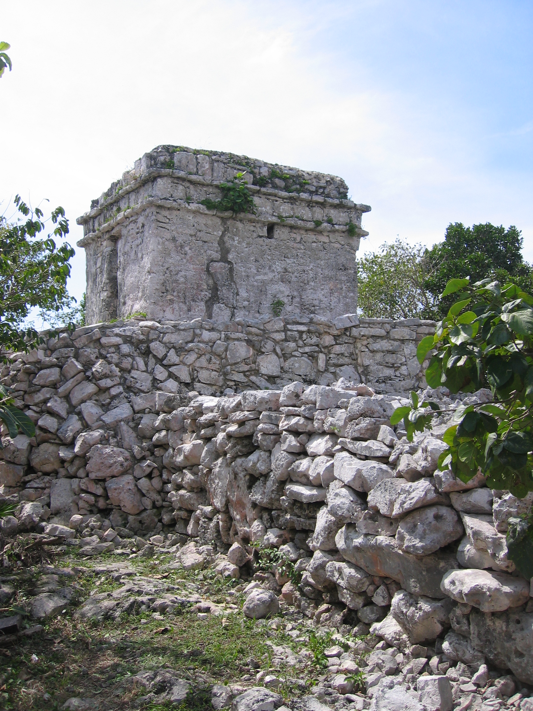
El Castillo
The main structure at Tulum is called (big surprise) El Castillo, and like many others, it is built in stages on much earlier temples. Several human burial excavations on the temple itself are visible, but much of the extensive decoration has faded. The sea itself forms a beautiful backdrop in front of the Castle.
|
Entry into the El Castillo area, looking to the north. Because of the number of visitors, not only is climbing not permitted, the entire temple area is out of bounds, and the mayan arch functions as a crowd control device |
Above, closer view of the iconic stairs to the castle. Below,
a closer
view inside the arch from back in the day (1997) when you
could go
there. |
looking east toward the ocean, one can see that there is more than one temple at the top of the castle. |
|
Compare this view of the stairs... |
...to the Catherwood painting from the 1830s |
A more northerly view shows the large temple to the north side of the top of the castle. |
|
Above, closeup of the stuccowork on the north temple, showing
the
Descending God above the doorway. Below, Catherwood etching of
this
structure from the 1830s. |
From the ocean side, the temple forms a nearly flat buttress against the ocean winds. |
A sacrificial platform in front of the Castle stairs. |


Templo del Dios del Viento (Temple of the Wind God)
The Wind God's Temple is a small structure, but is very prominent in the site, mainly because it is separated from the castle but also on the coast, and so becomes the structure one sees from the front of the castle looking out at the ocean. The view of the Temple of the wind god is impressive, but equally so is the view from this temple looking back at the castle.
|
Looking north from the castle, you see the aquamarine water and the Temple of the Wind God, which rises up on a second cliff. |
Temple of the Wind God |
Approach to the Temple of the Wind God. The temple itself is (unusually) built on a round platform. |
|
View of the Castle from the Temple of the Wind God. |

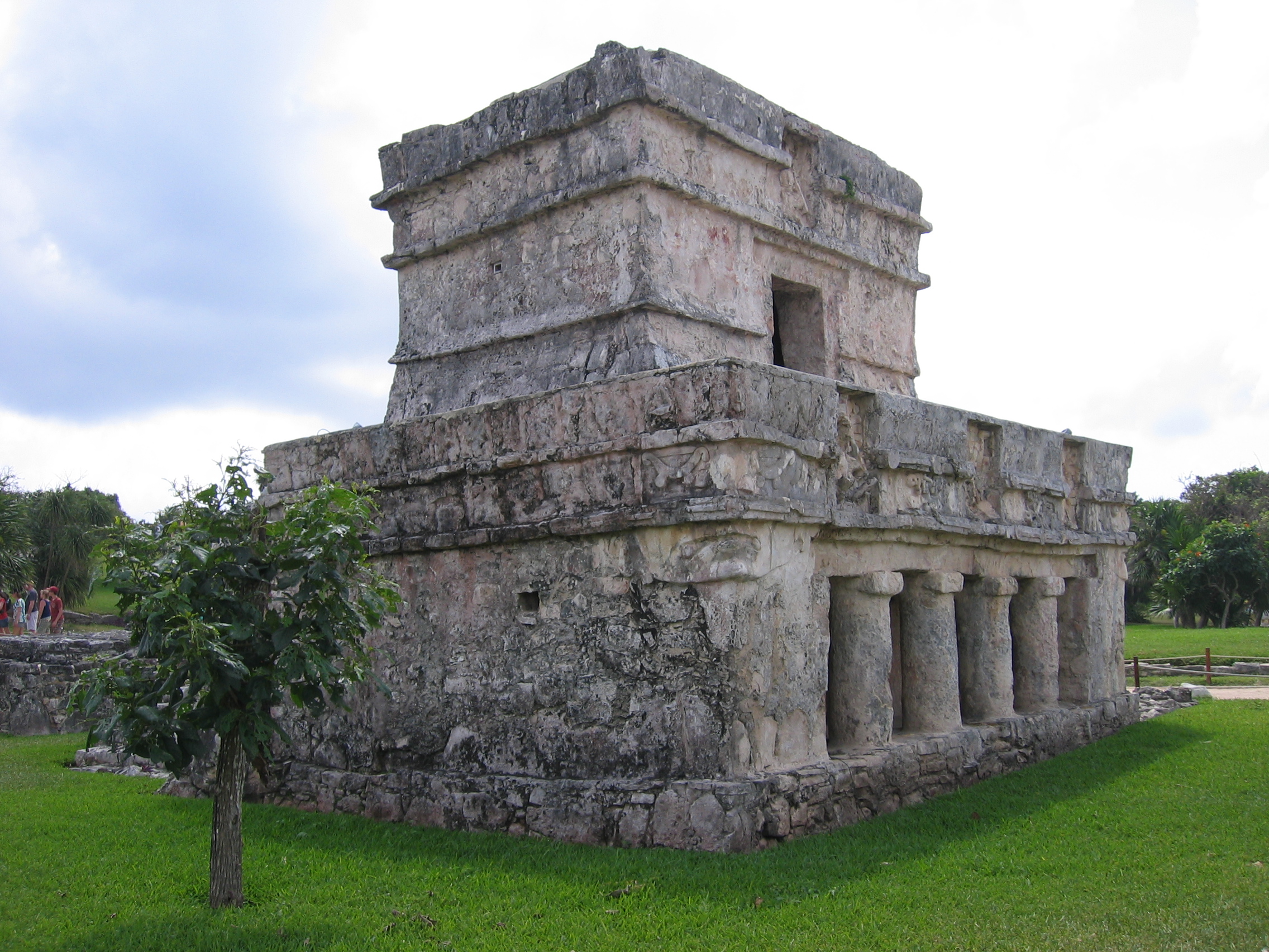
Templo del los Frescos (Temple of the Frescos, aka Templo del los pinturas, Temple of the Paintings)
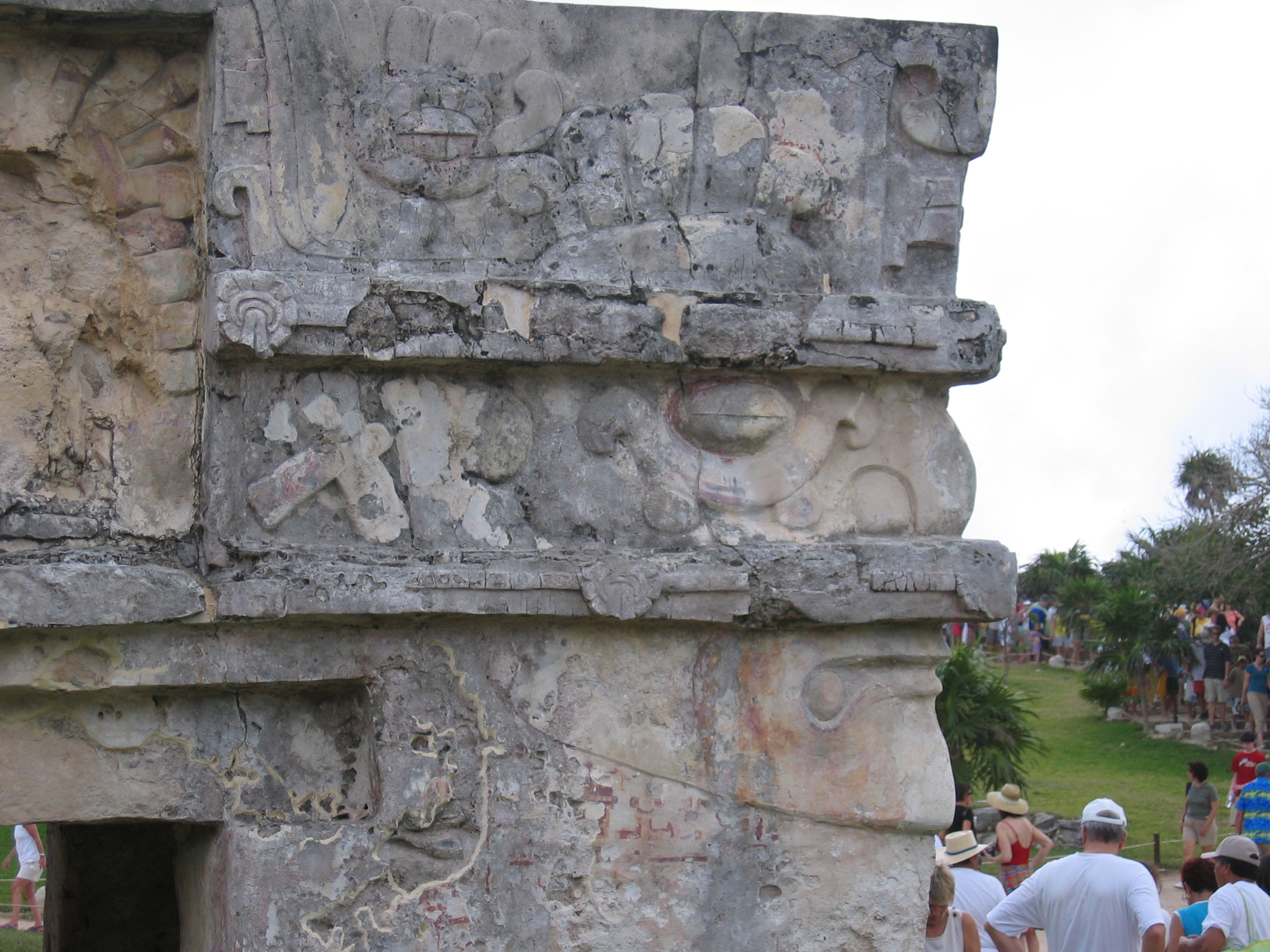
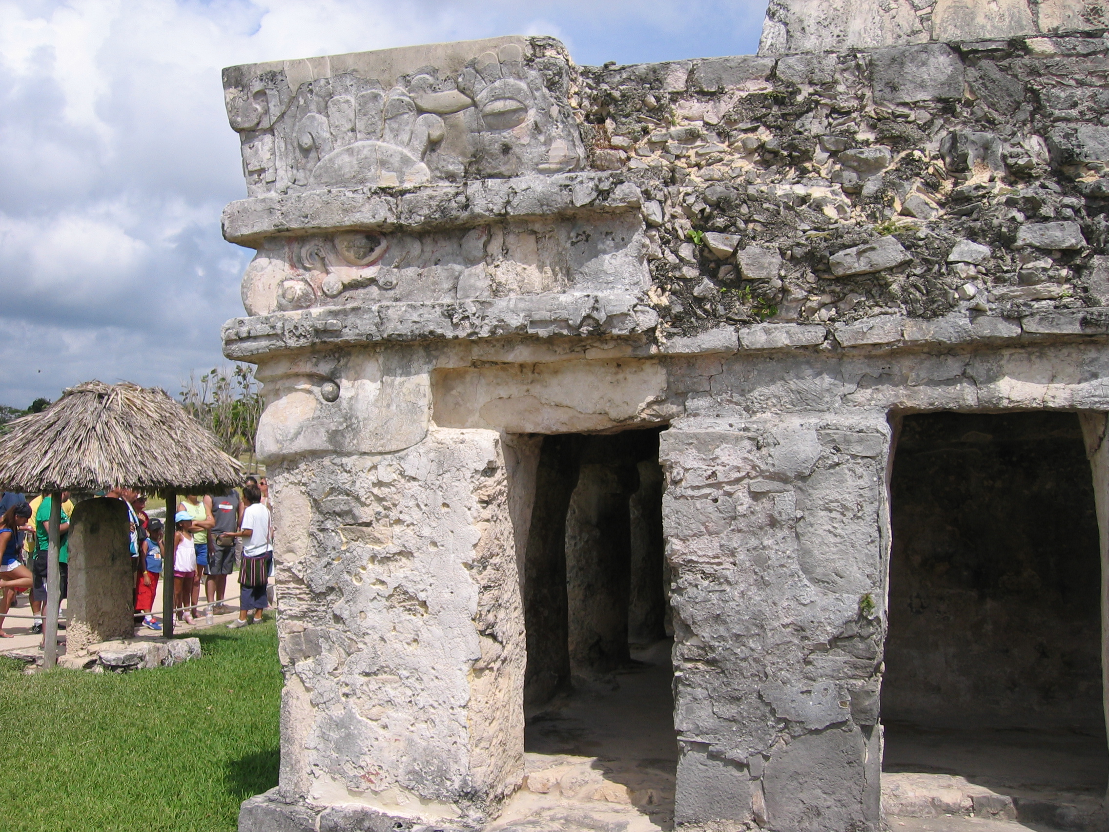
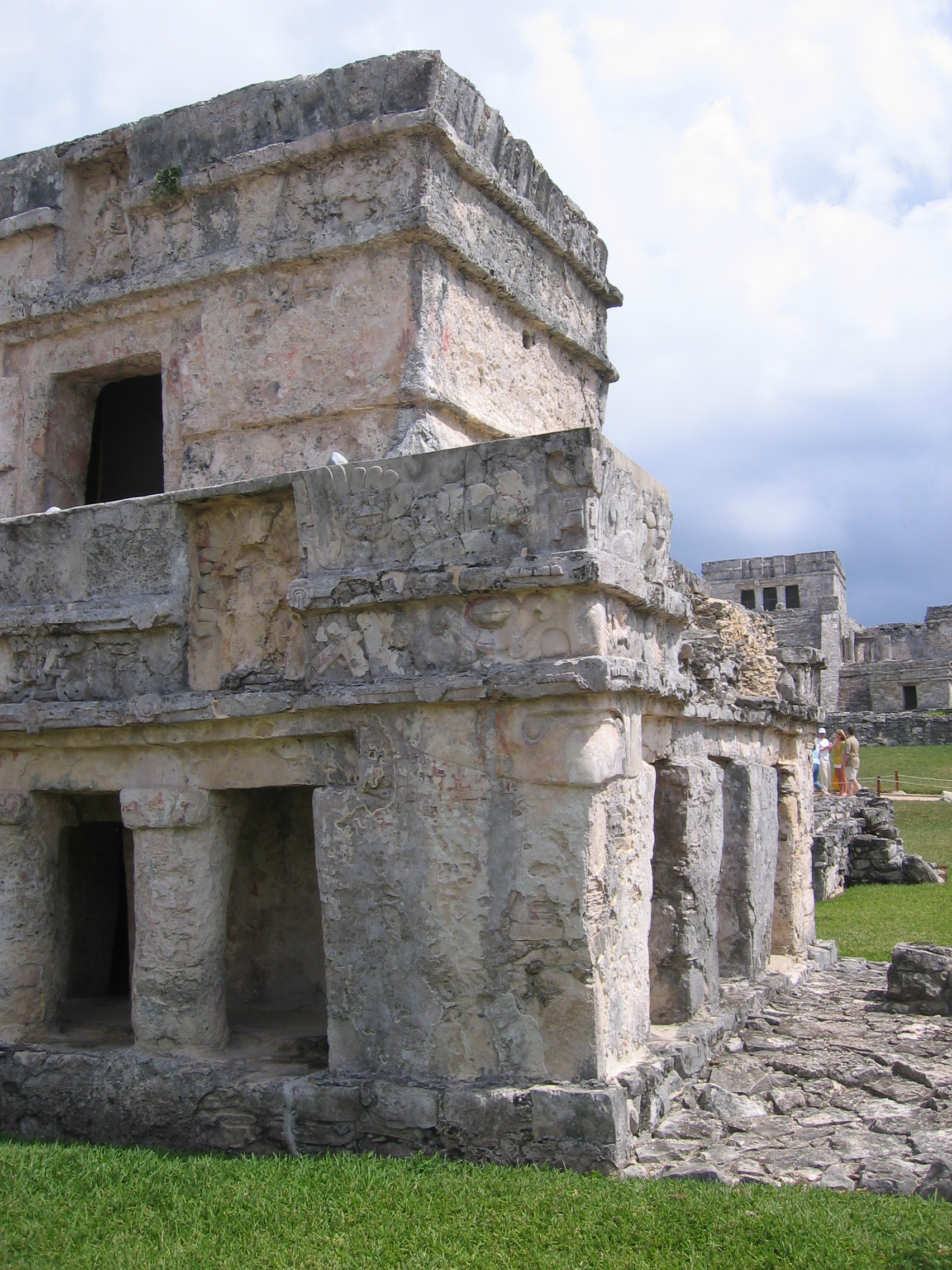
In many ways, the Temple of the frescos is the most impressive structure here, and the greatest reason to visit. It is not an enormous structure, but it is the only structure with significant preserved plasterwork on the site, to the point where remnants of the colors are also present, as well as the basic shape. While the panels above the entryways are fairly common among Mayan temples, what is unique here are the large human faces at the corners of the building. Along with the magnificent preserved work at Ek'Balam, it gives the visitor a real sense of how impressive these structures would have been in their prime, and the artistry of the culture that produced them. There are also murals inside the building that are not open to the public.
|
The temple of the frescoes from the rear. The stuccowork over the stone is clearly visible, and some colors remain in it as well. |
From the front, three panels with deities are visble. |
Detail of the front of the structure. |
|
Detail of the faces that form the corners of the building. Facial features, headdresses, and some color are still visible. Also visible once you notice are just some of the many people you will see here! |
Face-corner view 2. |
Another view of the corner faces. |


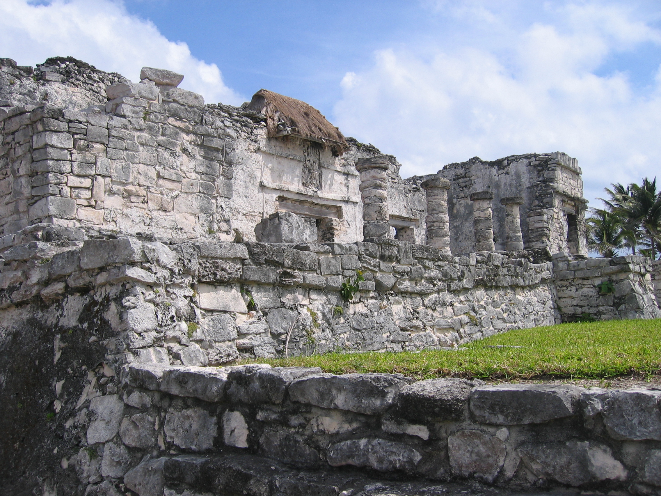
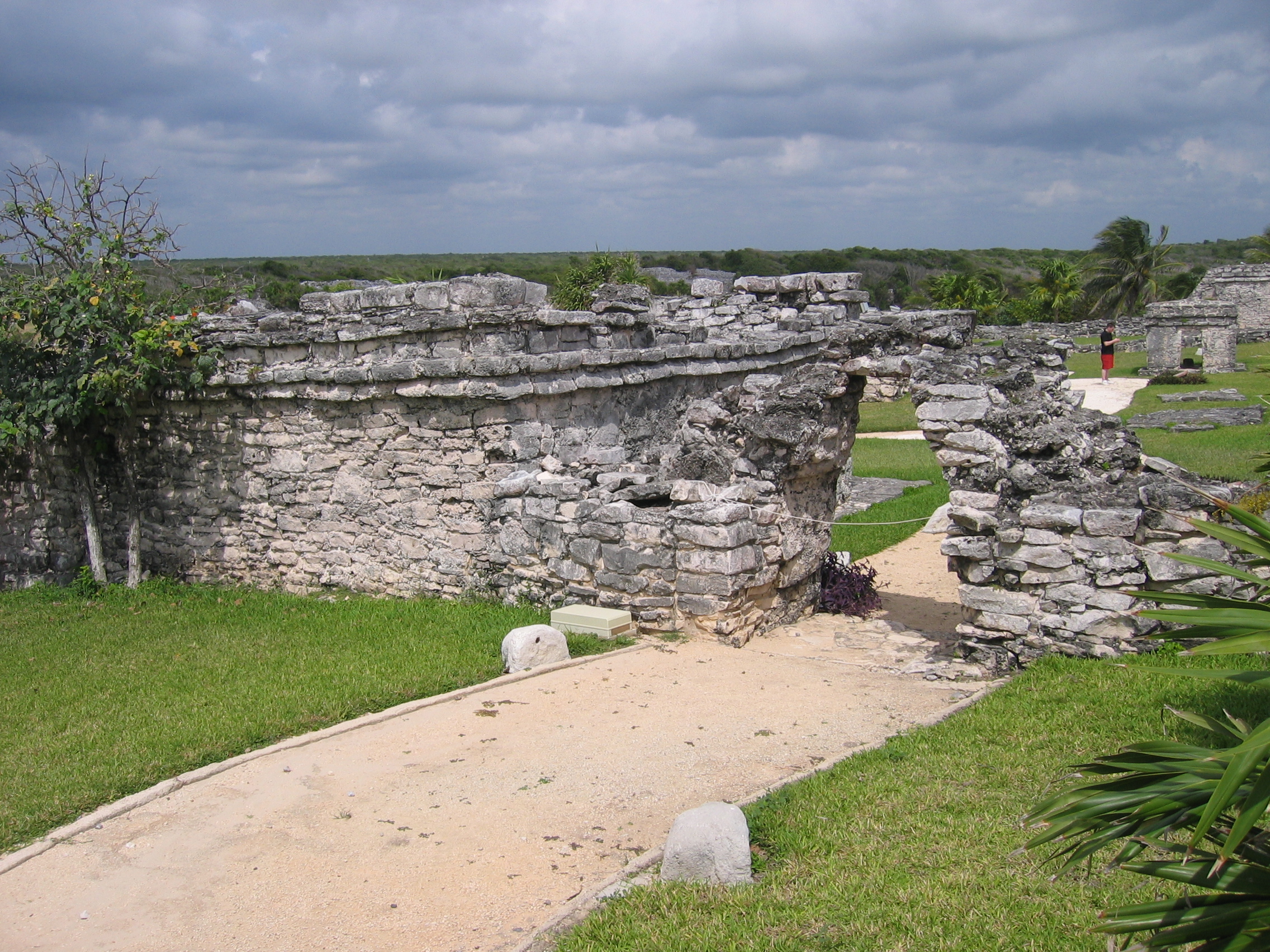
Other Structures
The other structures at Tulum are extensive, but not as well preserved or unique as those described so far. Still, there are some interesting highlights.
|
La Casa de Los Columnas - the house of the columns. Supposedly used by the king as a place to do business with others. |
A Catherwood 1830s painting of the house of the columns. |
El Palacio, also known as the House of the Halach Uinic (the First Lord). While not in great shape, it can be distinguised from other structures through its stucco panel of the Descending God (protected by thatch). |
|
A more distant voiew of the House of the Halach Uinic. |
The landscape viewed from the corner of the House of the Halach Uinic. |
Red paint can still be seen on some of the stone/stuccowork. |

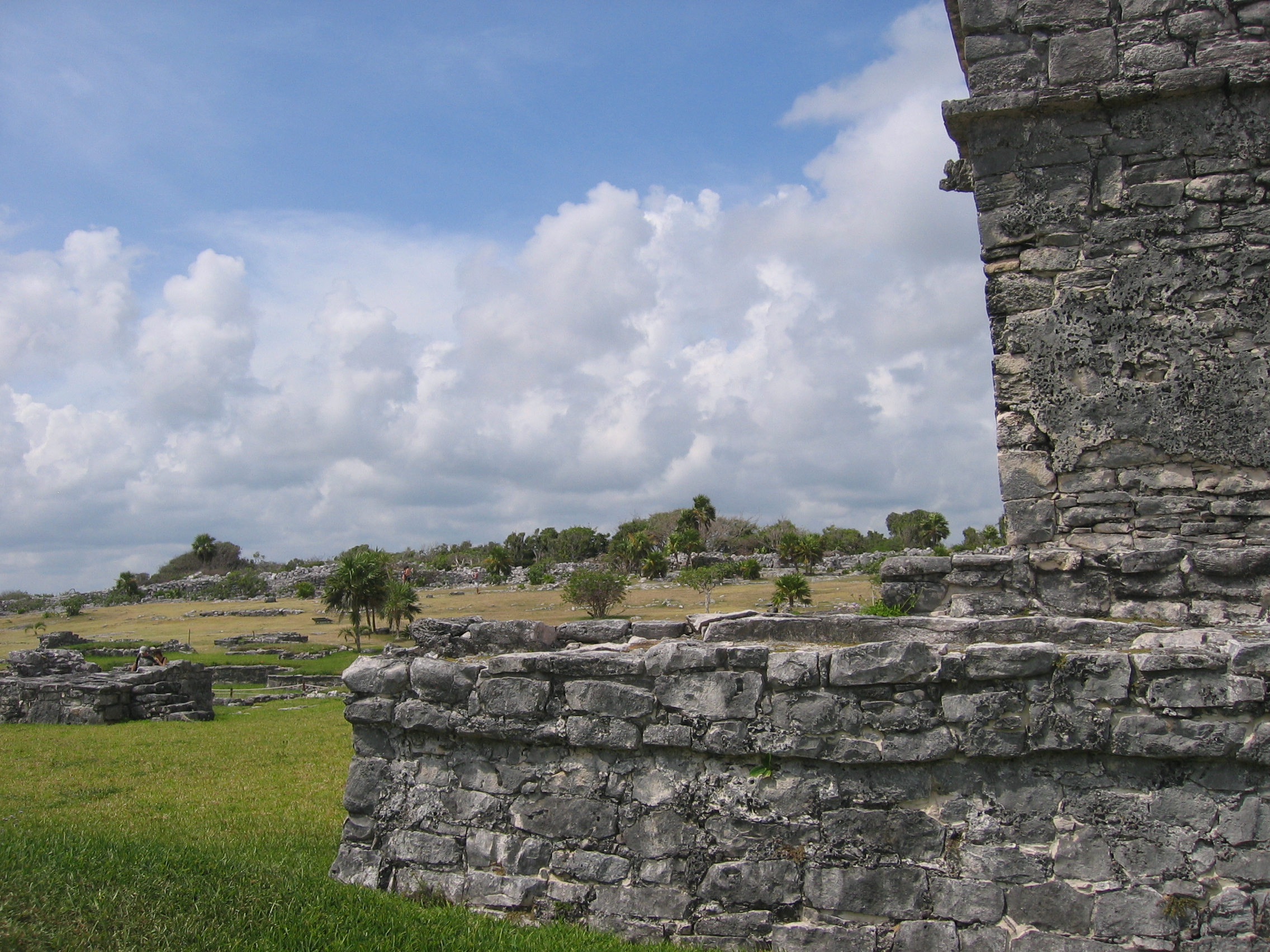
The Walls and Watchtowers
The outlying walls are one of Tulum's features, and while they mainly form a boundary for the landscape, they are also well away from all the main structures, and can be a nice place to get away from your fellow tourists. The watchtowers in particular are also interesting and seem rarely visited - many people seem to stay around the castle and then head down to the beach. Video is also available, showing the end of the wall to the south of the Castle, where the walls meet the cliff above the beach.
|
One of the entrances to the city, through the walls - which of course are not what they used to be. |
The Southwest watchtower of the city, a nice crowd-free place to get away. |
Yours truly at the southwest watchtower. |
Overall, Tulum gives pretty coast views, but as a set of ruins it leaves much to be desired compared to the other areas already described above. While it is most people's first choice for a visit simply because of convenience of access, if I had to choose I would put it last on my travels. It's overcrowed and it's the easiest one to leave out without missing a whole lot - the views are great, but there are also lots of other places with beautiful Gulf views.
Other Areas
These are the three major points that people tend to want to see when they visit the western Yucatan peninsula, but they are by no means the only ones. There are smaller structures littered throughout the whole peninsula. If you're staying near any of the resort areas, there will be structures likely within walking distance that have been at least partially excavated and prepared for the public. Every little town seems to have a few close to them, and they tend to "crop up" in many places. These are also well worth seeing, not because they're more spectacular than the rest (quite the opposite), but because quite often you'll be the only person there even given the crowds that flood Quintana Roo today.
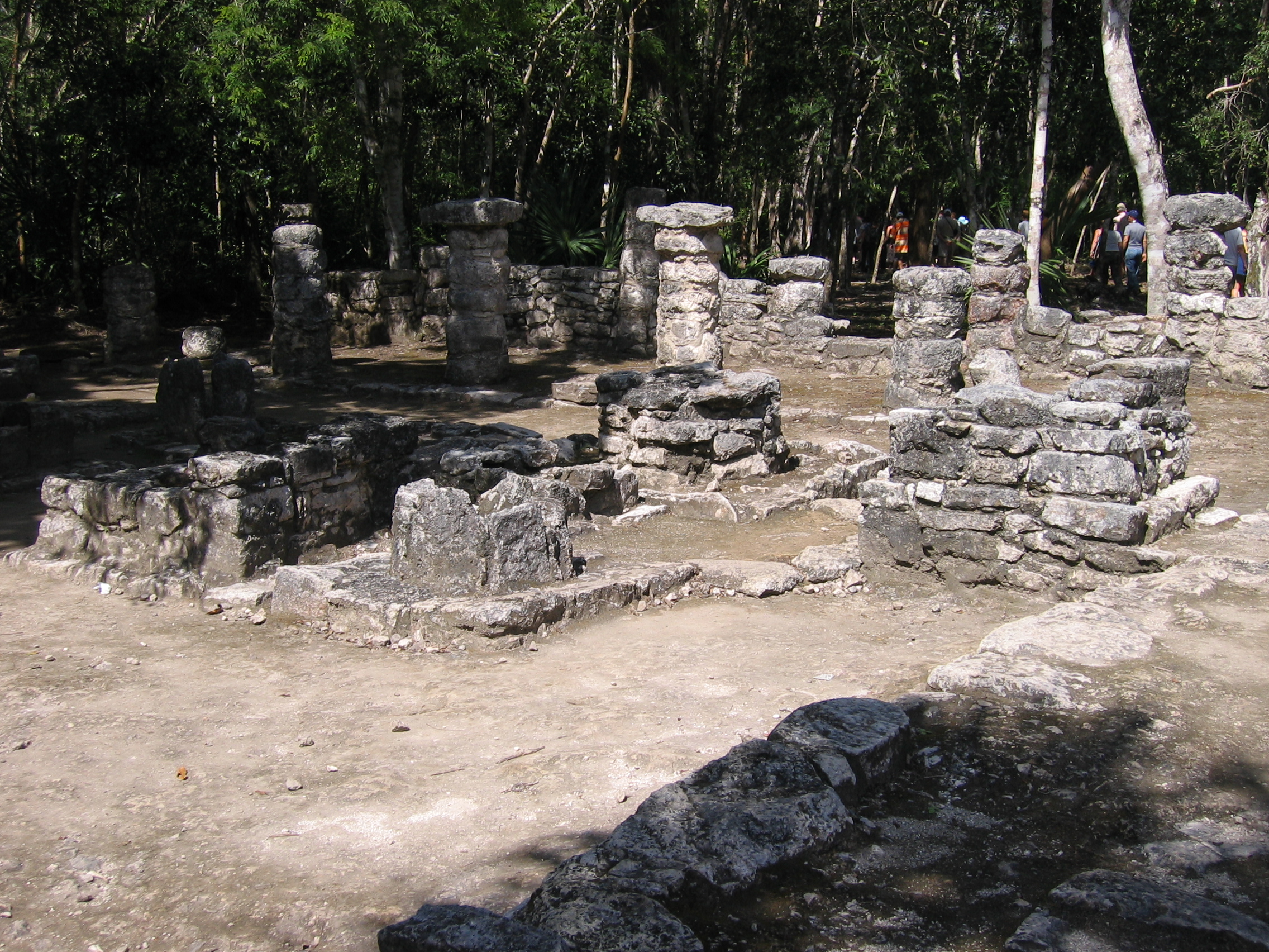
El Rey
A case in point is El Rey - it's smack in the middle of Cancun Island, literally right in the middle of the most popular resort area in Mexico. In some of the pictures below you can clearly see how close some of the hotels are - yet nobody's there. I was there for about an hour and a half and saw four other people the entire time, which meant you actually had an opportunity to study what was there, and to get a real idea of life at that time without life now creeping in too much (other than the odd hotel atrium in the background). It's also a lot quieter, and has a very sacred atmosphere. That has changed to some degree in more recent years (there's was at one point a supper club right next door to it, but the hurricane seemed to take care of that). It's still very undervisited compared to most of the other places described here.
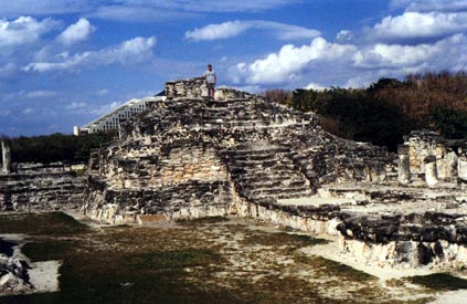
The Castle at El Rey, with Hotel in the Background, and yours truly at the top to give an idea of the true height of the pyramid. |
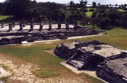
From the top of the Castle, looking back to one of the major temple platforms |
One of the more minor temples - note the iguana cleverly placed for this shot |
El Rey was a fishing village that was abandoned sometime in the 14th century. It has one raised temple, and many small temples all forming a main street for the village itself. It also has more small wildlife than you'll likely see elsewhere in Cancun because of the lesser degree of development in the immediate area. It is on the main bus route through the hotel zone, and is signed. If you're in the hotel zone, you can also go see the single temple that's on site of the former Sheraton hotel, directly across from the La Isla shopping mall.
Xaman-Ha
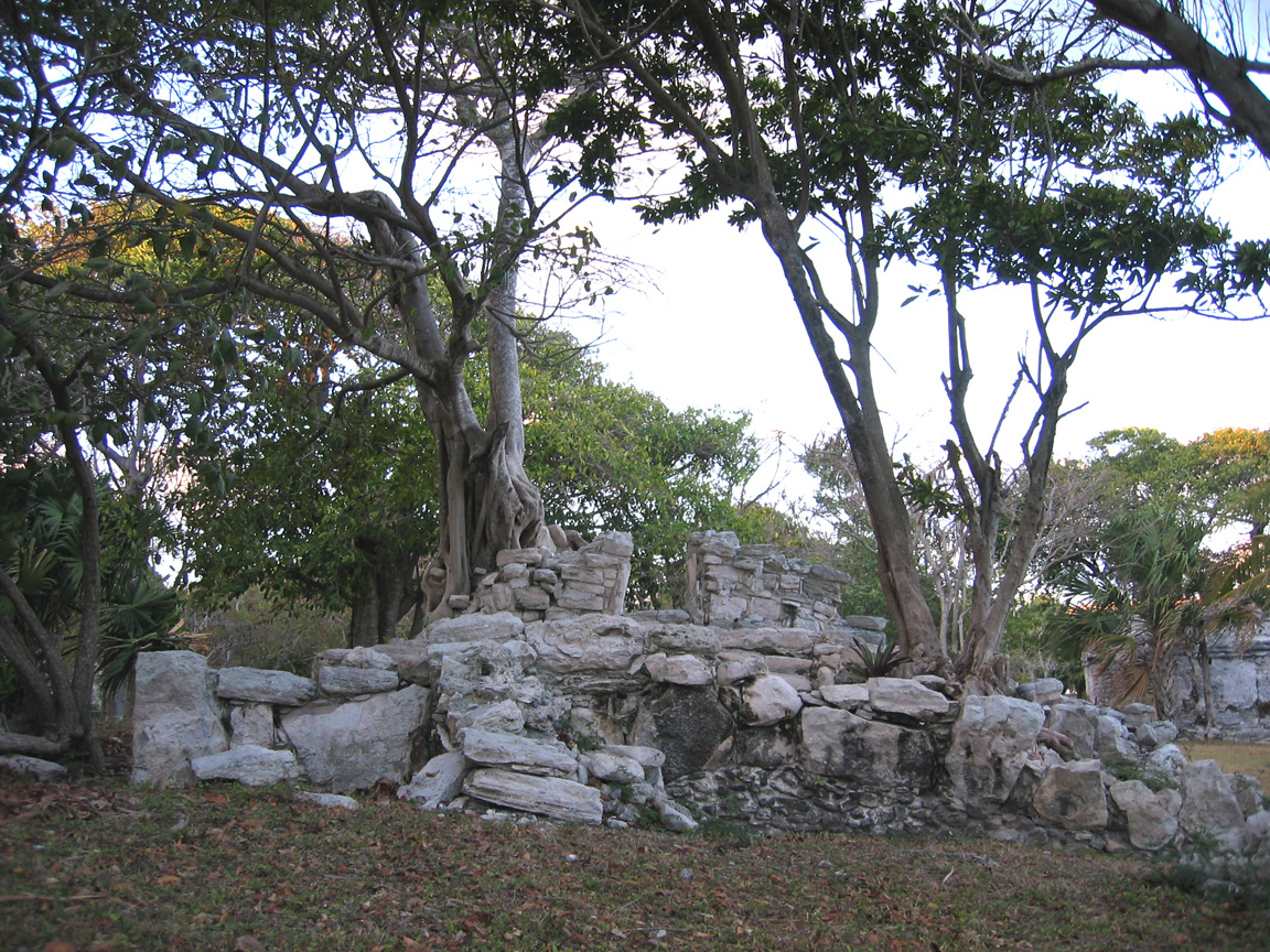
Similarly, there are two sets of ruins in parklike settings within walking distance of downtown Playa del Carmen - the original city of Xaman-Ha, which Playa del Carmen and the Playacar area now occupies. These are in somewhat better shape than El Rey, and seem to be less exposed to the elements. They make for a beautiful early evening stroll, and are still relatively undervisited.
|
In addition to this cluster, there are similar ruins further into Playacar. These have all been excavated, as opposed to the many simple mounds you will see elsewhere, but are fairly nondescript. |
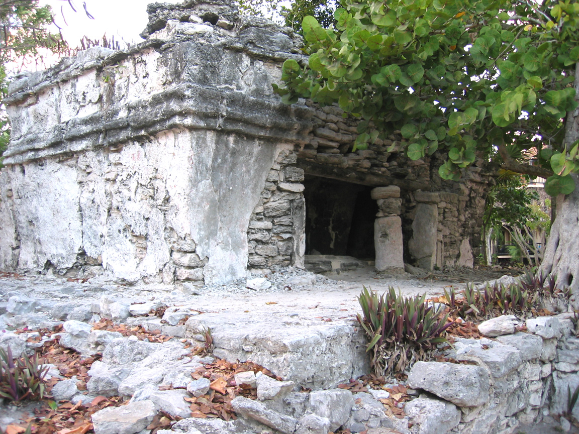
Note that some of the stucco is still present, giving you a better idea of the finished detail. Note also the condominium unit through the trees, showing how close this cluster is |