Mont Blanc - October 2007
le Mont Blanc
Christophe invited me to spend a week working with him in Montpellier. This was a difficult offer to refuse and I decided to arrive a few days early to permit a visit to Chamonix. I mentioned this possibility to Lisa Brown at her brother's wedding in August; Lisa said she would be keen to meet me in Chamonix for a late-season stroll up le Mont Blanc. Who would have expected the conditions to be so good in October?

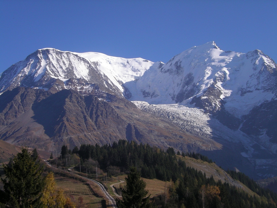
The Goûter route is spectacular, varied, and enjoyable from start to finish. I had wondered whether the route was popular solely because of its accessibility, its relatively low technical difficulty, and the fact that Mont Blanc is the summit of the Alps (4808 m). Not so, this route is great (even better without the crowds) and I recommend it.

photo: Lisa follows the trail onto the ridgecrest as we near the Tête Rousse hut. From here the hut is only a short walk across a small snowfield. During much of our trip the valley bottom remained under cloud cover while we enjoyed sunny clear skies.
I met Lisa in Chamonix on October 10, where we purchased food, fuel, maps, a guidebook, sorted out buses for the next morning, and obtained route conditions from the mountain office. In addition, we were pleased to discover that both the Tête Rousse (3167 m) and Goûter (3817 m) huts have winter rooms open year round. Furthermore, these are equipped with mattresses and blankets, meaning we could leave our tent, sleeping bags, pads, and shovel in Chamonix. Note that a stove is required at the Tête Rousse hut in winter whereas propane burners and gas are available up at the Goûter hut.
photo: The sunset as seen from the Tête Rousse hut. Sundown was at about 7:00 pm at this time of year. Sunrise was at about 7:30 am.
Day 1: Les Houches to Tête Rousse Hut
We started off from Chamonix by catching the first bus at 7:00 am on October 11 to the nearby village of Les Houches, 10 km southwest through the valley. The most common route up Mont Blanc, the Goûter route, is usually approached by combination of chairlift and train to the end of the Train du Mont Blanc railroad at the Nid d'Aigle (2372 m). The lift and train stop running in late September. As it was October, we started our climb right from Les Houches (1007 m), following trails, cat tracks, dirt roads, and paved roads under chairlifts up to the Col de Voza (1653 m) and on to Bellevue (1794 m), at the top of the Bellevue lift. The route through the ski slopes is interesting as it passes through a series of alpine chalets and small farms; had the lift been running, however, we would have gladly foregone these sights for a rapid climb to Bellevue. After sorting out the correct trailhead in the dark, we arrived at Bellevue about two hours after starting up.
photo: This was our turn-around point near the crest of le Dôme du Goûter at 4240 m. Here we are looking down on the impressive Aiguille de Bionnassay (4052 m). One of the many routes up Mont Blanc climbs over l'Aiguille de Bionnassay, following the obvious ridge before joining the normal route to the summit. This ridgeline defines the Franco-Italian border.
The route continues along the alpine railroad up to the Nid d'Aigle (2372 m). There is an alternate trail lower down below the Bionnassay glacier, but the mountain office recommended following the railroad. We arrived at the Nid d'Aigle after another two hours of hiking, where we took a lunch break in the sunshine, having broken through the cloud covering the valley below.
photo: This photo was taken from the ridgecrest atop l'Aiguille du Goûter, near the Goûter hut. On the left is the north face of l'Aiguille de Bionnassay and below lies the Glacier de Bionnassay. The glacier becomes heavily seracced lower down.
Shortly past the Nid d'Aigle, the route leaves the main trail onto a smaller trail (rather a network of trail options) marked by red dots of paint and cairns. The trail passes the Baraque Forestière des Rognes (2768 m), a small hut consiting of four stone walls with a loft. Some groups choose to spend a night here to acclimatize (no mattresses or blankets). The trail continues up a rocky ridge, crossing a few patches of icy snow, before levelling off just below the Tête Rousse hut (3167 m), near the Glacier de Bionnassay. We needed our ice axes in a few spots but managed without crampons as the snow was soft. The climb from the Nid d'Aigle to the Tête Rousse hut took about two and a half hours. At this point we decided to stop here for the night; we had gained 2160 m elevation since leaving Les Houches, and we figured we would get a better sleep at 3100 m than at 3800 m. We had met a few other groups who would also be spending the night at the lower hut before starting for the summit early in the morning.
photo: Lisa and I take a break on the descent of the Aiguille du Goûter. I included this photo because it seemed too good to be true to have such warm and dry conditions at 3500 m in mid October. Note the steel cable bolted to the rock behind me.
Day 2: Tête Rousse Hut to Dôme du Goûter and back
By the time we had eaten, packed, donned crampons, and roped up it was 3:45 am. We began the climb up l'Aiguille du Goûter. This part of the route is actually much more interesting than I had anticipated. First off, route-finding is not at all an issue. Alone on the face in complete darkness we had little difficulty sticking to the route up the rock: the path is marked by occasional red dots of paint, cairns, via ferrata style metal cables bolted to the rock in the steeper sections, and, most of all, a tell-tale trail of crampon scratches on the rock. Indeed, although the majority of this section is on rock, there are frequent patches of snow and it's best to keep crampons on the entire time. Lisa and I made our way up the face, which gets steeper near the top. This section consists of interesting scrambling the entire way. The metal cables appear whenever the route steppens. This part of the climb took a little bit longer than we'd anticipated, requiring four hours before we reached the Goûter hut (3817 m).
photo: A second breathtaking sunset view as seen from the Tête Rousse hut.
We melted snow at the hut where we met a group of ten or so Swiss who had completed la Traversée des Trois Monts on the previous day. Lisa and I continued up from the hut, followed the ridgecrest of the Aiguille du Goûter, and continued up the face of the Dôme du Goûter. We reached a group of two clients and one guide with whom we had spent the night at the hut. They were awaiting a helicopter to pick up one of the clients who wasn't enjoying the altitude. We continued upward after speaking with them (the chopper came and left). As we gained elevation, the wind became stronger and stronger. Eventually, at about 4240 m, we decided the wind was too strong. In addition, we were both feeling quite tired from the combined effects of the elevation, the previous day's effort, and lack of sleep/jetlag. Thus 4240 m on the Dôme du Goûter would be our highpoint on this route; after over 3200 m of climbing (in about 26 hours) we were still nearly 600 m below the summit.
photo: The Tête Rousse hut at 3167 m. These alpine huts are quite impressive. Equally impressive is the summer menu which was posted on the wall, including a selection of several wines and beer (in case the altitude and dehydration don't suffice to give you a headache).
The descent back to the Goûter hut was quick. The views of l'Aiguille de Bionnassay were spectacular. The weather remained sunny, clear, and warm on all three days we were on the mountain. If it hadn't been for the wind, this would have made a perfect trip on this mountain without the usual summer crowds. Back at the hut we both felt exhausted. After a one hour break, rehydration, and food, we plodded back down the steep scramble of the face of l'Aiguille du Goûter to the Tête Rousse hut, where we spent the night. The sunset views from the hut were breathtaking.

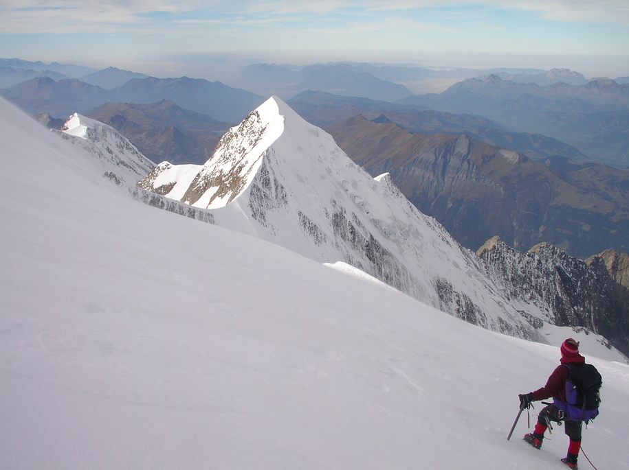
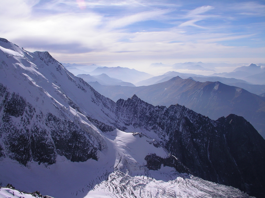
This mountain definitely merits a return visit, either via the Goûter route in summer, via the Grands Mulets route on skis in spring, or perhaps from l'Aiguille du Midi across la Traversée des Trois Monts...

In retrospect, one additional night on the mountain would have helped our chances of making the summit. A good autumn itinerary might look something like this: day 1 up to Tête Rousse, day 2 up to Goûter, day 3 summit and descent to Tête Rousse, day 4 descent to Les Houches.

photo: The Train du Mont Blanc railroad which we followed from the Col de Voza to the Nid d'Aigle.
Day 3: Tête Rousse Hut down to Les Houches
Following a thirteen-hour snooze and a casual morning enjoying the hut and its surroundings, we left the hut on October 13 to reverse our route back down to the Nid d'Aigle (we saw goats near the Baraque Forestière des Rognes) then down to Bellevue along the railroad, the Col de Voza (nice views of l'Aiguille du Goûter and l'Aiguille de Bionnassay), and down to Les Houches by about 5:00 pm. Having just missed the bus, we took a taxi back to Chamonix.
photo: This is the view from near the Col de Voza. On the left is l'Aiguille du Goûter and on the right is l'Aiguille de Bionnassay. The Dôme du Goûter lies just out of sight between the two. Mont Blanc lies behind, hidden from view. The railroad can be seen heading up from the bottom of the frame and then up the scar carved into the rock diagonally up and right across the face. The Baraque Forestière des Rognes lies atop the first dark rocky ridge, the Tête Rousse hut lies atop the next rocky ridge with light snow patches, and the Goûter hut lies atop the topmost left ridge covered in snow.
Montpellier
On October 14 I took the train back to Montpellier and Lisa flew home to the U.K. The next three photos show the old centre-ville of Montpellier, not far from Christophe's home. I spent the next week working at LIRMM while enjoying the beautiful city of Montpellier.
photo: shaded narrow pedestrian streets winding through the maze of downtown Montpellier
photo: more such streets...
photo: la Place de la Comédie in the centre of Montpellier
Return to Steph's Homepage