|
| |
|
Trip Summary
On August 20-21, I traversed the summits of the Old Settler with Chris and Tamsin Tarling. This route is mostly third class with several short sections of fourth class and a few rappels. The path we chose involved two short sections of low fifth class, each only a few metres long. The rock is mostly solid along the entire ridge. The technical difficulty is perfect; the route remains interesting but stress free for its entire length. Route-finding is straightforward and the continuous height and great position of the ridge makes it feel like you spend the entire day on a summit. As these images show the views are incredible (as often happens, distant peaks appear very faint in the photos). | |
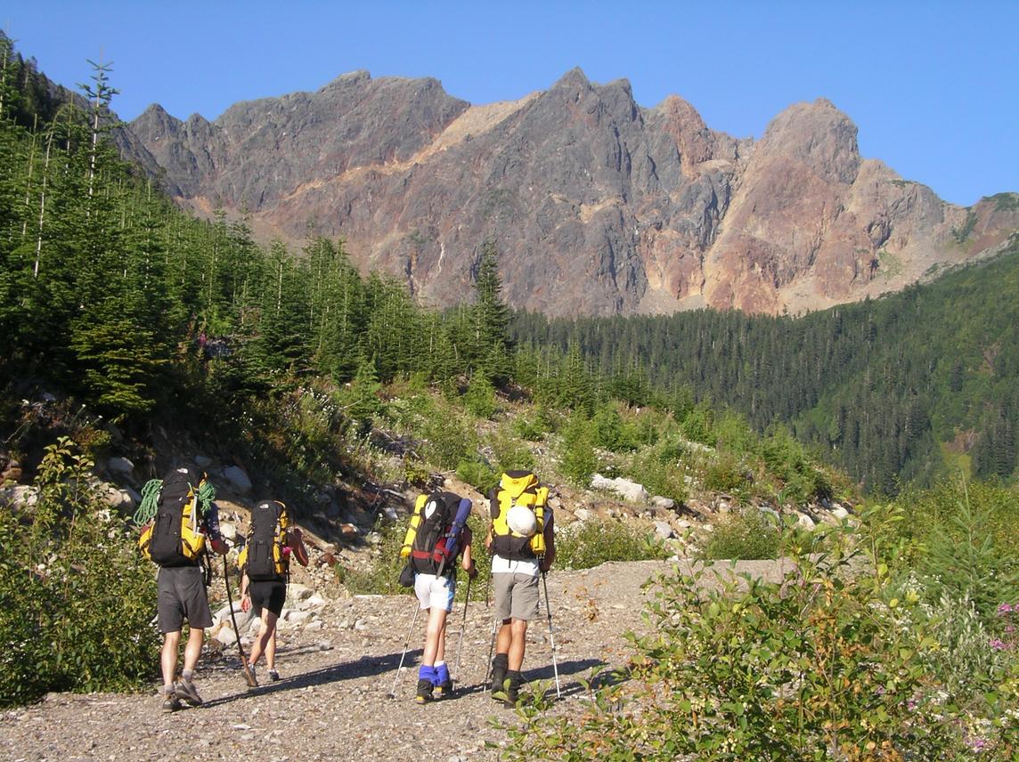 The gang (minus Russ and Steph) hikes in along Talc Creek FSR toward the Old Settler. We gained the ridge at the rightmost saddle and traversed north (left) over the south summit (reddish), over the central summits, across the diagonal red band, and over the north summit (true summit). We descended the red band. |
 view south from the south summit |
|
Details
Chris, Tamsin, and I left Vancouver at 1:00 pm. We met Nick, Karena, and Russ in Chilliwack and the six of us drove along Harrison Lake and up Talc Creek forest services road. Around 8.8 km from the start of Talc Creek FSR, about 200 m after a left branch, the approach forks right off the main road and is no longer drivable [elev. 840 m]. We hiked the remaining 2.5 km along the road, bushwhacked through the forest, meadow, and uphill through old growth before reaching the scenic Daiphy Lake [elev. 1435 m] around 7:30 pm. After dinner, the six of us lazed around a fire Russ had lit. That night was my best sleeps in a bivy yet: relatively warm, few bugs, under a clear starry sky. We rose at 5:00 am. A mean tree branch had scratched Karena's eye on the bushwhack and she was forced to stay at the campsite. Russ and Nick were headed up Duck à l'Orange, a nine-pitch 5.10a that climbs to the central summit. Chris, Tamsin, and I headed up the scree to gain the ridge at the southern col. Right from the col, the ridge follows fantastic third class rock. We soon climbed the fun chimney mentioned on Bivouac and after some more great scrambling on solid red rock we found ourselves on the south summit. Descending to the col between the south and central summits required a 25m rappel. Immediately after the rappel, we climbed a short section that was low fifth class (perhaps there exists an easier route since there is no mention of it). Climbing back up to the central summit was fun. We were able to fill our bottles with snow (this was the only snow patch directly on the route). The final 30 m to the main central summit involve a fun slabby fourth-class corner. We had lunch on the central summit, next to the helicopter landing pad. It was almost 11:00 am when we headed north again. | |
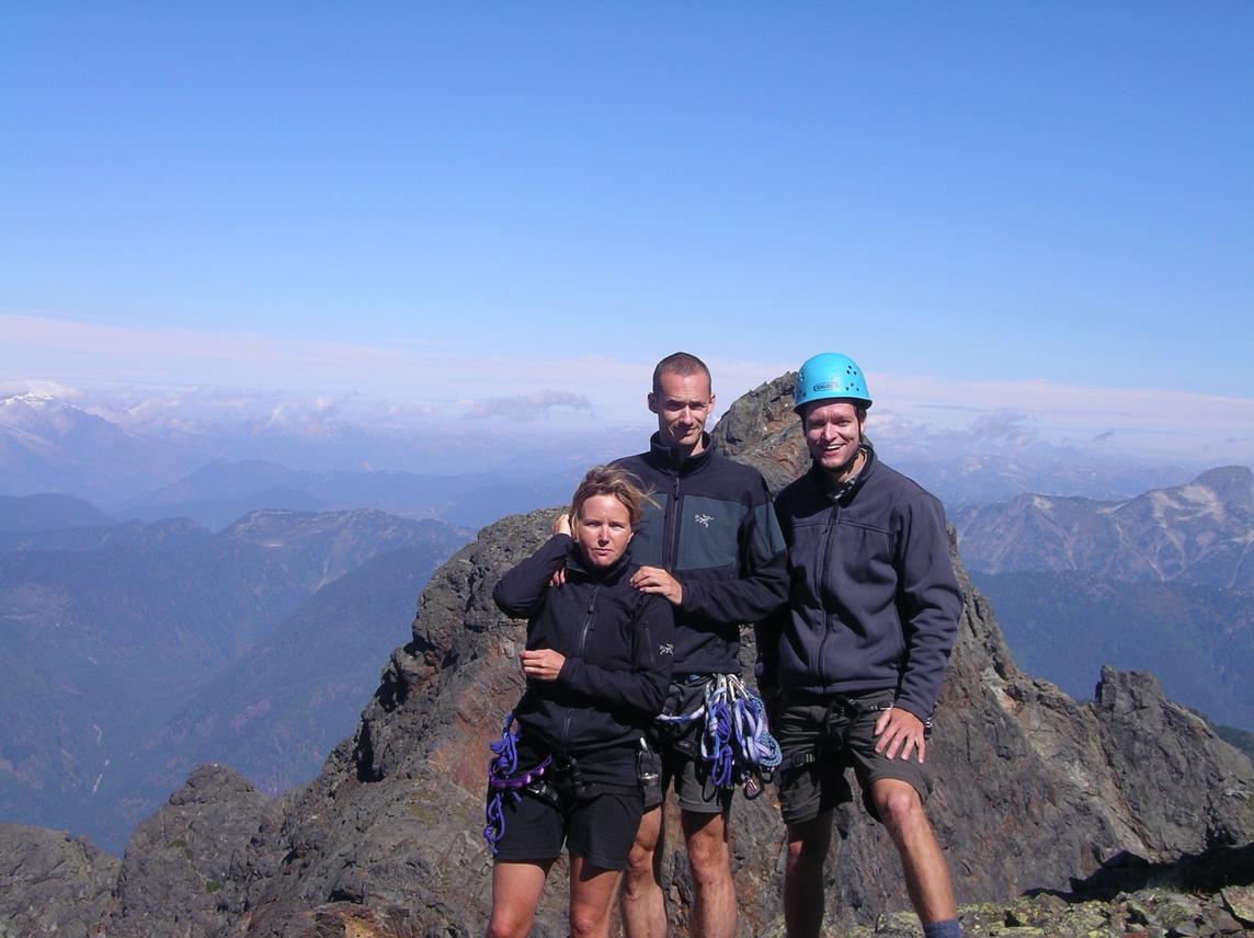 Here's our group shot on the central summit where we ate lunch. Behind us is the taller north summit which took another two hours to reach. |
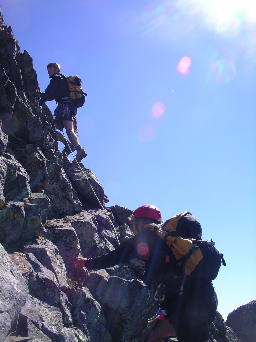 Chris and Tamsin climb the short fourth class section below the north summit. |
|
The traverse from the south central summit to the nearby lower north central
summit involves downclimbing
a short fourth class step, and the descent from the north central summit
involves downclimbing a longer fourth class section.
Both of these could have been rappelled easily
(several rap anchors from previous parties).
We now found ourselves on the red sandy col between the central
and north summits to which we would return for our descent.
The climb up the north summit involves a short section of exposed fourth class
rock after which we reached the true summit [elev. 2132 m].
After having a look at the northern end of the ridge,
we decided to descend via the red band in the hopes of returning to the car
before sunset.
Thus, we reversed our steps back to the red col, making one rappel over the
fourth class section.
The 50 m rope left us about 5 m above comfortable terrain;
a 60 m rope might have saved us a few minutes of awkward downclimbing.
We were back at the col at 2:00 pm, enjoying our final view of the horizon.
The descent of the red band involved much sandy loose rock (all of it red). The terrain is mostly unexposed and the traversing nature of the band meant we weren't kicking rocks onto each other. After traversing north (descender's right) to reach the bottom of the band, we headed left down the talus toward the south end of Daiphy Lake. We were back at the campsite at 4:00 pm for a swim in the sunshine. Karena checked in with Russ and Nick via radio. They were on their last pitch of roped climbing. We watched two specks moving up the rock 700 metres above us. After packing and a short break, Chris, Tamsin, Karena and I we headed off at 5:00 pm, starting down the bushwhack. We reached the road at 6:00 pm (quick thanks to Chris' excellent navigation through the scruff). Karena again checked in with the boys who were now at the col, about to begin descending the red band. We reached the cars at 7:00 pm, enjoyed a cold beer from the creek courtesy of Nick and Russ, and drove straight to the Old Settler pub in Harrison Hot Springs. | |
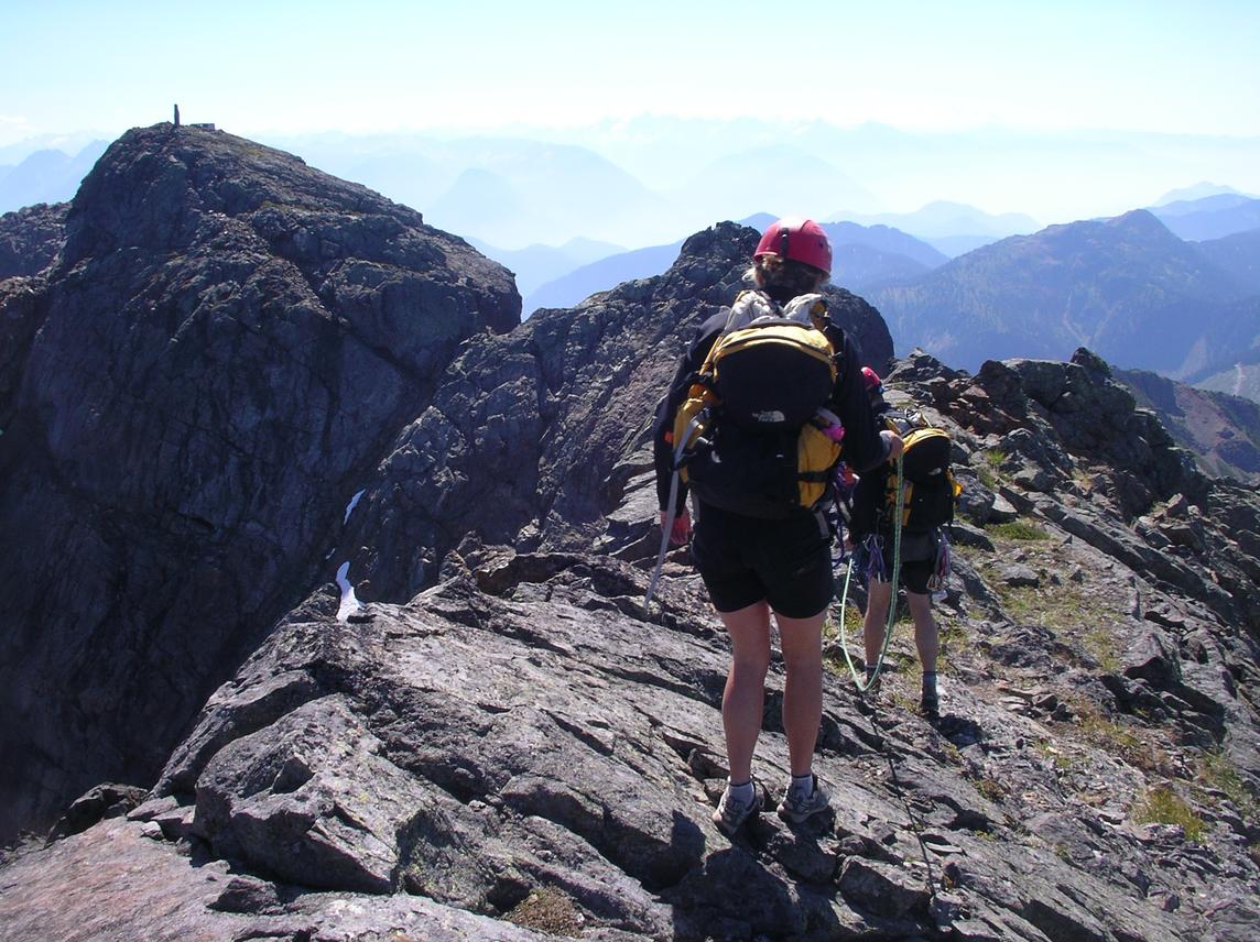 We head back to the red col between the north and central summits. The pillar on the central summit is a radio tower of sorts. |
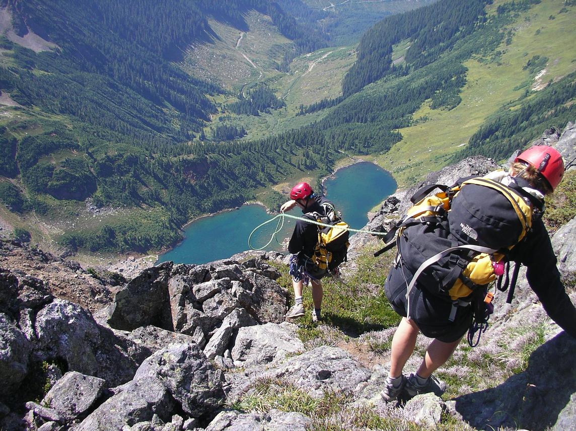 We begin descending toward the red col. Below is Daiphy lake. Our campsite is located on the flat peninsula, mostly hidden behind Chris' big head. Also visible is Talc Creek FSR and the bushwhack approach between the road and the lake. |
|
Reference Alpine Select. Kevin McLane. Elaho Publishing Corporation. 2001. Scrambles in Southwest British Columbia. Matt Gunn. Cairn Publishing. 2005. | |
