|
| |
|
Trip Summary
On September 10-11, Mike Cline, Christy Beever, and I hiked up the Sigurd Creek trail and climbed Ossa via the west ridge. The trail climbs tediously up steep valley hillsides, crossing numerous logs and boulders. We camped on the moraine below the glacier that flows north from the Ossa-Pelion col. Although low-lying clouds hid nearby summits as we hiked in on Saturday, clear skies greeted us early Sunday morning, making for a perfect September ascent. The grunt up the trail paid off with excellent scrambling along the west ridge of Ossa. Views: Pelion, Tantalus, Alpha, Mamquam, Garibaldi, Wedge, Weart, Cloudburst, and dozens of peaks to the northwest. See Mike's photos of our weekend. | |
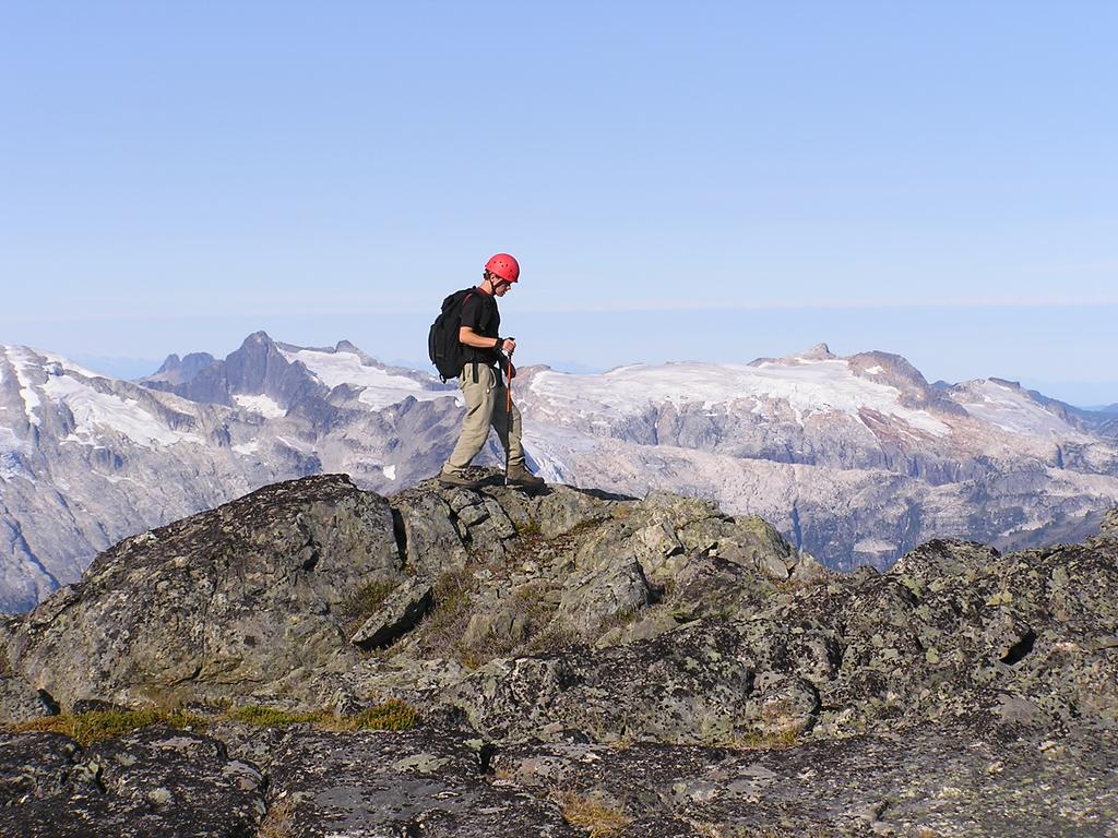 following the west ridge over the subsummit |
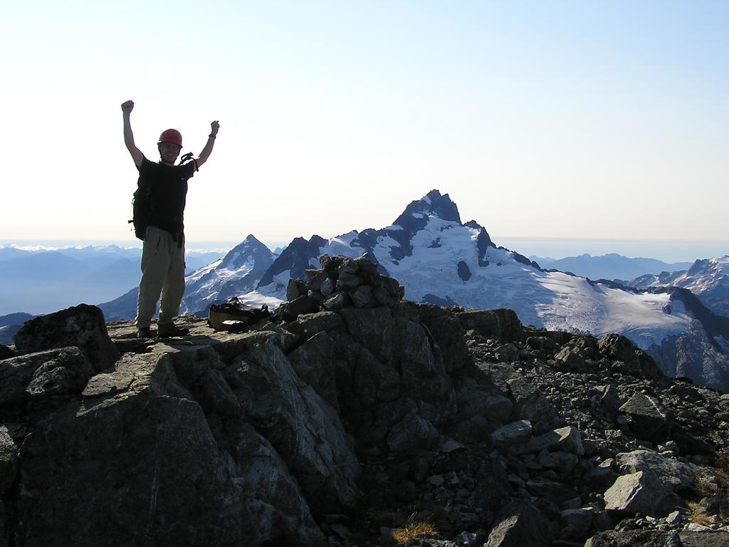 Mike strikes the proper summit pose. Mount Tantalus rises to the southeast. |
|
Details
We left Vancouver at 11:30 am and were hiking by 1:45 pm [traihead 60m elev.]. After a mere twenty minutes of pleasant flat terrain through deciduous forest, the trail climbs steeply to a first viewpoint, then a second, through avalache slide paths, along and across Sigurd creek, and finally up to the moraine below the hanging glacier. Along the way we had the misfortune of disrupting not one but two wasp nests (or were they bees?) leaving all three of us with numerous stings and an increased distaste for these evil striped winged insects. We arrived below the glacier at 7:15 pm [elev. 1220 m] and camped on the moraine next to the meltwater stream. The campsite setting was beautiful, with a view dominated by Pelion and Ossa and the hanging glaciers overhead, shifting, cracking, and releasing small icefall every few hours. As it turned out, this site is nicer than the trio of lakes described in the guidebook as the alternative locale for tenting. We enjoyed our mac + cheese + tuna dinner as sunlight faded. | |
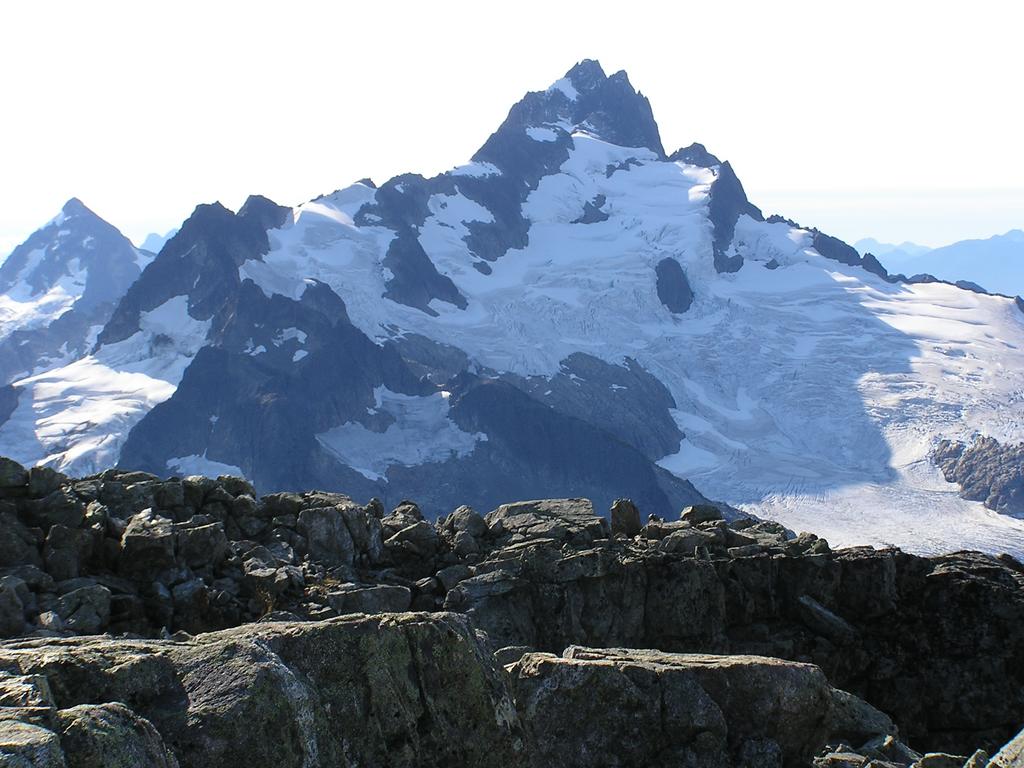 Perhaps the east face of Mount Tantalus, with its famous Rumbling Glacier, is viewed more often than this, the equally majestic, and more rarely seen, northwest face. The well-known north ridge route up Tantalus is clearly visible along the left horizon. Mount Alpha lies to the left (southeast). |
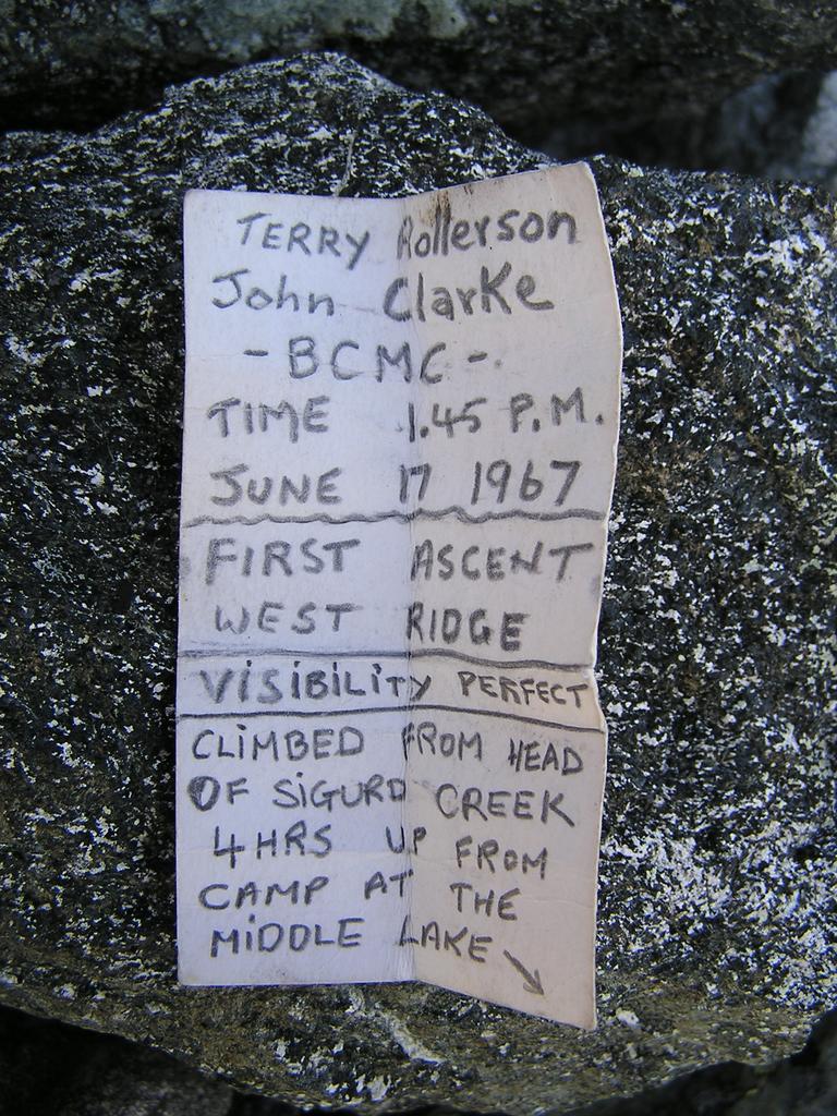 History: the summit register still contains John Clarke's entry from the first ascent of the west ridge in 1967. |
| The alarm woke us at 5:00 am. Over breakfast Christy wisely decided she would hang back due to unfriendly blisters that had developed while hiking in. Mike and I left camp around 6:30 am. A short climb up scruffy heather and bushes leads to the three lakes and soon to a talus bowl. We gained the ridge after climbing the talus and were rewarded with our first rays of sunshine and glorious views of the Tantalus range to the north. The route along the west ridge was great. The rock is solid and the scrambling interesting for the entire length of the ridge. Three humps are climbed on the way up, the crux of which lies halfway up the third, involving a short descent and climb back out of a gully over a dozen metres of fourth class rock on moderately-exposed terrain. We reached the summit at 9:45 am [elev. 2260 m]. The views along the entire ridge are breathtaking. I wished I could have identified peaks to the north and west. We started our descent at 10:30 am and arrived at camp at 1:30 pm. Christy (our basecamp manager) had kindly packed up the tent and sleeping bags, making for a speedy exit; we were hiking by 2:00 pm. We avoided getting stung on the way out and arrived back at the car at 6:45 pm with achy feet. | |
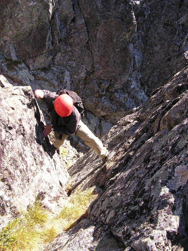 Mike climbs back out of the notch on the descent. The crux lies on the opposite side of the gully. Under dry conditions, the notch involves a short section of fourth class rock. |
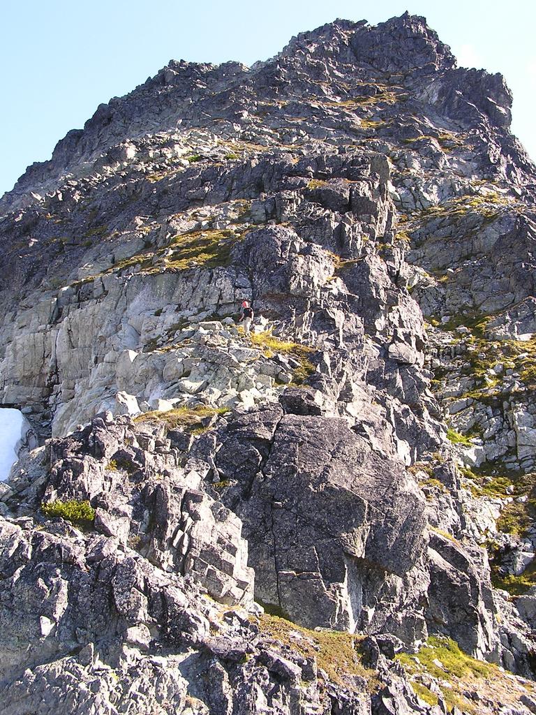 Mike descends the west ridge, enjoying the excellent rock found along the entire length of the ridge. |
|
Reference Scrambles in Southwest British Columbia. Matt Gunn. Cairn Publishing. 2005. | |
