|
| ||
 |
 |
|
Following a week in white-out on the Columbia Icefields, we were
eager to do some actual skiing, to be able to see the surrounding hills,
and perhaps even to summit a peak. On March 8, three of the four of us headed
to Mount Rohr: Matt Brown,
Reid Holmes, and I.
See Matt's and Reid's Rohr pages.
No sleds? Less than one metre of powder? Temps warmer than -20°C? Clear skies? Luxury! |
||
 |
 Location Location |
|
Mount Rohr is located on the north side of Duffey Lake Road near Marriot Basin
in the Cayoosh Creek area, just across the highway from
Joffre Lakes Provincial Park, between the towns of Mount Currie and Lillooet.
Access is about 3.5 hours by car from Vancouver.
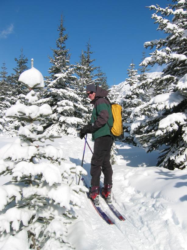
Reid (gets camera): "Hey Matt, any special reason you're carrying half the forest on your back?!" |
||
 |
 |
|
|
For a detailed view of our route, Reid overlaid our
actual GPS track
onto the Duffey Lake map. Red is on the way up. Blue is the return
trip. He also has a cool elevation plot.
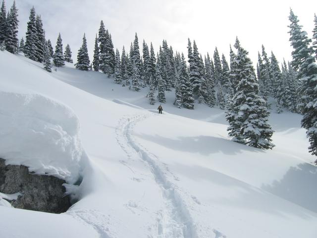
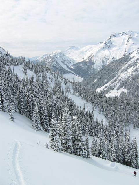
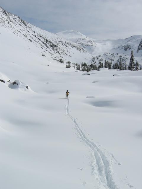
Depart Vancouver (5am, 10m) and drive to the sand shed near Cayoosh Pass on Duffey Lake Road (9am, 1280m). Skies are clear and the snow is great! The first two kilometres follow a logging road (take the left fork) after which a trail continues north toward Marriot Basin. After a few kms, we leave the trail and traverse east toward the lake (we went about 1km further north than we needed to before leaving the trail). We reach the bottom of the 350m snow gully by noon. At 1pm, sitting at 1800m atop the gully, we eat L1 with our first view of the valley and of our ascent route up Rohr, 3km to the southeast. We're at the base of Rohr (2000m) at 2:30. We head up the right side of the bowl to the west ridge. At 2270m, the wind has blown away the powder leaving harder icy snow. The slope averages 45° and is icy so we decide to drop the skis to kick steps up the north face to the summit. We top out at 4:15pm (2433m). We had set 4:15 as our turn-around time so we quickly head back (plus it's -15°C and a bit windy). On the way back we meet a skier and snowshoer camped near the top of the gully. Back at the car by 7:30. Pizza in Pemberton. Home just after midnight. Total mileage: 19.5km. |
||
 |
 |
|
|
Exploring the Coast Mountains on Skis. John Baldwin. Gordon Soules Book Publishers. 1994. Canada NTS 92 J/8 Duffey Lake 1:50,000. | ||
 |
 |
All photos courtesy
of Matt Brown except for the photo of Matt with the tree on his back which is Reid's. |
