Mount Samson is located northwest of Pemberton. This majestic peak rises to
2800m with an impressive north-facing cirque providing
snow and ice routes with an alpine feel different from most peaks in the
coast range.
On June 22, 2003, Reid Holmes and I climbed the Direct North Face of Mount
Samson.
The more mellow south face has a
3rd class snow/rock scramble which served as our descent route.
Our intention had been to climb Kevin McLane's description of the
North Face or its left variation. Amid blizzard and bad visibility,
we climbed directly up the steep buttress to the summit. The anticipation of
a straightforward descent down the south side kept us moving ahead over
increasingly difficult snow and ice. Turning around and downclimbing would
have been difficult on such steep and exposed terrain without visibility to
help in the route-finding (the leader's bootprints were mostly buried even
before the second reached them). All in all, a 19-hour day car-to-car made for
a very satisfying (and tiring) climb.
See Reid's GPS track overlaid on
the topo map,
elevation profile, and
photos.
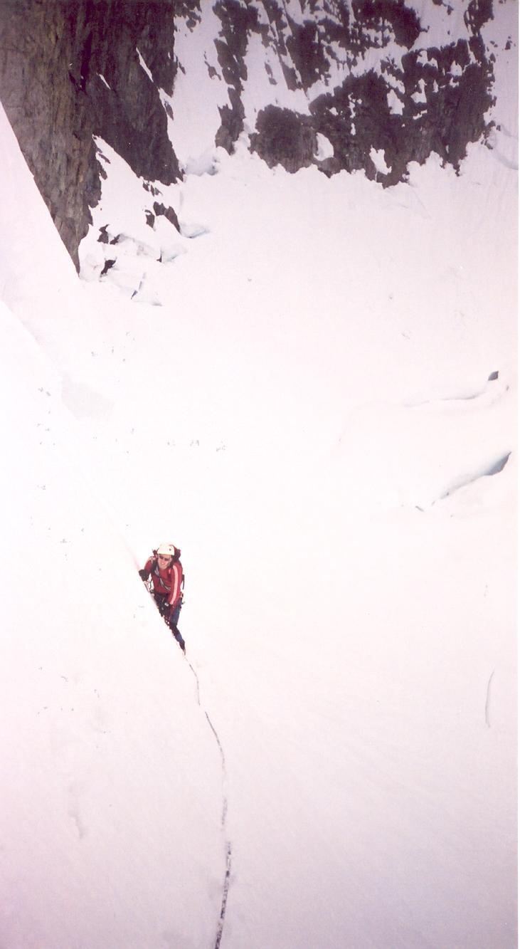
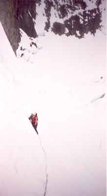
Here is our ascent line (photo
by Paul Morton, bivouac).
"We should be down by early
afternoon with time to spare for some relaxing sport climbing in Whistler..."
|
|
trip report by Reid Holmes
The Objective
After considerable drooling over Alpine Select, Steph Durocher and
I decided to try the North Face route of Mount Samson for a nice
weekend trip. Since Matt Brown had fallen "ill" the day before we
left, we took off with his pickets and ice screws and set out for the
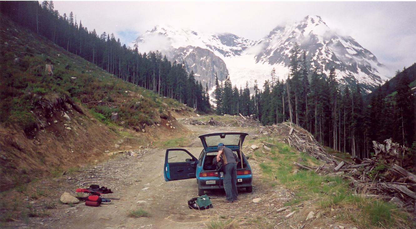
face. After a quick pizza dinner at Busterinos in Pemberton, we headed
up the Hurley River Road. After turning onto the final
road, listed as a 4wd-hc access in Alpine Select, Steph manoeuvred his
off-road vechicle, a 1991 Firefly, across the numerous cross ditches
and streams on the way up to the end of the road. We eventually
stopped 300m from the end of the road as it was still covered in a few
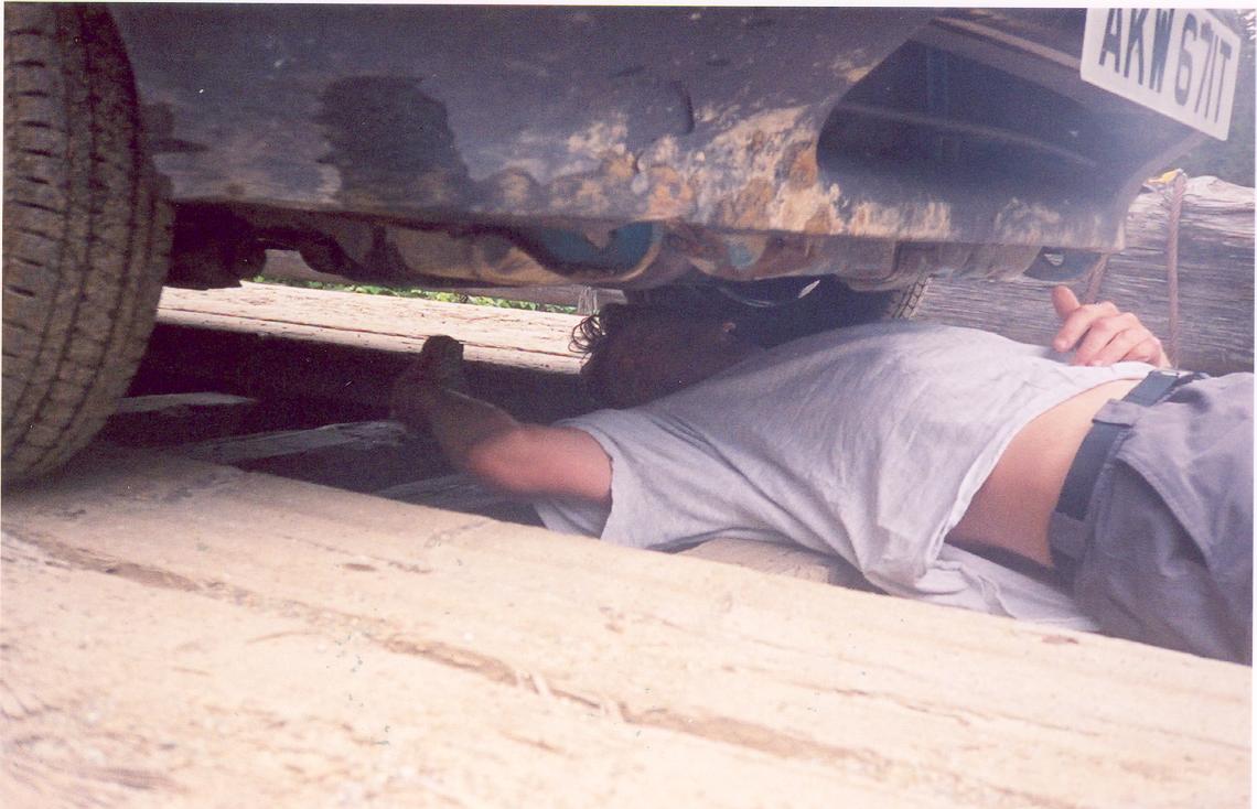
feet of snow. Upon stopping, we discovered the car was stuck in first
gear, as the exhaust system had been wedged against the shifter on one
of the less-successful ditch crossings. After a little bashing with a
fist-sized rock, Steph was able to "repair" the transmission. We hiked
to the end of the road and took a quick look at our intended route. We
decided that the major obstacle we would face would be gaining the
glacier in the first place. The toe of the glacier looked high,
omnious, and very fragmented, with dozens of uninviting large loose
seracs. We figured we would have to climb the rock buttress to the
west to get on the snow.
The Approach
The approach is indeed a rough trail. Much like the approach to
Mount Currie, it is much better developed at the beginning and tails
off about a third of the way in, as each party fends for themselves at
this point and finds their own route. The trail is well marked with
flagging tape, tape of every conceivable variety. There's blue,
yellow, pink, pink "road centre", red "riparian management
zone",
yellow and white "creek", and red and pink markers. It is recommended
to apply a greedy approach to following the tape, if you choose to
follow it at all. Just pick the colour which, at the time, appears to
head towards the mountain. Once it veers 90 degrees from the mountain,
as they all invariably do, choose a new line and proceed. Crossing the
creek to gain the moraine is easier the later you choose to cross it.
After climbing up the moraine and down the other side, traverse to the
northwest side of the lake to get to the base of the rock.
|
 |
Gaining the
Glacier
Climbing this rock rib would not be recommended in the rain. If you
slipped taking the direct route up, you would bounce your way down a
few hundred metres to the bottom. If you took the dirtier route up one
of the gullies this may not be so much of a problem, but there would be
greater rockfall issues. As the rock was generally dry we decided to
ascend the rock directly. The vertical rise of this section showed as
200m on the altimetre, and took us about ?? minutes to climb. We
didn't bother to rope up as it was only 4th class and the rock was
generally dry. We weren't sure if this section is different in other
parts of the season, but after getting to the top and looking at the
alternatives we couldn't figure out any better way to get up onto the
glacier. This section would probably be the biggest surprise to anyone
going on the description from Alpine Select.
Surmounting the
Face
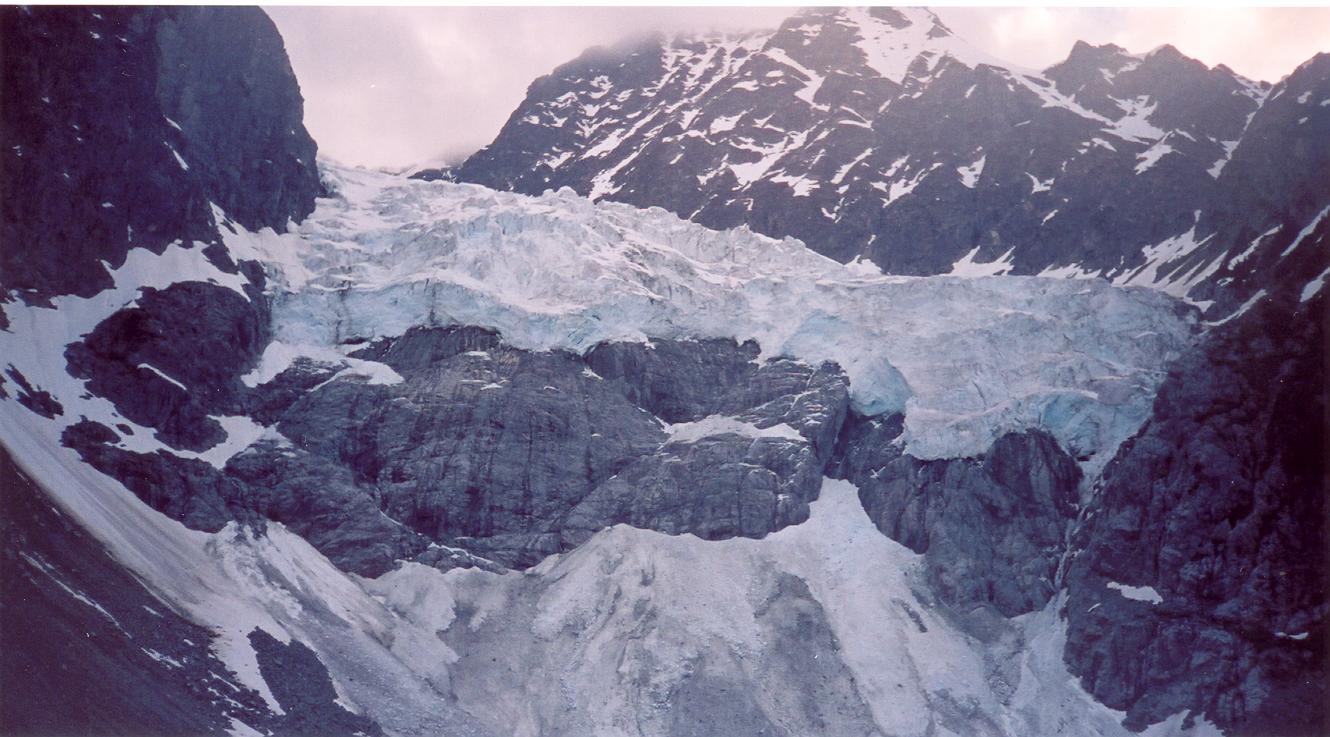
At around 1900m, the rock becomes steeper just as the glacier becomes
level and less broken-up. Here we put on crampons, roped up, and moved
onto the glacier. Just 50m into
the glacier traverse, we had to negotiate climbing over/through the first
crevasse of the day. The glacier was well bridged for the most part.
After reaching the base of the north face, we climbed over a small
bergschrund onto the steep snow face. We considered the rightmost line, but it
looked quite icy. We chose to climb upwards and left, between
two large horizontal bands of rock. At this point, the Alpine Select line
goes right. Being stuck in a cloud, with about 20m within sight ahead of us,
we kept moving upwards. The snow steepened and varied from deep loose powder,
to solid step-kicking snow, to solid ice. Toward the top, we placed screws and
pickets between us as we climbed. Above us was an overhaning cornice, through
which the only route appeared to be an 80° steep icy runnel.
Upon reaching a small bergschrund, we climbed
in to take shelter from the wind and snow, and to discuss options.
Descent was not possible since our route was steep, exposed, on
loose snow or hard ice, we were stuck in a cloud,
and our bootprints had now disappeared. Descending the south side seemed much
more appealing and motivated us to keep moving upward.
At the back of the bergschrund was clean solid ice. We sank screws for a
station and belayed a 50m pitch up the runnel. At its top, exactly one
rope length away, was another larger bergschrund belay station/shelter.
This worked well for Reid to follow up and lead the final snow pitch over the
summit ridge.
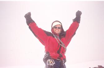
We were glad to find ourselves on the true summit, not requiring
to travel along the summit ridge.
|
The Descent
After the customary summit photos we were quick to descend as we were
several hours behind schedule. The ridge to the west of the summit
seemed too steep to quickly downclimb so we started off straight down
the backside. While we were initailly trying to reach over to the
right to meet up with the described descent in the guidebook, we ended
up just going straight down, following various little gullies that led
down and to the left. At one point we had a brief clearing and were
able to make out the shoulder that was our destination so we knew we
were on the right track. Once we reached the shoulder we regained
visibility and could once again see across the valley. It took us X
hours to reach the shoulder and from there another X hours to reach the
moraine at the base of the climb. We returned to the car at 10:20pm,
18h15m after we started.
Summary
The climb was fantastic. There was rock, ice, and mixed climbing in
a fantastic setting. On the drive back to Pemberton the transmission
on the Firefly got stuck in 3rd gear so it was a slow drive back to
Vancouver. While approach, climb, and decent took us over 18h, we had
poor visibility which likely caused us to take a harder line than we
needed to. We also knew that we had to get over the top to get back
down so we took our time to ensure that we stayed well-fed, hydrated,
and didn't make any mistakes. The GPS track had our total distance
covered recorded at over 24km for the day, with an elevation gain of
1500m.
|
 |

 Location