|
| ||
|
Trip Summary
Sloan is an excellent scrambling summit on mostly 3rd and 4th class rock, providing fantastic views far to the north and to the east. Not to be confused with its Washington namesake, this Sloan lies along the Hurley River Road, northwest of Pemberton, southwest of Gold Bridge. On October 5, 2003, five of us headed up the northeast ridge of Sloan. All week I courted various friends attempting to recruit a partner for Sloan. The NE ridge was reported to still be dry; with a rain forecast for Monday, this was likely the last weekend the route would remain snow free so this year. For Sunday, Environment Canada called for sunshine, clear skies, and warm temperatures in OCTOBER! Ault Creek FSR had recently been extended making the approach ridiculously short. A quick scramble to assemble a climbing partner led to a group of five: James Floyer, Chris Michalak, Chris and Tamsin Tarling, and me. |
 |
|
|
After leaving Vancouver at 5:30pm Saturday to grab a quick dinner at
Busterino's in Pemberton,
copilot James navigated by headlamp using three sets of directions:
the Alpine Select approach description, Bivouac road updates for Ault Creek FSR,
and Matt Gunn's guidebook description. The latter was the most useful.
Thanks to Chris M's Subaru handling skills, we arrived at the road end
4.5 hours after leaving Vancouver.
Chris T and Tamsin had a nice fire burning to greet us.
The starfilled sky was clear, leading James and I to forgo a fly on the tent.
Sure enough, at 4:20am, we were awakened by raindrops. Although not necessary
in the end, a quick trip to the car for the fly allowed a worry-free sleep
until 6:15.
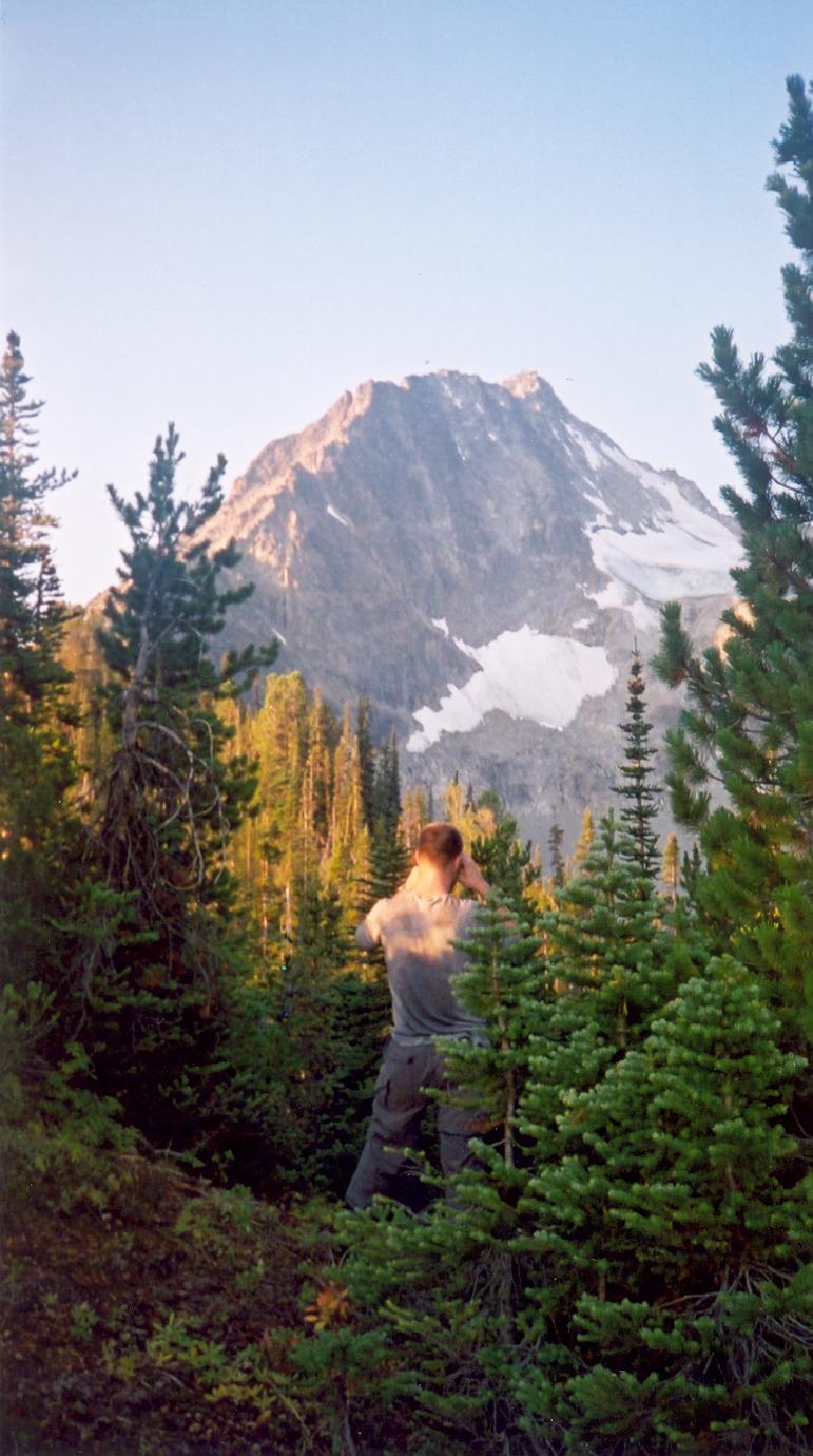
With breakfast completed, we considered either hiking to Lower Ault Lake or bushwacking directly up to the ridge crest in the trees. James thought the second approach might be better to avoid the steeper scramble to gain the ridge further along. This worked out well, as one finds frequent frequent animal trails and there is little low-lying brush, alder, or new growth foliage. We soon left the trees and moved to rock. |
|
|
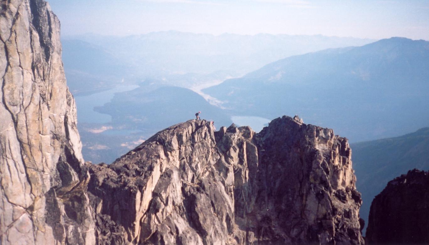
The route follows the ridge, rating quite consistently as third class,
easy scrambling, with the odd few moves of fourth class.
As McLane describes, the few fifth class steps are easily avoided by moving
a few metres to the south. The easier alternate route is always quite evident
and never requires moving far from the ridge.
Watch for loose rock, not so much falling from above, but rather
shifting under the foot. Much of the route is exposed requiring careful
movement.
We took frequent breaks and enjoyed the magnificent views of the
Chilcotin to the north.
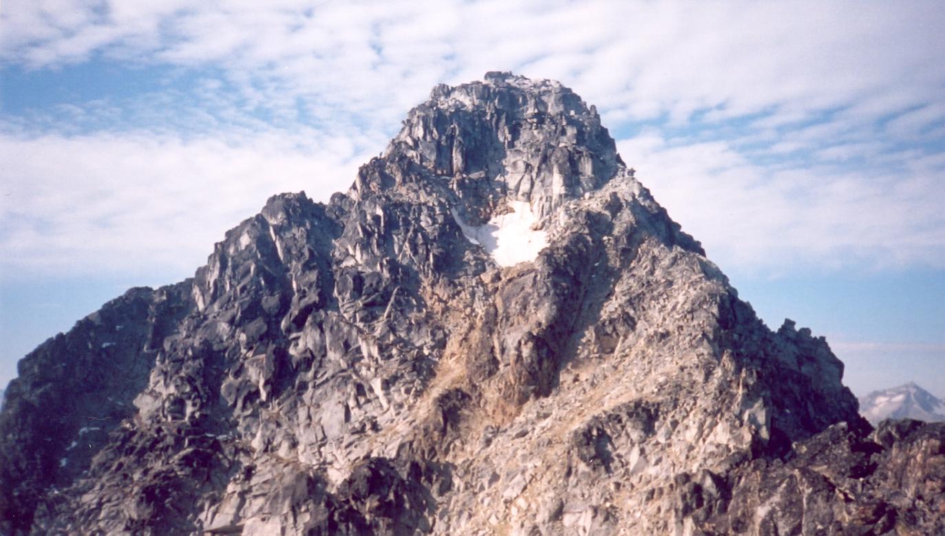
The final 25m below the summit is the only section requiring minor decision-making with respect to route-finding. The direct route up the middle involves two steps of low fifth class, each perhaps two or three metres. Chris M and James followed this route. I followed an easier route around the north side, past a small snow patch and up to the summit along 10m of 4th class rock; this variation was perhaps easier but longer and more exposed. Although we did not go this way, it seems the easiest scramble route may be found by crossing lower down below the snowpatch and around to the south side (climber's left). |
|
|
|
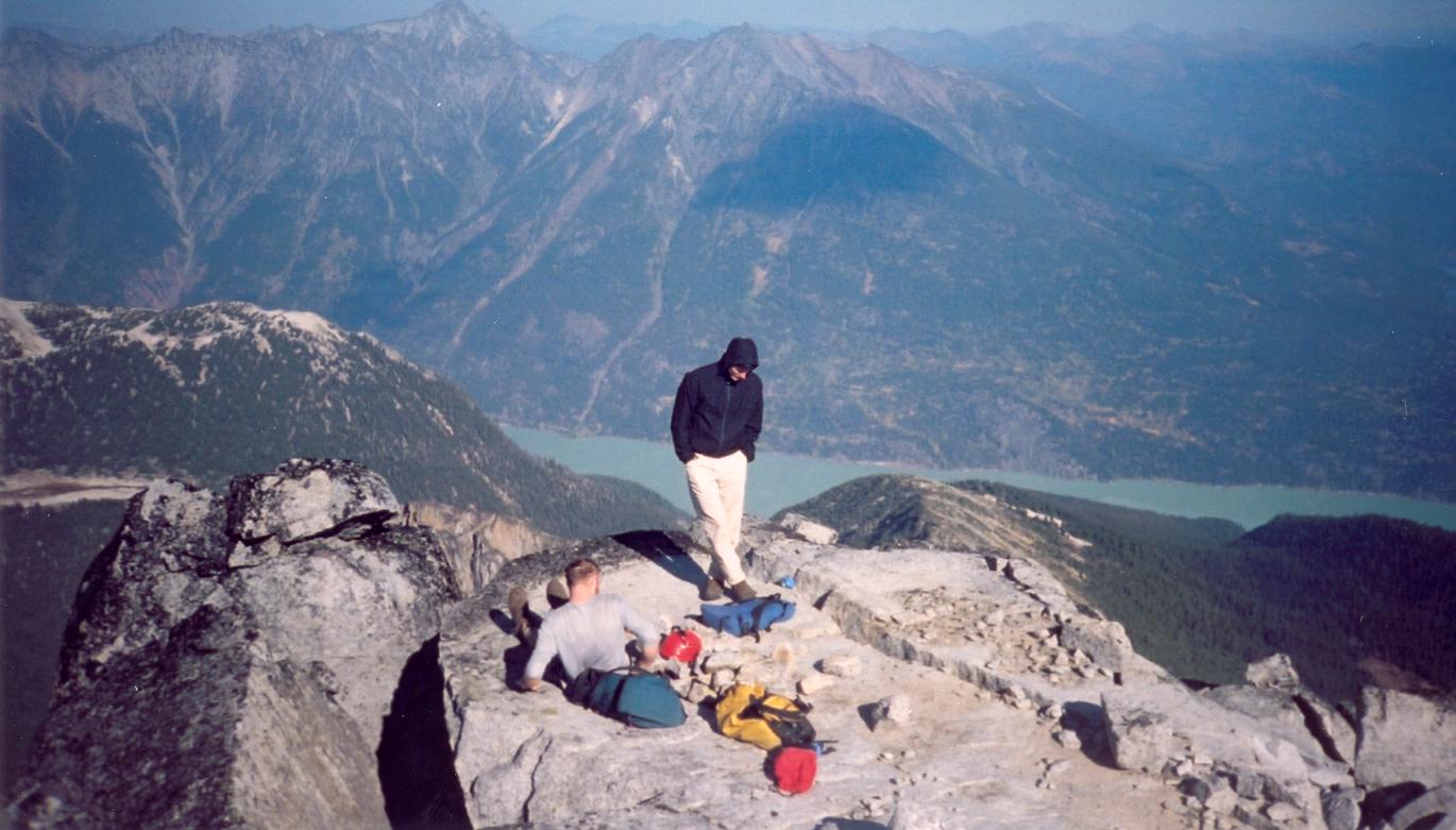
I reached the summit at 11:45, where Chris M and James were already enjoying
the sun. Chris T and Tamsin soon joined us for 45 mins of lunch, photos, and
summit register reading.
Although we hadn't roped up for the ascent, the final scramble to the summit
would be more safely reversed by rappel.
Deciding to keep our ropes in our packs and preferring to explore new ground on
the descent,
James scoped out the gully described in Matt Gunn's scramble
description which we decided to descend.
To reach it, traverse from the main summit (cairn) to the
western summit and continue behind down the boulders to the first large
gully to the south (descender's left).
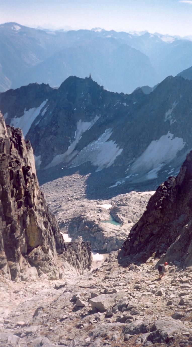
The gully continues straight down along semi-loose rock for a straightforward descent to the lakes. Just before exiting the gully, move to the west (descender's right) for a two-metre high, fourth-class step. From here, the route skirts the south face of Sloan along the three lakes. From the second lake, follow the stream directly to Lower Ault Lake. Again frequent animal trails near the stream make the going easy. We skirted the lower lake around its southern shore where we found a trail marked with orange and pink flagging tape. At one point the trail seems to head uphill when the clearcut and road end lie below. Here we left the trail for a medium bushwack. The trail was eventually rejoined lower down; who knows what it does in between but it might be worth committing to it for another hundred metres. We reached the car before 3pm and were back in Vancouver by 7pm. |
|
Route Info
Canada NTS 92 J/15 Bralorne 1:50,000. Alpine Select. Kevin McLane. Elaho Publishing Corporation. 2001. Scrambles in Southwest British Columbia. Matt Gunn. Cairn Publishing. 2005. A Guide To Climbing And Hiking In Southwestern British Columbia. Bruce Fairley. Gordon Soules Book Publishers. 1986. |
|
|
