Vantage, Cerise Creek - December 2006
Matt, Andrea and I visited Keith's hut for the first time in
the fall of 2001 to
climb Matier
and Joffre.
Matt and I returned (this time with Reid, skis, and two #5 cams)
to spend a night at the hut, ski a few runs
(more runs for Reid and Matt than for a lazy Steph), and tag a small nearby
summit.
See Matt's photos.
photo:
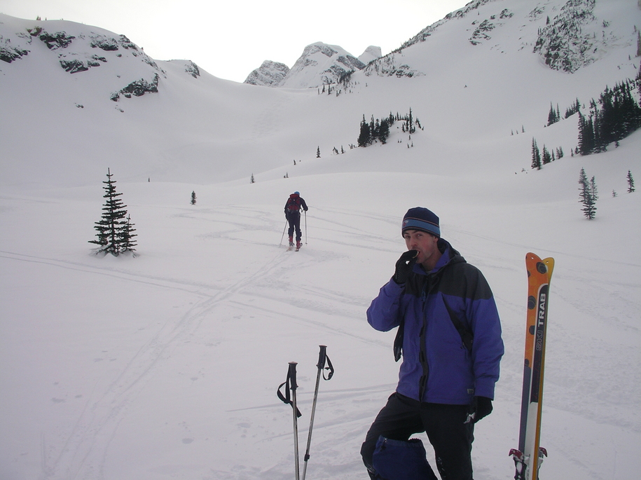
Matt on the winter approach trail to Keith's hut along Cerise Creek
below Joffre

Day 1: approach to Keith's hut
distance skied: ? km
We left Vancouver at a leisurely 8:00 am to start skiing just before noon.
The trail was broken and the approach was shorter than expected,
resulting in an early arrival at the hut by 2:00 pm.
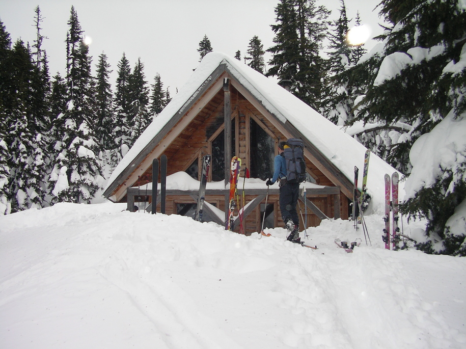
photo: Keith's hut
As we arrived the wind and snow picked up.
Reid and Matt braved the elements and climbed higher for a run before
nightfall. Steph volunteered to stay back at the hut to
keep an eye on the gear.
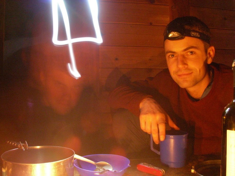
photo: A long exposure captures Reid and Matt enjoying their respective
evening activities relaxing in the hut.
Day 2: ascent of Vantage
distance skied: ? km
peak summited: Vantage, 2235 m, West Ridge
We left the hut at around 9:00 am. Route-finding wasn't difficult but
involved a few group decisions to minimize avalanche exposure while approaching
the ridge.
peak summited: Vantage, 2235 m, West Ridge
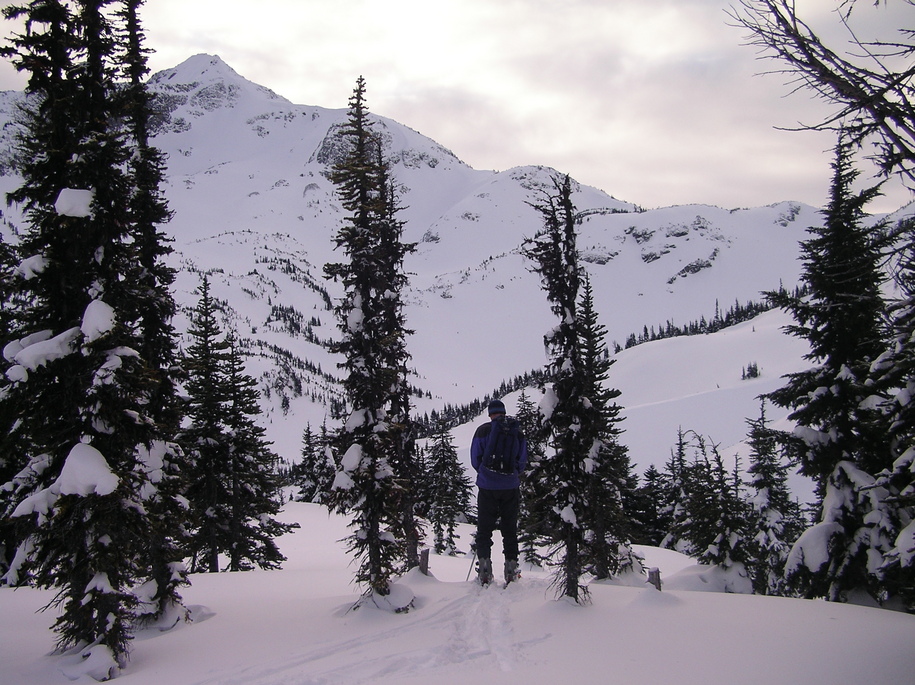
photo: Here is our view of the West Ridge of Vantage as we approached it.
Our ascent route follows the horizon, passing to the back of the first hump
on the ridge. On descent we skied the topmost obvious bowl seen between the two
trees in the middle of the photo.
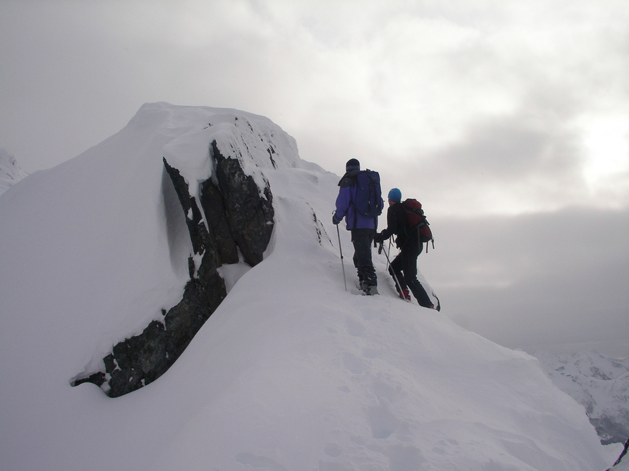
The summit is slightly exposed and required care due to cornices
hanging over the north face.
The final 100m were too icy and windblown to allow safe skiing.
We dropped skis and booted up. The last few steps took nearly 30 minutes
of ski pole shovelling
to clear snow from the rock to step up to the small summit ridge.
Each of us had an avi shovel in his pack but somehow
it never occured to anyone to use it instead of a ski pole.
photo: The final few metres to the summit required us to drop our skis and
clean some snow from the rock to safely tag the top. As shown in this photo,
Reid and Matt did all the work while I milled about below snapping photos
and asking "How does that route look?".
The route was very enjoyable and a good moderate objective
for this time of year.
The descent was straightforward. The return trip from the hut to the road
took only one hour.
photo: Following an enjoyable descent, Reid heads back up for one last run
while Matt refuels before catching up to Reid.
