|
Columbia Icefields - May
2005
|
Trip Summary
Four of us returned to the Columbia Icefields May 7 to 10, 2005.
In contrast to our
visit in February
2003, these four days on the icefields included
not only blue skies but also
successful ascents of Columbia and Snow Dome.
Mount Columbia and Snow Dome lie on both the continental divide and the
BC-Alberta border.
The summit of Columbia holds the honour of being the highest point
in Alberta and the second-highest in the Rockies.
Snow Dome holds the honour of defining the unique
hydrological apex of North America from which water flows to the three
oceans: Atlantic, Pacific, and Arctic.
We split into two teams for ropes, tents, and cooking.
Team Tele-Calgary was composed of Reid Holmes and Kevin Pyle.
Team AT-Vancouver consisted of Chris Tarling and myself.
While ascending, we roped up as a four on a single 60m 8.5mm rope
whereas for ski descents we split into two ropes, using a second
30m 8.5mm rope.
This worked well and we somehow managed
to minimize the chaos of roped skiing with full packs
(Chris, the expert skier in the group, was very patient with my inability to
make quick turns or to ski steeper, more interesting slopes).
See a map of the Columbia Icefields
and Reid's photos.
|
Day 1 - Saturday
May 7 - Athabasca Glacier to the Trench
|
After nearly 1.5 hours of sleep (loud end-of-term party in
the room nextdoor) we left our hotel room at the Saskatchewan crossing
around 5:30 am and drove 30 minutes to park across from the Icefields centre
[elev. 1980m]. The sky looked grim; it had rained heavily overnight and dark
clouds obstructed most of the surrounding terrain.
We carried skis following the short road and trail to the foot of the Athabasca
Glacier. After stepping into bindings and roping up, we quickly skied to the
headwall which we ascended by mid-morning.
|
To the left is the southwest face of Andromeda
and behind Reid is the unnamed peak.
|
Chris examines the east face of Columbia, over 10 km away,
as it appears from the highpoint on the Columbia Icefield.
|
As we skied southbound and gained elevation, the clouds dissipated
revealing a clear sky and the magnificent north and west aspects of
Andromeda, including the
reminiscent Skyladder.
Snow conditions were decent: two to five centimetres of recent snowfall rested
on a solid base. By 11 am we rested atop the headwall.
Here we enjoyed our first views of Mount Castleguard,
the gentle south slopes of Snow Dome above the serac wall,
the south face of Andromeda, and unnamed peak (where we would return
three days later).
|
|
Although we had placed a dozen of our own wands on the lower part of the
headwall,
we soon joined a highway of wands leading most of the way to the Trench.
The gentle uphill to the southwest seemed never-ending as we skied toward
the Trench, anxiously awaiting our first view of Columbia.
We spotted two camps positioned nearly halfway between the Trench and
Castleguard on the south side of the icefield.
Realizing we were making good time, and knowing a late-day ascent of Columbia
was unlikely, we slowed to an enjoyable pace, taking more frequent breaks
to photograph the peaks which had been hidden on our visit in February 2003.
|

Kevin and Reid cut perfect tele turns (while roped and carrying full
packs nonetheless) to the base of the Trench.
|

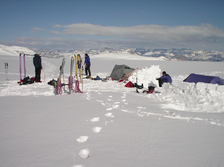
We established Camp 1 a few kms east of Columbia, well west of the
Trench.
|
After cresting the hill in the middle of the icefield [elev. 3000m]
and enjoying magnificent views of the east face of Columbia, we removed
skins, split into two ropes of two, and coasted to the bottom of the Trench
[elev. 2700m].
One option had been to camp near the Trench. Given that it was only
1:30 pm, we opted to continue westward to gain 300m and knock down a few kms
from our approach the next morning.
The route followed broken trail
up gentle rounded terrain.
The hot sun meant we were sweating even just wearing t-shirts.
We passed a lone skier who informed us there
were several vacated campsites ahead with good snow walls.
We reached these around 4 pm and pitched camp in warm sunshine.
We enjoyed cooking dinner and lounging around without need for
fleece or down. The skies remained clear in the evening
as we watched two groups return from Columbia.
We retired to bed early, around 8 pm, to make up for the lack of sleep on the
previous night.
|
|
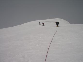
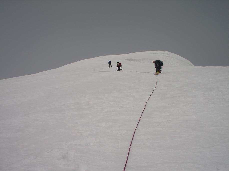
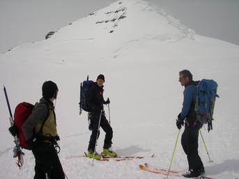
Only 50m of vertical to go. Kicking steps in the lead is Kevin,
followed by Reid and Chris.
|
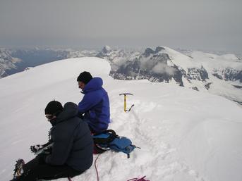
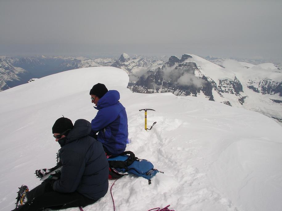
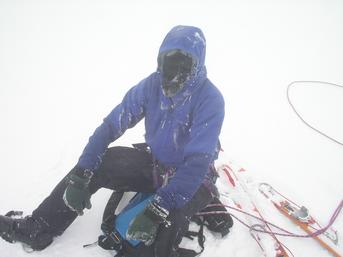
Reid and Kevin stare into BC while sitting on the highest point in Alberta.
To the right are South Twin and North Twin.
At the top is Mount Alberta.
|
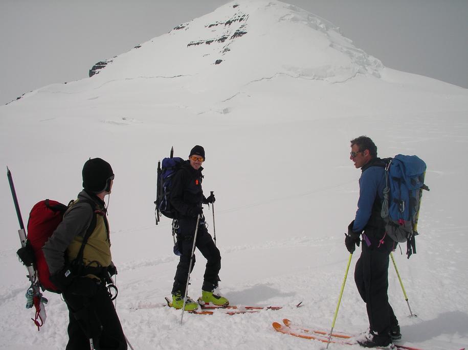
Everybody is pleased after a quick ascent and (quicker) descent of Columbia.
Our ski tracks head right and then left across the bergschrund.
Our steps head up just right of the rightmost rock band.
|
Day 2 - Sunday
May 8 - Columbia
|
We rose at 5 am again. Unlike the clear skies we had enjoyed the night before,
heavy clouds to the west completely obstructed Columbia and our approach.
After cooking breakfast we decided to wait for the weather to clear and
returned to bed for a few hours.
Around 9:30 am we decided to give the route a go, even though conditions
hadn't changed
much. As we headed out, brief breaks in the clouds gave us hope for a clear view
from
the summit. The approach was short and soon we crossed the bergschrund where we
left our skis [elev. 3300m]. From here, we kicked steps to the summit which
was reached
at 12:00 pm [elev. 3747m]. On cue, the skies cleared providing great views
including
Mount Sir Sandford to the southwest in the Selkirks,
Mount Clemenceau to the west,
Mount Alberta nearby to the northwest,
the Twins to the north, the Stutfields, Kitchener, Snow Dome, and Andromeda to
the northeast,
Castleguard to the east, and the impressive north face of Mount Bryce to
the south.
|
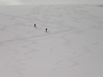
Reid and Kevin returning to the base of the Trench
|
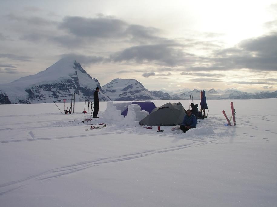
Camp 2 in the evening with Columbia on the left
|
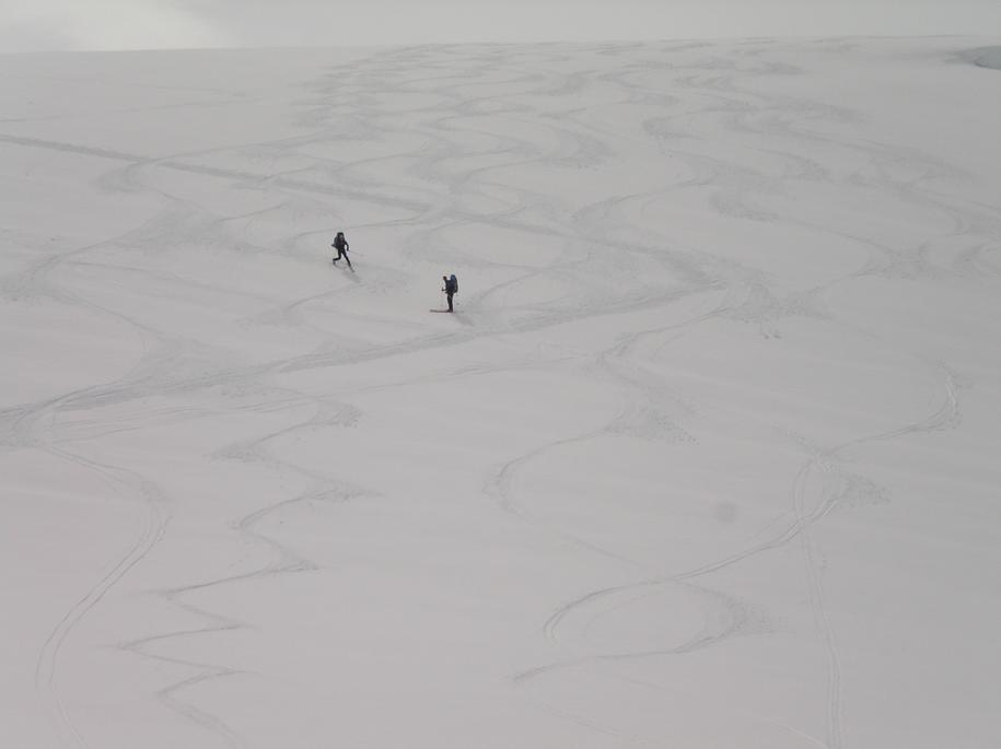
After 30 minutes of photos and refueling, we descended quickly in the snow.
Upon reaching our skis, we removed skins, and skied unroped back to camp.
After lunch and a rest, we broke camp, and we continued on unroped along
the pleasant ski downhill back to the Trench.
Here we roped up, donned skins, and circled east, then northeast, north,
and finally northwest below the western slopes of Snow Dome. The views of
Columbia and
the Twins changed rapidly as we circled around the deep rocky walls below
the Trench.
We set camp at around 7 pm. Chris and Kevin built walls while Reid and I cooked
dinner.
Bed by 9 pm.
|
|
Day 3 - Monday
May 9 - Snow Dome
|
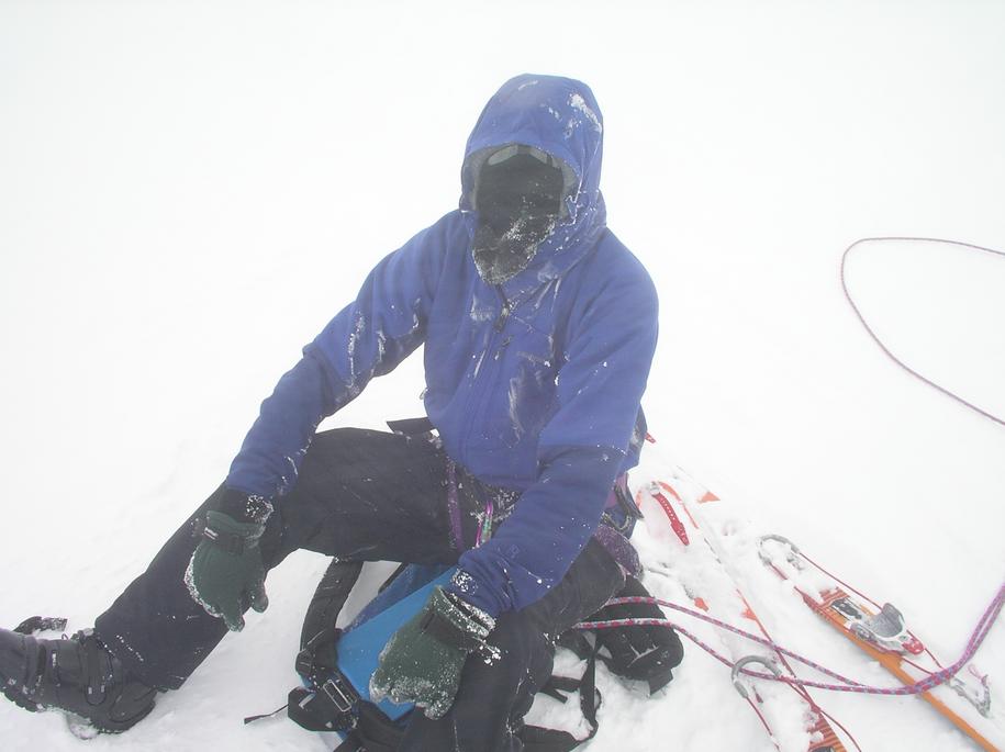
Strong winds picked up during the night and we awoke to complete whiteout,
much like that of our last visit to these parts.
We had big plans to climb North Twin, the Stutfields, Kitchener, and Snow Dome
today. These were not to be and back to bed we returned.
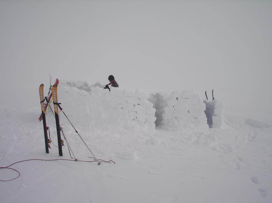
Around 9:30 am the four of us exited the tents to erect a tall wall.
We had expected the winds to come from the southwest; instead, they blew
very strongly from the northeast. After 45 minutes of coordinated effort,
we had a solid wind block which proved very effective. Chris' snow saw was
essential to this construction project, allowing us to cut perfect bricks out
of the hard-packed snow.
After cooking breakfast we returned to our beds.
|
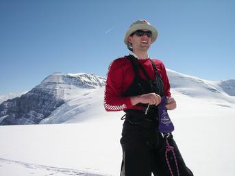
Kevin enjoys the view and the balmy temperatures on the summit
of Snow Dome.
|
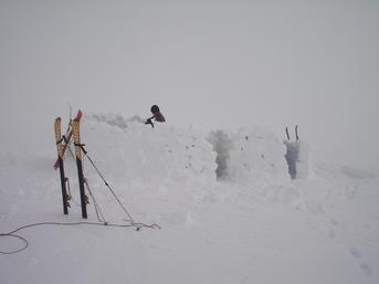
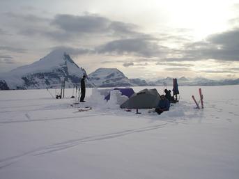
Camp 2 after building the new wall
|
Around 1 pm, feeling bored, we decided to make a GPS-guided visit to the
summit of Snow Dome, 450m above us. Reid's white-out navigation skills
shone again as he guided us to the top in zero vis and heavy winds
[elev. 3451 m].
The ceremonial urination on the summit took place (recall,
it's the hydrological apex ...).
After a clumsy but quick descent (again, Reid masterfully kept us on track) we
coasted back in to camp, enjoyed lunch behind the shelter of our wall, and
returned
to bed for an afternoon nap. Dinner followed. In the early evening,
skies cleared somewhat toward Columbia
but remained covered over the icefield to the south and to the east.
|
|
Day 4 - Tuesday
May 10 - Descent
Skies we partly overcast when we rose, similar to the previous night's display.
We packed camp and descended down to the icefield. As we rose again to
the highpoint of
the icefields, skies cleared and the temperature rose. We quickly returned to
the top
of the headwall where we hoped to make an ascent up the backside of Andromeda.
After skiing down to the base of Unnamed, we dug a cache where left our
overnight
gear and extra food. From here, Reid lead a solid 500m elevation gain up the
northeast ridge of Unnamed. The blue sky disappeared and we again found
ourselves
in a thick cloud and a cold wind. I was worried about the angle of the ski
descent.
We were 100m from the summit of Unnamed and 100m above the
Andromeda-Unnamed col
(the Andromeda summit is only 300m above the col up an easy snow ridge).
In retrospect, my worry was ill-founded and
we could have either 1) stayed put and waited to see if the weather cleared,
2) continued to the summit of Unnamed,
or 3) descended to the col.
Both Unnamed and Andromeda
would have been straightforward ascents, even in zero vis.
Of course, the descent turned out
to be no problem and the sky cleared as soon as we reached our gear cache.
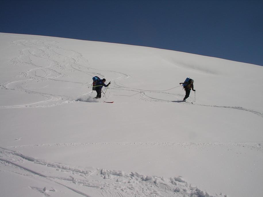
From here we enjoyed a straightforward ski descent on two ropes (with nice turns
on the headwall)
to the base of the Athabasca Glacier. After hiking to the car and changing into
better-smelling clothing,
we visited the icefields centre for poutine, a cheeseburger, and a beer.
|
Reference
Summits and Icefields: Alpine Ski Tours in the Rockies and Columbia
Mountains of Canada.
Chic Scott. Rocky Mountain
Books. 1999.
The 11,000ers of the Canadian Rockies.
Bill Corbett. Rocky Mountain
Books. 2004.
Exploring the Columbia Icefields.
Druid Mountain Enterprises. 1:50,000, contour interval 40m, 1km grid.
Canada NTS 83 C/3
Columbia Icefields 1:50,000.
Bivouac
|