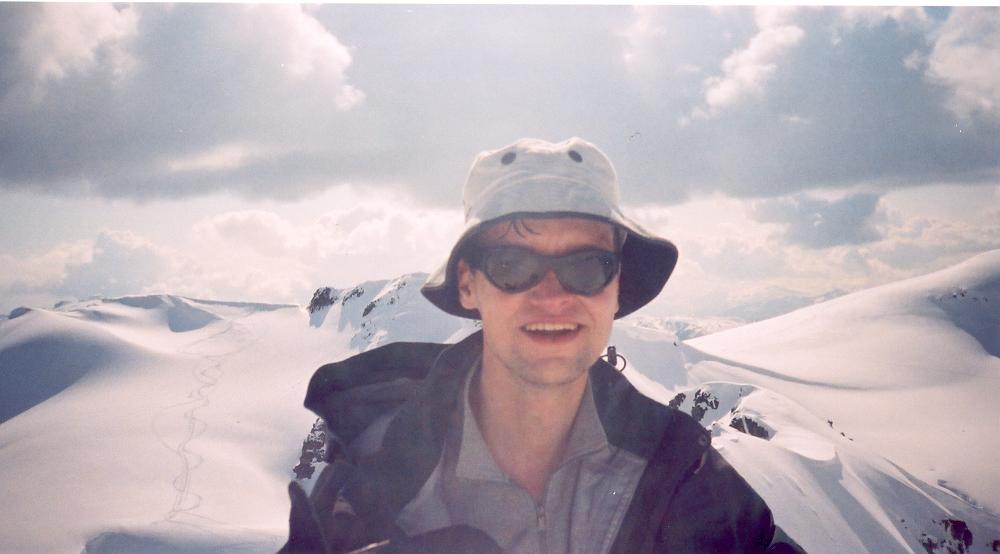
| Prelude | |
| After scoping the area out in late 2002, I had hoped to ski the Spearhead traverse sometime in 2003. In April, our group (Matt, Aaron, Reid, Stock) decided they would do the Névé traverse. As I had skied the Névé previously, I convinced Chris M to join me and ski up Mamquam. As things turned out, I ended up tagging along for the traverse. In early May, Matt, Tim, and I headed up Singing Pass to Russet Lake in the hopes of completing the Spearhead. | |

|
Poor weather led us to stop early in the afternoon and spend the night at the Himmelsbach hut at Russet Lake. The next morning Matt noticed the metal baseplate on one of his bindings was split in two. We worked a temporary fix, first with accessory cord, then with wire and tape: enough to ski back down to Whistler, but not solid enough to complete the traverse. Turns out I too stripped a pair of screws out of my own bindings by sliding into a tree well on the way out. In between the skiing weekends were trips to Skaha, Vantage, Squamish, and Shuksan. We reserved the Victoria day long weekend for a final visit to the Spearhead. The weather forecast looked great. Unfortunately, Reid's family was going sailing for the weekend (probably the better alternative), Tim had some contract work piling up, and Matt fell ill with a cold-flu-bug-thing. Chris M was busy moving or had some other non-skiing excuse and Jan was picking Jay up at the airport. I got on the phone and called Aaron, Mark, Stock, Chris T, and even emailed a friend of Geoff's who I'd heard might be interested. Everyone was busy. So... it appeared the Spearhead would have to wait until 2004. But the conditions were PERFECT: SUNSHINE and lots of it, good SNOW, LOW avalanche conditions, and a Monday HOLIDAY. After talking to Andrea (who did not initially approve of the idea) I decided to head up alone. My plan was to take the first lift up Whistler Sunday, camp on either the Naden or Ripsaw glaciers, and exit Monday evening, with climbs of Fitzsimmons, Tremor, and Decker if conditions, time, weather, and my energy level permitted. |
|
Sunday
May 18 | |
| 5:40 Alarm. Breakfast. Sleepy. Drive to Whistler alone on the road. | |
|
|
8:00 Whistler parking lot. Tape feet. Drink last of chocolate milk and finish cherry-filled doughnut. 8:30 I board the gondola for the lazy approach to Singing Pass using Matt's pass (thanks for the lift Matt!). Up top, neither the Peak chair nor the Harmony chair are running. I wait a bit, then ask staff when the lifts are starting up. They inform me "the Peak chair may start up around noon, when the snow softens up a bit". Noon?! |
|
At 9:30 I decide not to wait for the lifts and skin up to Harmony bowl. I had never skied the musical bumps before; they're quite pleasant. 12:20 Russet Lake. The sun is very hot, but the snow remains good. |
|
1:30 I reach the top of the Fissile/Whirlwind col. It's time for lunch. From here, the standard route either stays high onto the ridge of Overlord or descends northeast, losing much elevation. I was happy to see tracks heading up the high route. Last June I'd needed crampons to get onto the ridge. |
|
It turned out to be icy again; this time I strapped my skis to my back and kicked steps onto the ridge. From here, the Baldwin map again indicates two options, the first travels between Benvolio and Fitzsimmons, and the second heads upward around the south side of Benvolio. I had planned to take the first route, but trail was broken on the southern route and it looked alright. |
|
|
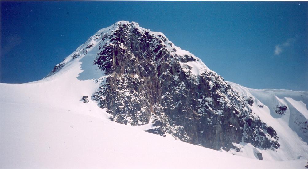
From there, a gentle ski uphill led to the summit of Benvolio. This was an unexpected bonus. I figured I would then ski past Fitzsimmons without climbing it to get more kms behind me today. Skiing down past the south face of Fitzsimmons, I saw an inviting snow couloir heading up. Conditions were perfect. I checked my watch (4:10) removed my skis, checked the map, and decided to head up. |
|
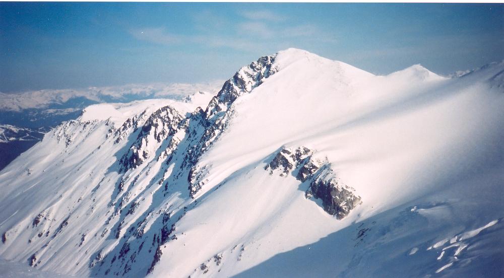
I was on the summit by 4:40 - definitely worth the extra half-hour! A quick descent and ski down the Diavolo glacier (avoiding two very large open crevasses) followed by a seemingly-long uphill climb led to the ridge just east of Iago. I was getting tired by this point. I knew the next downhill across the Iago Glacier and climb up the Macbeth Glacier would be icy in the morning and the guidebook recommends getting to the Naden or Ripsaw glaciers as the halfway point, so off I went. The first two dowhhill bumps were pleasant but the ridge below them, separating the Iago and Macbeth glaciers, had been in the shade for many hours, meaning the steep, long, icy traverse that followed was not quite so pleasant. |

|
After crossing to the sunny side of the ridge, the ski down onto the Macbeth Glacier triggered a few very small sun-warmed surface slides. Interestingly, along the glacier were bear paw prints, heading straight upward. I had seen these last May also, and I'm guessing these guys travel long distances in a migration of some sort, as opposed to looking for food high up in the alpine (where there is none) to head back down into a into some lush snow-free neighbouring valley. The final climb to the edge of the Naden glacier was tiring. I reached the top at 7:00. |
|
|
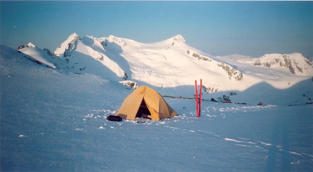
There, I found a great camp spot: flat snow, views of both sunset and sunrise, dry rock on which to cook, some wind shelter, no nearby avalanche slopes. I cooked soup and rice, set the tent, and enjoyed the much-anticipated sleeping bag coziness. After browsing the map, I set the alarm. The first two glaciers tomorrow morning would be relatively flat and could be skied on hard snow; I tried to select a wake-up time that would allow the icy snow on Tremor to have softened a bit before I reached it while maintaining an early start for a potentially long day. The night was cold and, although there was no wind, I did not sleep well. |
|
Monday
May 19 | |
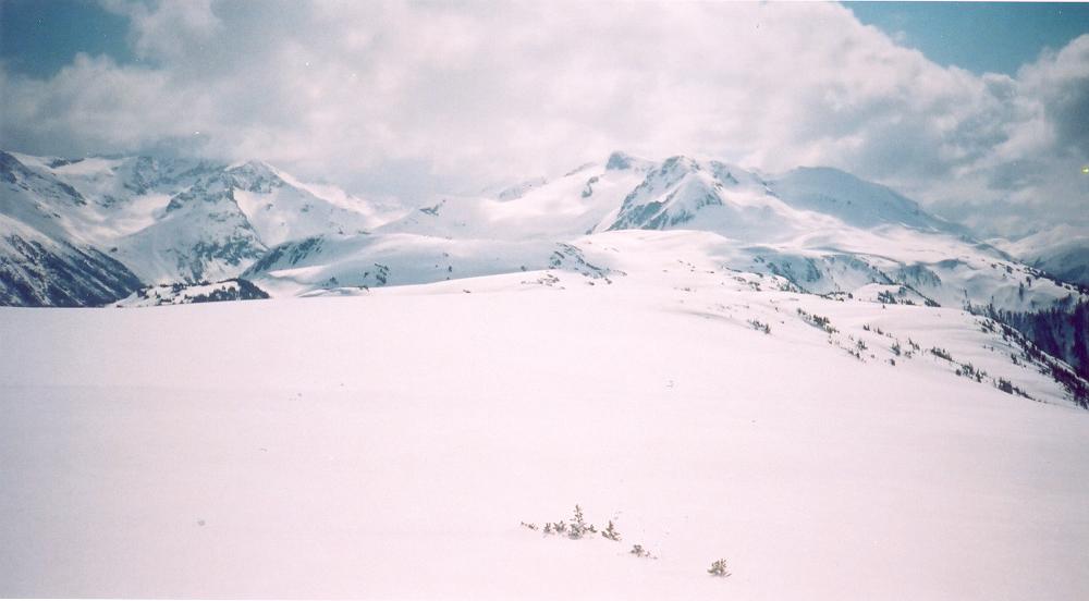
| 5:45 Alarm. The sun is already hitting the tent. H2O bottle number 1 is frozen (next to sleeping bag). I figured it might get cold so I kept bottle number 2 in my sleeping bag. I pack then tent while heating water for oatmeal and hot chocolate. 7:15 A quick ski over the Naden glacier leads to a short icy ridge that requires kicking steps. The ski across the Ripsaw glacier is pleasant. I'm happy to gain elevation first thing in the morning, before being tired. | |
|
The skies are clear. I enjoy the pleasant windfree and peoplefree silence and the deep panoramas to east and south. As I reach the Shudder-Tremor col, I meet two skiers, Trevor and Stephanie from Kamloops, packing camp below Tremor. I had seen them climbing to the Naden glacier a few kilometres across the valley while I was near Overlord yesterday. |

|
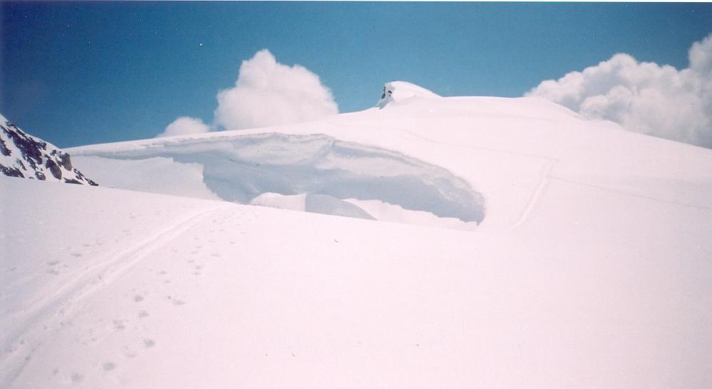
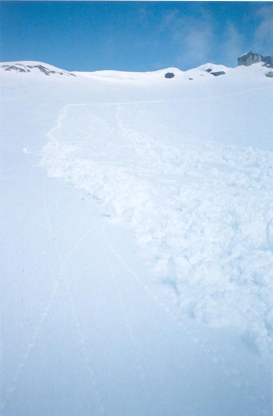
The three of us climb Tremor. Trevor begins a ski descent down the North Face. His first five or six turns are textbook as he keeps his eye open for the approaching bergschrund 100m below. Suddenly, he triggers a large slab fracture line, and he's sliding down in a cloud of snow under a class 2 slab avalanche. |
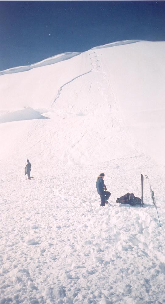
|
The debris spreads for about 100m, averaging .5m - 1m in thickness. Only partially buried, Trevor pulls himself from the snow and let's us know he's okay. Phew! Unfortunately, one of his skis is buried somewhere under the debris. The three of us then spend the next 45 mins probing the snow. Just as I'm starting to think there's no way we'll find it, Trevor calls out success. The two ski ahead of me as I have a snack and check the map. After crossing over to the next glacier and enjoying a gentle downhill onto it, I finally reach the peak I've been seeing from a distance, thinking I've reached Decker. I look the map over again and realize I'm actually standing below Trorey and that Decker is one more glacier over. The route to the summit looks inviting as I consider kicking steps up Trorey. I decide not to go up in an attempt to return to Vancouver for dinner (this will not work out because of traffic and I later regret not climbing Trorey). The sky is beginning to cloud over and the snow is getting harder. |
|
|
A traverse leads to the col east of Decker and then to the summit of Decker. From there, it's a nice powder run down 9th Hole. I meet up with Trevor and Stephanie again and we head up to the Blackcomb/Spearhead col. We ski down the Blackcomb glacier and follow the road for 4km to 1100m at the top of the Excalibur chair. This is the snowline, and it's a steep downhill stomp back to the village. 4:00pm I reach the Blackcomb base, call Andrea, and try to find my way back to the parking lot. |
|
Reference | |
|
Exploring the Coast Mountains on Skis.
John Baldwin. Gordon Soules Book Publishers. 1994.
Garibaldi Provincial Park website. BC Parks. Bivouac Backcountry Whistler. John Baldwin. 1999. 1:25,000. Canada NTS 92 J/2 Whistler 1:50,000. Garibaldi. International Travel Maps. 1:100,000. Garibaldi Provincial Park, BC Parks (pdf) | |
 Click to see all photos.
 | |
