Black Hills 2023
I spent four days from June 13-16, 2023, cycling in Wyoming and South Dakota, starting at Devils Tower, then east and south through Black Hills National Forest.

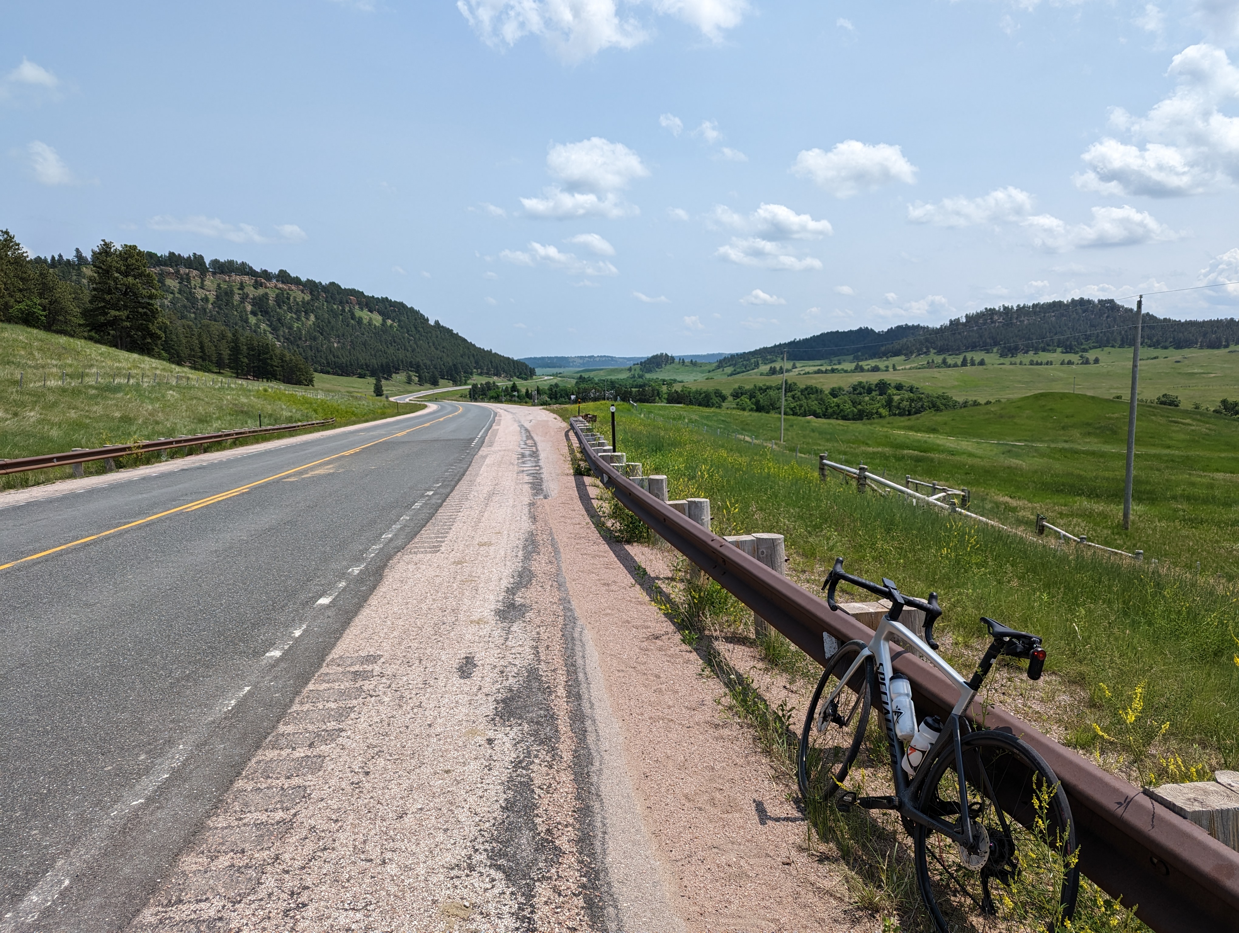
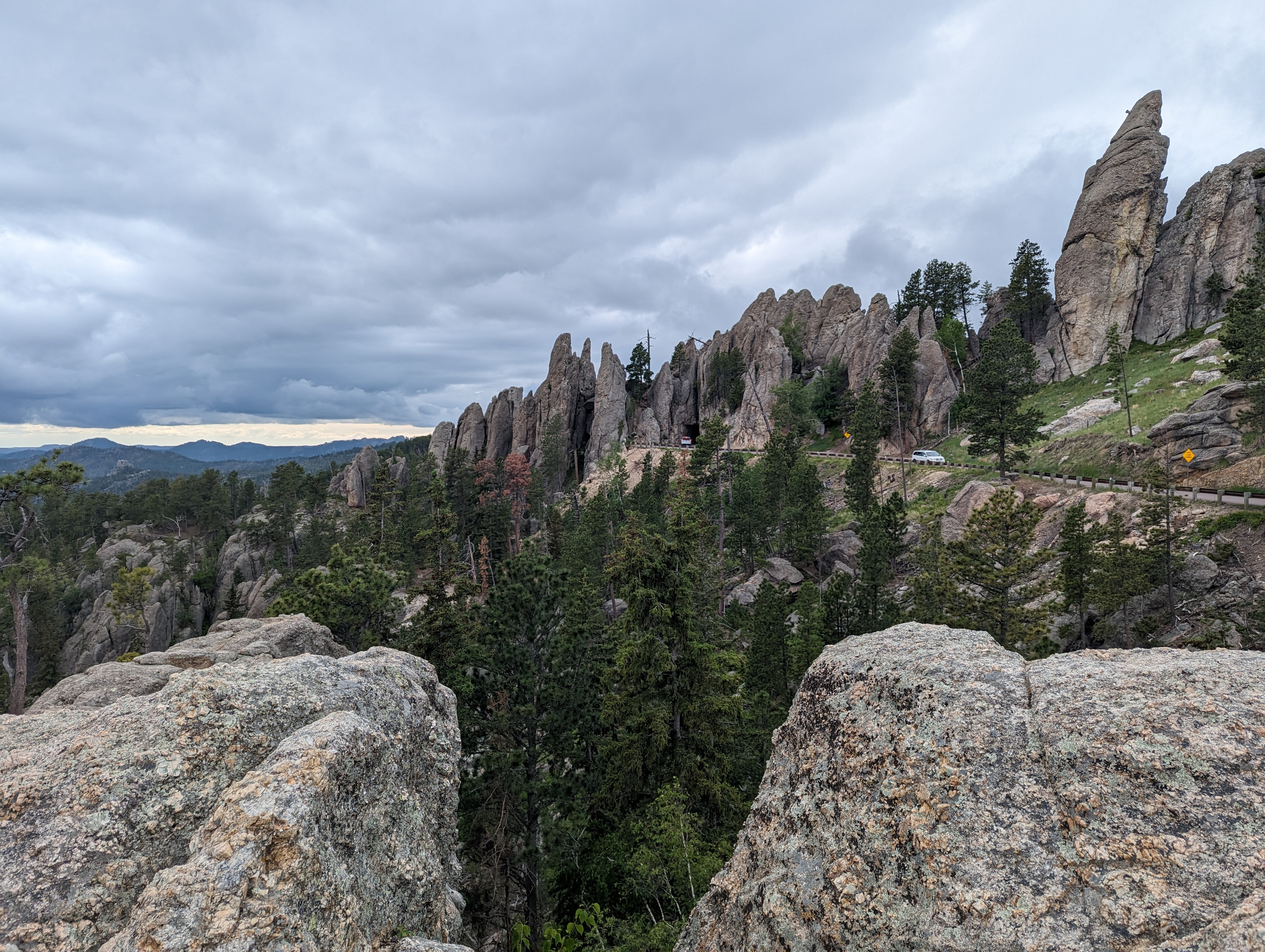
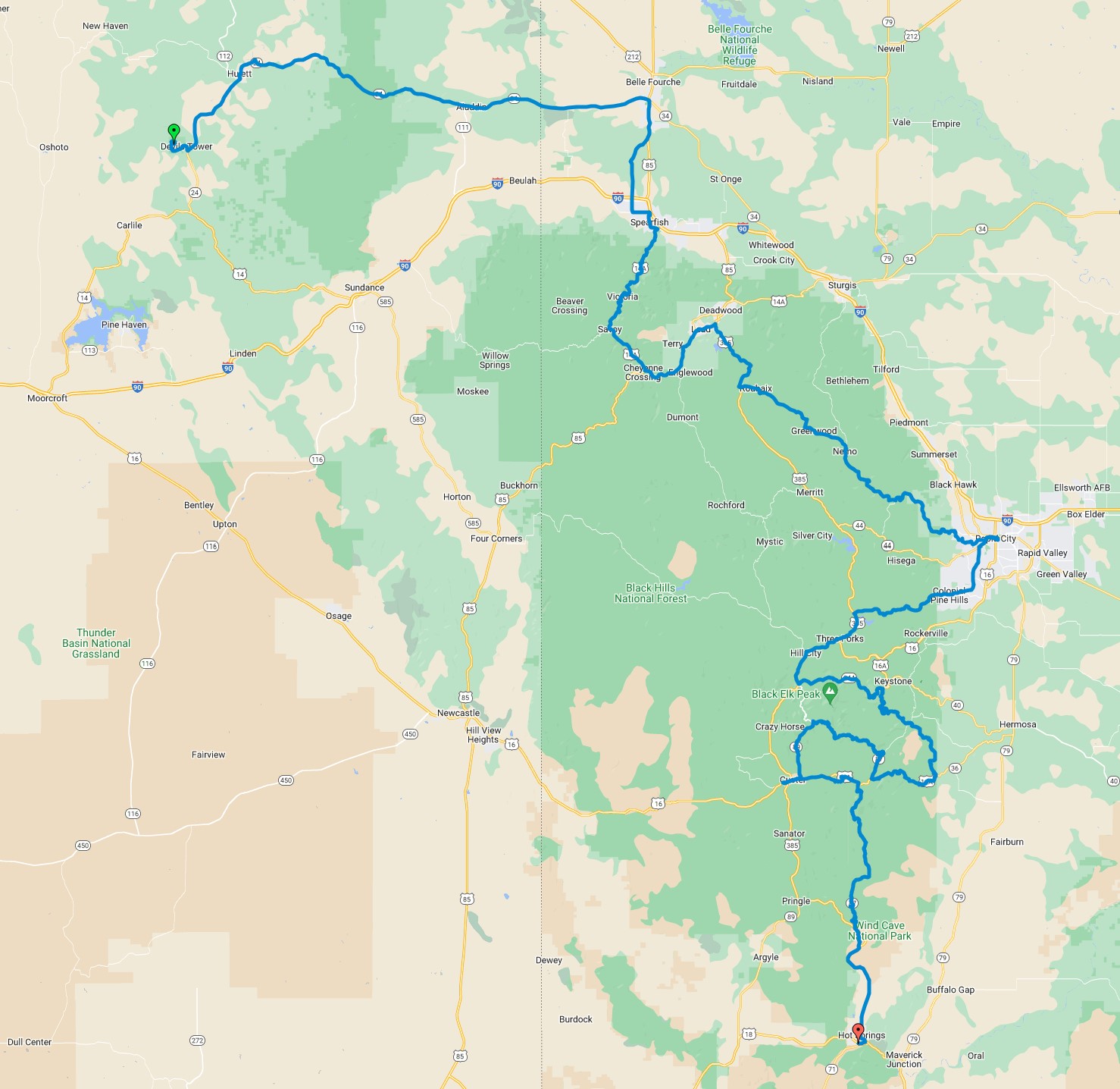
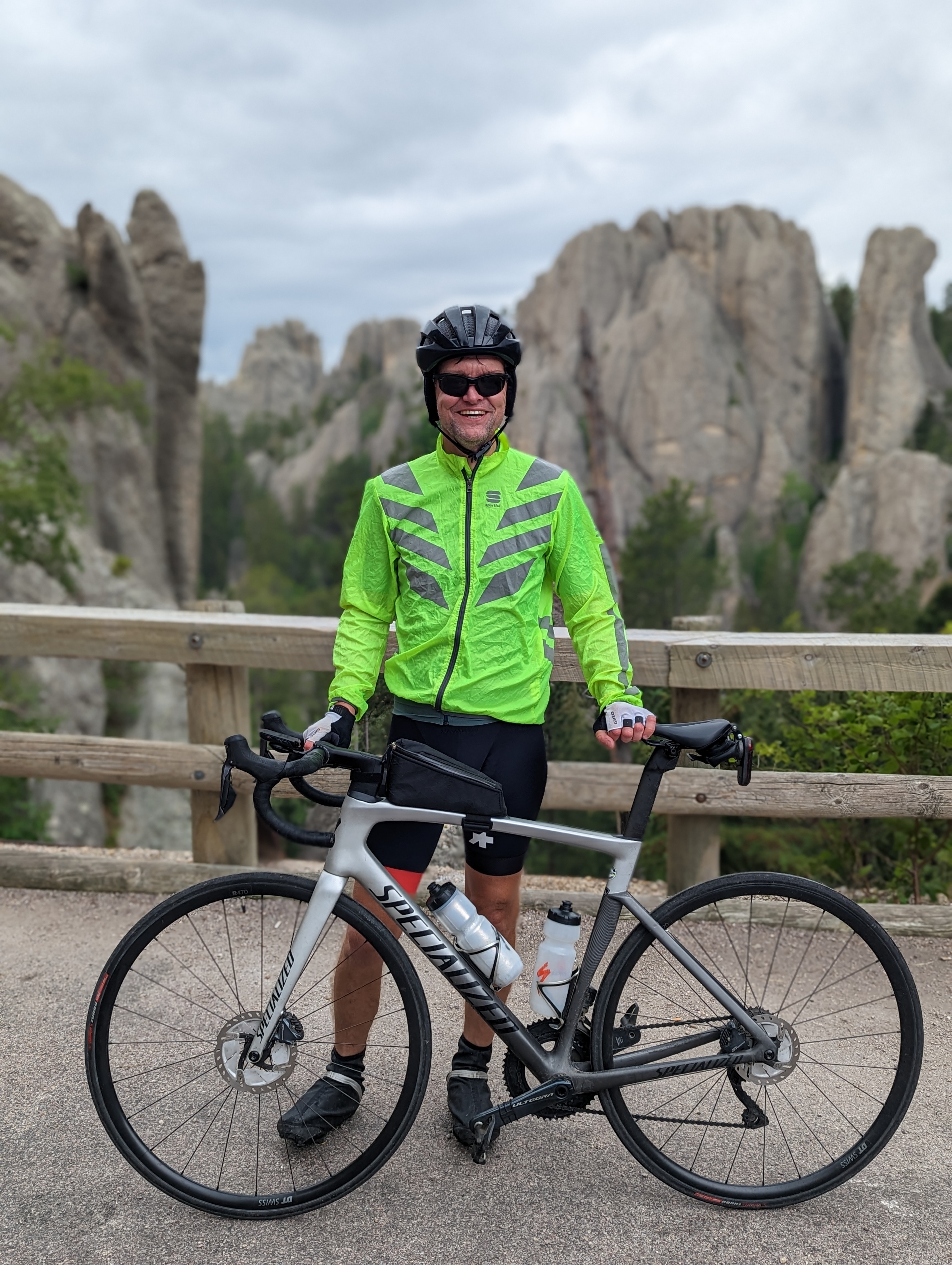
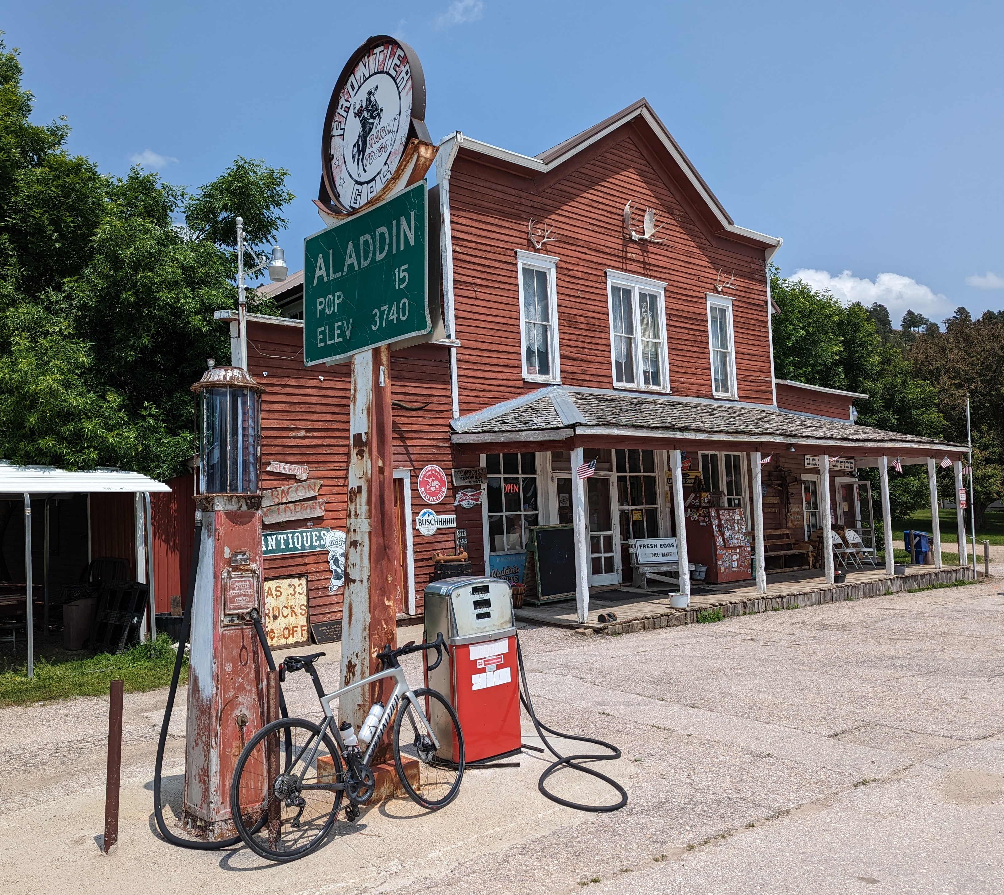
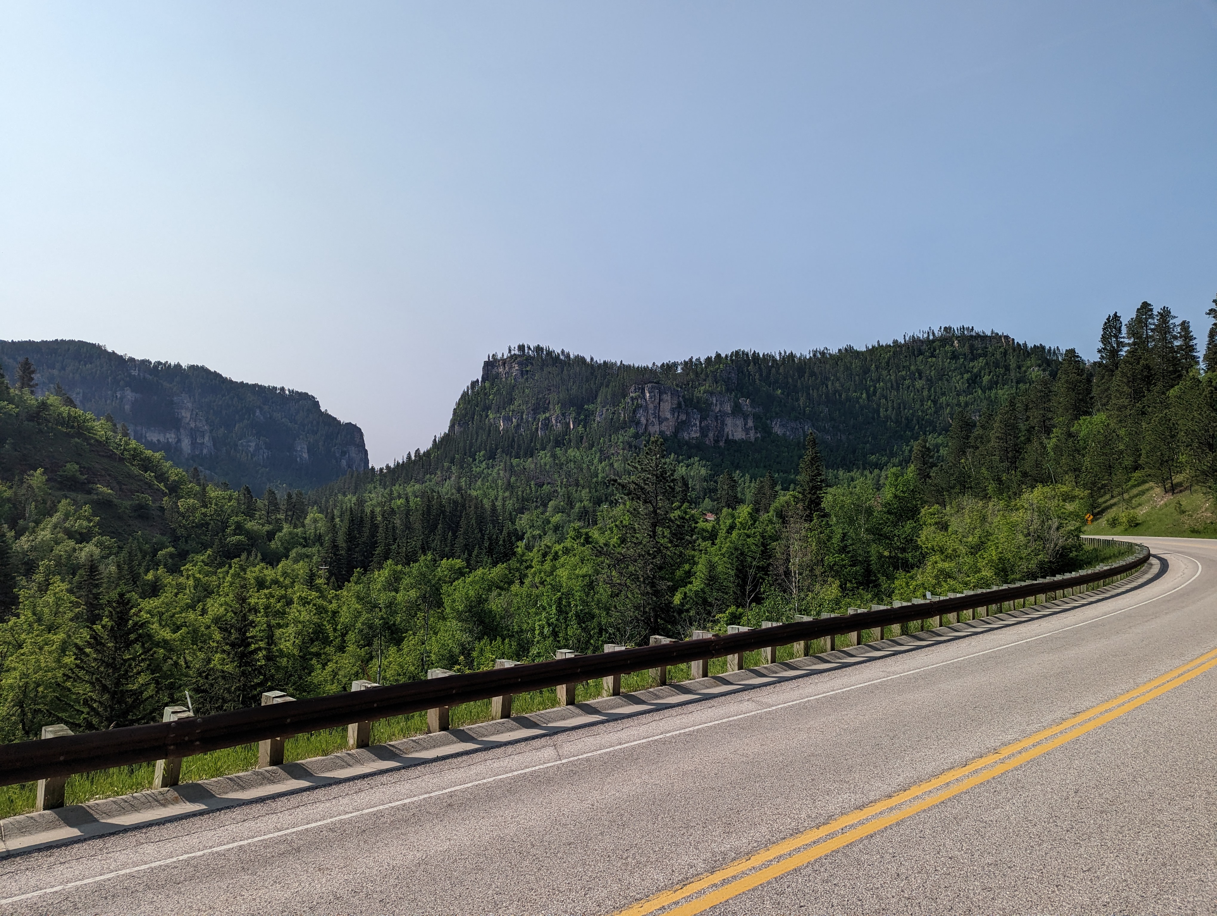
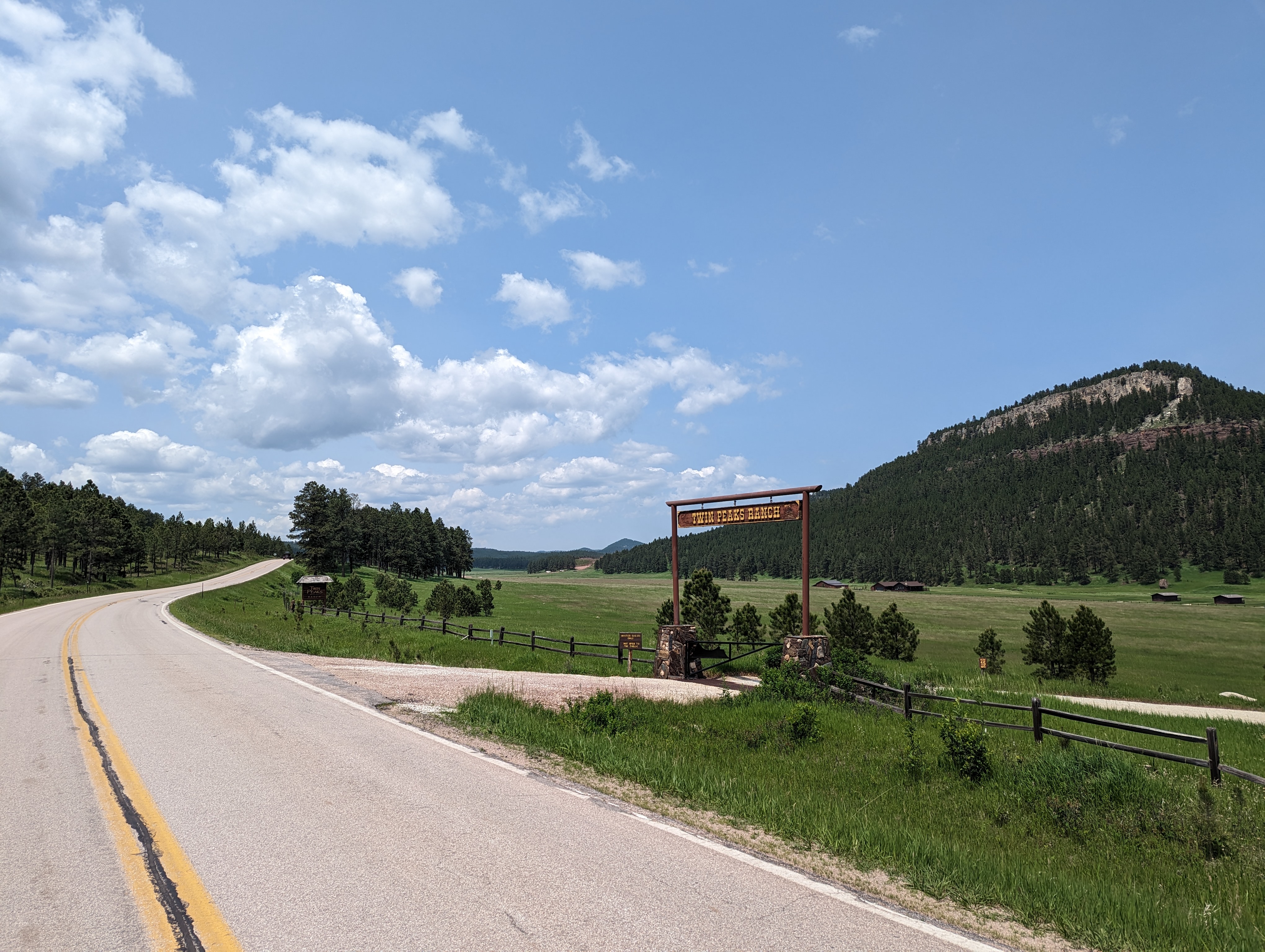
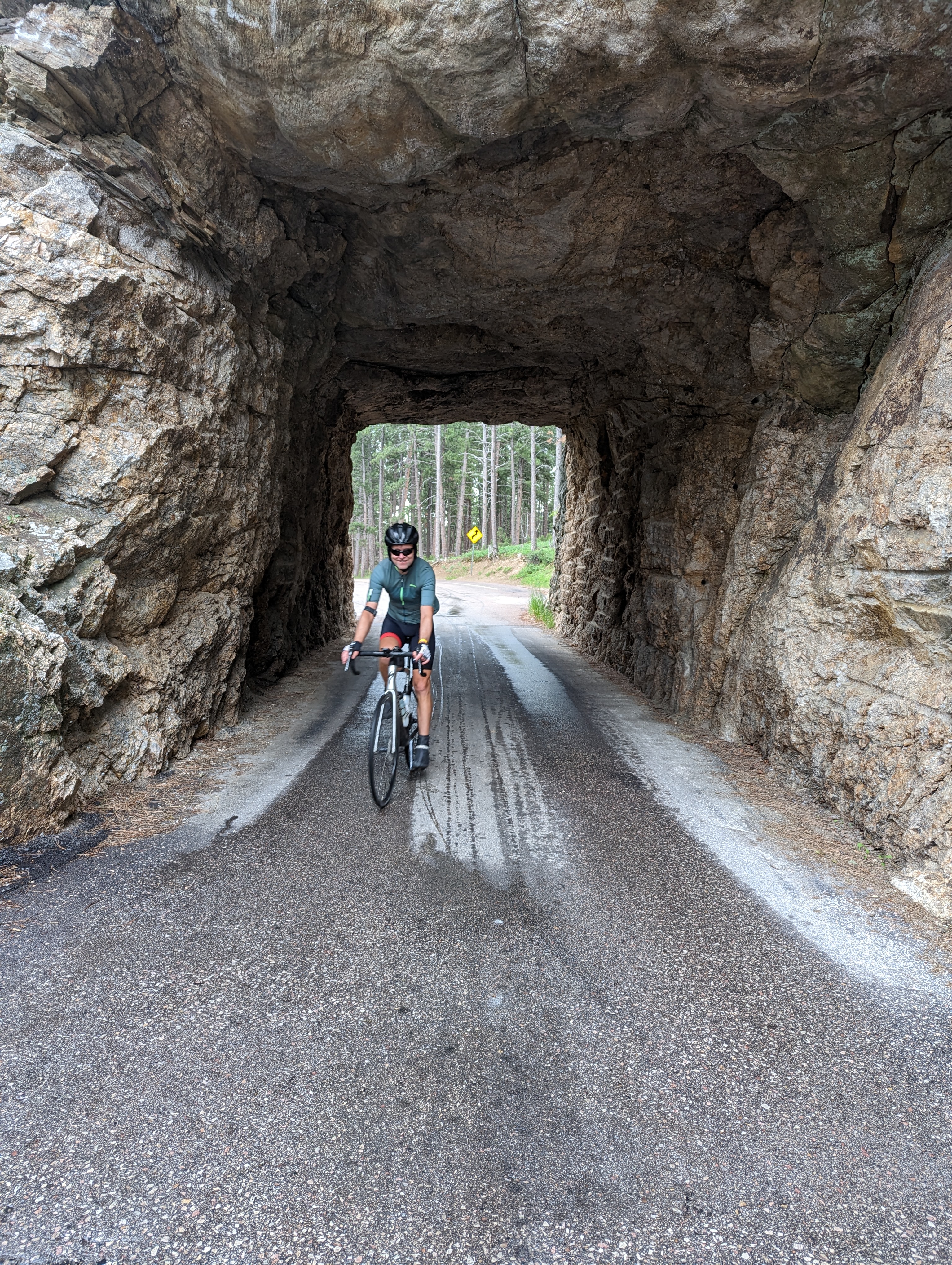
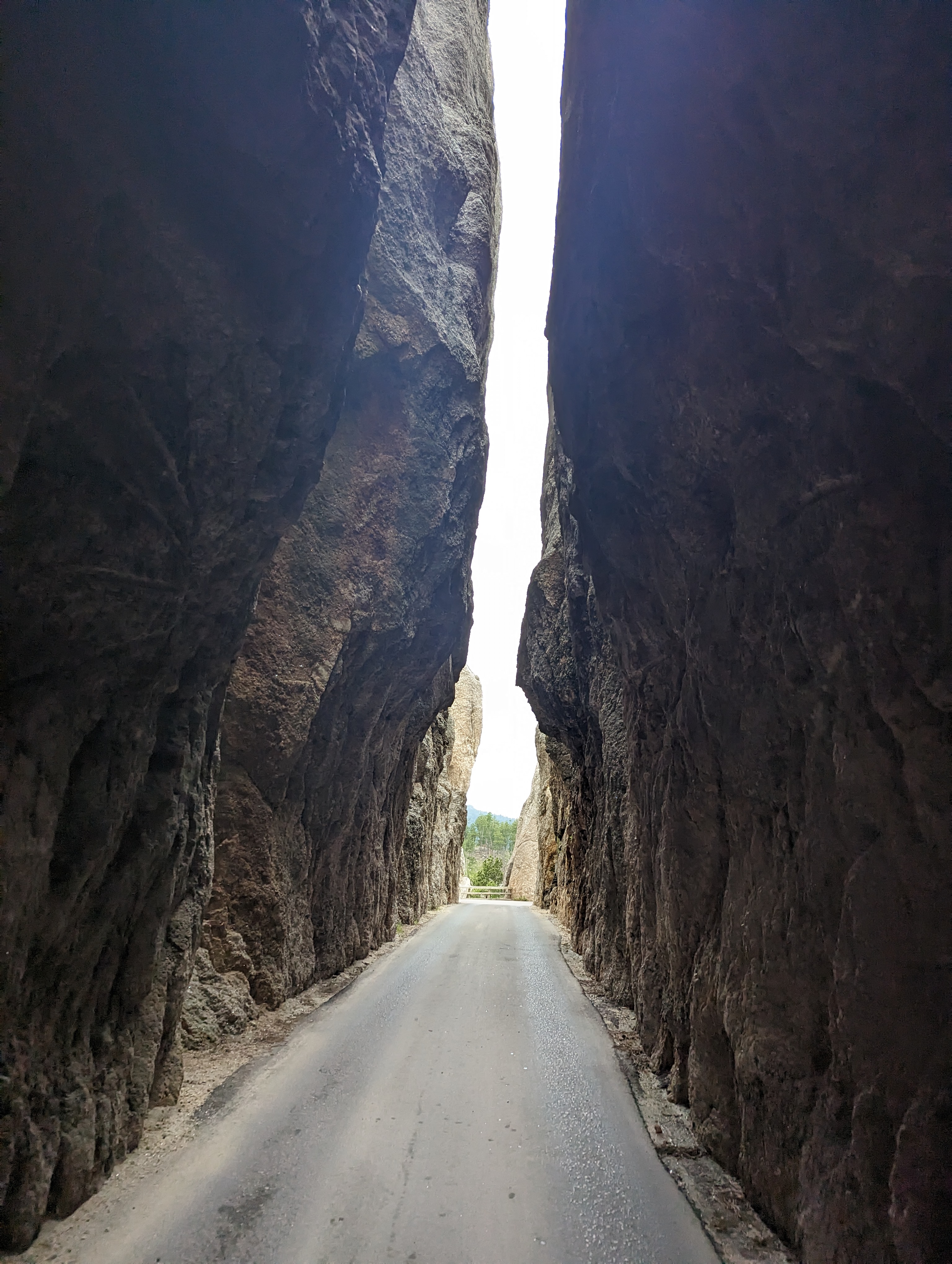
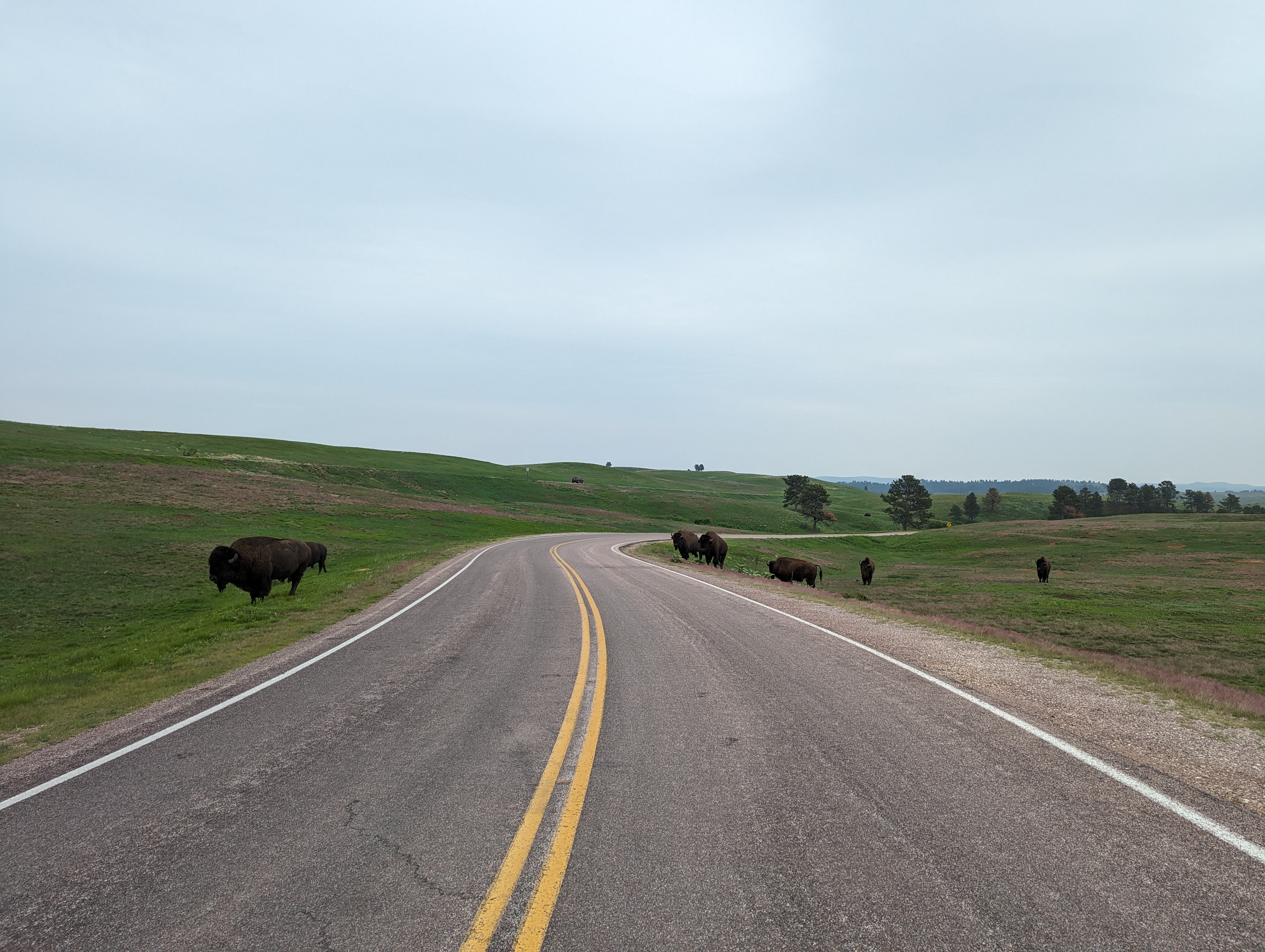
In addition to endless views over gorgeous rolling hills, highlights included cycling to/through/across Devils Tower, Spearfish Canyon, Mount Rushmore, Iron Mountain Road, Needles Highway, herds of free-roaming wild buffalo, mountain goats, horses, and cattle, and the towns of Spearfish, Lead, Rapid City, and Hill City. These are some of the biggest climbs and highest elevations in this part of the continent, through a mixture of beautiful rolling grasslands and granite peaks whose summits reach over 2200 m, with multiple paved cols over 1900 m.

I drove from Winnipeg to Devils Tower with my mother, Christiane, 1100 km passing through Manitoba, North Dakota, South Dakota, Montana, and Wyoming. We met on the road once or twice a day, and at the hotel after each day's ride.

This route has incredible cycling terrain, yet I encountered very few cyclists over four days of cycling, all within 5 km of Spearfish; most visitors to this region travel by internal combusion engine, specifically, by motorcycle, RV, pick-up truck, or ATV. Roads were in excellent condition, most with clean paved shoulders. Some roads had light to moderate traffic, but this was never a problem for cycling (though it might be busier later in summer or on weekends). The Garmin Varia radar was a great help with traffic (see below). The climbs are scenic and interesting, with frequently changing views, a variety of tunnels and loops over brigdes, and tall climbs for this part of the continent (the Needles Highway climbs to 1932 m, with nearby summits reaching over 2200 m).

Despite riding over 400 km of incredible cycling terrain in a popular US tourist desination, amazingly (sadly) I only encountered two or three other cyclists during my four-day cycle tour. Some large climbs (eg, on Day 1) don't even have Strava segments.

total distance cycled: 426 km
total elevation gain: 5542 m
total time cycling: 18 hours, 4 minutes (over 4 days)
average speed: 23 km/h

photo: after climbing the Needles Highway on Day 3
Day 1: Devils Tower to Spearfish
distance cycled: 105 km
elevation gain: 798 m
time cycling: 3 hours, 45 minutes
Strava
After leaving our hotel in Bowman ND, we drove into South Dakota, then Montana, and finally into Wyoming and to Devils Tower National Monument. After changing into cycling kit, I started cycling east, enjoying views back to Devils Tower for miles. Following a quick descent from Devils Tower and 20 km with only small changes in elevation, I enjoyed two 200m climbs (neither of which currently has Strava segments) up to 1424 m, which served as a warm-up for the next few days. This was followed by 40 km downhill, during which I stopped for snacks and water at the general store in the tiny village of Aladdin WY (population 15). I soon crossed into South Dakota and arrived at the town of Belle Fourche, where I turned south for the final 20 km and 150 m false-flat uphill to Spearfish.
photo: I started my ride at the base of Devils Tower in Wyoming, seen here 7 km from my start point.
After checking in to the hotel in Spearfish and showering, my mom and I walked downtown for dinner on the patio at REDwater Kitchen.

Riding a shorter distance worked well for the first day, allowing us to drive 250 km in the morning to reach Devils Tower, start riding before 11:00, and finish at 3:20.

photo: I took a break on the shaded porch of the general store in Aladdin on Day 1.
Day 2: Spearfish to Rapid City
distance cycled: 118 km
elevation gain: 1566 m
time cycling: 5 hours, 13 minutes
Strava
Day 2 started with a 760m climb over 35 km to 1861 m. The route out of Spearfish follows the scenic Spearfish Canyon, towards to the pass below Terry Peak (2153 m). The first 30 km climbs at a comfortable 1-4%, then kicks up to 5-8% for the final 5 km to the pass. I stopped at the resort at Savoy to fill bottles. After a quick descent of 400 m into the town of Lead, I stopped for a pastry and a lemonade at a bakery. Lead maintains the appearance of former gold rush town (apparently, it was the site of the most productive gold mine in the western hemisphere). Continuing downhill from town, I reached another 300 m climb, followed by rolling terrain through forests, and farmland, an another stop for food and rehydration at a general store in Nemo. From here, a few smaller climbs, but mostly downhill to 1000 m, led to my destination for the night: Rapid City.
photo: nearing the top of Spearfish Canyon on Day 2
Rapid City is the largest in which we stayed (population 75,000), spending the night at the Alex Johnson hotel, and eating dinner a few blocks away, on the patio at the Firehouse Brewing Company, followed by ice cream at the Silver Lining Creamery to help cool ourselves from the heat.
photo: riding through ranches toward Rapid City on the afternoon of Day 2
Day 3: Rapid City to Custer
distance cycled: 138 km
elevation gain: 2588 m
time cycling: 6 hours, 40 minutes
Strava
The Queen stage by every metric: total vertical, highest elevation, longest distance, greatest effort, and 5-star scenery! One of the best routes I've ever cycled! Sunny and hot in the morning, then overcast in the afternoon, when the road was always damp, but I never seemed to get rained on. As a result, the wind died, and the temperature was perfect: not too hot climbing, not too cold descending. As a bonus, I managed to keep my chamois on my Tarmac and my wheels on the tarmac while descending on wet switchbacks (still enjoyable and fast despite the H2O, and not so stressful with disc brakes). The climbing was excellent, likely made more enjoyable by the fact that I managed to remain hydrated and fueled (which often requires a conscious effort). My shifters and derailleurs got a workout today.
photo: with my mother, Christiane, at Mount Rushmore on Day 3. This was the only time it rained during the trip (no rain while on the saddle).
After breakfast at Starbucks on the ground floor of my hotel, I cycled out of Rapid City and immediately started climbing. The first 500 m vertical were in the sun, already hot and humid before 9 am. My mother passed me and stopped by the side of the road, allowing me to refill bottles and eat early, which would be crucial throughout the day, with all the climbing ahead. We met again in Hill City, a cute touristy town, where we had hot drinks and pumpkin cake on the patio, as we watched dark storm clouds quickly moving towards us. I rode out of Hill City on a pleasant highway shoulder without much traffic toward Mount Rushmore, across rolling terrain, passing numerous rocky boulders and sharp granite needles (good rock climbing here - I need to specify 'rock' when referring to climbing in a cycling TR). A few raindrops fell and there was distant thunder, but very little rain until I reached Mount Rushmore. I took a few photos, then found shelter in the cafeteria with a doughnut as the rain arrived. I met my mother, we took photos together, the rain stopped, and I resumed my ride (downhill now) on damp roads, but no more rain.
photo: one of multiple tunnels on Iron Mountain Road on Day 3
From this point on was some of the most amazing terrain I have cycled outside Europe. First was Iron Mountain Road, a long winding 6% climb on a beautifully paved narrow road through the forest, with its many tunnels and bridged loops. Next was the spectabular Needles Highways, a longer steeper climb up to 12%, with non-stop incredible views of the surrounding mountains, as the road winds between and through granite needles, and finally to the summit, where I stopped for a break and photos after a challenging climb, before descencing to Sylvan Lake (also gorgeous) and down to Custer.

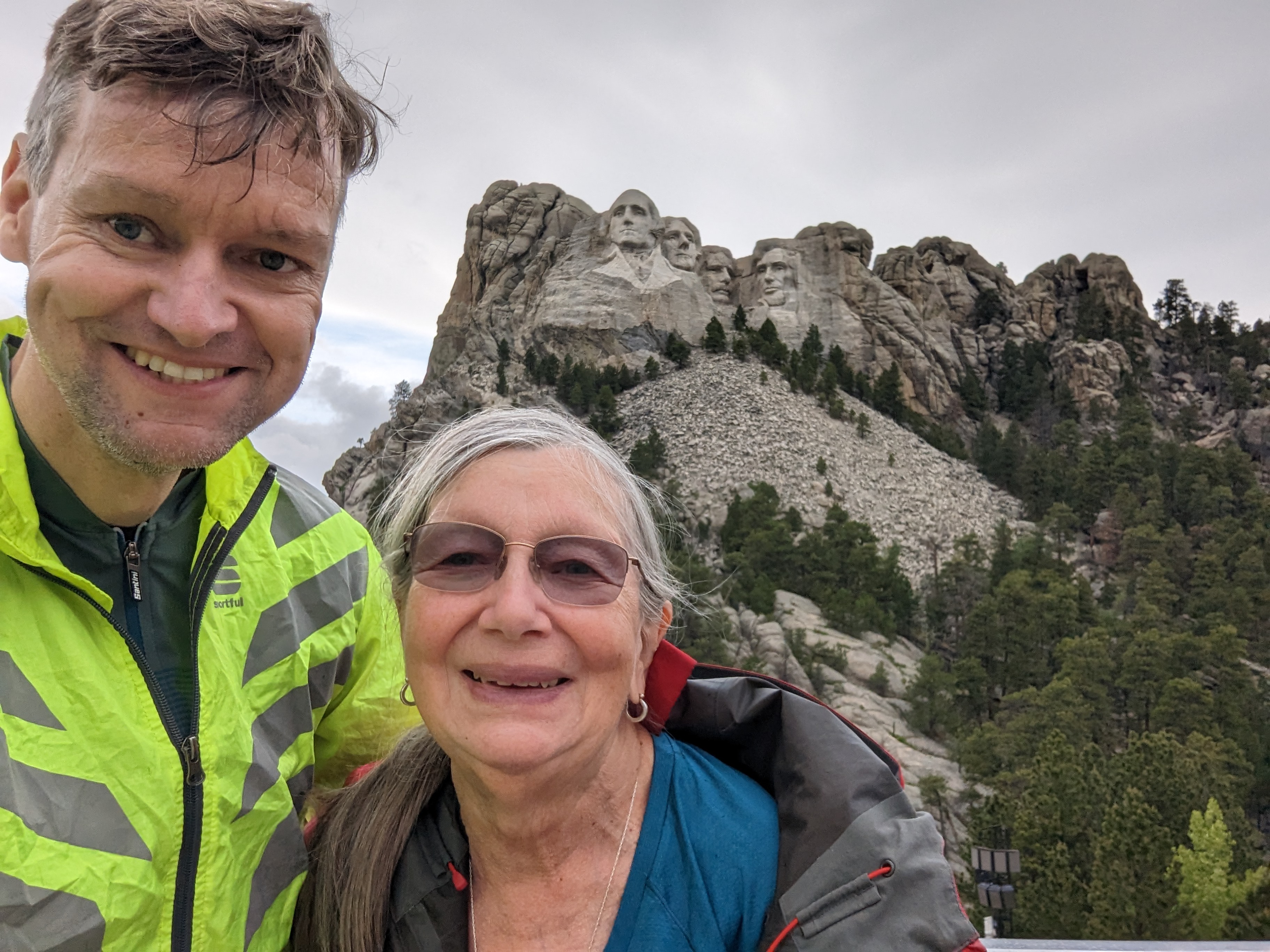
After a long day in the saddle with lots of satisfying vertical, I checked in to the hotel, showered, changed, before enjoying steak and beer at the Mt Rushmore Brewing Company.

photo: The Needles Highway winds its way through several narrow corridors between needles (Day 3).
Day 4: Custer to Hot Springs
distance cycled: 63 km
elevation gain: 590 m
time cycling: 2 hours, 26 minutes
Strava
The weather was overcast and damp today, but with essentially no rain again. The temperature was cooler than on Day 3. The route was straightforward, shorter than on previous days, and with more downhill than up, to allow finishing before noon to start the drive back to Winnipeg. Each of the four days was slightly different than the others; today involved multiple fast downhills separated by short low-grade climbs or flats in open grassland. Most of today's route remained in Custer State Park and Wind Cave National Park, passing through forests and grassland, including herds of wild bison. Crossing cattle guards at 50 km/h is perhaps easier than at slow speed, but more stressful. The route ended in the town of Hot Springs, where I showered at a gym before having lunch, and driving over 1000 km to Grand Forks for the night. A nice finish to this cycling trip!
photo: riding through a herd of wild bison on Day 4
Equipment and Logistics
Unlike previous trips, during which I carried all my gear and clothing with me, this time I only carried snacks, water, flat repair gear, a rain shell, a headband, and a lightweight lock, i.e., what I typically carry on a day ride; everything else remained in the vehicle. Thanks to my mother Christiane Durocher for driving the support vehicle! Partway through the trip I mounted my cockpit bag on my top tube and kept only my wallet and phone in my jersey pockets. In addition to being able to bring more clothes in the vehicle, I could bring additional tools I don't usually carry, such as a floor pump instead of a lightweight pump, along with various spares (tires, cleats, a chain), a larger first-aid kit, etc. In the end, none of these were necessary, as I had no mechanical issues the entire trip, nor any injuries.

I booked hotels 24 hours in advance, once I arrived at my destination for the night and checked the next day's weather. I had planned each day's route months prior, starting and ending each day in larger towns. I rode the routes as planned; there were no road closures. The hotels were good: each was comfortable, clean, quiet, and located within walking distance from restaurants.

photo: non-stop gorgeous views, this one on Day 1
This was my first cycle tour with a Garmin Varia. I can't emphasize enough how useful this was, allowing me to keep my eyes forward, and only doing a shoulder check before turning into a lane. This was also my first cycle tour on disc brakes (happy to have these on long wet descents) and with Shimano Di2 (convenient with so much shifting on rolling hills and longer climbs).

photo: the Needles Highway (Day 3)
Return to Steph's Homepage