Skoki: Fossil Mountain and Mount Richardson
A quick scan of my summit list reveals that my feet hadn't reached the top of a peak since July 16, 2007. Moving to the prairies, becoming a father, and starting a new job were certainly contributing factors to the subsequent hiatus. Almost exactly four years later, on July 17 and 18, 2011, I explored the Skoki area near Lake Louise for a brief two-day tour that would include hiking the loop around Fossil Mountain and visits to the summits of Mount Richardson and Fossil Mountain. The area is well known as a popular destination for both hikers in summer and backcountry skiers in winter, many of whom sleep at the famous Skoki Lodge. Much of the hike is at or above treeline, with excellent views of the surrounding summits, valleys, and alpine lakes. The terrain is comfortable, with gentle grades, moderate elevation changes, well established trails, and short spans between campgrounds (four campgrounds are on the 20 km loop around Fossil Mountain). Several of the peaks have straightforward scramble routes with easy access from the main trail.

This trip provided exactly what I craved: a long hike in the alpine with a couple of fun scrambles (along safe routes) to nearby summits.

photo (left to right): Mount Richardson, Pika Peak, and Ptarmigan Peak as seen from the trail just south of the fork to the Hidden Lake campsite.
Day 1: Hike around Fossil Mountain
distance hiked: 30.7 km
peaks summited: Fossil, 2946 m, Southwest Face
9:00 am. From the Fish Creek trailhead (1698 m), the hike begins by following the Temple Fire Road for 3.8 km through the Lake Louise ski resort to reach the Skoki trailhead. After another 3.5 km under pleasant tree cover the trail reaches the Hidden Lake campsite (2200 m).

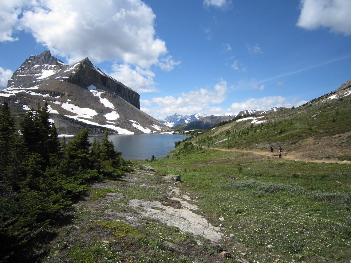
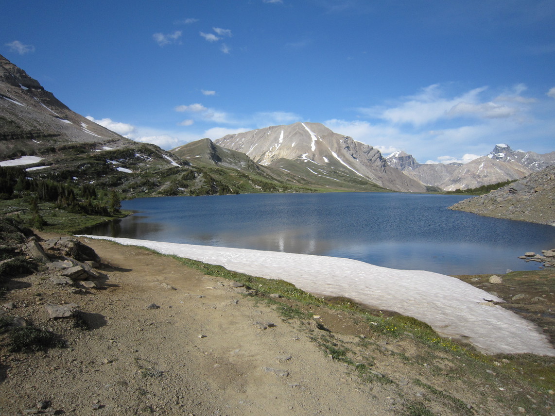
11:00 am. I set my tent, hang my food, drop most of my gear, and continue northeast along the trail over Boulder Pass (2345 m) and around Ptarmigan Lake.

photo: looking southwest toward Ptarmigan Lake and Redoubt Mountain
The trail continues east to the junction for Deception Pass. From here I hike east across Baker Lake, south of Fossil Mountain, and turn north over Cotton Grass Pass. The majority of the overnight traffic seems to be concentrated on the routes to the lodge or to Baker Lake. The hike over Cotton Grass Pass is sufficiently distant from the trailhead that most day hikers have disappeared, resulting in some quiet kilometres through the valley.
photo: the Wall of Jericho as seen from Jones' Pass near Skoki Lodge
The trail forks east over Jones' Pass (2210 m) and the north end of Fossil Mountain. After the pass, forks lead northwest to Skoki Lodge or south to Deception Pass.
photo (left to right): Ptarmigan Peak, Zigadenus Lake, Myosotis Lake, and the Wall of Jericho, as seen while hiking south toward Deception Pass
The trail climbs gently southward to Deception Pass.

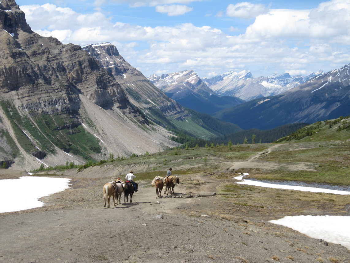
3:00 pm. I reach Deception Pass (2485 m) and stop for a half hour break. I meet a large guided group headed for the lodge as well as a group on horseback.

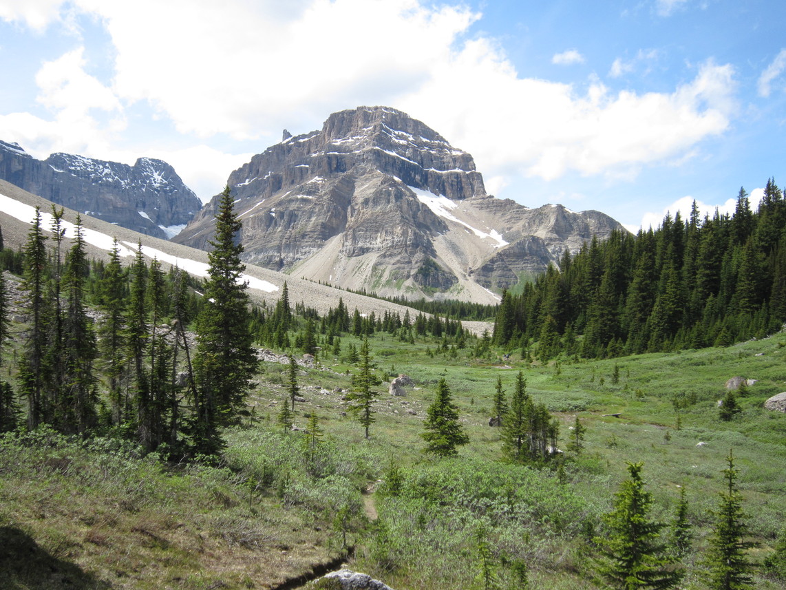
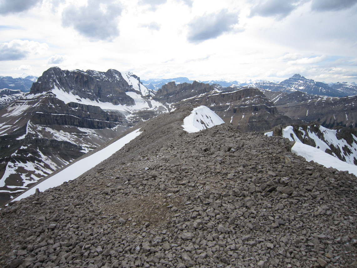
3:30 pm. I leave the trail and ascend the southwest face of Fossil Mountain. As described in the guidebook, the route is mostly loose scree.

photo: Five horses and two riders cross Deception Pass. To the left is the Wall of Jericho.
5:00 pm. The view from the summit makes the climb worth the trouble. The quick descent helps redeem the slog up: a long snow patch allows boot skiing and avoids much of the scree.
photo: the view northwest from the summit of Fossil Mountain (2946 m)
Back at Deception Pass, the return hike is pleasant over familiar terrain: around Ptarmigan Lake and over Boulder Pass.

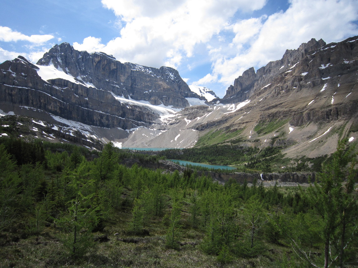
6:30 pm. I arrive at the tent at the Hidden Lake campground, cook dinner, and relax. It rains overnight.

photo: The southwest face of Fossil Mountain as seen from across Ptarmigan Lake, near Boulder Pass. Note the obvious descent line on snow.
Day 2: Mount Richardson
distance hiked: 17.7 km
peaks summited: Richardson, 3086 m, Southwest Ridge
6:30 am. The sky is clear. I rise and cook breakfast.

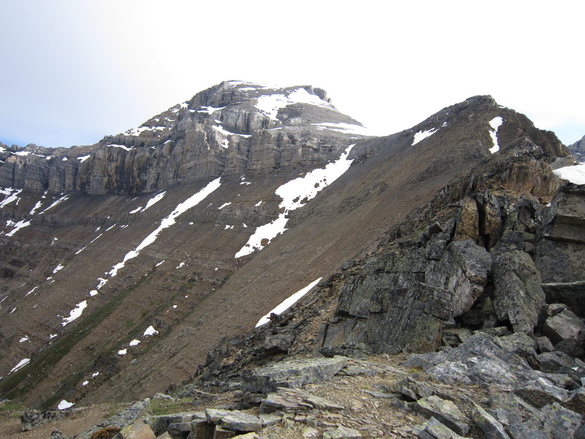
7:30 am. I head north to Hidden Lake and west to gain Richardson's southwest ridge.

9:00 am. I reach the ridge crest. The sky has clouded over, a heavy wind blows over the north side of the ridge, and rain is falling. I stop to see what the weather holds: heavy rain and fog can be seen across the valley over Lake Louise and Mount Temple. If the weather worsens I will descend.

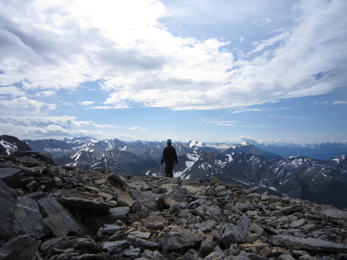
9:45 am. The sky begins clearing. The rock dries almost instantly. I resume the climb and start traversing the ridge. The route involves an enjoyable combination of hiking, scrambling over easy rock along the ridge crest, climbing scree, and kicking steps up 45° snow.

photo: the southwest ridge of Mount Richardson, as seen from just below the hump
11:00 am. I reach the summit. An immense summit cairn provides shelter from the wind while I sit to eat. I decide against continuing the traverse over Pika and Ptarmigan Peaks as I had considered doing. Although the route on Pika's appealing west ridge is free of snow, that route is steeper and the possibility of rain is a concern (the rain indeed returns a few hours later). Also, the late spring and cooler temperatures have left a few large cornices on the traverse across the Richardson-Pika col. Furthermore, the usual descent from Pika involves a traverse across to Ptarmigan over snow-covered scree slopes above steep rock faces. These would likely be fine, but the combination of possible rain, cornices, and snow on the traverse lead me to opt for a safe descent by reversing the ascent route.
photo: self-portrait as I begin the descent of Richardson
12:30 pm. I arrive back at the tent after a straightforward and pleasant descent.

1:00 pm. I begin the hike out.

2:30 pm. I arrive in the parking lot, where a friendly German couple offers me a lift to the Lake Louise village.

4:20 pm. Bus leaves the Lake Louise village.

6:50 pm. Arrival in Calgary.

photo (left to right): Mount Richardson and Pika Peak above Hidden Lake. The scramble route follows the ridge from the left up Richardson. The traverse continues across the Richardson-Pika col on the horizon and up the West (left) Ridge of Pika. The usual descent from Pika requires reversing the West Ridge, and traversing east (right) between the two dark bands of rock below the south face of Pika. Alternatively, one can return back over Richardson.
Return to Steph's Homepage