Swiss Alps Cycling Tour 2022
Reid Holmes and I spent five days from May 23-27, 2022, cycling in the Swiss Alps from Lausanne to Zürich, through the cantons of Vaud, Bern, Fribourg, Obwalden, Nidwalden, Schwyz, Uri, Glarus, and Zürich. We climbed Col de la Croix (1776 m), Col du Pillon (1546 m), Brünigpass (1008 m), and Klausenpass (1948 m).

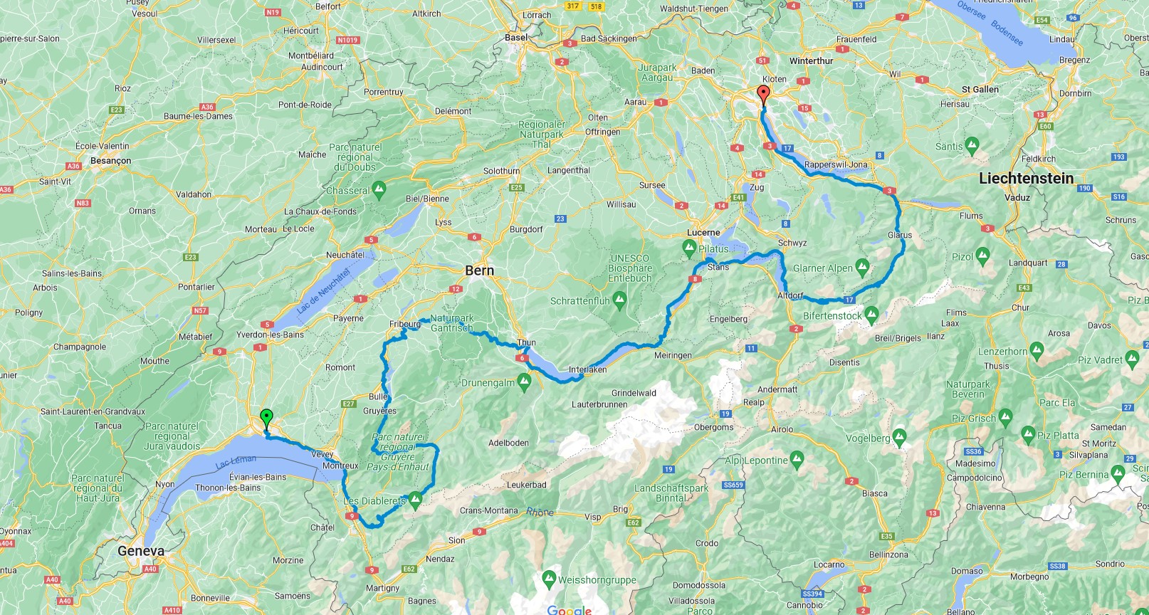
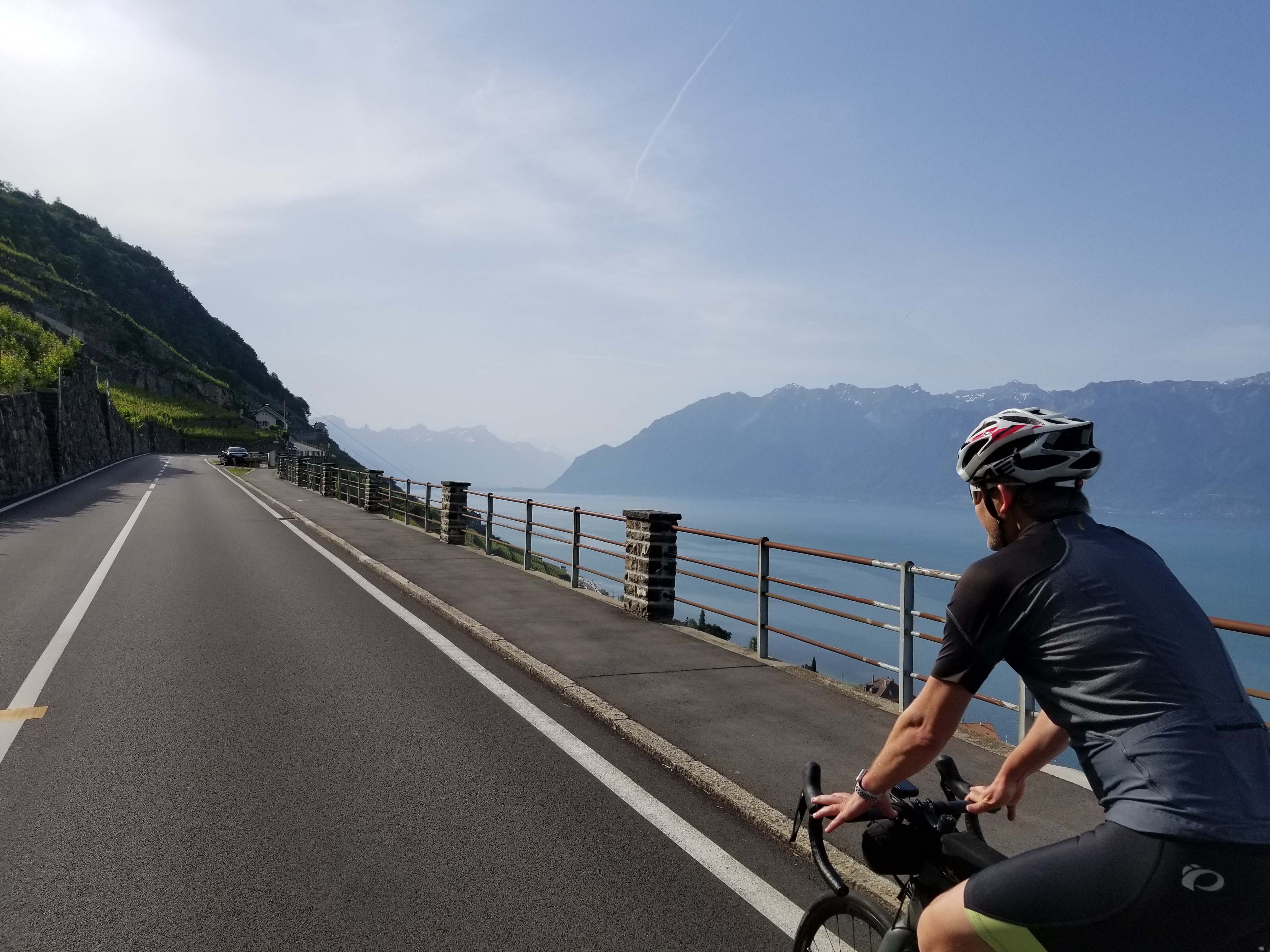
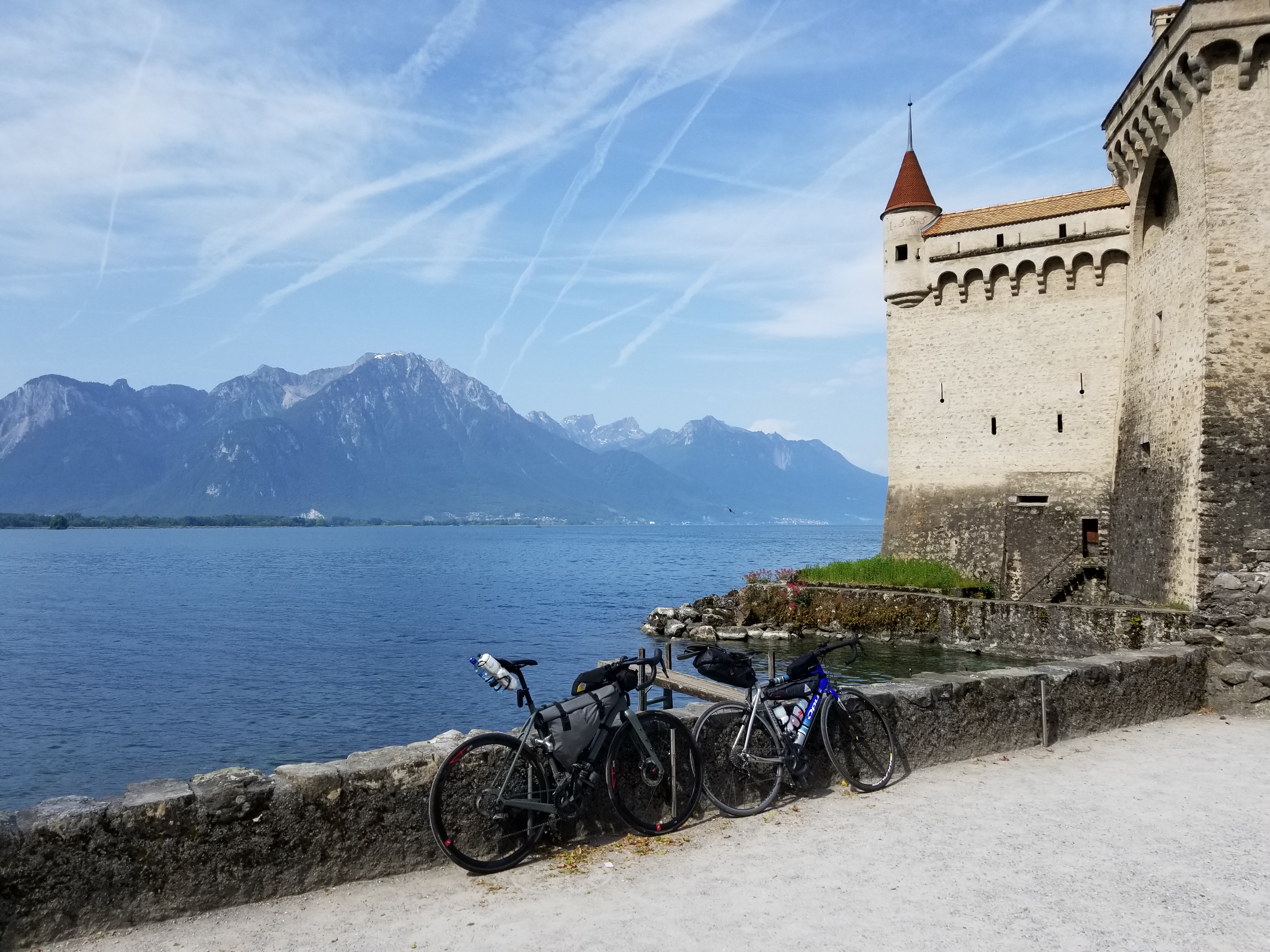
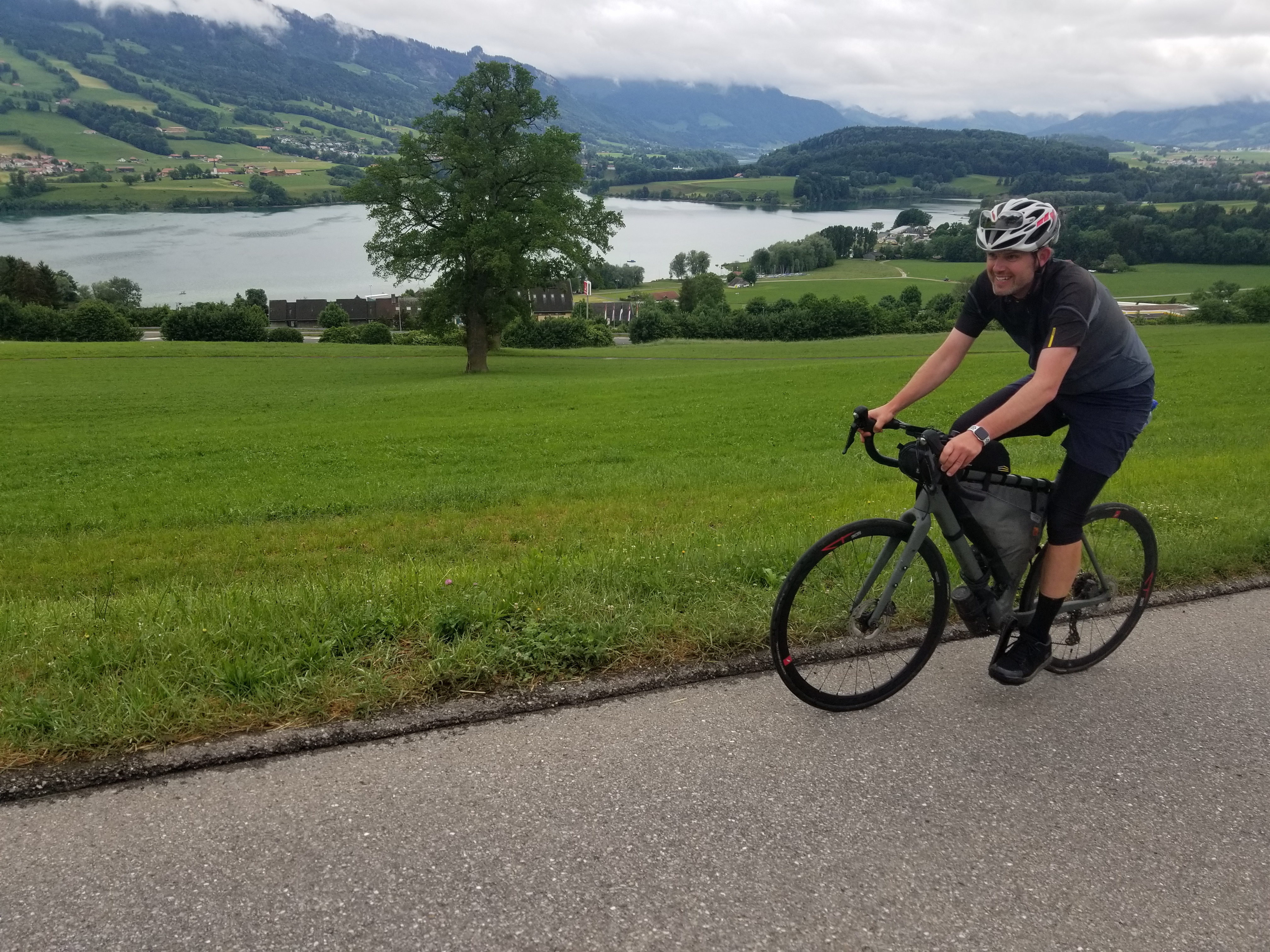
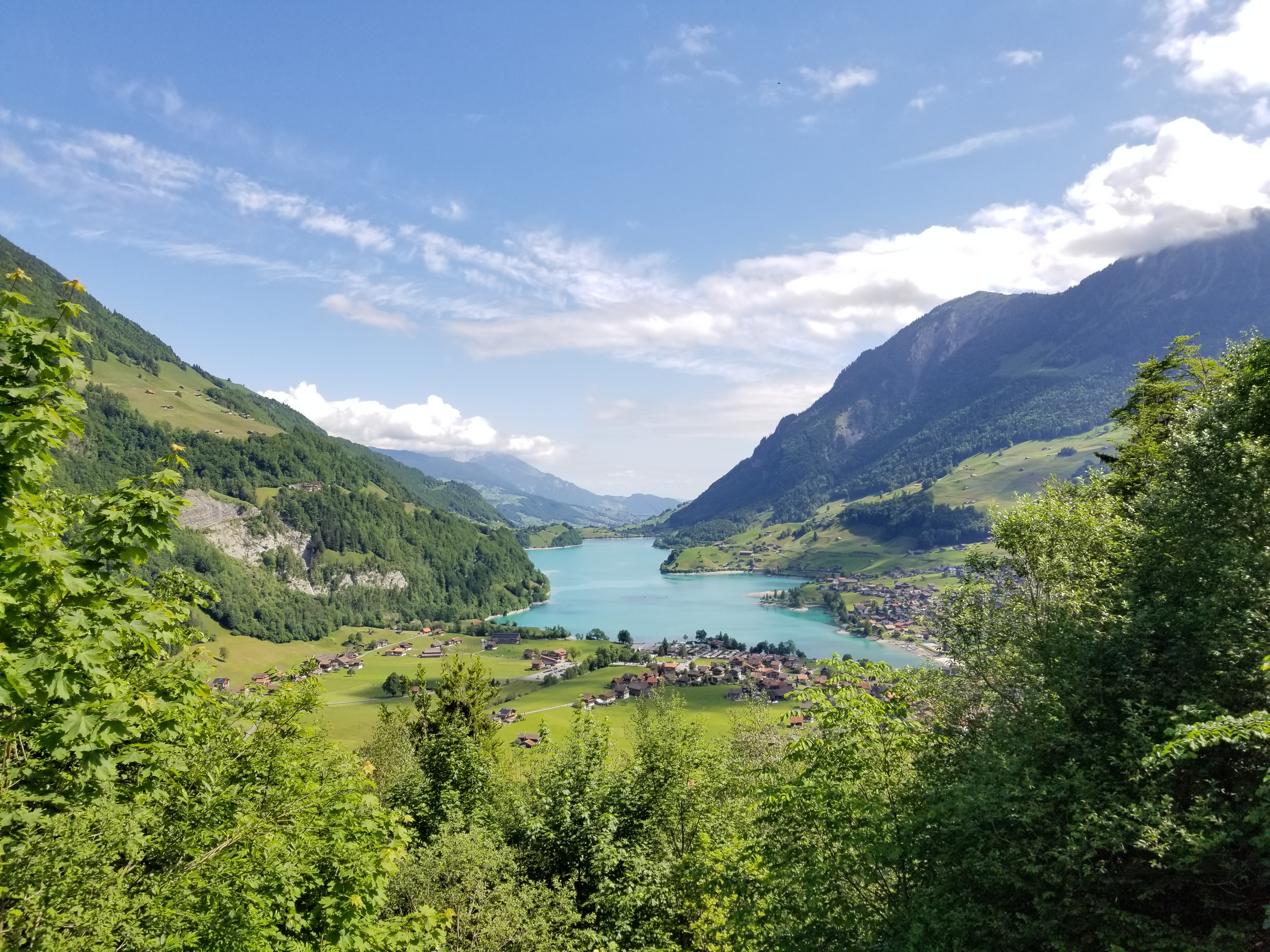
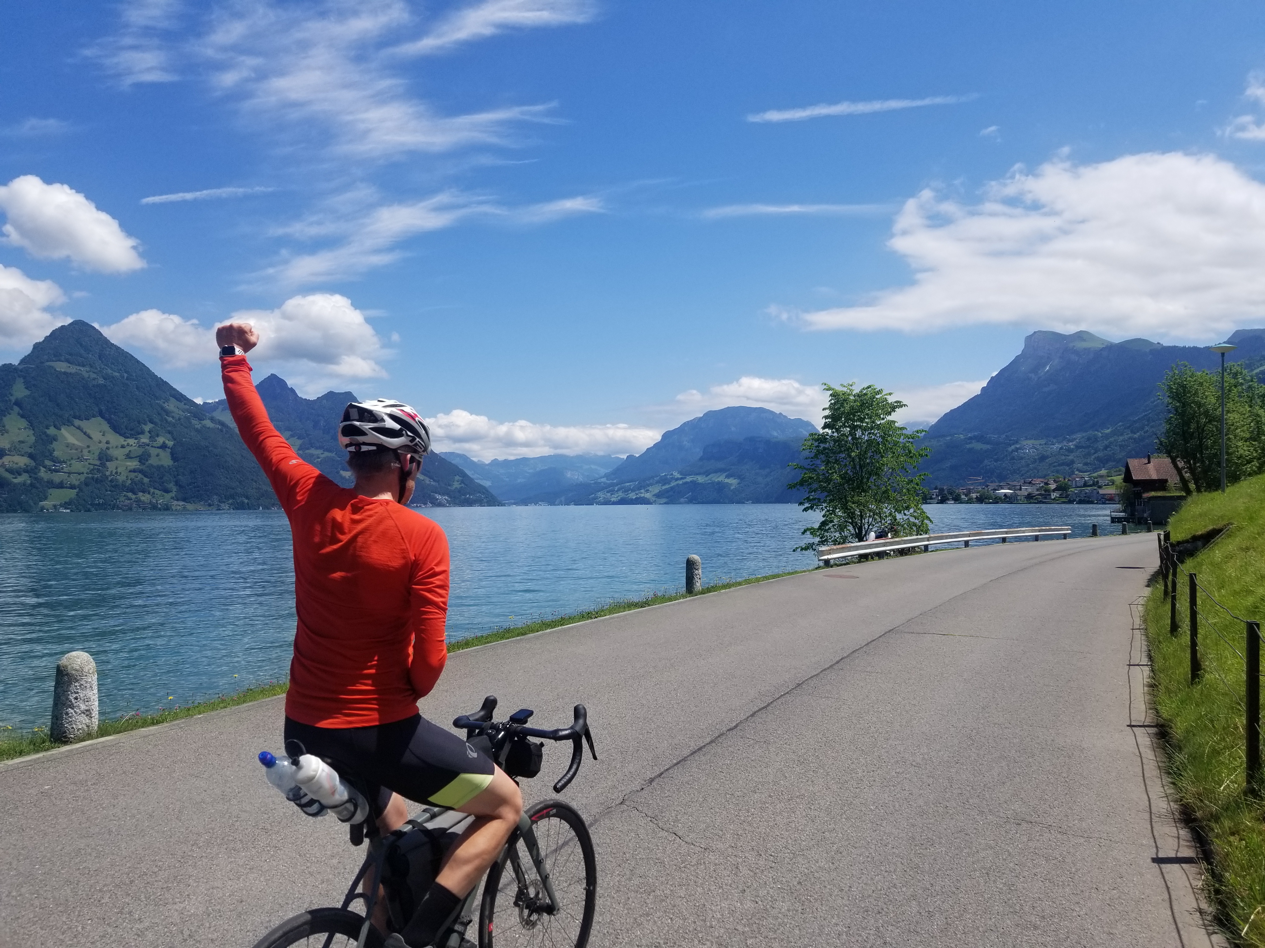
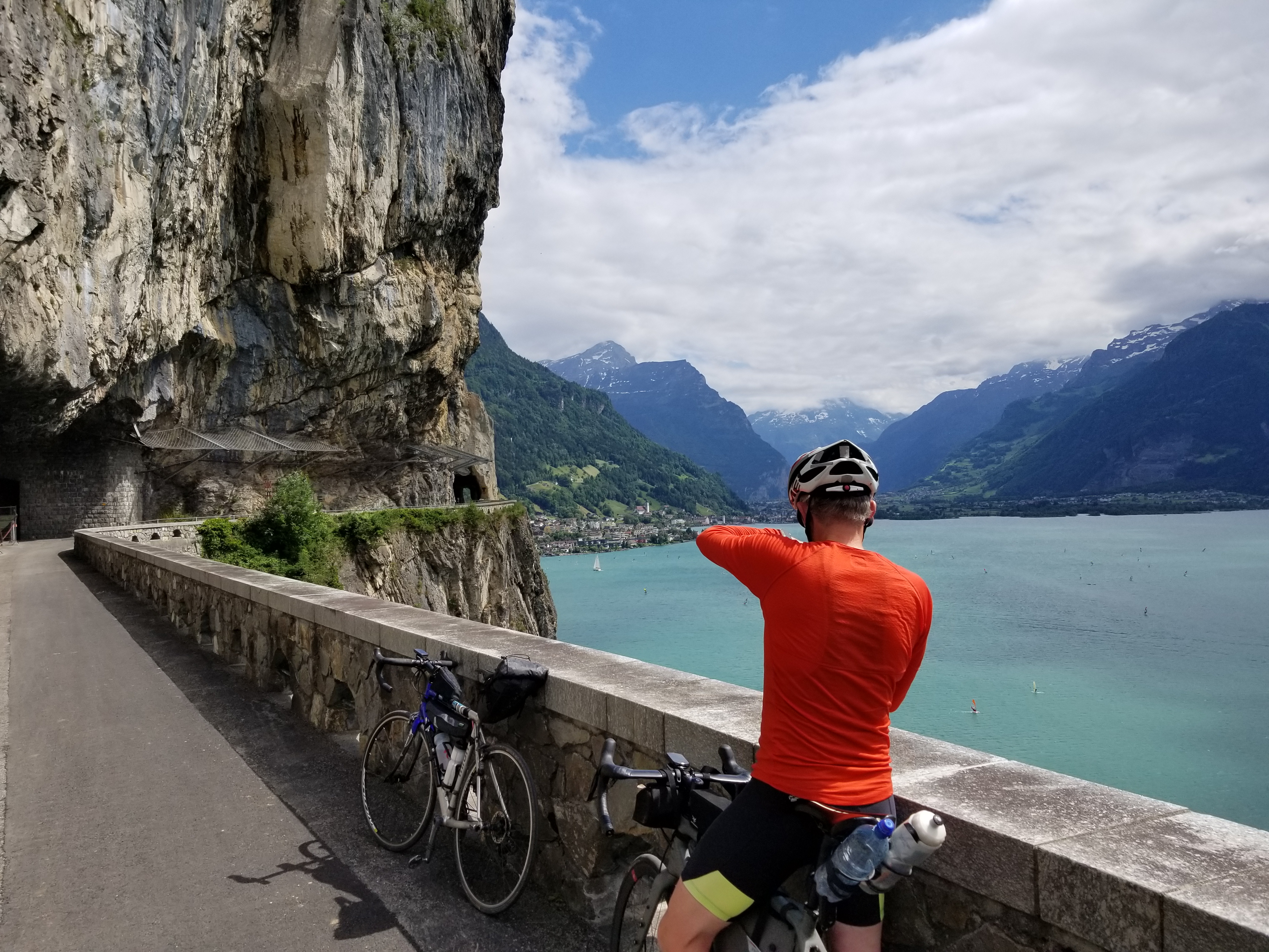
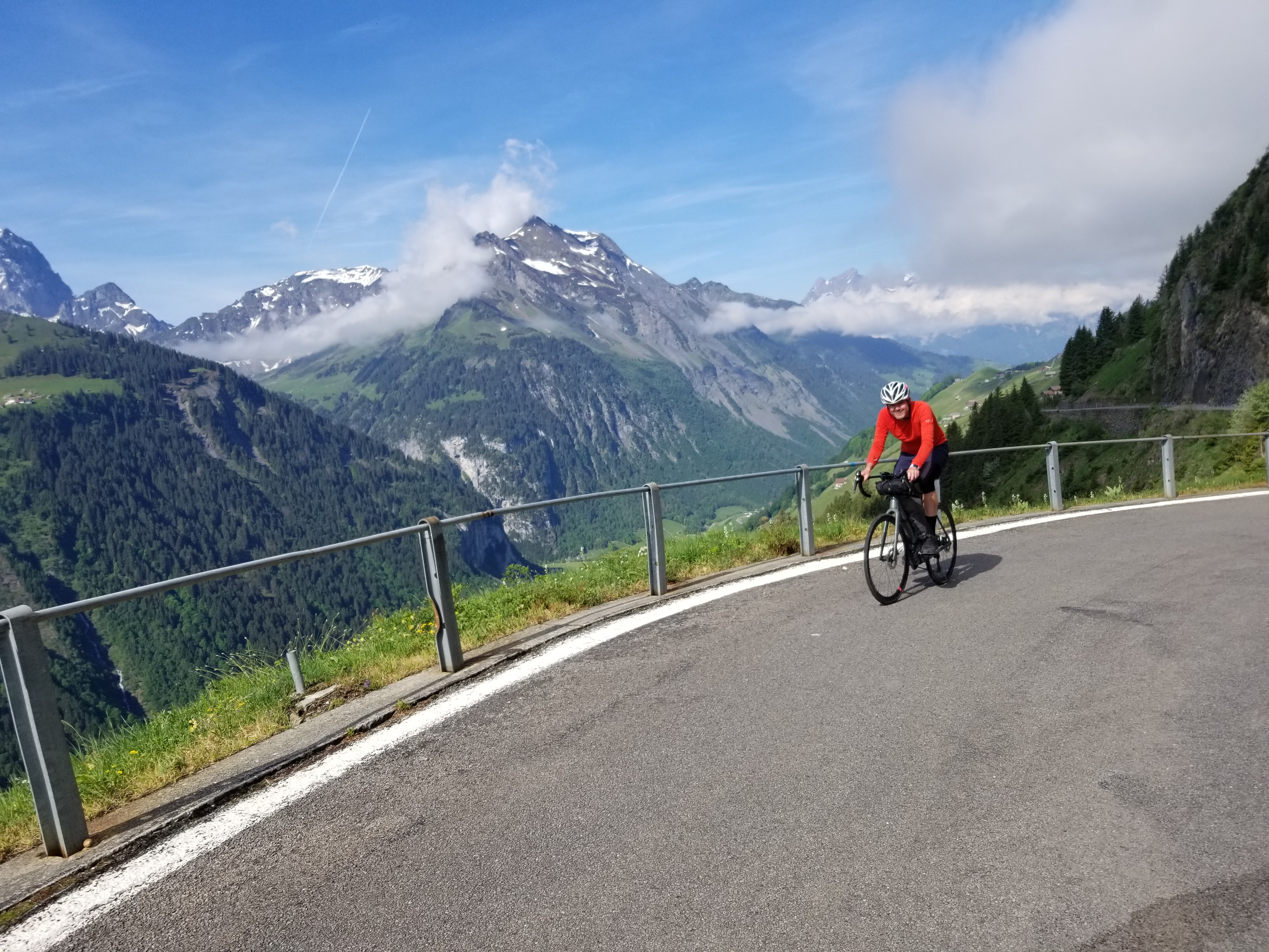
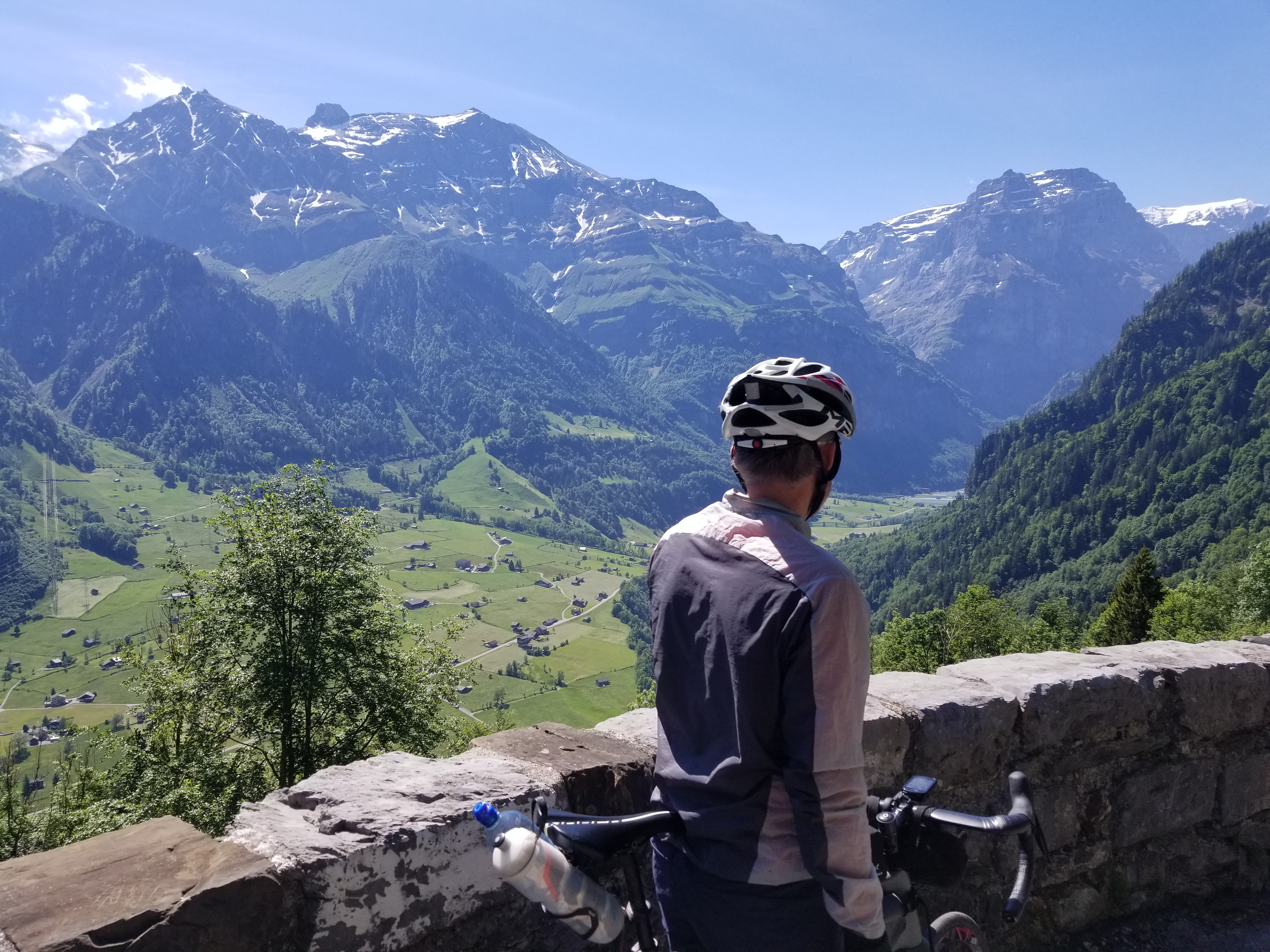
In addition to the climbs, highlights included gorgeous lakes: lac Léman (Lake Geneva), lac de la Gruyère, Thunersee, Brienzersee, the spectacular Lungerersee on the descent from Brünigpass, Samersee, riding along the cliffside trail overlooking Vierwaldstättersee (Lake Lucerne), and Obersee; castles: Château de Chillon in Montreux, Château de Gruyères, and Schloss Thun; stopping in the towns of Gstaad, Fribourg, Thun, Interlaken, Brienz; coffee (with cake) stops in cute villages twice a day; and comfortable (and quiet) hotels every night with dinner on a terrasse.

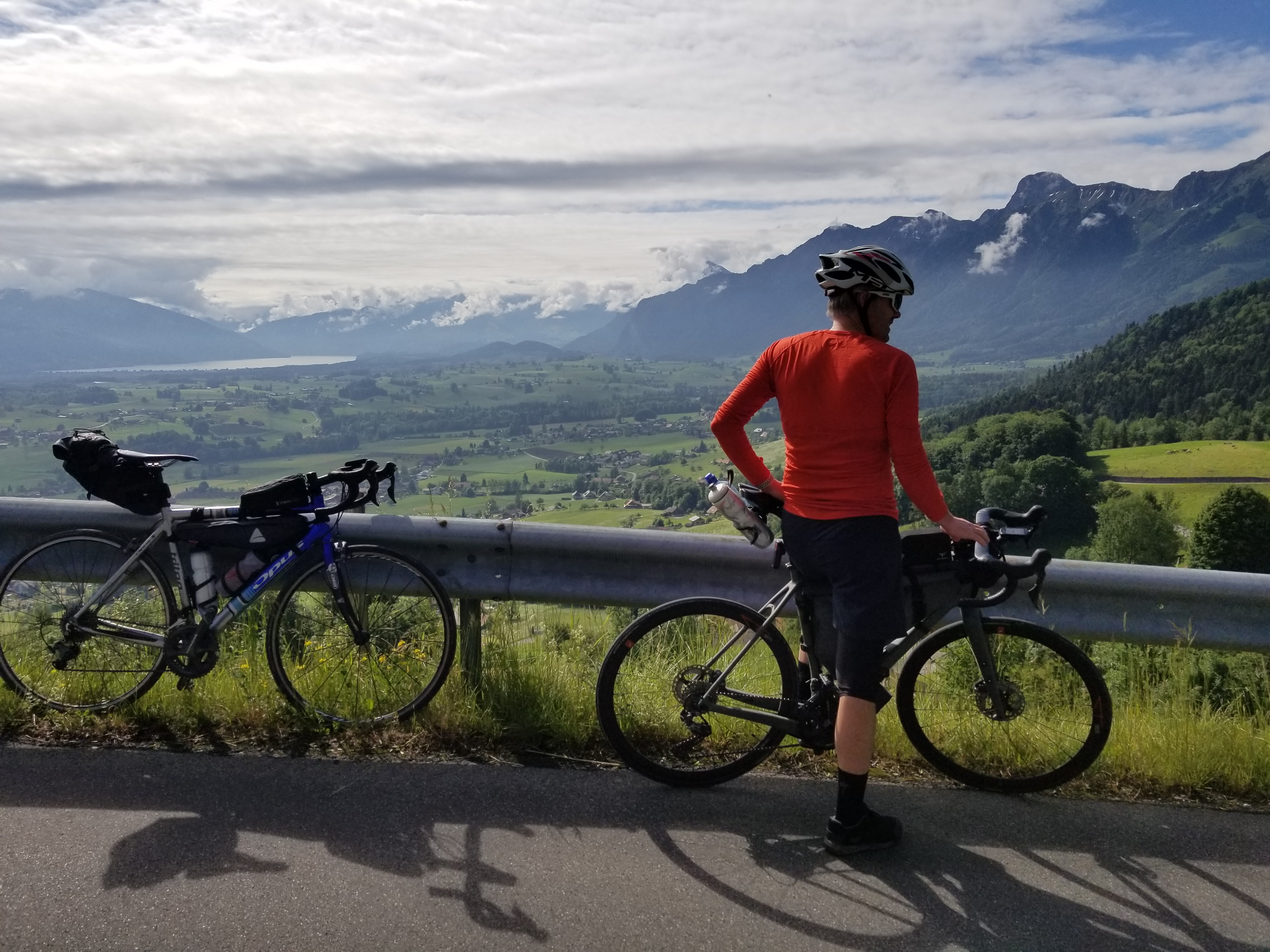
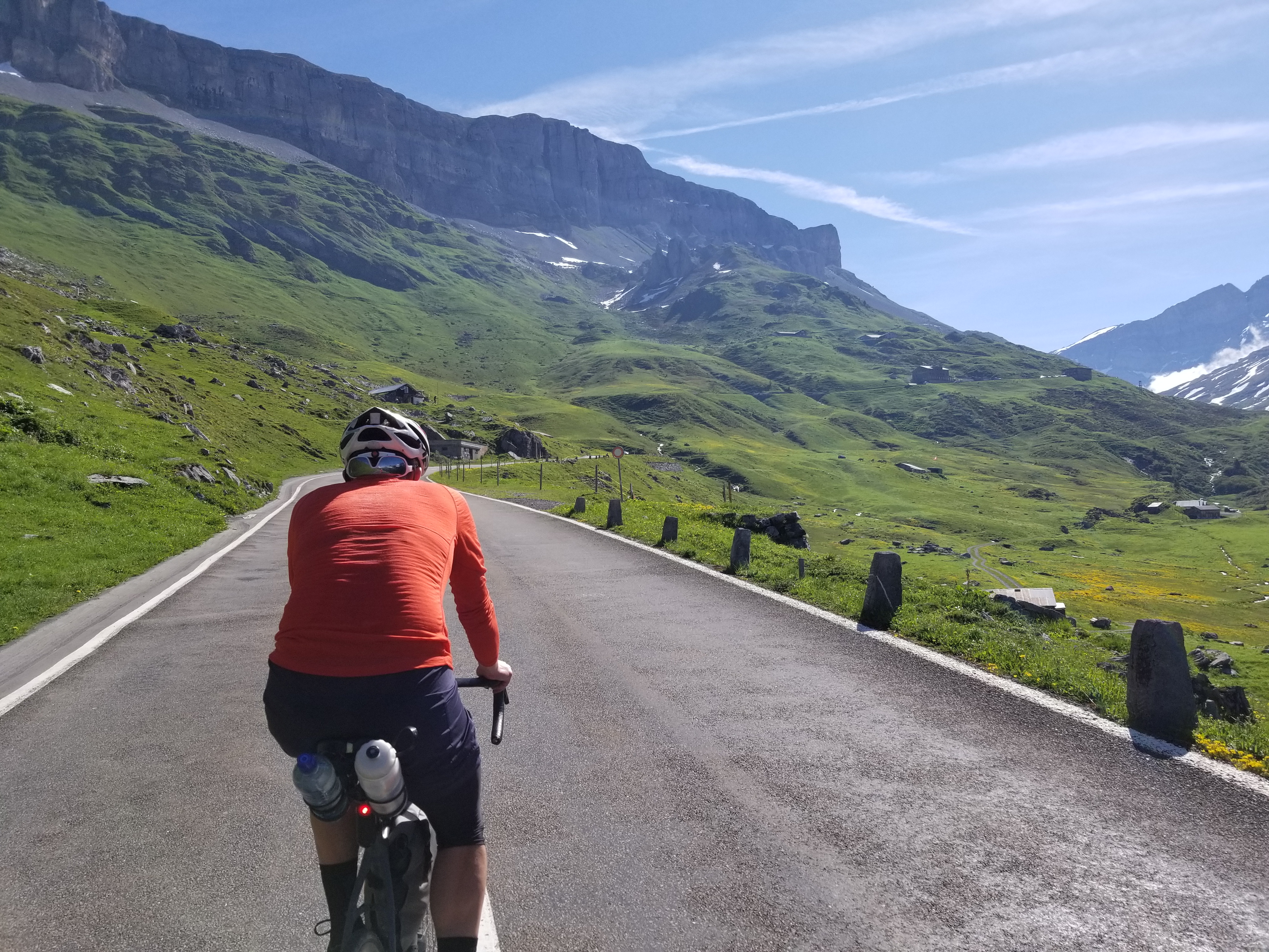
We travelled a combination of quiet secondary roads, farm roads, bike paths, some roads with light to moderate vehicle traffic, and one gravel path. Swiss drivers are very respectful of cyclists, and our route always felt safe. The entire ride was in the Alps, with constant views of peaks and alpine lakes.

Stage 9 of the 2022 Tour de France includes many roads we cycled on Days 1 and 2 between Lausanne and Bulle, over Col de la Croix and through Les Diablerets.

We mostly followed Swiss National Cycling Route 4, the Alpine Panorama Route. Due to the seasonal closure of a tunnel and a road closure through a military zone, we modified the route on Day 1 to avoid Col des Agites and go instead further south and east, over Col de la Croix and Col du Pillon, before joining Route 4 on Day 2 (from Lausanne: Route 1 🠪 Route 59 🠪 Route 9 🠪 Route 4 in Montbovon). We had planned to climb Glaubenbielen Pass on Route 4 on Day 3, but opted instead to ride through Interlaken and over Brünigpass to rejoin Route 4 in Giswil (from Thun: Route 99 🠪 Route 9 🠪 Route 4 in Giswil). Finally, we left Route 4 in Niederurnen to continue directly to Zürich on Day 5.

I had difficulty sleeping, getting only one or two hours of sleep on many nights. We had initially planned to cycle for seven days, but ended early as a result. We had intended to continue to the end of Route 4 in St. Margrethen and return west to Basel along the Rhine river on Route 2.

total distance cycled: 503 km
total elevation gain: 6737 m
total time cycling: 24 hours, 51 minutes (over 5 days)
average speed: 21 km/h

photo: riding along the north shore of Lac Léman (Lake Geneva) from Lausanne to Montreux on the morning of Day 1
Day 1: Lausanne to les Diablerets
distance cycled: 80 km
elevation gain: 1701 m
time cycling: 4 hours, 58 minutes
Strava
I flew into Zürich on Sunday, assembled my bike, stored bags at an airport hotel, cycled to the train station to take a train to Lausanne, where I toured the city on foot and joined Reid and family for dinner at their apartment before spending the night at a hotel. We met at Reid's apartment early Monday morning and set off after pumping tires and a stop at a coffee shop. After riding out of Lausanne, the route contours the north shore of Lac Léman through vineyards overlooking spectacular views across the water to France. We stopped for cake and coffee at Château du Chillon in Montreux, before continuing to Aigle and starting the climb toward Col de la Croix (1776 m). After lunch in Gryon, we reached the col as a few drops of light rain fell (the forecast called for rain all afternoon, but we only received a brief light shower). After a short descent from the col (being cautious on wet switchbacks) we arrived in les Diablerets, a ski resort town that was quiet this time of year. We got a room at Hôtel les Sources just before a heavy rain started. Showers and foosball at the hotel, followed by pizza and beer on a patio (sheltered from the rain, which continued most of the night).
photo: Château du Chillon in Montreux on the eastern shore of Lac Léman (Lake Geneva) on Day 1
Day 2: les Diablerets to Schwartzenburg
distance cycled: 122 km
elevation gain: 1609 m
time cycling: 5 hours, 45 minutes
Strava
We started the day in light rain with a short climb to Col du Pillon. I was glad to have brought shoe covers, a warmer jersey, a rain shell, neoprene gloves, and a headband. The rain stopped during the descent (which was not steep) and patches of blue sky appeared, providing views of the surrounding peaks. We frequently rode through fields of cattle in alpine pastures with bells ringing around their necks. A funny incident occurred when we had to step off the road and walk our bikes in a grassy field for a hundred metres to avoid a work crew resurfacing a short section of a farm road; we had to cross a cattle fence, which we knew was electric, but we both got zapped while carrying bikes over the fence. We enjoyed a pleasant coffee stop in the touristy town of Gstaad, before continuing through rolling valleys to lunch in the unique HR Giger Museum at the Château de Gruyères.

photo: riding along lac de la Gruyère on the afternoon of Day 2
After some rolling hills and following Route 4 away from the main road through winding farm roads, we arrived in the scenic city of Fribourg (another coffee and cake stop). We had a few steep climbs out of Fribourg (requiring more effort after 100 km) before arriving in Schwartzenburg, where we checked ourselves into Hotel Sonne, and enjoyed a beer, crackers, cheese and smoked ham on our balcony before a lasagna dinner. Throughout the day we moved from French-speaking southwestern Suisse into German-speaking central Schweiz.
photo: the gorgeous views of the Lungerersee as seen on the descent from Brünigpass on Day 4
Day 3: Schwartzenburg to Brienz
distance cycled: 83 km
elevation gain: 707 m
time cycling: 3 hours, 55 minutes
Strava
I was unable to sleep during the night, so we modified our route to go through Interlaken instead of climbing Glaubenbielenpass. After breakfast at the hotel, we headed east through rolling fields before a scenic, fun, and fast descent into Thun. We visited Schloss Thun and enjoyed crêpes in the town square by the river. From Thun we followed Route 99 along a gravel path through a forest, before joining Route 9 along the south shore of Thunersee. The ride along the lakeshore to Interlaken was fast due to being mostly flat, where we stopped for our usual coffee and cake in the town centre. We continued along the north shore of Brienzersee to the scenic town of Brienz. After checking in to Hotel Weisses Kreuz, we visited the town before eating dinner by the lake. Brienz is a scenic holiday village, not as busy (nor as expensive) as the nearby Interlaken, but arguably more interesting, with a beautiful boardwalk along the shore of Brienzersee, and the Brunngasse, a cobbled street of traditional Swiss wood homes, named the "most beautiful street in Europe".
photo: descent toward Thun on the morning of Day 3
Day 4: Brienz to Unterschächen
distance cycled: 97 km
elevation gain: 1448 m
time cycling: 4 hours, 45 minutes
Strava (to the ferry)
Strava (from the ferry)
Our fourth day turned out to be tremendous fun. We continued along our modified route, following Route 9 north over Brünigpass (1008 m) with gorgeous views to the north of the Lungerersee around which we cycled (see photo above). This road had some traffic, but again felt safe due to the courtesy and patience of Swiss drivers. After cycling along Sarnersee, we filled our bottles at a communal fountain in the town of Sarnen, as we did in various villages every day, and had savoury pastries with chocolate milk from a bakery. We continued to the Vierwaldstättersee (Lake Lucerne), where we joined a bike path superhighway (which we briefly followed in the wrong direction) that follows the scenic lakeshore to the ferry terminal in Beckenried. Our timing for the ferry was perfect, and in a few minutes we were relaxing in the sun on the upper deck of the ferry as we crossed to Gersau on the north shore of the Vierwaldstättersee. We had sandwiches on a café terrasse in Gersau before continuing east to Ingenbohl.
photo: riding toward the ferry terminal in Beckenried on the south shore of Vierwaldstättersee (Lake Lucerne) on Day 4
Here the guide for Route 4 strongly recommends taking a ferry south along the lake to avoid cycling the 10 km stretch between Ingenbohl and Flüelen due to heavy traffic. We had checked the route on Google maps in advance: it seemed safe, with a separate bike path, so we choose to ride it. This turned out to be a highlight of the trip, riding along a gorgeous bike path along cliffs high above the eastern shore of the Vierwaldstättersee, passing through several tunnels along the way, a comfortable distance from the traffic jam on the road (often separated by rock cliff wall).

In the morning we had called to reserve a hotel in Flüelen. Upon arriving in the early afternoon, we decided to continue further, and called ahead to reserve a room at the Alpina hotel, a 600 m climb up to the town of Unterschächen. In addition to providing enjoyable cycling for the latter half of our afternoon, this allowed us to climb the first 600 m of the 1600 m climb to Klausenpass (1948 m). The hotel was perfect, with a nice quiet room on an upper floor overlooking the mountains. Unterschächen is a cute small Swiss alpine village. We walked to a small cluster of homes by pastures, visited the church, and had dinner at the hotel restaurant on the terrasse.

photo: riding along a gorgeous bike path along cliffs high above the eastern shore of the Vierwaldstättersee (Lake Lucerne), passing through several tunnels along the way on Day 4
Day 5: Unterschächen to Zürich
distance cycled: 119 km
elevation gain: 1272 m
time cycling: 5 hours, 28 minutes
Strava
Once again I had difficulty sleeping, as was unfortunately the case for much of the week. I decided to move my return flight earlier, which was easy to change in the morning before leaving the hotel. Reid was extremely understanding and accommodating; instead of completing Route 4 as planned, we would follow Route 4 over Klausenpass, leaving the route near the town of Niederurnen to continue toward Zürich, with the option of taking a train at various points after the pass.

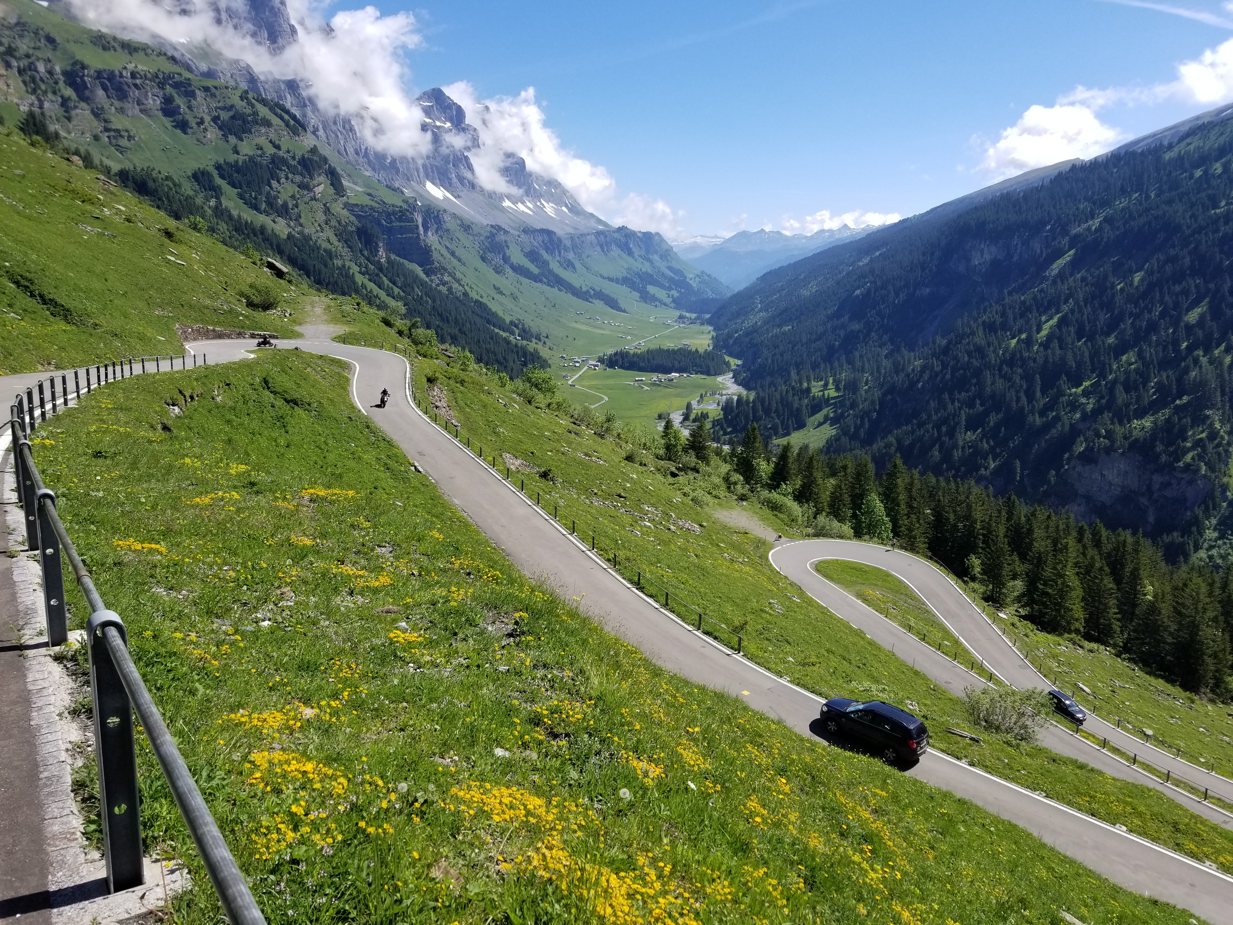
Klausenpass (1948 m) was another highlight of the trip. We'd both expected it to be more challenging, and we found ourselves at the summit less than 90 minutes after leaving the hotel. It was a sunny day, and the views were stunning on the entire climb. We stopped for a Coke at the top, before a spectacular descent through twisting switchbacks down the northeast side.

photo: climbing Klausenpass on Day 5
After lunch at a bakery in Glarus, we continued on mostly flat roads into a headwind for the final 70 km into Zürich. This last stretch felt like a grind compared to the scenic paradise in which we had cycled all week; we left the calm cycle route and rode into a headwind with more traffic than we'd been used to all week. After a brief stop for convenience store ice cream in Wädenswil, we followed busy roads along the south shore of the Zürichsee (Lake Zürich) to the Zürich train station in the city centre.

Reid swam in the Limmat river before taking the train back to Lausanne. I took the train to the airport. After retrieving my luggage from the airport hotel, I packed my bike in my hotel room, showered, checked in to my flight, ate dinner in the airport food court, and visited Flughafenpark (a park on a hilltop at the centre of the Zürich airport) before managing to get a few hours of sleep ahead of my flight the next morning.

photo: climbing Klausenpass on Day 5
Equipment and Logistics
We did not reserve any hotels in advance. It was low season, the hotels were nearly empty, and we were always able to get a room at every hotel we called, at most a few hours before checking in. This allowed flexibility for our distance and time cycling each day, depending on weather, the amount of climbing, and our energy levels, and permitted us to modify our route on the go (which we did). We never felt rushed to reach any particular destination for the night, and on most days we cycled further than the stop we had planned in the morning. The hotels all included a breakfast buffet with a plentiful selection. I reserved a room at an airport hotel for the night before my departure and confirmed in advance that I could store my bike case and a suitcase during the week while cycling. I assembled my bike in front of the hotel before riding to the train station on the day of my arrival.

I purchased a SIM card at the Zürich airport shortly after my arrival for 20 CHF with unlimited calls, texts, and data within Switzerland.

I brought a bike lock, but used it only a few times (e.g., on trains and in one hotel where we left our bikes in a ski storage room overnight). The lock fits in my jersey pocket and is light (175 g). It's not as secure as a u-lock, but provides a good compromise in terms of balancing weight against preventing someone from easily running off with the bike.

photo: descending upper Klausenpass on Day 5
We had planned our route in advance and uploaded courses to our Garmins. We updated courses in the morning on days we modified our route. This is easier than it was a few years ago, with improved usability on the Garmin Connect and Strava mobile apps for route editing and uploading. On previous cycling trips I loaded maps from Open Street Map to my Garmin. This time I purchased Garmin's Europe Cycle Map, which required some problem-solving to load onto my Garmin (these instructions succeeded).

My equipment was similar to what I used in 2018, but in addition to my Revelate Designs seat bag and cockpit bag, I added an Axiom frame bag to carry a warmer long-sleeve cycling jersey, neoprene gloves, a headband, shoe covers (extra layers because we were cycling at elevation in May, all of which I wore) and a pack of disposable masks (because it's 2022). I usually ride in SPD-SL road cleats, but for overnight touring I often use mountain SPD clips, since walking in them is easier (except in 2018, when I cycled in SPD-SL road cleats). I lost one of my flip flops on our descent from Col de la Croix into Les Diablerets on Day 1, so I was glad to have cycling shoes that permitted walking.

I bought an 11-34 cassette for this trip (instead of using my 11-28 flatlander cassette). This required a Wolf Tooth Roadlink derailleur hanger extension to accommodate the larger sprockets. I appreciated the lower gears on climbs (which I didn't have in France in 2019/2020).

photo: descending lower Klausenpass on Day 5
Return to Steph's Homepage