|
| ||

|
Trip Summary
The Twin Sisters are two neighbouring peaks 15 km southwest of Mt. Baker visible from the southern Coast Range and the northern Cascades. Both are known for fabulous scrambling along their western ridges. Matt Gunn recently recommended the West Ridge of North Twin Sister to me. Back in October we thought we were making our last ascent of 2003 on Sloan. However, the extended sunshine and lack of west coast precipitation allowed us to sneak in yet one more rock ascent; on November 8, I climbed the West Ridge of North Twin Sister with Matt Brown, Zosia Bornik, and Chris Tarling under clear skies and unexpectedly warm temperatures. The fantastic photos displayed here were taken by Chris who kindly agreed to let me post them. You can find Matt's photos here. | |
|
Rock
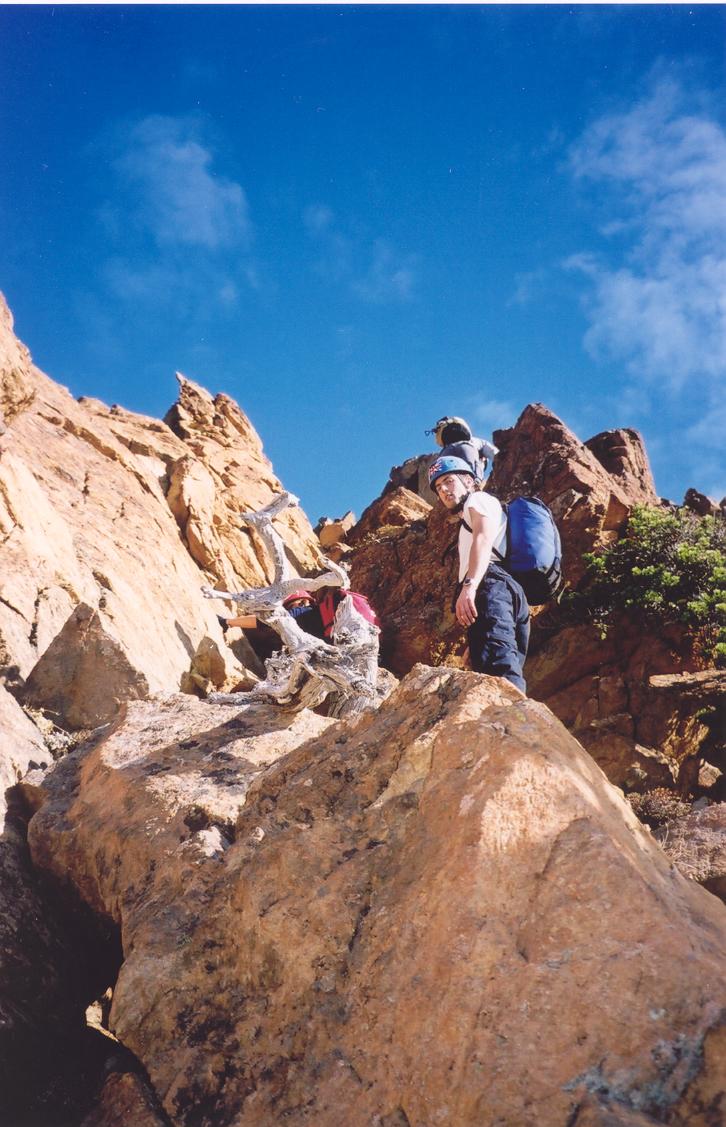
The amazing quality of the rock on the West Ridge deserves a descriptive paragraph to itself. The rock is a tanned red colour, mostly solid, very featured, highly textured and easy to grip, dunite (a rock composed of the mineral olivine). I'm definitely not a geologist, but quick reasearch into the area seems to indicate this rock is not very common. Too bad, because the rock makes for perfect third and low fourth class scrambling: positive handholds are spaced half a metre apart, wide enough for comfortable boot footholds and interspersed with a reassuring jug whenever necessary. At regular intervals, large flat ledges appear, preventing the setting from feeling overly exposed. The friction provided by the rock is unbelievable. If you had rock shoes, you could climb an 80° slab on this stuff. The rock is not as solid as granite and I wouldn't be completely comfortable placing gear on it. However, a scramble on this dunite makes for a very satisfying outing. |

|
|
|
Approach
We again took Matt Gunn's route description for a test drive (for his upcoming scrambles guidebook). Again, the driving direction, approach directions, and route description were great. I picked up Chris at home at 4:45 and we met Matt and Zosia at the Petro-Canada at 5:00. Chris pulled out some fun two-way radios that allowed us to talk between cars on the highway. At 6:00 we stopped at Tim Horton's just before the Sumas border crossing. At 7:20 we parked at the gate on Galbraith Creek Road [365m] and we were biking by 7:45. As with many such bike approaches, it seems it will be worse than it actually turns out to be. The first few kilometres of the approach are steep but are soon over. My three friends kindly waited up for me as I showed my lack of exercise over the last few months. After the first turnoff, the angle eases and the route follows a pleasant tree-lined trail to a stream crossing. Shortly afterwards, the Twin Sisters come into view. Matt B suggested we keep biking up the trail toward the campsite. After a break, being a wuss I decided I'd rather hike than keep biking uphill. The road is still good at this point and could be biked right up to the campsite and trailhead in the clearcut. This would allow for a faster descent back down the road, and would likely have saved us ten to fifteen minutes. From here, a gentle hike uphill through the trees leads to the West Ridge. All morning we overheard a conversation on the radio, likely another party out of sight on a different route. | |
|
Route
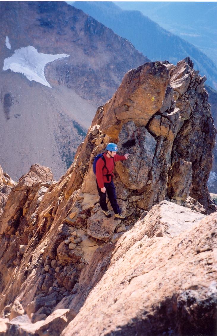
Ridge routes always seem enjoyable; route finding is often simpler and views are ever present. Such is the case on the West Ridge of North Twin Sister. Although the upper north slopes just to our left were covered in thick frost, our ridge line faced the sun and the rock was warm and dry. The scrambling is mostly third class with perhaps two sections of fourth class for which some parties may feel more comfortable roping up and/or rapping if descended. We reached the summit [2024m] at 1:20 where we lunched, shot some photos, and signed the dinky summit register. The gps indicated 13.3 km on the ascent (most of that distance gained on bikes). Panorama: sunshine and excellent views of Baker, the Fraser Delta and the North Shore, the San Juan Islands, and hundreds of misty hills southward to Seattle.
Descent
|
|
|
|
Reference
Scrambles in Southwest British Columbia. Matt Gunn. Cairn Publishing. 2005. | ||
