South Chilcotins
Chris, Reid, and I visited South Chilcotin Mountains Provincial Park near Goldbrige, British Columbia, from August 7-11, 2014. The region was granted park status in 2010, having been promoted from a protected area. This park provides amazing access to the alpine with a dense network of trails and few crowds. We accessed the park from the High Trail where I did my best to keep up with Reid and Chris as we backpacked a spectacular 100 km loop that visited two ridges on opposite sides of Spruce Lake. Most visitors travel through the park on mountain bike or horseback and remain on the primary trails close to the valley containing the Spruce Lake drainage. Although we saw horse and bike tracks in the alpine, we did not encounter anyone above treeline.

This was a most enjoyable hike, allowing Reid, Chris, and I to reunite in the mountains for the first time since each of us became fathers; the last time was in 2005. Unlike Chris and Reid who have managed to stay in great hill-climbing shape, running and cycling this past year seemed insufficient to help me keep up with the impressive pace these two set!

photo: Lorna Lake as seen from the summit of Tyaughton on day 3, the high point on Trail Ridge and the midpoint of our route
Day 1: from the prairies to the treeline
distance hiked: 15.4 km
elevation gain/loss: 1544 m / 799 m
9:15 am. After an alpine start to catch an early flight from Winnipeg, Steph meets Reid and Chris at the corner of Georgia and Hornby streets in Vancouver. They drive north along the Sea to Sky Highway and the Hurley River Road to reach Goldbridge. From there it's a short drive along Carpenter Lake and easy 2WD access to the High Trail trailhead (1100 m).

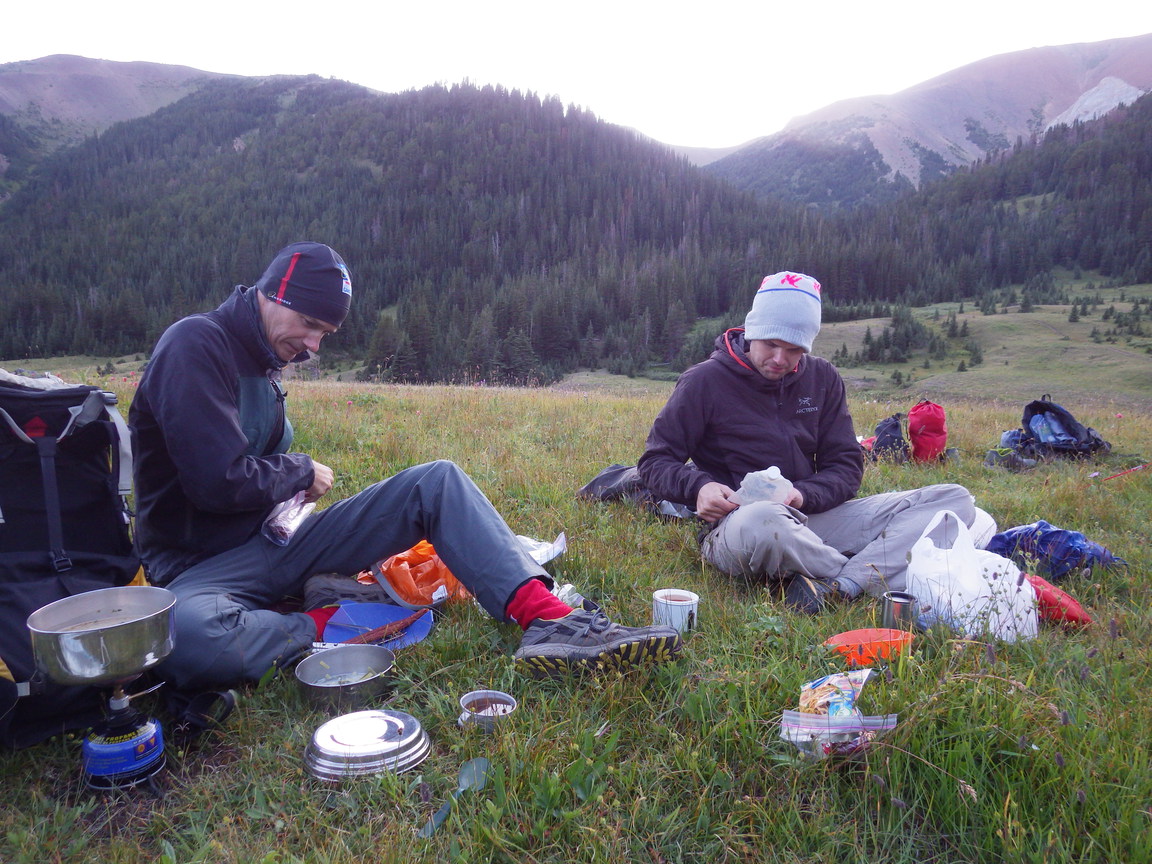
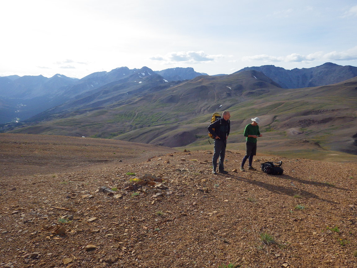
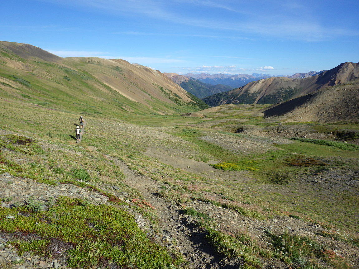
3:00 pm. We park the car, exchange cotton for polypropylene (or merino wool for some of us), saddle packs, and head uphill along the High Trail. The first few kms follow an old logging road, from which a trail branches leading to pleasant subalpine meadows. We followed the trail past small alpine tarns, two campsites with nice views, and a cabin at which mountain bikers sipped cans of beer.

7:30 pm. Ceding to Steph's whining that he'd been awake since early that morning, the group agrees to stop at the last campsite before Windy Pass.

photo: our campsite near Windy Pass
Day 2: Windy Pass to Deer Pass
distance hiked: 27.6 km
elevation gain/loss: 1807 m / 1352 m
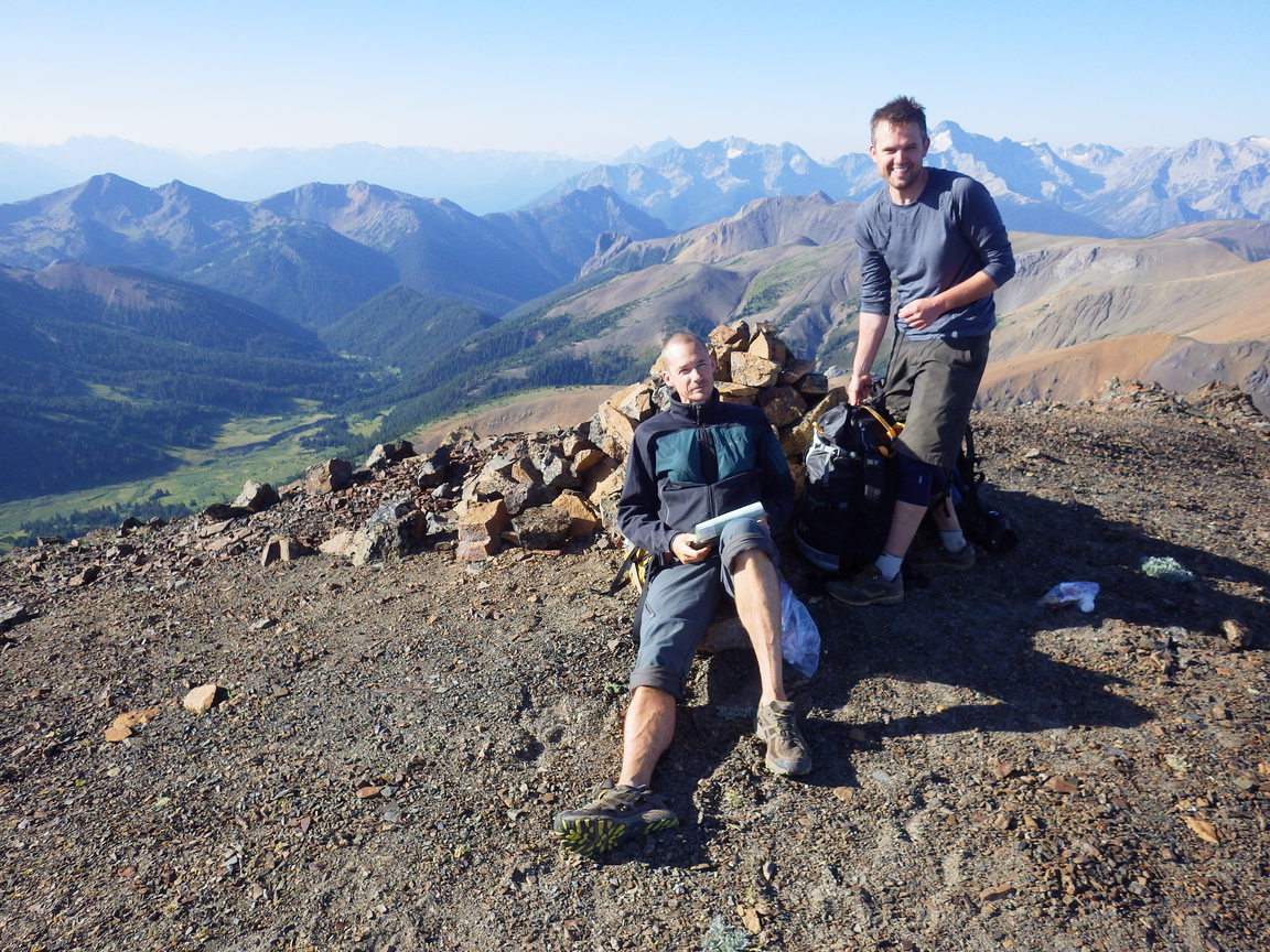
peak summited: Sheba, 2664 m (Chris and Reid)
7:30 am. After cooking breakfast and packing camp efficiently, we head over Windy Pass (2200 m) and lose 650 m elevation down into the valley towards Spruce Lake (1550 m).

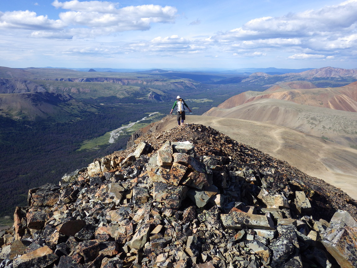
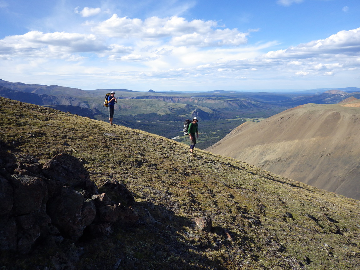
1:00 pm. We climb up to Sheba Ridge, where we have a late lunch after gaining its crest. Chris and Reid continue to the summit of Sheba (2664 m) while Steph contours the scree below and around a nice tarn and a sandy campsite. We meet again southwest of Mount Sheba and follow the ridge northwest to Deer Pass (2200 m).

7:00 pm. The campsite at Deer Pass has a flat tent pad sheltered from the wind. We had hoped to reach the campsite at Lizard Lake, but we decide to stop here for the night. A small lake with a sandy shoreline and nice views on either side of the pass make this campsite quite scenic.

photo: looking northwest from Windy Pass
photo: heading into the alpine towards Sheba Ridge on the west side of Spruce Lake
photo: crossing scree westward, south of Mount Sheba, just below Sheba Ridge
photo: approaching Deer Pass after a long day
Day 3: Trail Ridge
distance hiked: 22.2 km
elevation gain/loss: 1109 m / 1852 m
peaks summited: Deer, 2500 m [?]
Solomon, 2589 m (Chris and Reid)
Tyaughton, 2851 m
8:30 am. We saddle up, having slept one hour longer than the previous morning. Continuing along Sheba Ridge, the climb over Solomon (2591 m) takes longer than expected, validating our decision to stop at Deer Pass the previous night. The descent to Lizard Lake (2200 m) is pleasant, following dried-out sandy stream beds, talus, and spongy patches of moss.

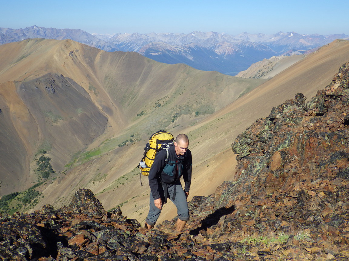
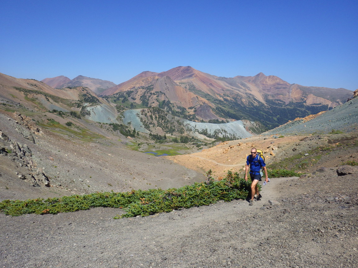
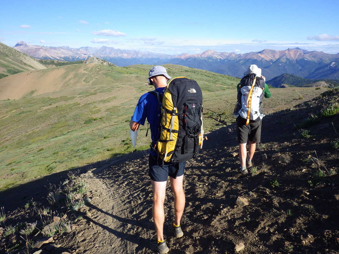
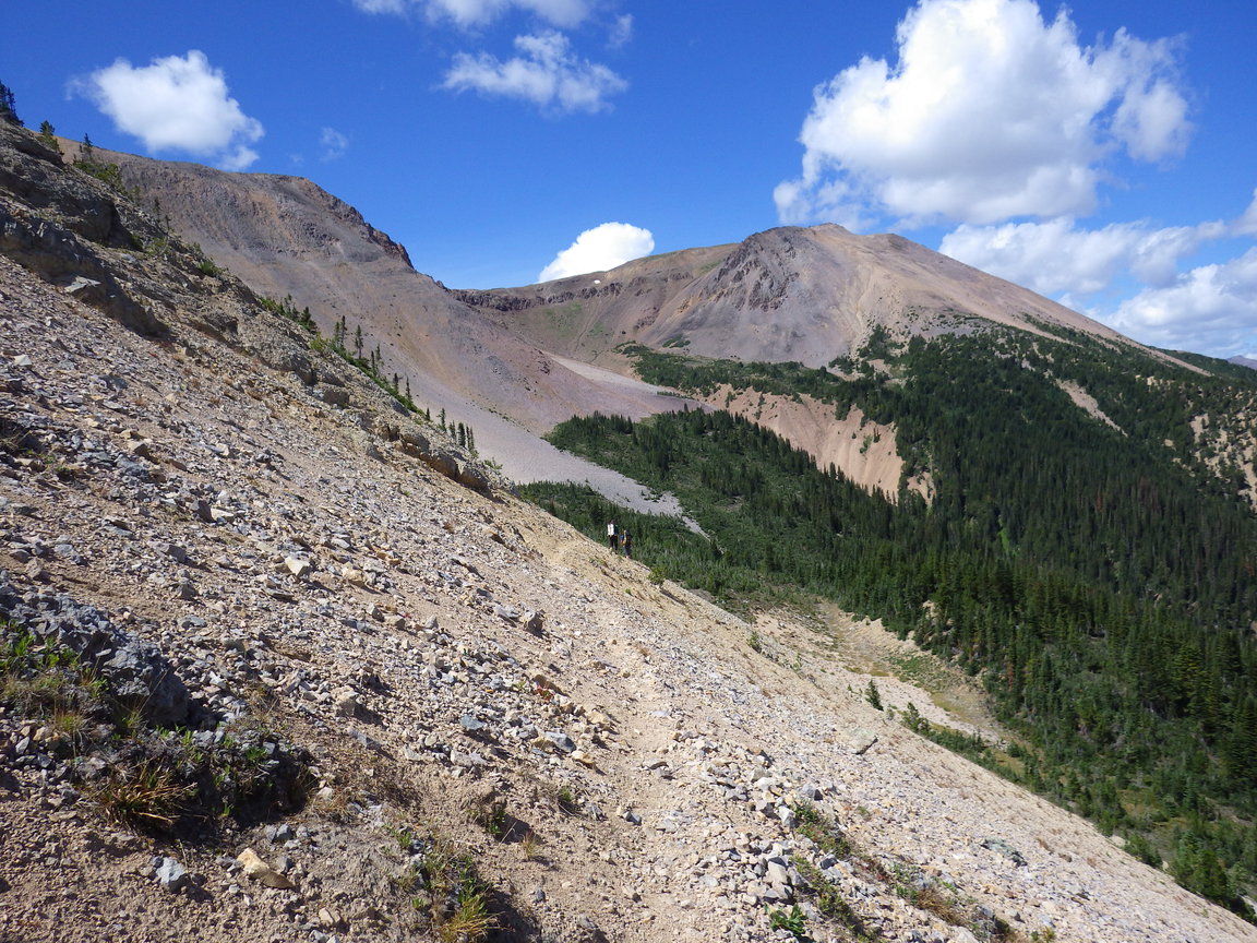
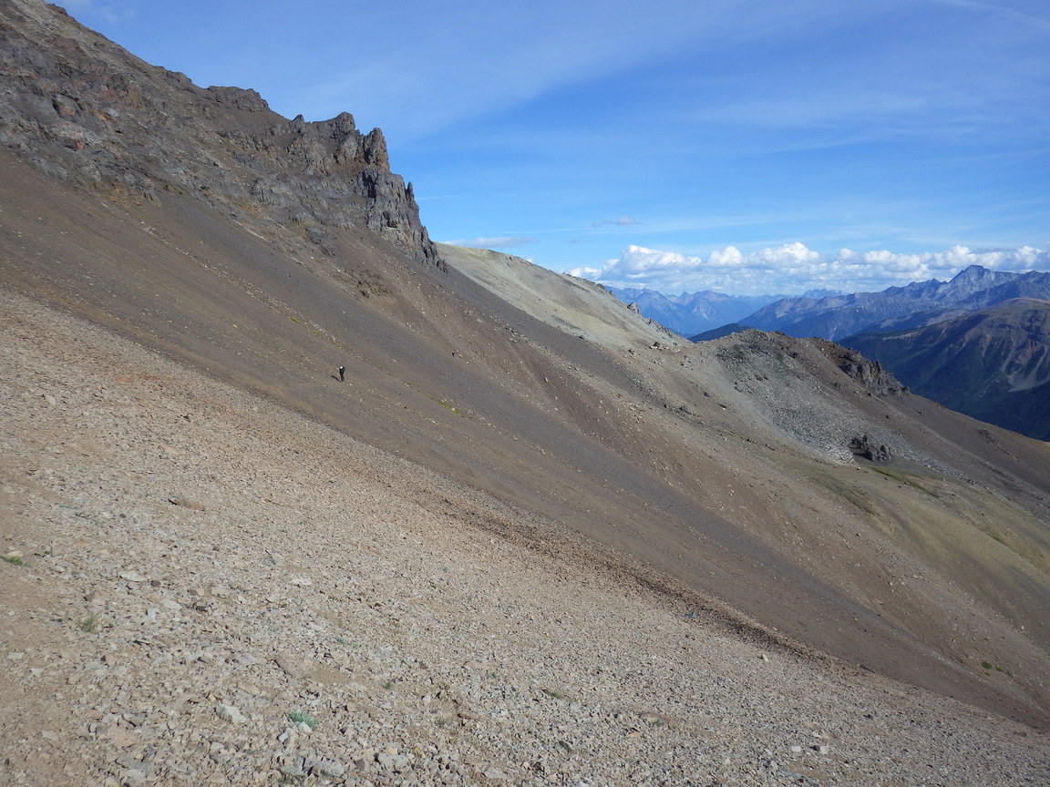
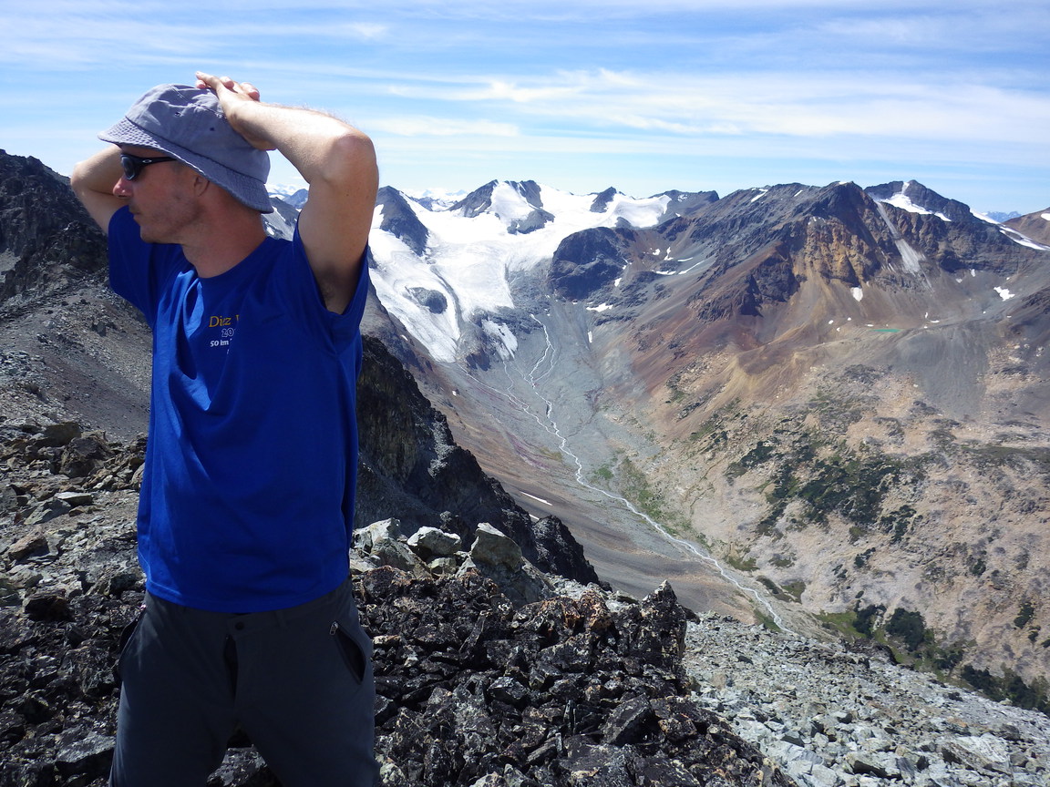
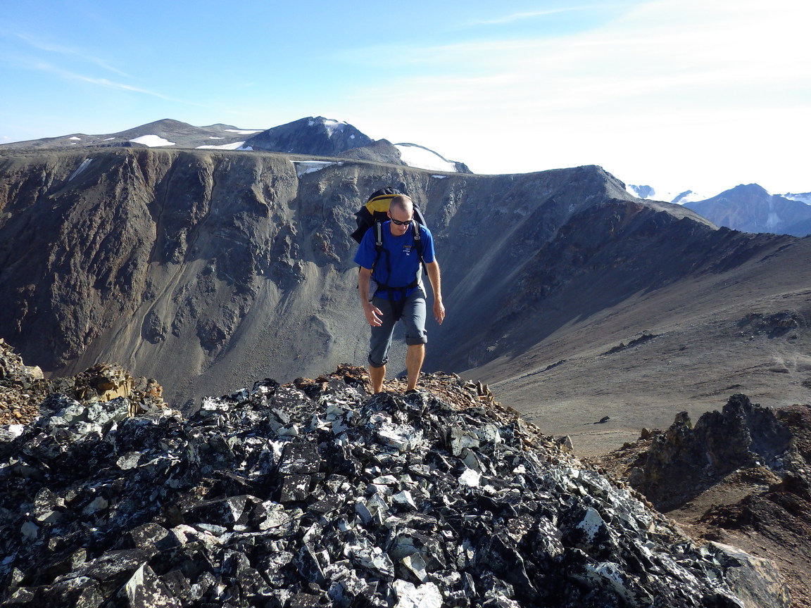
11:00 am. We fill bottles and have a snack at a stream near Lizard Lake before starting up the slopes to gain Trail Ridge and summit Tyaughton. The 750 m of vertical gain goes better than expected as the slope is less steep and the rock more stable than anticipated.

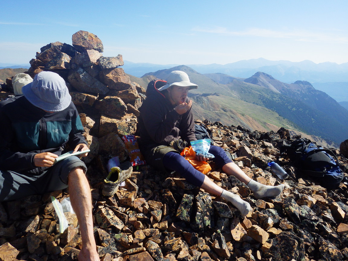
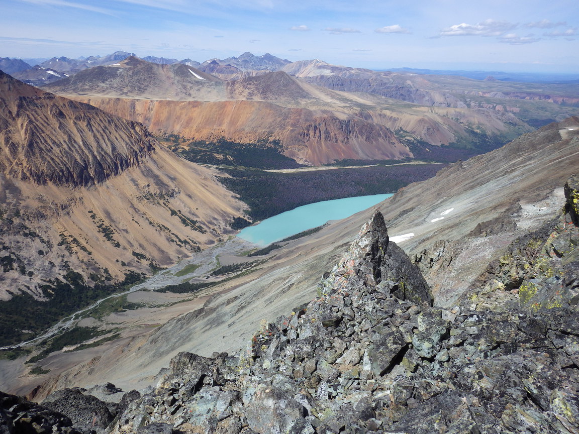
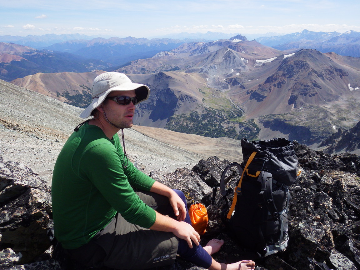
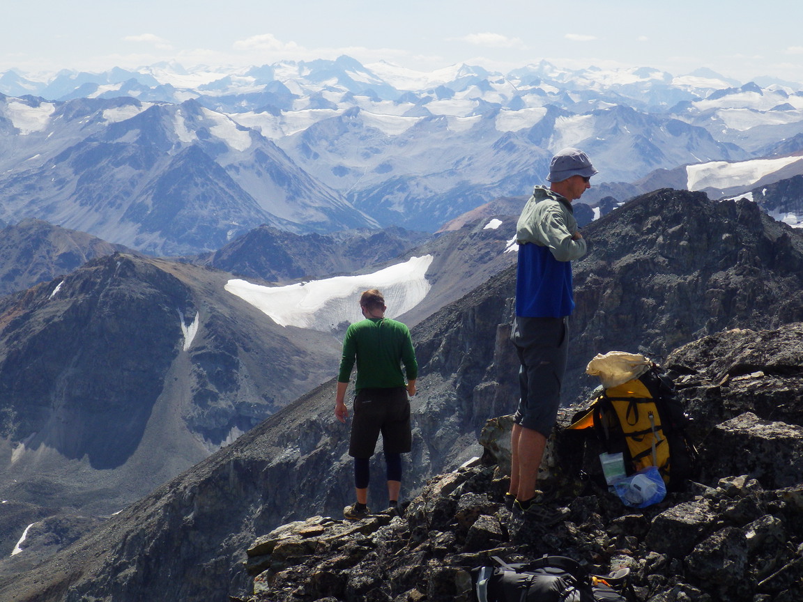
1:30 pm. We reach the ridge, stop for a quick snack, and continue to the summit of Tyaughton a short distance higher along the ridge. We enjoy lunch, photos, and a rest on the summit, with perfectly clear skies and no wind.

photo: Having gained Trail Ridge, we prepare to climb the final few steps to the summit of Tyaughton.

3:00 pm. We leave the summit and continue northward along Trail Ridge.

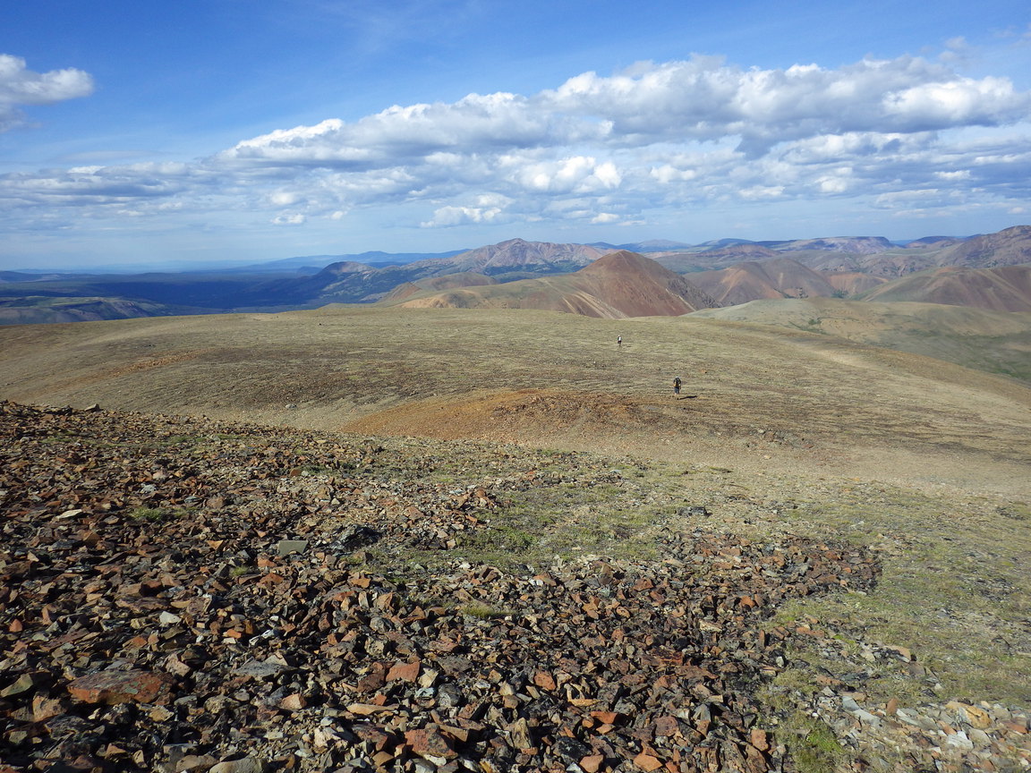
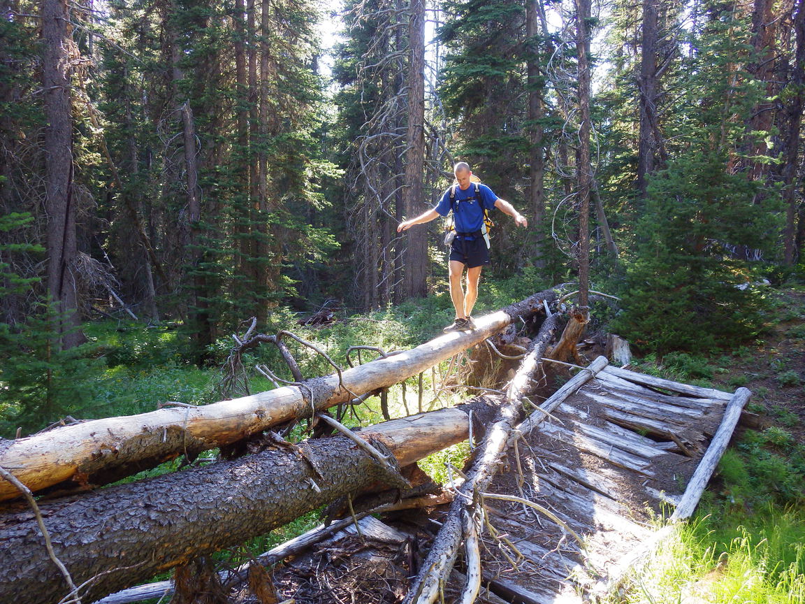
4:00 pm. Steph knocks a rock onto his hand, requiring Chris to extract the first aid kit for some butterfly stitches, gauze, and tape. Once the wound is cleaned, closed, and covered, we continue north along Trail Ridge, over a minor summit whose descent involved a bit of loose rock underfoot, and down to Lorna Pass (2200 m), where we meet the well-established Lorna Pass Trail. From here we continue south to join the main Tyaughton Creek Trail south towards Spruce Lake. The trail contours and descends into a beautiful subalpine valley and eventually into the trees. For the second time in three days we see people. This time it's a larger group of mountain bikers. Shortly afterwards we see a black bear moving away from us across a clearing into the forest. We stop for the night to camp at the horse campsite at the junction with the Deer Pass Trail (1650 m).

photo: Reid rests his feet one last minute before continuing to the summit.
photo: enjoying the view from the summit of Tyaughton
photo: more summit views
photo: Reid descends Trail Ridge northward. Our route follows the rounded ridgeline seen in the distance.
photo: Chris reaches a small summit along Trail Ridge.
photo: Trail Ridge flattens before dropping to Lorna Pass in the valley below.
photo: Chris and Reid descend towards Lorna Pass.
photo: We followed the main trail through the valley south towards Spruce Lake.
photo: The valley campsites are equipped for horse camps. This one included a stack of dry firewood.
Day 4: Spruce Lake
distance hiked: 14.2 km
elevation gain/loss: 327 m / 434 m
peaks summited: Cunningham, 2545 m (Chris and Reid)
Unnamed, 2400 m [?] (Chris and Reid)
9:00 am. Feeling energetic, Chris and Reid head off trail through the trees for a side trip to scramble up Mount Cunningham (2545 m) and return via the summit and west ridge of [?]. This adds 10.5 km and 1025 m vertical gain in 4.5 hours to their day.

2:00 pm. We leave the campsite and continue south along the Tyaughton Creek Trail. It's easy hiking on a nice trail with a moderate downhill grade, mostly following the river bank. Four creek crossings break up the routine (flip flops are recommended to keep hiking footwear dry). We encounter a group on horseback. We decide to follow the fork for the Greasy Hill Trail which turns out to be overgrown and has a large number of fallen trees; the valley trail would likely have been quicker.

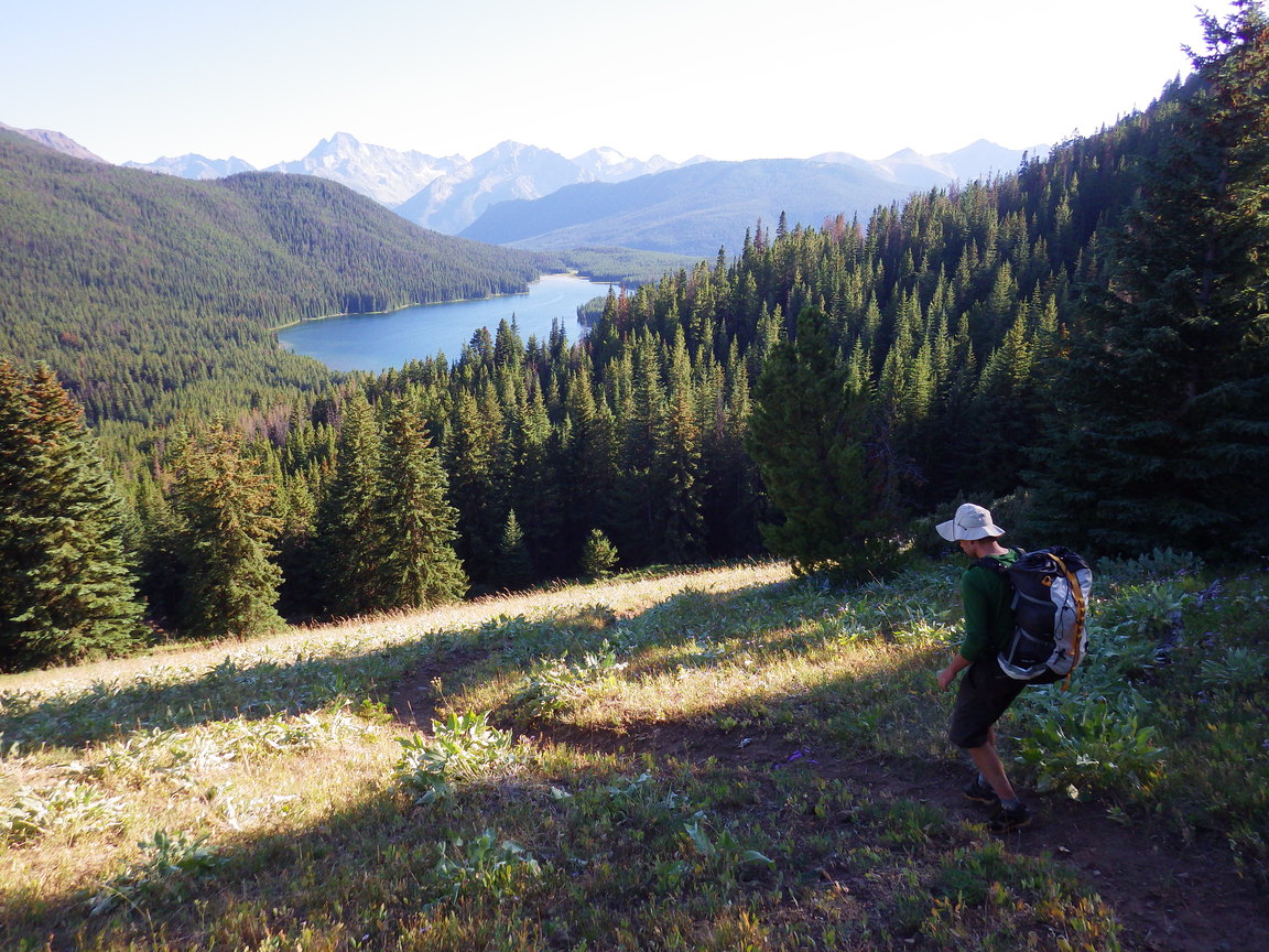
6:30 pm. We stop at a nice campsite on a point on the eastern shore of Spruce Lake (1550 m), where we enjoy a swim and a pleasant relaxing evening.

photo: Chris crosses a fallen tree that crushed a bridge on the Greasy Hill Trail. It its current condition, this trail requires crossing dozens of such clusters of fallen trees.
photo: We descend towards Spruce Lake. We camped at a nice waterfront site on the small point seen near the middle of the opposite shore.
Day 5: Nea Ridge and Pearson Trail
distance hiked: 23.4 km
elevation gain/loss: 1187 m / 1739 m
peaks summited: Nea, 2490 m
6:20 am. We saddle up and start hiking up the High Trail from Spruce Lake toward Windy Pass. Instead of taking the direct route out, we rose early to allow us to follow the ridge from Windy Pass to Nea Peak. We make good time on the trail, arriving at Windy Pass (2200 m) just before 8:00 am, having gained 650 m.

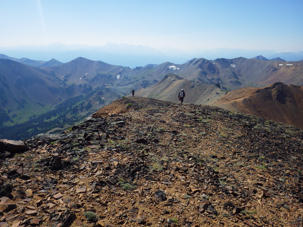
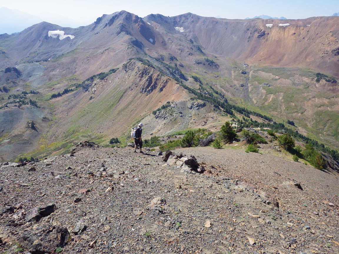
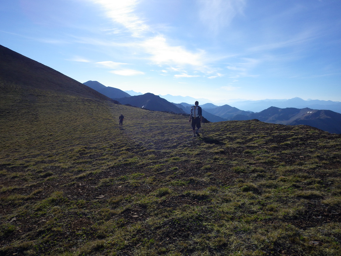
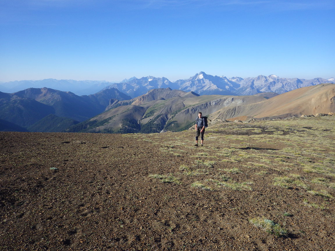
8:00 am. We leave the trail at Windy Pass and continue east along the ridge. We follow a faint trail through the scree for most of the way, although many options are possible and the route is obvious. The going is very enjoyable, with pleasant grades, solid footing, little exposure, beautiful views of the alpine and surrounding region, all under perfect weather conditions once again. We spot a herd of mountain goats (we count twenty) just below us on the ridge.

photo: We leave the trail at Windy Pass to gain the ridgeline towards Nea.
10:30 am. After following the ridge over a few minor summits and cols, we reach the summit of Nea for the usual snacks and photos. We begin the descent along the south ridge towards Eldorado Pass (2100 m). Here we join the Pearson Trail which we follow into a small valley, fill water bottles, and continue over Camel Pass (2100 m). The trail descends into the valley to join the High Trail. This closes our loop and the last few kms are spent reversing our route from four days earlier out the High Trail back to the car (1100 m).

2:30 pm. We reach the car, drive to Pemberton for burgers and beer, and then to Vancouver to meet Matt, Mike, and James at the Fringe.

photo: This is where we left the High Trail at Windy Pass to follow the ridge east toward Nea.
photo: This cairn is on one of the small summits along the ridge, between Windy Pass and the summit of Nea.
photo: Chris follows the ridge towards Nea.
photo: snack and map check on the summit of Nea before descending the ridge to Eldorado Pass
photo: following the ridge south from Nea towards Eldorado Pass
photo: Eldorado Pass lies just ahead. Camel Pass lies at the col in the distance, above Chris' head on the horizon, right of the oval-shaped snow patch (Chris is the leftmost hiker, ahead of Reid).
photo: Reid descends the final few metres along the ridge south of Nea towards Eldorado Pass. The Pearson Trail can be seen heading from Eldorado Pass to Camel Pass (which lies outside the top left corner of the frame).
photo: Chris hikes along the Pearson Trail to Camel Pass with Eldorado Pass behind him. Nea is the high point at the centre of the horizon. Our route from Windy Pass follows the ridge along the horizon from the left, across the sequence of smaller summits to Nea. The summit to the right (northeast) of Nea is Eldorado.
photo: South of Camel Pass the Pearson Trail descends to meet the High Trail near Pearson Creek.
Return to Steph's Homepage